Moraine State Park
- Status
- Open (per official listing)Daily sunrise – sunset
- Entrance fee
- Not posted
- Day-use reservations
- None mentioned
- Dogs
- Dogs allowed, with restrictions
- Camping
- YesAlso cabins
- Official site
- pa.gov(724) 368-8811
Official page last checked Oct 29, 2026. Details last changed Oct 29, 2026. How we keep this current
Current alerts 1
Partial closure Temporary Trail Closure - North Country Trail A section of the North Country TrTemporary Trail Closure - North Country Trail A section of the North Country Trail within Moraine State Park will be temporarily closed from… (more)
Temporary Trail Closure - North Country Trail A section of the North Country Trail within Moraine State Park will be temporarily closed from approximately October 23 to December 31, 2026. The closure is necessary for safety purposes during sewage line construction and replacement. The section of North Country Trail that will be closed is from the crossing under the 422 bridge heading north to the Moraine dam on Lake Arthur. For thru hiking purposes, an alternative route is to leave the North Country Trail at McDanels Launch on the north shore of Moraine State Park and follow park roadways to West Park Road. Hikers can then follow West Park Road to the south, to the intersection with Burnside Road, where a roadwalk portion of the North Country Trail exists towards McConnells Mill State Park.
Posted by the park. Official alert
Overview
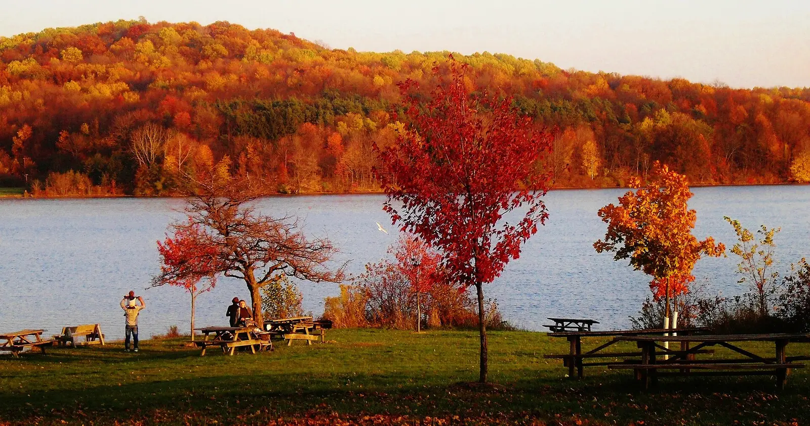

Moraine State Park is a 16,463-acre park in Butler County, about 11 miles northeast of Ellwood City.
Popular activities here are snorkeling and diving, snowmobiling, cross-country skiing, golf, and horseback riding. Its trail network totals roughly 29.2 miles, according to the park. Water access includes a swimming beach, a boat ramp, a fishing pier, and boat or kayak rentals. Camping is available: 3 camping areas, including tent sites, primitive or hike-in sites, and group camping. The park says there are no showers. Roofed lodging includes cabins.
Hours
Park, gate, office and facility hours are listed separately because they often differ. Alerts above override normal hours.
| Facility | Days | Hours | Season |
|---|---|---|---|
| Park | Daily | sunrise – sunset | — |
| Daily | 8 a.m. – 4 p.m. | — |
Official wording
The park is open every day of the year, sunrise to sunset. Day use areas close at dusk. Park information, launch permits, cabin information, and assistance can be obtained at the park office near the entrance to the South Shore. The park office is open year round, Monday through Friday, from 8:00 A.M. to 4:00 P.M., and weekends during the summer. The Davis Hollow Marina office on the North Shore provides marina applications, launch permits, and general park information. It is open from April 15 to October 30.
Source: official park page, checked Oct 29, 2026. Times are local to the park (America/New York).
Reservations
- Day use
- No day-use reservation requirement mentioned
- Booking system
- ReserveAmerica (Aspira), Pennsylvania State Parks contract
- Phone
- 888-PA-PARKS (888-727-2757)
We link to the official booking system rather than showing live availability, which changes minute to minute.
Pets
Dogs allowed, with restrictions
Not allowed in or on: the beach areas.
Dogs are permitted in Cabins #7 and #11 for a fee. To keep these areas clean and safe, pets are prohibited in the beach areas.
Service animals are generally permitted where pets are not. Check with the park for specific areas.
Camping
| Campground or site type | Sites | Hookups / features | Price |
|---|---|---|---|
| No Camping Camping is prohibited in the park. Private campgrounds nearby offer camping. Information is available at the park office. | — | — | |
| Backpacking The Link Road Overnight Shelter on the North Country National Scenic Trail is available to backpackers by reservation only. | — | — | |
| Organized Group Tenting There are two tent camping areas available for organized groups:
• Muskrat Cove
• Five Points
These rustic camping areas have:
• Restrooms
• Picnic tables
• Cooking grills
• Water, but no showers | — | Showers | — |
Camping details from the park
No Camping
Camping is prohibited in the park. Private campgrounds nearby offer camping. Information is available at the park office.
Backpacking
The Link Road Overnight Shelter on the North Country National Scenic Trail is available to backpackers by reservation only.
Organized Group Tenting
There are two tent camping areas available for organized groups:
- Muskrat Cove
- Five Points
These rustic camping areas have:
- Restrooms
- Picnic tables
- Cooking grills
- Water, but no showers
From the official park page, checked Oct 29, 2026. Site counts and prices can change; confirm when booking.
Cabins and lodging
- Modern Cabins: 11 units
Modern Cabins
Moraine State Park Cabin Map (PDF)
♿ Eleven modern cabins are available for rent year round. These cabins sleep six people and have:
- Two bedrooms
- Bathroom with shower
- Kitchen
- Dining/living area
- Electric heat
- Dock on Lake Arthur during the summer season
Renters must provide:
- Linens
- Towels
- Cookware
- Tableware
Play equipment for children is in a central area.
Dogs are permitted in Cabins #7 and #11 for a fee.
GPS DD: Lat. 40.96586 Long. -80.11389
Things to do
GolfDisc golfBikingHorseback ridingSnorkeling and scubaMountain bikingWinter sportsSnowmobilingCross-country skiingHuntingFishingSwimmingBoatingPicnickingHikingCampingCanoeing and kayaking
Trails
| Trail | Length | Difficulty | Notes |
|---|---|---|---|
| Butterfly Trail | 0.5 mi | Easiest | Recreations permitted: hiking Trailhead amenities: benches This trail, lined with native plants, consists of one main loop with short side loops that traverse various of habitats, including a frog pond, forest, meadow, and lake shoreline. Spot frogs and turtles at the frog pond or enjoy the dragonflies and damselflies hoovering around on the bridge. Relax in the gazebo while listening to frogs, herons, and buzzing bees.Hiking |
| Five Points Trail | 1.3 mi | Easiest | Recreations permitted: hiking Trailhead amenities: modern restrooms, potable water On the North Shore, this trail meanders through forests and by a small pond. Access the trail near Lakeview Beach and the organized group tenting area.Hiking |
| Glacier Ridge Trail | 14.8 mi | Most difficult hiking in the park | Recreations permitted: hiking, backpacking Trailhead amenities: none Designated as part of the North Country National Scenic Trail, this trail extends from the western end of Moraine State Park to Jennings Environmental Education Center. The trail winds through forests, crosses streams, and offers scenic views of Lake Arthur. Glacier Ridge Trail can be accessed at PA 528, Mount Union Road, the bike rental, and McDanels Launch Area. Link Road Backpacking Shelters are available to backpackers by reservation only. Contact the park office for backpacking information.HikingBackpacking |
| Hilltop Trail | 3 mi | More difficult | Recreations permitted: hiking Trailhead amenities: none On the South Shore, this trail passes by different stages of forest regeneration, cavity-nesting bird boxes, and the remains of a springhouse. Hikers can choose a 1.1-mile shorter loop or a 3-mile longer loop. The trail includes flat grassy areas and gradual inclines that lead to fields high above the highway and lake. Access this trail near the entrance of Bear Run Boat Launch.Hiking |
| Horseback Riding Trail | 20 mi | More difficult | Recreations permitted: hiking, equestrian, snowmobiling Trailhead amenities: none In the southwest and east sides of the park, the equestrian trail system is a combination of loops with out and back spurs. There are multiple trailheads: Porter Cove, Rt 488, Swamp Run Rd., North Country Club Rd., Burton Rd., McCall Rd., and Election House Rd. The trails on the east side of the park allow snowmobiles. Horseback riding is limited to designated trails and roadsides throughout the park.HikingEquestrianSnowmobiling |
| Mountain Bike Trails | 6 mi | Most difficult | Recreations permitted: hiking, mountain biking Trailhead amenities: none Various loop trails for mountain bikes are on the North Shore. Trails include steep slopes, rough surfaces, and slippery areas. These technical trails are primarily for experienced off-road riders in good physical condition who have equipment for off-road riding. Trailheads are accessed from Mt. Union Road and Alexander Ridge Road.HikingMountain biking |
| Multi-use Trail | 7 mi | Easiest | Recreations permitted: hiking, biking, snowmobiling Trailhead amenities: modern restrooms, potable water, benches The paved, multi-use trail winds near the shoreline between the bike rental (open spring to fall) in the northwest corner of the park and the Davis Hollow Marina area. The trail can be accessed at many places, including the Lakeview Day Use and Watts Bay Marina areas.HikingBikingSnowmobiling |
| Pleasant Valley Trail | 1.9 mi | Easiest | Recreations permitted: hiking, cross-country skiing recommended Trailhead amenities: modern restrooms, potable water, picnic tables This lovely trail offers an easy hike through the hills and valleys of the South Shore, passing through wooded and open grassy areas. The trail passes near the Windy Knob and Bear Run picnic areas, crosses Hilltop Trail, and then intersects with Sunken Garden Trail. When conditions permit, the trail is groomed for cross-country skiing in winter. Access to this trail is directly across Pleasant Valley Road from the Pleasant Valley Picnic Area.HikingCross-country skiing recommended |
| Sunken Garden Trail | 3.6 mi | Easiest | Recreations permitted: hiking, cross-country skiing recommended Trailhead amenities: modern restrooms, potable water, picnic tables For an enjoyable and scenic hike that is close to the park office, Sunken Garden Trail offers views of the lake shoreline and travels through a variety of habitats and terrains. Hikers can choose from three loops: 1.9-mile loop, 2.4-mile loop, or 3.6-mile loop. When conditions permit, the trail is groomed for cross-country skiing in the winter. In the Pleasant Valley Area, access the trail near the non-powered boat launch.HikingCross-country skiing recommended |
| Wyggeston Trail | 4.6 mi | Most difficult | Recreations permitted: hiking Trailhead amenities: none For the more adventurous, this trail has rougher, rockier terrain and is a more challenging hike than the other trails on the South Shore. The trail takes hikers into a remote, undeveloped section of the park with diverse natural plant communities, and by an old house foundation, stone fences, and a historic oil central powerhouse. The trail can be hiked either as a 1.5-mile, white-blazed loop, or a 3-mile, yellow blazed, linear trail between Christley Road and Park Road. Combine both trails for a 4.6-mile excursion one way.Hiking |
Trail descriptions from the park
29.2 miles of trails
The hiking trails of Moraine State Park wander through forests and grassy areas, along lake edges, and past wetlands.
For your safety and to protect the resource, please stay on the trails. For the safety of all park visitors, please keep dogs leashed and under physical control at all times.
Moraine State Park Map
Swimming
Swimming is permitted at two beaches along the shore of Lake Arthur:
- Lakeview Beach on the North Shore is a 656-foot sand beach
- The Pleasant Valley Beach on the South Shore is a 400-foot turf and sand beach. A sand volleyball court and playground are on the west side of the beach.
Showers, changing facilities, and snack bars are available at both beaches.
The beaches are open daily from Memorial Day Weekend to Labor Day unless otherwise posted. The regular hours are 8:00 A.M. to sunset.
Swim at your own risk.
To keep these areas clean and safe, pets are prohibited in the beach areas.
Smoke-Free Beaches
Smoking is prohibited on the beaches and in the swimming areas.
For visitors who smoke and still want to use the beaches, designated areas adjacent to the beaches are provided. The restriction includes:
Read more from the park
- Cigarettes
- Pipes
- Cigars
- E-cigarettes
- Other handheld, lighted smoking devices
Snack Shop Concessions
The concessions serve a variety of hot and cold fast foods including beverages and desserts Memorial Day through Labor Day. Hours are 11:00 A.M. to 7:00 P.M., Wednesday to Sunday; and closed Mondays and Tuesdays.
The Lakeview Beach Concession is at Lakeview Beach on the North Shore, about five miles from Pennsylvania Route 422.
The Pleasant Valley Beach along Pleasant Valley Road on the South Shore, about one mile from Pennsylvania Route 422 and .5 mile from the park office.
Amenities
Facilities
- Picnic areas
- Picnic shelters
- Group facilities
- Restrooms: not available (stated by the park)
- Showers: not available (stated by the park)
Water
- Swimming beach
- Boat ramp
- Marina or boat slips
- Boat, canoe or kayak rentals
- Fishing pier
Camping
- Tent camping
- Primitive or backcountry camping
- Group camping
Lodging
- Cabins
Recreation
- Golf course
- Disc golf
- Horse trails
✓ listed by the park · ✕ the park says it is not available. Anything not shown here isn’t mentioned by the official source — that means unknown, not unavailable.
Accessibility
Moraine State Park offers a range of accessibility accommodations to ensure all visitors can enjoy its natural beauty and recreational opportunities.
Accessible Picnic Tables
Accessible picnic tables are located in the Pleasant Valley Area on the South Shore.
Pleasant View Pavilion 1
Pavilion 1 seats 80 people.
Pleasant View Pavilion 2
Pavilion 2 seats 80 people.
McDanels Boat Launch - #6 Osprey Pavilion
The Osprey Pavilion seats 60 people.
McDanels Boat Launch - #7 MPF Pavilion
MPF Pavilion seats 144 people.
Water Access
The 528 Bridge Launch is accessible.
There is an ADA kayak launch at the Pleasant Valley non-powered launch.
Nearby Crescent Bay Boat Rental is also ADA accessible.
Fishing Access
An accessible fishing pier is located at the McDanels Boat Launch.
Read more from the park
Accessible fishing via stabilized shoreline is available at the 528 Bridge Boat Launch. This shoreline features a compacted gravel path leads to a stabilized gravel platform.
Accessible fishing via stabilized shoreline is available at the Bear Run Boat Launch. This shoreline features a compacted gravel path leads to a stabilized gravel platform.
Accessible fishing via stabilized shoreline is available at the Point Picnic Area. This shoreline features a compacted gravel path leads to a stabilized gravel platform.
There is not an ADA restroom at Point Picnic Area, but there are others nearby.
Hunting
This park offers accessible hunting options. Visitors holding a DCNR Mobility Device Permit can contact the park office for more information about accessible hunting locations within the park.
DCNR permits visitors with a DCNR Mobility Device Permit to use powered mobility devices on designated state park and forest lands, including administrative roads and trails not normally open to standard motorized vehicles.
Visitors interested in a DCNR Mobility Device Permit can fill out an application and submit it at any state park or forest office.
Historic Place
The Oil Well Exhibit is open one day per month from June-October by volunteers. Located on Park Road Service Road.
Note: There are no restroom facilities at the Oil Well Exhibit, and no ADA-designated parking. There is a turf path to access.
Official accessibility information
Conditions change. Contact the park to confirm specific accessible features before your visit.
Getting there
- Address
- 225 Pleasant Valley Road
Portersville, PA 16051-2031 - Nearest town
- Ellwood City — about 11 mi northeast (straight line)
- Coordinates
- 40.9395, -80.0971
- Phone
- (724) 368-8811
- morainesp@pa.gov
Google Maps directionsApple MapsOfficial park map (PDF)
Directions from the park
Moraine State Park is in northwestern Pennsylvania near the crossroads of I–79 and I–80. It is bisected by PA 422 running east/west and PA 528 running north/south. To access the South Shore Area, take the South Shore Exit off PA 422. To access the North Shore from PA 422, take the North Shore Exit. GPS Decimal Degrees: Lat. 40.9395 Long. -80.0971
Nearby state parks
Sources and freshness
- Pennsylvania State Parks — park page — last checked Oct 29, 2026; page says updated Sep 3, 2026
- DCNR Find a Park: content-fragment JSON feed used by the pa.gov park finder
- Wikidata
- USGS PAD-US 4.1 (boundary and acreage)
- Photo: Moraine State Park in Fall 03.JPG — CC0 1.0 (public domain dedication), ILoveCustard
“Last checked” is when our system last read the official source. “Last changed” (Oct 29, 2026) is when the information shown here last differed from the previous check. Hours, fees and rules can change without notice — confirm with the park before you go. Methodology