McConnells Mill State Park
- Status
- Open (per official listing)Daily sunrise – sunset
- Entrance fee
- Not posted
- Day-use reservations
- None mentioned
- Dogs
- Not stated — check with park
- Camping
- None listed
- Official site
- pa.gov(724) 368-8811
Official page last checked Oct 29, 2026. How we keep this current
Current alerts 2
Partial closure Temporary Trail Closure - North Country Trail A section of the North Country TrTemporary Trail Closure - North Country Trail A section of the North Country Trail within Moraine State Park will be temporarily closed from… (more)
Temporary Trail Closure - North Country Trail A section of the North Country Trail within Moraine State Park will be temporarily closed from approximately October 23 to December 31, 2026. The closure is necessary for safety purposes during sewage line construction and replacement. The section of North Country Trail that will be closed is from the crossing under the 422 bridge heading north to the Moraine dam on Lake Arthur. For thru hiking purposes, an alternative route is to leave the North Country Trail at McDanels Launch on the north shore of Moraine State Park and follow park roadways to West Park Road. Hikers can then follow West Park Road to the south, to the intersection with Burnside Road, where a roadwalk portion of the North Country Trail exists towards McConnells Mill State Park.
Posted by the park. Official alert
Water quality Drinking water will not be available at the Kildoo Day Use Area until further notice. Due to changes in drinking water regulations, the existing system needs upgraded. A project is being developed to fix the problem, but a… (more)
tice. Due to changes in drinking water regulations, the existing system needs upgraded. A project is being developed to fix the problem, but a timeframe is not currently available.
Posted by the park. Official alert
Overview
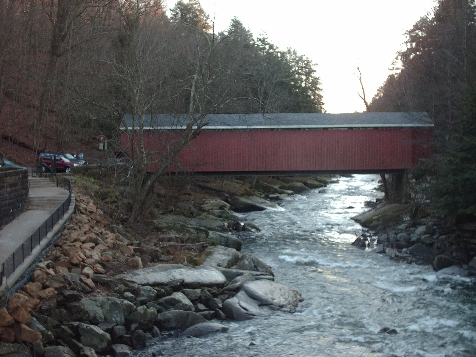

Covering about 2,837 acres, McConnells Mill State Park lies in Lawrence County, about 9 miles northeast of Ellwood City.
Things to do include rock climbing, hunting in season, boating, fishing, and picnicking. Its trail network totals roughly 11.2 miles, according to the park. On the water side, there is a boat ramp.
Hours
Park, gate, office and facility hours are listed separately because they often differ. Alerts above override normal hours.
| Facility | Days | Hours | Season |
|---|---|---|---|
| Park | Daily | sunrise – sunset | — |
Official wording
The park is open every day of the year, sunrise to sunset. Day use areas close at dusk. The historic gristmill is open on a limited schedule. Contact the Moraine State Park office for facility seasons and hours.
Source: official park page, checked Oct 29, 2026. Times are local to the park (America/New York).
Reservations
- Day use
- No day-use reservation requirement mentioned
- Booking system
- ReserveAmerica (Aspira), Pennsylvania State Parks contract
- Phone
- 888-PA-PARKS (888-727-2757)
We link to the official booking system rather than showing live availability, which changes minute to minute.
Things to do
BoatingPicnickingRock climbingFishingHuntingHiking
Trails
| Trail | Length | Difficulty | Notes |
|---|---|---|---|
| Alpha Pass Trail | 1.5 mi | More difficult | Recreations permitted: hiking Trailhead amenities: non-flush restrooms at Point Parking Area, benches At the northern end of McConnells Mill State Park, this trail is part of the North Country National Scenic Trail. Beginning at the Alpha Pass scenic vista, the trail follows the east bank of Slippery Rock Creek. A spur leads to the Point Parking Area, or continue following the trail along the creek to the historic mill.Hiking |
| Breakneck Falls Trail | 1.5 mi | More difficult | Recreations permitted: hiking Trailhead amenities: none Hikers can enjoy songbirds and large mature hemlock trees all year, and an abundance of wildflowers in the spring. Beginning at Breakneck Bridge, the trail follows along the eastern banks of Slippery Rock Creek to a short creek crossing at Cheeseman Run, ending with a steep climb through large boulders to the falls. The trail ends at the base of the falls. Hike back to the trailhead along the same path.Hiking |
| Hells Hollow Trail | 0.5 mi | Easiest | Recreations permitted: hiking Trailhead amenities: non-flush restrooms, picnic tables Beginning at Hells Hollow parking lot, follow and cross Hell Run on your way to a lime kiln and Hells Hollow Falls. Although the main trail is smooth and level, the section by the waterfall can be slippery.Hiking |
| Kildoo Trail | 3 mi | More difficult | Recreations permitted: hiking Trailhead amenities: non-flush restrooms, benches Kildoo Trail is south of the historic gristmill and begins at either end of the covered bridge. On the eastern bank, the easier section of the trail leads to Kildoo Falls. Continue on rockier terrain and cross Slippery Rock Creek at Eckert Bridge. Following the blue blazes of the North Country Trail, continue on the west bank upstream to the covered bridge.Hiking |
| Slippery Rock Gorge Trail | 6.2 mi | Most difficult | Recreations permitted: hiking, backpacking Trailhead amenities: non-flush restrooms Beginning at the Hells Hollow Parking Lot, Slippery Rock Gorge Trail (part of the North Country Trail) splits off Hells Hollow Trail just before the second footbridge. The trail follows the upper Hell Run Valley and then Slippery Rock Creek Gorge before descending into the deepest part of the gorge, Walnut Flats -- broad alluvial flood plain. At times, the trail traverses very steep terrain and significant changes in elevation. Hikers should allow a minimum of six hours to hike to Eckert Bridge and back. This iHikingBackpacking |
Trail descriptions from the park
11.2 miles of trails
Rugged trails traverse the gorge. Please wear appropriate clothing, including boots. For your safety and to protect the resource, please stay on the trails.
McConnells Mill State Park Map
Guidelines for a Safe Hike
- Wear sturdy shoes to protect your feet
- Stay on the trail -- if you hike off of the trail, you might get lost or damage the fragile habitat
- Carry drinking water -- DO NOT drink from streams, springs, or lakes without properly treating the water first
- Carry the proper safety equipment, like a first aid kit, whistle, and a poncho
- Check the weather before you hike -- it is not safe to hike in thunderstorms or when heavy snow is expected
- If you leave your purse, wallet, or valuables in your vehicle, be sure to lock them in the trunk or other hidden location in your vehicle
Amenities
Facilities
- Picnic areas
- Picnic shelters
Water
- Boat ramp
✓ listed by the park · ✕ the park says it is not available. Anything not shown here isn’t mentioned by the official source — that means unknown, not unavailable.
Accessibility
McConnells Mill State Park offers a range of accessibility accommodations to ensure all visitors can enjoy its natural beauty and recreational opportunities.
Accessible Picnic Tables
The Kildoo picnic area hosts ADA picnic tables. These accessible picnic tables are on the opposite end of the Kildoo parking area from the pavilion, near the restroom.
Kildoo Pavilion
The Kildoo pavilion can accommodate up to 50 people. There is ADA parking nearby.
Official accessibility information
Conditions change. Contact the park to confirm specific accessible features before your visit.
Getting there
- Address
- McConnells Mill Road
Portersville, PA 16051 - Nearest town
- Ellwood City — about 9 mi northeast (straight line)
- Coordinates
- 40.9517, -80.1685
- Phone
- (724) 368-8811
- morainesp@pa.gov
Google Maps directionsApple MapsOfficial park map (PDF)
Directions from the park
The park is about 40 miles north of Pittsburgh, via I-79, near the intersection of PA 19 and US 422. From US 422 west, the park entrance is on the left less than one half mile from the intersection of PA 19. For GPS devices, search for Kildoo Parking Lot at McConnells Mill State Park. GPS Decimal Degrees: Lat. 40.951710, Long. -80.168474
Nearby state parks
Sources and freshness
- Pennsylvania State Parks — park page — last checked Oct 29, 2026; page says updated Aug 14, 2026
- DCNR Find a Park: content-fragment JSON feed used by the pa.gov park finder
- Wikidata
- USGS PAD-US 4.1 (boundary and acreage)
- Photo: McConnells Mill Bridge and Creek.jpg — Public domain (released by the author), Nyttend
“Last checked” is when our system last read the official source. No change has been detected since this page was first published. Hours, fees and rules can change without notice — confirm with the park before you go. Methodology