Point State Park
Also known as Forks of the Ohio
- Status
- Open (per official listing)Daily sunrise – sunset
- Entrance fee
- Not posted
- Day-use reservations
- None mentioned
- Dogs
- Not stated — check with park
- Camping
- None listed
- Official site
- pa.gov(412) 565-2850
Official page last checked Oct 29, 2026. How we keep this current
Current alerts 1
Alert Contrary to some information found online, there is no fee to enter Point StatePark, which is open from sunrise until 11 pm daily. Point is a day-use only park and has no swimming or camping facilities.
Posted by the park. Official alert
Overview
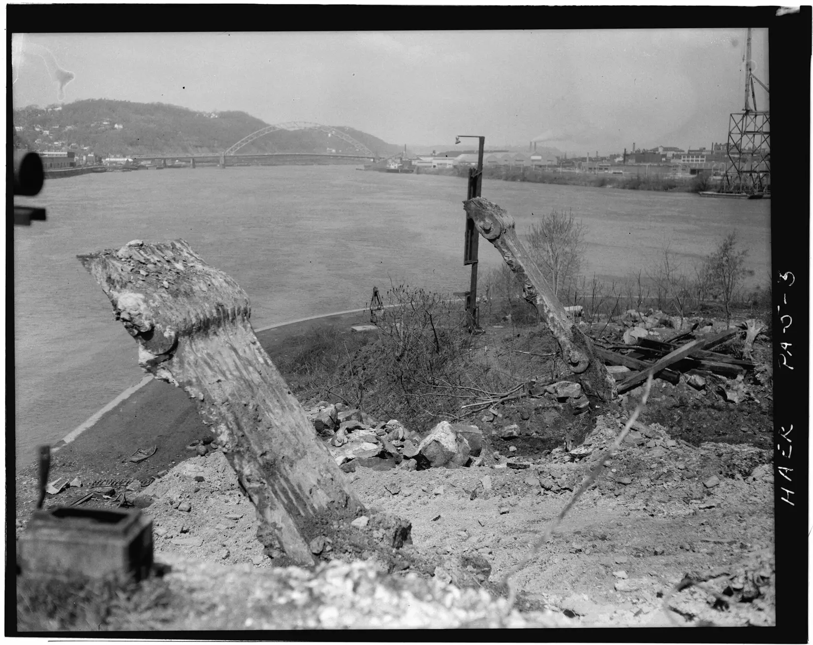
In Allegheny County, in Pittsburgh, Point State Park covers about 37 acres.
The park supports canoeing and kayaking, boating, biking, fishing, and hiking. The official site lists about 141 miles of trails. Water access includes a fishing pier.
Hours
Park, gate, office and facility hours are listed separately because they often differ. Alerts above override normal hours.
| Facility | Days | Hours | Season |
|---|---|---|---|
| Park | Daily | sunrise – sunset | — |
Official wording
The park is open every day of the year, sunrise to sunset. Day use areas close at dusk. The park office is open specific hours. Contact the park office for facility seasons and hours.
Source: official park page, checked Oct 29, 2026. Times are local to the park (America/New York).
Reservations
- Day use
- No day-use reservation requirement mentioned
- Booking system
- ReserveAmerica (Aspira), Pennsylvania State Parks contract
- Phone
- 888-PA-PARKS (888-727-2757)
We link to the official booking system rather than showing live availability, which changes minute to minute.
Things to do
BikingBoatingFishingHikingCanoeing and kayaking
Trails
| Trail | Length | Difficulty | Notes |
|---|---|---|---|
| Three Rivers Heritage Trail | 1 mi | Easiest | Recreations permitted: hiking, biking Trailhead amenities: modern restroom, potable water, benches This trail section within Point State Park has scenic views of the Allegheny River, Pittsburgh Bridges and North Shore. The trail is also in close proximity to a National Historic Landmark and the Fort Pitt Block House. The Three Rivers Heritage Trail is a pedestrian trail and greenway system in the Pittsburgh area, covering 37 miles along both sides of the Allegheny, Monongahela, and Ohio Rivers. It is a nearly complete route for cyclists, walkers, and runners, and in some places rollerbladers. HikingBiking |
Trail descriptions from the park
This activity or structure is ADA accessible.
Visitors can walk along ADA accessible paved promenades on the riverfront and to overlooks for dramatic views of Pittsburgh, its busy waterways, scenic hillsides, and many bridges.
Natural landscaping and a 100-foot tall fountain enhance the beauty of this unique park at the “Forks of the Ohio.” Numerous benches are throughout the park.
Several long distance hiking trails converge in Point State Park.
Point State Park Map
Great Allegheny Passage
The Great Allegheny Passage Rail Trail offers 141 miles of hiking and biking between Cumberland, Md., and Point State Park. In Cumberland, the rail trail joins the C&O Canal Towpath -- creating a continuous trail experience (325 miles long) to Washington, DC.
The 10-foot wide multipurpose trail is built on railroad corridors of gentle grades, sweeping curves, large bridges, and tunnels that pass through mountains, not over them.
The terminus of the rail trail is at the Forks of the Ohio marker near the fountain in Point State Park.
The trail system links the Cumberland and Pittsburgh metropolitan areas, providing visitors with an opportunity to travel through and learn about a region important to the development of national culture and politics.
George Washington envisioned the Potomac River as a trade route linking the Atlantic Ocean and the upper Ohio River Basin. The history of the region and the tangible character of the trail corridor itself highlight the concept of “the frontier” in American culture and the westward migration of Anglo-American society into the trans-Appalachian region of the continent.
The Great Allegheny Passage is a part of the Potomac Heritage National Scenic Trail, which is a diverse network of trails and routes running between Point State Park and Point Lookout in Maryland.
The Fort Pitt Museum is an official National Park Service Passport stamp location for the trail.
GPS DD: Lat. 40.44189 Long. -80.01324
Amenities
Facilities
- Amphitheater
Water
- Marina or boat slips
- Fishing pier
✓ listed by the park · ✕ the park says it is not available. Anything not shown here isn’t mentioned by the official source — that means unknown, not unavailable.
Accessibility
Point State Park offers a range of accessibility accommodations to ensure all visitors can enjoy its natural beauty and recreational opportunities.
Fishing Access
There are ADA accessible fishing piers on both rivers in the Wharf Area.
Allegheny River Wharf Side
Monongahela River Wharf Side
Hiking
Riverfront Promenade - Visitors can stroll along ADA accessible paved promenades on the riverfront and to overlooks for dramatic views of Pittsburgh, its busy waterways, scenic hillsides, and many bridges.
Visitors can stroll along ADA accessible paved promenades on the riverfront and to overlooks for dramatic views of Pittsburgh, its busy waterways, scenic hillsides, and many bridges.
Theaters and Amphitheaters
The Monongahela and Allegheny Amphitheaters are accessible to both the top and the bottom.
Monongahela Amphitheater
Allegheny Amphitheater
Historic Place
Point State Park is designated as a National Historic Landmark. Multiple plaques can be found throughout the park commemorating the park and local historically significant events.
Official accessibility information
Conditions change. Contact the park to confirm specific accessible features before your visit.
Getting there
- Address
- 601 Commonwealth Place
Pittsburgh, PA 15222-1212 - Nearest town
- Pittsburgh
- Coordinates
- 40.4417, -80.0072
- Phone
- (412) 565-2850
- pointsp@pa.gov
Google Maps directionsApple MapsOfficial park map (PDF)
Directions from the park
The 36-acre park is located at 601 Commonwealth Place. From the east, take I-376 west to the Stanwix Street Exit. Turn left at the light onto Fort Pitt Boulevard and bear right onto Commonwealth Place. From the south and west, take I-376 East across the Fort Pitt Bridge. Keep in the center lane to take Exit 70A, the Boulevard of the Allies. Follow signs for Boulevard of Allies. Turn right onto Commonwealth Place. From the north, take I-279 South across the Fort Duquesne Bridge. Take the I-376 East Exit then take the Stanwix Street Exit on the left. Make a left at the light onto Fort Pitt Boulevard and bear right at the Y onto Commonwealth Place. GPS Decimal Degrees: Lat. 40.4417 Long. -80.00719 Parking The park’s parking lot is located along Commonwealth Place (across from the Post Gazette building) and is operated by Boulos Parking Inc. The lot is open from 6:00 A.M. to 11:00 P.M. daily for a fee. To get to the park, visitors should walk out of the parking lot entrance, turn left, and follow the sidewalk to the main entrance of the park (located across from the Wyndham Hotel). There is some limited metered parking along Commonwealth Place near the park entrance as well as a pull-in visitor drop off area. Several parking lots and garages are located within walking distance of the park. For the locations and the parking rates, contact the Pittsburgh Parking Authority. Call ahead, reserved parking is available for the Parking Authority garages and lots Monday through Friday, from 10:00 A.M. until 2:00 P.M. Visitors must contact the Pittsburgh Downtown Partnership at 412-566-4190 at least 24 hours in advance. There is no fee for the service; however, parking rates still apply. Public Transit Visitors may wish to use public transportation to get to the park. The T light rail system (subway) is free to ride in the Golden Triangle and the North Shore. Buses are no longer free to ride within the Golden Triangle. More information about bus service and the T is available from the Port Authority of Allegheny County.
Nearby state parks
Sources and freshness
- Pennsylvania State Parks — park page — last checked Oct 29, 2026; page says updated Aug 14, 2026
- DCNR Find a Park: content-fragment JSON feed used by the pa.gov park finder
- Wikidata
- USGS PAD-US 4.1 (boundary and acreage)
- Photo: Charles W. Shane, Photographer, April 1970. REMAINS OF EYE-BARS OF ANCHOR PIERS FOR FIRST POINT BRIDGE, DEMOLISHED C.1927. - Point Bridge, Spanning Monongahela River at Point of HAER PA,2-PITBU,38-3.tif — Public domain (US federal government work), Related names: Dravo Construction Company Fort Pitt Bridge Works Allegheny County Department of Public Works Richardson,
“Last checked” is when our system last read the official source. No change has been detected since this page was first published. Hours, fees and rules can change without notice — confirm with the park before you go. Methodology