Jennings Environmental Education Center
- Status
- Status not postedDaily sunrise – sunset
- Entrance fee
- Not posted
- Day-use reservations
- None mentioned
- Dogs
- Not stated — check with park
- Camping
- None listed
- Official site
- pa.gov(724) 794-6011
Official page last checked Oct 29, 2026. How we keep this current
Overview
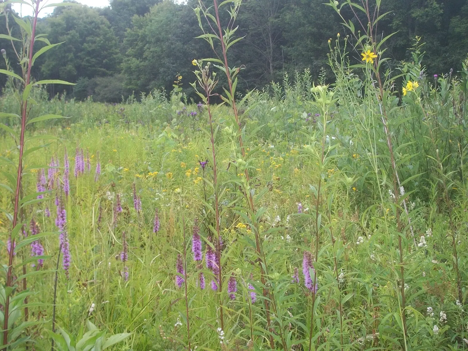

Covering about 299 acres, Jennings Environmental Education Center lies in Butler County, about 11 miles southeast of Grove City.
Things to do include cross-country skiing, winter sports, picnicking, and hiking. Its trail network totals roughly 5 miles, according to the park.
Hours
Park, gate, office and facility hours are listed separately because they often differ. Alerts above override normal hours.
| Facility | Days | Hours | Season |
|---|---|---|---|
| Park | Daily | sunrise – sunset | — |
| Mon–Fri | 8 a.m. – 4 p.m. | — |
Official wording
The park is open every day of the year, sunrise to sunset. Day use areas close at dusk. The office is open from 8:00 A.M. to 4:00 P.M., Monday through Friday, and some weekends. Contact the center office for facility seasons and hours, particularly for weekend schedules.
Source: official park page, checked Oct 29, 2026. Times are local to the park (America/New York).
Reservations
- Day use
- No day-use reservation requirement mentioned
- Booking system
- ReserveAmerica (Aspira), Pennsylvania State Parks contract
- Phone
- 888-PA-PARKS (888-727-2757)
We link to the official booking system rather than showing live availability, which changes minute to minute.
Things to do
Winter sportsCross-country skiingPicnickingHiking
Trails
| Trail | Length | Difficulty | Notes |
|---|---|---|---|
| Black Cherry Trail | 0.5 mi | Easiest | Recreations permitted: hiking, snowshoeing recommended Trailhead amenities: modern restrooms in park office, potable water, picnic tables Traveling through both upland and bottomland, this trail has good habitat for spring wildflowers, ferns, and birds. For a short distance, the trail follows Big Run, a small stream that flows through the park.HikingSnowshoeing recommended |
| Blazing Star Trail | 0.22 mi | Easiest | Recreations permitted: hiking, snowshoeing recommended, cross-country skiing recommended Trailhead amenities: non-flush restrooms, picnic tables, benches Named for the beautiful wildflower that turns the prairie purple in late July and early August, this self-guiding trail travels through the middle of the prairie. Follow the signs and discover how the prairie was formed and why it is unique.HikingSnowshoeing recommendedCross-country skiing recommended |
| Deer Trail | 0.35 mi | Easiest | Recreations permitted: hiking, snowshoeing recommended, cross-country skiing recommended Trailhead amenities: none Accessed at the end of Blazing Star Trail, this short, flat, wide loop trail travels through an area where trees were removed to open the forest canopy, expanding the prairie and oak savannah ecosystem. This important resource management effort provides additional habitat for a variety of wildlife, including the endangered massasauga rattlesnake.HikingSnowshoeing recommendedCross-country skiing recommended |
| Glacier Ridge Trail | 0.31 mi | Easiest hiking in the park | Recreations permitted: hiking, snowshoeing recommended Trailhead amenities: none This trail links Jennings to Moraine State Park. In Jennings, it travels though some of the most scenic woodlands in the park. In Moraine, the trail continues for 14.8 miles to the western side of the park, and many portions are designated as the North Country Trail.HikingSnowshoeing recommended |
| Hepatica Trail | 0.26 mi | Easiest | Recreations permitted: hiking, snowshoeing recommended, cross-country skiing recommended Trailhead amenities: none Spring wildflowers, such as the fragile hepatica, can be seen along this connecting trail that links Oakwoods Trail to Glacier Ridge Trail.HikingSnowshoeing recommendedCross-country skiing recommended |
| Massasauga Trail | 0.47 mi | Easiest | Recreations permitted: hiking, snowshoeing recommended, cross-country skiing recommended Trailhead amenities: none Starting in the prairie, this trail soon enters a mixed hardwood forest of predominately oak and hickory. The dry forest soon drops into the damp, scenic Big Run valley, providing an opportunity to observe barred owls, before rising again to meet Deer Trail.HikingSnowshoeing recommendedCross-country skiing recommended |
| North Country National Scenic Trail | 0.9 mi | Easiest hiking in the park | Recreations permitted: hiking, backpacking Trailhead amenities: none This National Scenic Trail passes through Jennings and utilizes a number of the woodland trails, including Glacier Ridge, Ridge, and Black Cherry. This blue-blazed trail system links North Dakota to New York, traveling through seven states with a distance of more than 4,600 miles.HikingBackpacking |
| Oakwoods Trail | 1.2 mi | Easiest | Recreations permitted: hiking, snowshoeing recommended, cross-country skiing recommended Trailhead amenities: none Accessed from Deer Trail or Massasauga Trail, this is the longest trail at Jennings and covers varying terrain and several different types of habitat, including an area recently influenced by beaver. Unique to this trail are several manmade pits. It is believed that the pits were excavated in the 19th century for ore bearing clay, which was taken to local iron furnaces.HikingSnowshoeing recommendedCross-country skiing recommended |
| Old Elm Trail | 0.25 mi | Easiest | Recreations permitted: hiking, snowshoeing recommended Trailhead amenities: modern restrooms, potable water, picnic tables Starting west of the center office and looping back to it, this trail passes through an area of the park once dominated by large elm trees. Most succumbed to Dutch elm disease in the 1930s, leaving nothing but rotting logs behind.HikingSnowshoeing recommended |
| Old Field Trail | 0.18 mi | Easiest | Recreations permitted: hiking, snowshoeing recommended, cross-country skiing recommended Trailhead amenities: none Linking Deer Trail to Oakwoods Trail, Old Field Trail passes through an area dominated by hawthorns and other small shrubs. This is evidence that the area was a farm field many years ago.HikingSnowshoeing recommendedCross-country skiing recommended |
| Old Mill Trail | 0.14 mi | Easiest | Recreations permitted: hiking, snowshoeing recommended Trailhead amenities: none Accessed by following Woodwhisper Trail for 0.04 mile, this trail connects the center office to Black Cherry Trail and passes by the remains of a 19th century sawmill.HikingSnowshoeing recommended |
| Prairie Loop Trail | 0.28 mi | Easiest | Recreations permitted: hiking, snowshoeing recommended, cross-country skiing recommended Trailhead amenities: none The educational signs continue on this short loop that can be accessed from Blazing Star Trail. This trail is recommended for viewing wildflowers in the summer and fall.HikingSnowshoeing recommendedCross-country skiing recommended |
| Ridge Trail | 0.68 mi | More difficult | Recreations permitted: hiking, snowshoeing recommended Trailhead amenities: none This rough, wooded trail passes through the only area open to hunting in the park and can be an interesting extension to Black Cherry Trail. Large boulders and rocky terrain highlight this steep trail.HikingSnowshoeing recommended |
| Wetlands Kiosk Trail | 0.68 mi | Easiest | Recreations permitted: hiking, snowshoeing recommended Trailhead amenities: none Accessed half-way along Woodwhisper Trail, this short trail leads to an educational kiosk overlooking a passive wetland treatment site.HikingSnowshoeing recommended |
| Woodwhisper Trail | 0.16 mi | Easiest | Recreations permitted: hiking, snowshoeing recommended Trailhead amenities: potable water, benches Popular with people with strollers, this ADA accessible trail with a crushed stone path loops through an upland, mixed hardwood forest. A short spur trail leads to an educational kiosk overlooking a passive wetland treatment site.HikingSnowshoeing recommended |
Trail descriptions from the park
5 miles of trails
Jennings offers many hiking opportunities that traverse varying terrain and diverse habitats. Visitors may walk through more than 300 acres of forest and prairie.
The trail system is designed as a series of loops, with trail signs at every intersection, making it possible to choose a variety of hiking experiences.
Trails are designed for foot traffic only. Bicycles and motorized vehicles are prohibited. Some trails are appropriate for cross-country skiing. Pets are permitted, but must remain on a leash at all times.
Jennings Environmental Education Center Map
Note: The eastern prairie is a rare ecosystem that is home to the endangered massasauga rattlesnake. Although this small and reclusive snake is very timid, it is venomous and visitors should be careful when walking through its home.
Staying on the mowed paths and keeping alert can reduce the chances of an unexpected encounter.
Amenities
Facilities
- Picnic areas
- Picnic shelters
✓ listed by the park · ✕ the park says it is not available. Anything not shown here isn’t mentioned by the official source — that means unknown, not unavailable.
Accessibility
Jennings Environmental Education Center offers a range of accessibility accommodations to ensure all visitors can enjoy its natural beauty and recreational opportunities.
Accessible Picnic Tables
ADA accessible picnic tables are available in both picnic areas.
Prairie Picnic Pavilion
There is vehicle access for loading/drop-off/parking and ADA tables within pavilion.
Woodwhisper Trail
0.16 mile | Easiest hiking | Loop trail | Marked with signs
Recreations permitted: hiking, snowshoeing recommended
Trailhead amenities: potable water, benches
Popular with people with strollers, this ADA accessible trail with a crushed stone path loops through an upland, mixed hardwood forest. A short spur trail leads to an educational kiosk overlooking a passive wetland treatment site.
Read more from the park
Hunting
This park offers accessible hunting options. Visitors holding a DCNR Mobility Device Permit can contact the park office for more information about accessible hunting locations within the park.
DCNR permits visitors with a DCNR Mobility Device Permit to use powered mobility devices on designated state park and forest lands, including administrative roads and trails not normally open to standard motorized vehicles.
Visitors interested in a DCNR Mobility Device Permit can fill out an application and submit it at any state park or forest office.
Historic Place
The Foltz School House offers ADA parking, access and restroom facilities.
Official accessibility information
Conditions change. Contact the park to confirm specific accessible features before your visit.
Getting there
- Address
- 2951 Prospect Road
Slippery Rock, PA 16057-5023 - Nearest town
- Grove City — about 11 mi southeast (straight line)
- Coordinates
- 41.0093, -80.0036
- Phone
- (724) 794-6011
- jenningssp@pa.gov
Google Maps directionsApple MapsOfficial park map (PDF)
Directions from the park
The center is 12 miles north of Butler, on PA 528. GPS DD: Lat. 41.00925 Long. -80.00359
Nearby state parks
Sources and freshness
- Pennsylvania State Parks — park page — last checked Oct 29, 2026; page says updated Sep 3, 2026
- DCNR Find a Park: content-fragment JSON feed used by the pa.gov park finder
- Wikidata
- USGS PAD-US 4.1 (boundary and acreage)
- Photo: Jenningsbloom.jpg — Public domain (released by the author), VitaleBaby at Wikipedia
“Last checked” is when our system last read the official source. No change has been detected since this page was first published. Hours, fees and rules can change without notice — confirm with the park before you go. Methodology