State Parks Near Salem, Ohio
19 state park units lie within 50 miles of Salem, including 7 parks across the line in West Virginia and Pennsylvania. The closest is Guilford Lake State Park, about 7 mi south of town. 5 parks are within 25 miles, close enough for an evening visit.
- Closest park
- Guilford Lake State Park7 mi south
- Within 25 miles
- 5of 19 within 50 mi
- With camping
- 116 with cabins
- Dog-friendly
- 3pets allowed
State parks near Salem, nearest first
Straight-line distance from central Salem; driving distance is usually longer.
Guilford Lake State Park
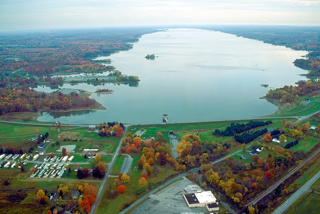
On the water side, there is a swimming beach, a boat ramp, and boat or kayak rentals. Camping is available: 2 camping areas, including tent sites.
Hours, fees and rules for Guilford Lake State Park →Lake Milton State Park
Water access includes a swimming beach, a boat ramp, and boat or kayak rentals.
Hours, fees and rules for Lake Milton State Park →Beaver Creek State Park
On the water side, there is a boat ramp. Overnight options include 3 camping areas, with tent sites and group camping.
Hours, fees and rules for Beaver Creek State Park →West Branch State Park
Water access includes a swimming beach and a boat ramp. Camping is available: 3 camping areas, including tent sites, group camping, and showers.
Hours, fees and rules for West Branch State Park →Quail Hollow State Park
Camping is available: campsites, including tent sites and group camping.
Hours, fees and rules for Quail Hollow State Park →Tomlinson Run State Park
Things to do include horseback riding, historic sites, boating, swimming, and biking. Camping is available: 55 campsites, including RV sites with electric hookups and tent sites. There are also cabins for rent.
Hours, fees and rules for Tomlinson Run State Park →Wingfoot Lake State Park
Water access includes boat or kayak rentals.
Hours, fees and rules for Wingfoot Lake State Park →Jefferson Lake State Park
Water access includes a swimming beach and a boat ramp. For overnight stays there are 2 camping areas (tent sites).
Hours, fees and rules for Jefferson Lake State Park →Nelson-Kennedy Ledges State Park
In Portage County, about 12 miles northwest of Warren, Nelson-Kennedy Ledges State Park covers about 169 acres.
Hours, fees and rules for Nelson-Kennedy Ledges State Park →Mosquito Lake State Park
Water access includes a swimming beach, a boat ramp, a fishing pier, and boat or kayak rentals. Overnight options include 3 camping areas, with tent sites, group camping, and showers. There are also yurts for rent.
Hours, fees and rules for Mosquito Lake State Park →Portage Lakes State Park
Water access includes a swimming beach and a boat ramp.
Hours, fees and rules for Portage Lakes State Park →Raccoon Creek State Park
Visitors come for snorkeling and diving, snowmobiling, cross-country skiing, mountain biking, and horseback riding. Facilities for water recreation include a swimming beach, a boat ramp, a fishing pier, and boat or kayak rentals.
Hours, fees and rules for Raccoon Creek State Park →McConnells Mill State Park
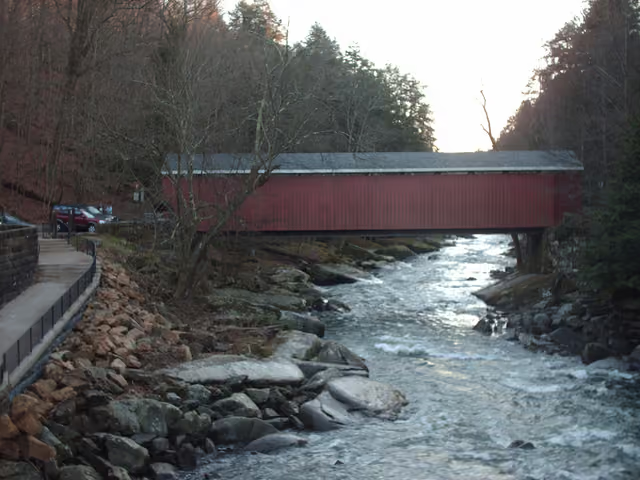
Things to do include rock climbing, hunting in season, boating, fishing, and picnicking. Its trail network totals roughly 11.2 miles, according to the park. On the water side, there is a boat ramp.
Hours, fees and rules for McConnells Mill State Park →Tinkers Creek State Park
Covering about 8 acres, Tinkers Creek State Park lies in Portage County, about 3 miles southwest of Aurora.
Hours, fees and rules for Tinkers Creek State Park →Moraine State Park
Popular activities here are snorkeling and diving, snowmobiling, cross-country skiing, golf, and horseback riding. Its trail network totals roughly 29.2 miles, according to the park.
Hours, fees and rules for Moraine State Park →Hillman State Park
Popular activities here are horseback riding, mountain biking, hunting in season, fishing, and biking.
Hours, fees and rules for Hillman State Park →Punderson State Park
On the water side, there is a swimming beach, a swimming pool, a boat ramp, and boat or kayak rentals. Camping is available: 3 camping areas, including tent sites, primitive or hike-in sites, and group camping.
Hours, fees and rules for Punderson State Park →Jennings Environmental Education Center
Things to do include cross-country skiing, winter sports, picnicking, and hiking. Its trail network totals roughly 5 miles, according to the park.
Hours, fees and rules for Jennings Environmental Education Center →Pymatuning State Park
The park supports snorkeling and diving, snowmobiling, cross-country skiing, golf, and disc golf. The official site lists about 7 miles of trails.
Hours, fees and rules for Pymatuning State Park →
Best picks by activity
Camping near Salem
- Guilford Lake State Park 7 mi south · Campground listed
- Beaver Creek State Park 19 mi southeast · Campground listed
- West Branch State Park 22 mi northwest · Campground listed
- Quail Hollow State Park 25 mi west · Campground listed
- Tomlinson Run State Park 27 mi southeast · 55 campsites
+ 6 more in the list above
Cabins and lodging near Salem
- Tomlinson Run State Park 27 mi southeast · Cabins or other roofed stays
- Mosquito Lake State Park 31 mi north · Cabins or other roofed stays
- Raccoon Creek State Park 36 mi southeast · Cabins or other roofed stays
- Moraine State Park 39 mi east · Cabins or other roofed stays
- Punderson State Park 43 mi northwest · Cabins or other roofed stays
+ 1 more in the list above
Dog-friendly state parks near Salem
- Raccoon Creek State Park 36 mi southeast · Pets allowed under park rules
- Moraine State Park 39 mi east · Pets allowed under park rules
- Pymatuning State Park 46 mi northeast · Pets allowed under park rules
Swimming near Salem
- Guilford Lake State Park 7 mi south · Beach, pool or swim area
- Lake Milton State Park 14 mi northwest · Beach, pool or swim area
- West Branch State Park 22 mi northwest · Beach, pool or swim area
- Tomlinson Run State Park 27 mi southeast · Beach, pool or swim area
- Jefferson Lake State Park 30 mi south · Beach, pool or swim area
+ 6 more in the list above
Hiking near Salem
- Tomlinson Run State Park 27 mi southeast · Hiking trails listed
- Raccoon Creek State Park 36 mi southeast · Hiking trails listed
- McConnells Mill State Park 36 mi east · Hiking trails listed
- Moraine State Park 39 mi east · Hiking trails listed
- Hillman State Park 40 mi southeast · Hiking trails listed
+ 2 more in the list above
Fishing near Salem
- Tomlinson Run State Park 27 mi southeast · Fishing listed
- Raccoon Creek State Park 36 mi southeast · Fishing listed
- McConnells Mill State Park 36 mi east · Fishing listed
- Moraine State Park 39 mi east · Fishing listed
- Hillman State Park 40 mi southeast · Fishing listed
+ 1 more in the list above
Questions about state parks near Salem
What is the closest state park to Salem?
Guilford Lake State Park is the closest, about 7 miles south of Salem in a straight line. Next are Lake Milton State Park and Beaver Creek State Park.
How many state parks are near Salem?
19 state park units are within 50 miles, and 5 within 25 miles. That includes parks, recreation areas, historic sites and natural areas run by the state.
Which state parks near Salem have camping?
11 parks list camping, the nearest being Guilford Lake State Park, Beaver Creek State Park and West Branch State Park. Check each park page for site types, hookups and how to reserve.
Are dogs allowed at state parks near Salem?
Yes, at 3 parks, including Raccoon Creek State Park, Moraine State Park and Pymatuning State Park. Dogs usually must be leashed, and some areas such as beaches or buildings may be off-limits.
Are there free state parks near Salem?
None of the nearby parks list free entry; most charge a daily vehicle fee or accept an annual pass. Fees are on each park page.
State parks near other cities
- Near Youngstown, OH17 mi northeast
- Near Warren, OH23 mi north
- Near New Castle, PA27 mi east
- Near Akron, OH37 mi west
- Near New Philadelphia, OH42 mi southwest
- Near Pittsburgh, PA56 mi southeast
- Near Wooster, OH57 mi west
- Near Wheeling, WV58 mi south
Or see all Ohio state parks, West Virginia state parks, Pennsylvania state parks or every city we cover.
Built from official park data and updated as parks change; this list was last rebuilt Oct 30, 2026. Features shown are those the official source lists. Filter these parks on the map.