South Yuba River State Park
- Status
- Open (per official listing)Daily sunrise – sunset
- Entrance fee
- $10 per dayAnnual pass available
- Day-use reservations
- None mentioned
- Dogs
- Statewide rule — see below
- Camping
- None listed
- Official site
- parks.ca.gov(530) 432-2546
Official page last checked Oct 29, 2026. How we keep this current
Overview
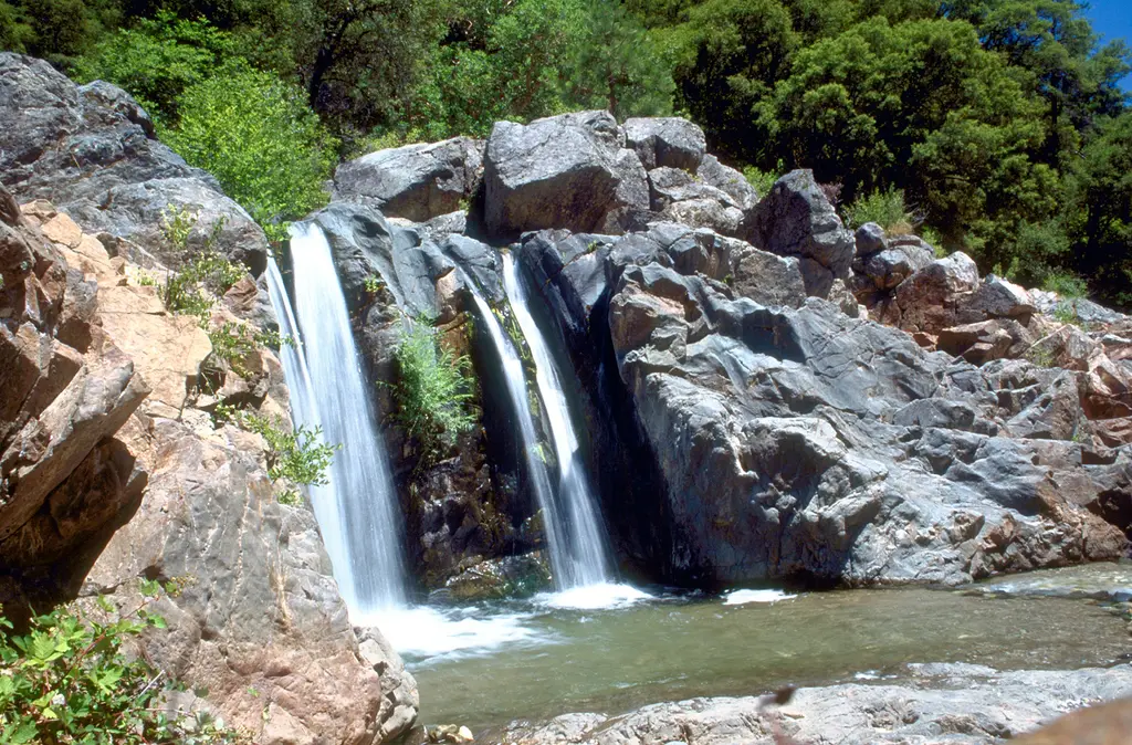

South Yuba River State Park is a 3,678-acre park in Nevada County, about 9 miles northwest of Grass Valley.
Things to do include historic sites, boating, swimming, fishing, and ranger programs. Facilities for water recreation include a swimming beach.
Hours
Park, gate, office and facility hours are listed separately because they often differ. Alerts above override normal hours.
| Facility | Days | Hours | Season |
|---|---|---|---|
| Park | Daily | sunrise – sunset | — |
Official wording
Sunrise-Sunset
Source: official park page, checked Oct 29, 2026. Times are local to the park (America/Los Angeles).
Fees and passes
| Item | Amount |
|---|---|
| Vehicle Day Use | $10 |
Official wording
Special rates may apply for peak season, high demand holiday periods, and during weekends. Prices are subject to change without notice. • Vehicle Day Use: $10.00
California park passes
- California Explorer Annual Pass — $195. Vehicle day-use entry to 134 state parks incl. high-demand Southern California beaches Details
- Golden Poppy Annual Pass — $125. Vehicle day-use entry to 112 state parks Details
- Historian Passport — $50. Admission for up to four people at per-person-fee State Historic Parks Details
- Off-Highway Vehicle (OHV) Annual Pass — $50. Entry to State Vehicular Recreation Areas that collect day-use fees Details
- SNO-Park Pass — $40 season / $15 day. 18 SNO-PARK winter recreation areas Details
From the California state guide. Confirm which passes this park accepts.
Reservations
- Day use
- No day-use reservation requirement mentioned
- Booking system
- ReserveCalifornia
- Phone
- (800) 444-7275
We link to the official booking system rather than showing live availability, which changes minute to minute.
Pets
See the park’s wording
Are dogs allowed? Yes: Dogs allowed on all trails and shoreline areas of South Yuba River State Park, except the area known as Family Beach. Dogs not allowed here from the covered bridge at Bridgeport, 200 feet downstream on both sides of the river.
Service animals are generally permitted where pets are not. Check with the park for specific areas.
Things to do
BoatingHistoric sites and toursPicnickingFishingRanger and interpretive programsSwimmingHiking
Amenities
Facilities
- Restrooms
- Drinking water
- Picnic areas
- Visitor center
- Nature center or museum
- Parking
Water
- Swimming beach
✓ listed by the park · ✕ the park says it is not available. Anything not shown here isn’t mentioned by the official source — that means unknown, not unavailable.
Accessibility
Overview
South Yuba River State Park includes portions of a 20-mile segment of the South Yuba River canyon between Malakoff Diggins State Historic Park and the Bridgeport covered bridge. The park offers day use areas, scenic vistas, and several architecturally different bridges spanning from the Gold Rush era to the mid-20th century. Access points to the park are located at Edwards Crossing, Purdon Crossing, Highway 49, and Bridgeport. The park headquarters is located off Highway 49 at 17660 Pleasant Valley Road in Penn Valley. Call (530) 432-2546 for more information.
Trails
The Buttermilk Bend Trail is an ‘out-and-back’ accessible trail that is 0.70 miles each way that offers stunning views of the South Yuba River Canyon. Springtime wildflower hikes are popular between March and May. The surface is compacted soil. Some segments of the trail may be more challenging for some users. This trail is located high above the canyon with steep side slopes and rugged terrain. There are two armored crossings on the trail that water flows over during rain events that might be challenging for some users. The trail is generally flat at less than 5% slopes with intermittent sections between 5% to 8% and one section for 3 feet at 9%. Accessible parking is located at the trailhead and a non-flush accessible restroom is located in the lower parking lot.
Read more from the park
Trail Name Running Slope Cross Slope Trail Width Trail Surface
Buttermilk Bend Trail 3% Average 3% Average 4 FT Average Soil
9% Maximum 5% Maximum 3 FT Minimum
Exhibits/Programs
The elegant Bridgeport covered bridge dates from the 1860s and is considered the longest surviving single span covered bridge in America. It is located on Pleasant Valley Road, about halfway between Highway 20 and Highway 49, just outside of French Corral. There are two accessible parking spaces in an adjacent lot, with one van accessible. Route from the parking lot to the bridge is generally accessible; surface is compacted aggregate. Route across the bridge utilizes a nonslip mat to cover gaps in the bridge decking and provide a wheelchair accessible experience. A generally accessible turnaround area is available on the opposite side of the bridge; surface is compacted aggregate.
Official accessibility information
Conditions change. Contact the park to confirm specific accessible features before your visit.
Getting there
- Address
- 17660 Pleasant Valley Road
Penn Valley, CA 95946 - Nearest town
- Grass Valley — about 9 mi northwest (straight line)
- Coordinates
- 39.2917, -121.1944
- Phone
- (530) 432-2546
Entrances
- Directions point
Google Maps directionsApple MapsOfficial park map (PDF)
Directions from the park
South Yuba River State Park is located off Highway 49, north of Nevada City. The park is accessible from Edwards Crossing, Purdon Crossing, Highway 49 and Bridgeport. Address: 17660 Pleasant Valley Road, Penn Valley, CA 95946
Nearby state parks
Sources and freshness
- California State Parks — park page — last checked Oct 29, 2026
- California State Parks Listing page (one link per unit, page_id = officialId), unioned with the CSP Enterprise GIS 'ParkEntryPoints' ArcGIS layer (coords, address, county, unit number, management status) and the 'CSPParkUnit_CurrentStatus' layer (open/partial/full closure)
- Wikidata
- USGS PAD-US 4.1 (boundary and acreage)
- Photo: South Yuba River waterfall.jpg — Public domain (US federal government work), Michael Nevins, U.S. Army Corps of Engineers
“Last checked” is when our system last read the official source. No change has been detected since this page was first published. Hours, fees and rules can change without notice — confirm with the park before you go. Methodology