Malakoff Diggins State Historic Park
- Status
- Open (per official listing)Daily sunrise – sunset
- Entrance fee
- $10 per dayAnnual pass available
- Day-use reservations
- None mentioned
- Dogs
- Dogs allowed, with restrictions
- Camping
- Yes
- Official site
- parks.ca.gov(530) 265-2740
Official page last checked Oct 29, 2026. How we keep this current
Overview
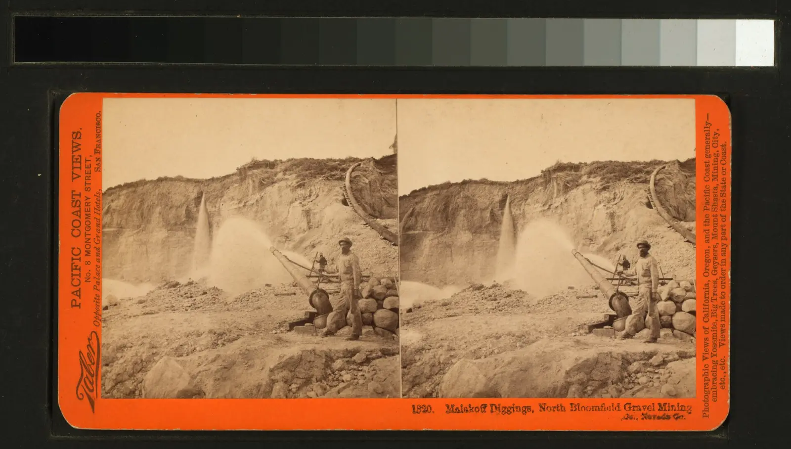
Malakoff Diggins State Historic Park is a 3,165-acre historic site in Nevada County, about 13 miles northeast of Grass Valley.
The park supports horseback riding, historic sites, boating, swimming, and fishing. The official site lists about 20 miles of trails. For overnight stays there are campsites (RV sites, tent sites, and group camping).
Hours
Park, gate, office and facility hours are listed separately because they often differ. Alerts above override normal hours.
| Facility | Days | Hours | Season |
|---|---|---|---|
| Park | Daily | sunrise – sunset | — |
| Daily | 10 a.m. – 6 p.m. | Memorial day – labor day | |
| Daily | 10 a.m. – 4 p.m. | — | |
| Sat–Sun | 10 a.m. – 4 p.m. | Nov 1 – May 31 |
Official wording
The park is open daily on a self-guided basis from sunrise until sunset. Memorial Day – Labor Day (Summer): Daily 10 a.m. – 6 p.m. Labor Day - October 31: Daily 10 a.m. – 4 p.m. November – May: Saturday and Sunday, 10 a.m. – 4 p.m.
Seasons/Climate/Recommended Clothing: Summer and spring are warm; fall and winter can be cool. Layered clothing is advised.
Source: official park page, checked Oct 29, 2026. Times are local to the park (America/Los Angeles).
Fees and passes
| Item | Amount |
|---|---|
| Vehicle Day Use | $10 |
Official wording
Special rates may apply for peak season, high demand holiday periods, and during weekends. Prices are subject to change without notice. • Vehicle Day Use: $10.00
California park passes
- California Explorer Annual Pass — $195. Vehicle day-use entry to 134 state parks incl. high-demand Southern California beaches Details
- Golden Poppy Annual Pass — $125. Vehicle day-use entry to 112 state parks Details
- Historian Passport — $50. Admission for up to four people at per-person-fee State Historic Parks Details
- Off-Highway Vehicle (OHV) Annual Pass — $50. Entry to State Vehicular Recreation Areas that collect day-use fees Details
- SNO-Park Pass — $40 season / $15 day. 18 SNO-PARK winter recreation areas Details
From the California state guide. Confirm which passes this park accepts.
Reservations
- Day use
- No day-use reservation requirement mentioned
- Camping
- Required
- Booking system
- ReserveCalifornia
- Phone
- (800) 444-7275
Open sites for the Chute Hill Campground and in-town cabins are available by reservation only.
We link to the official booking system rather than showing live availability, which changes minute to minute.
Pets
Dogs allowed, with restrictions
Not allowed in or on: historic buildings.
Are dogs allowed? Yes: Except for service animals, dogs not allowed inside historic buildings. Call the park to learn about available dog-friendly trails. Dogs must be on a controlled leash at all times.
Service animals are generally permitted where pets are not. Check with the park for specific areas.
Camping
Camping
Open sites for the Chute Hill Campground and in-town cabins are available by reservation only. Please log into (www.reservecalifornia.com) to make your reservations.
Please note:
- Campground does not have showers.
- Maximum trailer size for passage through campground is 19 feet.
- Potable water is available in various locations in the campground
- Unless posted above, fires are currently allowed in designated fire rings.
- Firewood is available for purchase in the visitor center. Burn it where you buy it!
- Cabins are not located within the campground area; they are in the historic town area.
Overnight facilities: En route Campsites, Tent Camping, Group Campsites, Remote Camping, RV Access
From the official park page, checked Oct 29, 2026. Site counts and prices can change; confirm when booking.
Things to do
BoatingHistoric sites and toursPicnickingFishingRanger and interpretive programsSwimmingGeocachingHikingHorseback ridingCamping
Trails
Trails
Malakoff Diggins has over 20 miles of trails throughout the park. Trails range in length from 1/2 mile to 3 miles one way, from easy to steep elevation changes. Call the park to learn about available dog-friendly trails. Dogs must be on a controlled leash at all times.
Amenities
Facilities
- Restrooms
- Drinking water
- Picnic areas
- Visitor center
- Nature center or museum
- Parking
- Group facilities
Camping
- Tent camping
- RV camping
- Group camping
Recreation
- Horse trails
✓ listed by the park · ✕ the park says it is not available. Anything not shown here isn’t mentioned by the official source — that means unknown, not unavailable.
Accessibility
Overview
Malakoff Diggins State Historic Park is nestled amongst the pine-studded chaparral forest of the Sierra Nevada Foothills and is home to California’s largest hydraulic gold mine. Visitors can see huge cliffs carved by mighty jets of water, results of the gold-mining technique of washing away entire mountains to find gold. The park Visitor Center features displays on mining and pioneer life in the old mining town of North Bloomfield, as well as a short video on hydraulic mining. Phone (530) 265-2740 for more information.
Trails
The Overlook Trail is an ‘out-and-back’ accessible trail that is 0.13 miles each way that ends at an overlook of the Diggins escarpment. The surface is compacted aggregate for most of the trail. The trail is generally flat at less than 5% slopes with intermittent sections between 5% to 8%. Accessible parking is provided at the trailhead along North Bloomfield Road.
Trail Name Running Slope Cross Slope Trail Width Trail Surface
Overlook Trail 4% Average 2.2% Average 5 FT Average Aggregate & Wood
8% Maximum 5% Maximum 5 FT Minimum
Official accessibility information
Conditions change. Contact the park to confirm specific accessible features before your visit.
Getting there
- Address
- 19000 North Bloomfield Road
Nevada City, CA 95959 - Nearest town
- Grass Valley — about 13 mi northeast (straight line)
- Coordinates
- 39.3661, -120.8988
- Phone
- (530) 265-2740
Entrances
- Directions point
Google Maps directionsApple MapsOfficial park map (PDF)
Directions from the park
Travel 11-miles north on highway-49 toward Downieville. Turn right onto Tyler Foote Road, stay on the pavement and follow the yellow line to the park. The road changes names a few times (Curzon Grade Road, Back Bone Road, Derbec Road, North Bloomfield Road). These are not high-speed roads. The park is 26-miles from Nevada City.
Nearby state parks
Sources and freshness
- California State Parks — park page — last checked Oct 29, 2026
- California State Parks Listing page (one link per unit, page_id = officialId), unioned with the CSP Enterprise GIS 'ParkEntryPoints' ArcGIS layer (coords, address, county, unit number, management status) and the 'CSPParkUnit_CurrentStatus' layer (open/partial/full closure)
- Wikidata
- USGS PAD-US 4.1 (boundary and acreage)
- Photo: Malakoff Diggings, North Bloomfield Gravel Mining (NYPL b11707287-G89F355 035F).tiff — Public domain (copyright expired), Scan by NYPL
“Last checked” is when our system last read the official source. No change has been detected since this page was first published. Hours, fees and rules can change without notice — confirm with the park before you go. Methodology