Ryerson Station State Park
Notice: IRON BRIDGE — details
- Status
- Open (per official listing)Daily sunrise – sunset
- Entrance fee
- Not posted
- Day-use reservations
- None mentioned
- Dogs
- Dogs allowed
- Camping
- YesAlso cabins, yurts
- Official site
- pa.gov(724) 428-4254
Official page last checked Oct 29, 2026. Details last changed Oct 29, 2026. How we keep this current
Current alerts 2
Alert Parking and Traffic CongestionThe parking at Pavilion No. 3 is limited to five vehicles only.
Posted by the park. Official alert
Closure IRON BRIDGEPlease be advised that due to structural integrity issues, the Iron Bridge will remain closed indefinitely. Hikers can access trails from the… (more)
Please be advised that due to structural integrity issues, the Iron Bridge will remain closed indefinitely. Hikers can access trails from the trailhead adjacent to Pavilion 3 in the Maple Grove Day Use Area
Posted by the park. Official alert
Overview
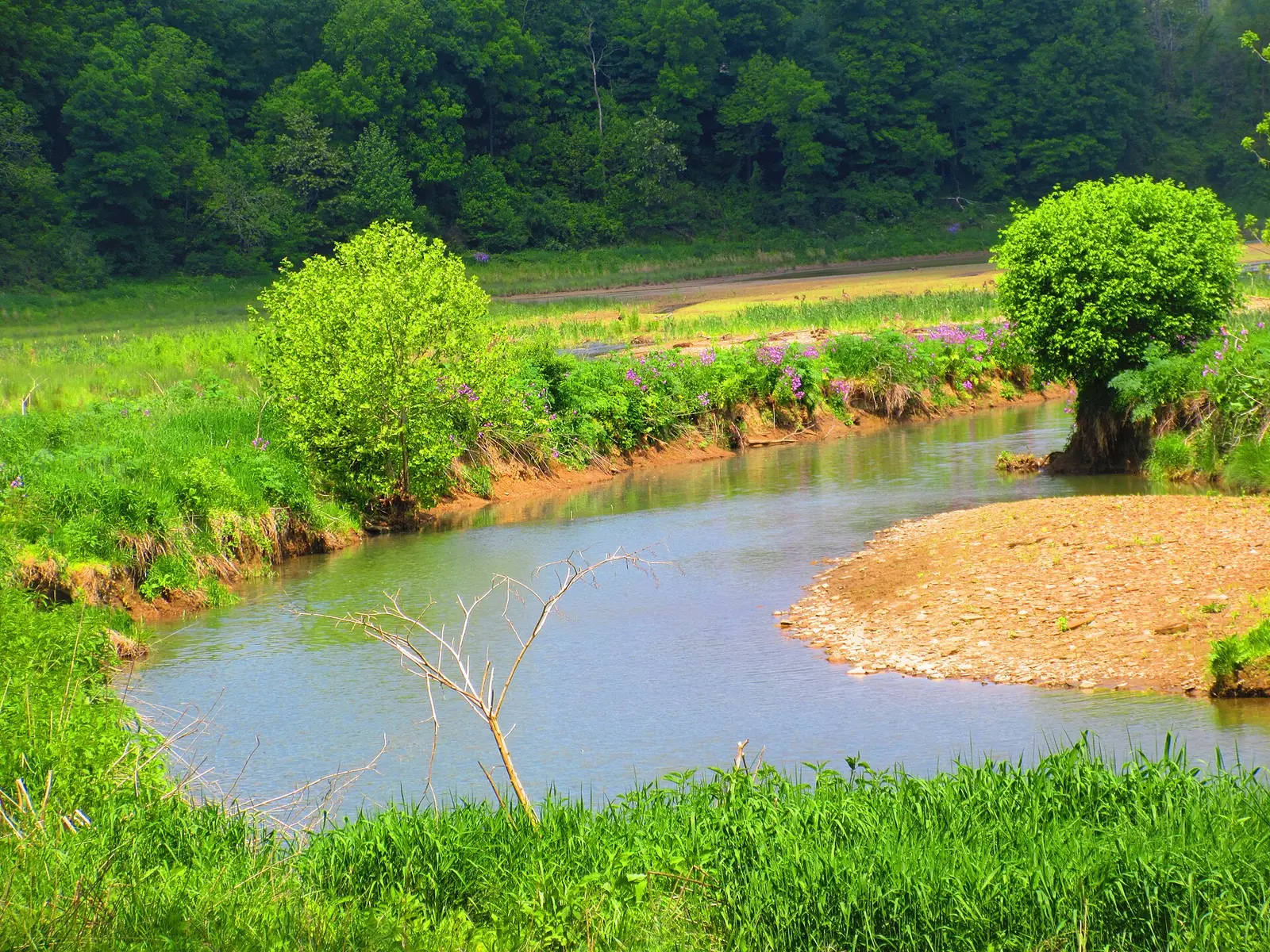

In Greene County, about 16 miles east of Moundsville, Ryerson Station State Park covers about 1,135 acres.
Things to do include snowmobiling, cross-country skiing, winter sports, hunting in season, and swimming. Its trail network totals roughly 13 miles, according to the park. On the water side, there is a swimming pool. Overnight options include 2 camping areas, with RV sites with full hookups, tent sites, and group camping. There are also cabins and yurts for rent.
Hours
Park, gate, office and facility hours are listed separately because they often differ. Alerts above override normal hours.
| Facility | Days | Hours | Season |
|---|---|---|---|
| Park | Daily | sunrise – sunset | — |
| Daily | 8 a.m. – sunset | — |
Official wording
The park is open every day of the year, sunrise to sunset. Day use areas are open from 8:00 A.M. to sunset. The park office is open specific hours. The pool, overnight areas, and other areas are open specific seasons and hours. Contact the park office for facility seasons and hours.
Source: official park page, checked Oct 29, 2026. Times are local to the park (America/New York).
Reservations
- Day use
- No day-use reservation requirement mentioned
- Booking system
- ReserveAmerica (Aspira), Pennsylvania State Parks contract
- Phone
- 888-PA-PARKS (888-727-2757)
We link to the official booking system rather than showing live availability, which changes minute to minute.
Pets
Dogs allowed
Pets are permitted at designated sites for a fee.
Service animals are generally permitted where pets are not. Check with the park for specific areas.
Camping
| Campground or site type | Sites | Hookups / features | Price |
|---|---|---|---|
| Camping Season: ♿ A 35-site tent and trailer campground is open year round. A smaller family-assist restroom is open from November to April. Ryerson Station State Park Campground Map (PDF)
♿ A 35-site tent and trailer campground is open year round. Modern tent-only sites feature a parking pad for one vehicle. Many sites have electric with a select few, having full-hookup service. Electric-only sites are available with 50-amp hook ups. All campsites feature a fire ring and a picnic table.
Full-hookup campsites have:
• On-site water
• 50-amp electric
• Sewage hookup
Modern restrooms with showers are available year round. A smaller family-assist restroom is open from November to April. There is a sanitary dump station and coin-operate | — | Many sites have electric with a select few, having full-hookup service. Electric-only sites are available with 50-amp hook ups. Full-hookup campsites have: • 50-amp electric • Sewage hookupShowers | — |
| Organized Group Tenting A rustic camping area is available for organized adult or youth groups from the second Friday in April to the end of September.
The area can accommodate up to 100 people and provides:
• Vault toilets
• Drinking water
• Fire rings
• Picnic tables
• Pavilion | — | — |
Camping details from the park
Camping
Ryerson Station State Park Campground Map (PDF)
♿ A 35-site tent and trailer campground is open year round. Modern tent-only sites feature a parking pad for one vehicle. Many sites have electric with a select few, having full-hookup service. Electric-only sites are available with 50-amp hook ups. All campsites feature a fire ring and a picnic table.
Full-hookup campsites have:
- On-site water
- 50-amp electric
- Sewage hookup
Modern restrooms with showers are available year round. A smaller family-assist restroom is open from November to April. There is a sanitary dump station and coin-operated laundry facilities.
Pets are permitted at designated sites for a fee.
Access is not guaranteed during severe winter weather.
Organized Group Tenting
A rustic camping area is available for organized adult or youth groups from the second Friday in April to the end of September.
The area can accommodate up to 100 people and provides:
- Vault toilets
- Drinking water
- Fire rings
- Picnic tables
- Pavilion
From the official park page, checked Oct 29, 2026. Site counts and prices can change; confirm when booking.
Cabins and lodging
- Camping Cottages: 2 units
- Deluxe Cottages: 3 units
Camping Cottages
Two camping cottages in the Polly Hill Campground are open year round.
Each cottage sleeps five people and has:
- Wooden walls and floors
- Windows
- Electric lights and outlets
- Electric heat
- Bunkbeds
- Porch
- Picnic table and fire ring
- Nearby shower house
Parking for up to two vehicles is available at each cottage.
Deluxe Cottages
♿ Located in the campground, three deluxe cottages are open year round.
Each deluxe cottage sleeps five and has:
- Two rooms
- Two-burner electric range and microwave oven
- Countertop and cabinets
- Refrigerator
- Table and benches
- Wooden walls and tile floors
- Windows
- Ceiling fans
- Electric lights and outlets
- Electric heat
- Bunk beds
- Porch
- Picnic table and fire ring
- Nearby shower house
Deluxe Cottage A, three campsites, and the shower house are ADA accessible.
Things to do
Winter sportsHuntingFishingSnowmobilingSwimmingCross-country skiingPicnickingHikingCamping
Trails
| Trail | Length | Difficulty | Notes |
|---|---|---|---|
| Bluebird Trail | 0.36 mi | Easiest | Recreations permitted: hiking Trailhead amenities: none This short loop trail gains about 80 feet of elevation up from Lazear Lane in the Maple Grove Day Use Area.Hiking |
| Box Turtle Trail | 0.36 mi | More difficult | Recreations permitted: hiking Trailhead amenities: none Passing through forest and spruce plantations, this trail traverses a variety of habitats in the eastern end of the park.Hiking |
| Chess Cemetery Trail | 0.2 mi | More difficult | Recreations permitted: hiking Trailhead amenities: none Chess Cemetery Trail is a short trail that originates from the eastern end of Pine Box Trail, the trail ends at the Chess Cemetery.Hiking |
| Deer Trail | 0.83 mi | Easiest | Recreations permitted: hiking Trailhead amenities: none Deer Trail is a loop trail that travels around the perimeter of Polly Hill Campground.Hiking |
| Fox Feather Trail | 1.3 mi | More difficult | Recreations permitted: hiking Trailhead amenities: none Fox Feather trail is a self-guided trail that connect to two different points on Lazear Trail.Hiking |
| Iron Bridge Trail | 0.76 mi | More difficult | Recreations permitted: hiking Trailhead amenities: picnic tables Iron Bridge Trail connects Bristoria Road to Deer Trail on the northern half of the park. The Iron Bridge that spans the North Fork Dunkard Fork is closed, splitting this trail in two segments. The segment of the trail on the southern half of the park passes through the valley bottom before connecting to Lazear Trail.Hiking |
| Lazear Trail | 2.4 mi | More difficult | Recreations permitted: hiking Trailhead amenities: non-flush restrooms, picnic tables, benches This is the longest trail in the park and is named for a family who owned a large portion of the property that is now Ryerson Station State Park. This trail gains approximately 410 feet of elevation.Hiking |
| Orchard Trail | 0.3 mi | Easiest | Recreations permitted: hiking Trailhead amenities: none Orchard Trail connects Lazear Trail with Tiffany Ridge Trail. This relatively flat trail passes the remnants of an old orchard.Hiking |
| Pine Box Trail | 2 mi | More difficult | Recreations permitted: hiking Trailhead amenities: none Beginning near the Iron Bridge, this trail follows the valley bottom along Kent Run before gaining approximately 280 feet of elevation and leveling out along the ridge top before returning to the valley bottom ending in the parking lot near Poland Run Road.Hiking |
| Polly Hollow Trail | 0.88 mi | More difficult | Recreations permitted: hiking Trailhead amenities: modern restrooms, picnic tables This trail starts adjacent to the park office and gains approximately 200 feet of elevation before connecting to Deer Trail and proceeding on to connect with Three Mitten Trail.Hiking |
| Saw Dust Trail | 0.7 mi | More difficult | Recreations permitted: hiking Trailhead amenities: none Sawdust Trail is a fairly steep trail that originates along Lazear Lane and proceeds to gain approximately 410 feet of elevation before dead ending on the edge of the park at private property.Hiking |
| Three Mitten Trail | 1.38 mi | More difficult | Recreations permitted: hiking Trailhead amenities: none This mitten-shaped loop trail gains approximately 300 feet of elevation from Bristoria Road before crossing the ridge and dropping in elevation on the return leg of the loop.Hiking |
| Tiffany Ridge Trail | 0.76 mi | More difficult | Recreations permitted: hiking Trailhead amenities: none This trail connects to two places on Lazear Trail and one on Orchard trail, gaining approximately 190 in elevation this trail passes through open woodlands.Hiking |
Trail descriptions from the park
13 miles of trails
The trails allow visitors to explore the park on foot and on cross-country skis in winter. The trails traverse many habitats, like:
- Mature forests
- Wet valley bottoms
- Evergreen plantations
- Fields in ecological succession
Most trails are wide, easily followed, and therefore not color-blazed.
Ryerson Station State Park Map
Swimming
♿ The pool complex is ADA accessible, including a lift for the pool.
Weather and staff availability permitting, a swimming pool and spray park are open daily from Memorial Day to Labor Day from 11:30 AM – 6:30 PM, unless otherwise posted.
Amenities
Facilities
- Picnic areas
- Picnic shelters
- Group facilities
Water
- Swimming pool
Camping
- Tent camping
- RV camping
- Electric hookups
- Water hookups
- Sewer hookups
- Group camping
Lodging
- Cabins
- Yurts
✓ listed by the park · ✕ the park says it is not available. Anything not shown here isn’t mentioned by the official source — that means unknown, not unavailable.
Accessibility
Ryerson Station State Park offers a range of accessibility accommodations to ensure all visitors can enjoy its natural beauty and recreational opportunities.
Polly Hill - Site 21
Site 21 in the Polly Hill Campground offers a full hook-up with 50-amp service and a gravel back-in driveway. The driveway is 40 feet long, accommodating vehicles up to 50 feet in length.
Polly Hill - Site 27
Site 27 in the Polly Hill Campground features modern electric service with 50 amps and a gravel pull-through driveway. The driveway is 70 feet long, accommodating vehicles up to 45 feet in length, and domestic pets are allowed.
Polly Hill - Site 29
Site 29 in the Polly Hill Campground is designated for modern tent use only and accommodates vehicles up to 30 feet in length.
Read more from the park
Polly Hill - Deluxe Camping Cottage A
Deluxe Camping Cottage A can accommodate up to 5 people and domestic pets are allowed. Guests are reminded to bring their own bed linens, towels, dishes, pots and pans.
Polly Hill - Deluxe Camping Cottage B
Deluxe Camping Cottage B can accommodate up to 5 people and domestic pets are allowed. Guests are reminded to bring their own bed linens, towels, dishes, pots and pans.
Swimming and Beaches
An ADA accessible swimming pool is open Memorial Day to Labor Day from 11:30 AM – 6:30 PM, unless otherwise posted.
The pool has an ADA lift and zero entry. The entire pool complex is ADA accessible.
Swim at your own risk. Please read and follow posted rules.
Official accessibility information
Conditions change. Contact the park to confirm specific accessible features before your visit.
Getting there
- Address
- 361 Bristoria Road
Wind Ridge, PA 15380-1258 - Nearest town
- Moundsville — about 16 mi east (straight line)
- Coordinates
- 39.8861, -80.4455
- Phone
- (724) 428-4254
- ryersonstationsp@pa.gov
Google Maps directionsApple MapsOfficial park map (PDF)
Directions from the park
The park is on both sides of Bristoria Road, just off of Pennsylvania Route 21, three miles from Wind Ridge. These highways are accessible from either Washington or Waynesburg, PA. GPS Decimal Degrees: Lat. 39.88614 Long. -80.44549
Nearby state parks
Sources and freshness
- Pennsylvania State Parks — park page — last checked Oct 29, 2026; page says updated Mar 5, 2026
- DCNR Find a Park: content-fragment JSON feed used by the pa.gov park finder
- Wikidata
- USGS PAD-US 4.1 (boundary and acreage)
- Photo: Ryerson Station.jpg — Public domain (released by the author)
“Last checked” is when our system last read the official source. “Last changed” (Oct 29, 2026) is when the information shown here last differed from the previous check. Hours, fees and rules can change without notice — confirm with the park before you go. Methodology