Lyman Run State Park
- Status
- Open (per official listing)Daily sunrise – sunset
- Entrance fee
- Not posted
- Day-use reservations
- None mentioned
- Dogs
- Dogs allowed
- Camping
- 35 campsites
- Official site
- pa.gov(814) 435-5010
Official page last checked Oct 29, 2026. How we keep this current
Current alerts 2
Alert USING A GPS FOR DIRECTIONSTo ensure a safe and comfortable trip into the park, if using a GPS, please set your driving options to "Use Mostly Freeways" or equivalent. This… (more)
To ensure a safe and comfortable trip into the park, if using a GPS, please set your driving options to "Use Mostly Freeways" or equivalent. This will ensure your GPS will use frequently traveled paved roads into the park.
Posted by the park. Official alert
Alert Attention ATV Enthusiasts. We have been receiving many questions regarding ATVAttention ATV Enthusiasts. We have been receiving many questions regarding ATV registration in the Commonwealth of Pennsylvania. All information… (more)
Attention ATV Enthusiasts. We have been receiving many questions regarding ATV registration in the Commonwealth of Pennsylvania. All information regarding ATV registration can be found at: www.snowatvreg.dcnr.pa.gov Information on the ATV Regional Trail Connector Program can be found at: ATV Regional Trail Connector Pilot (pa.gov) DCNR ATV Frequently Asked Questions ATVs are not permitted to be offloaded in undesignated areas. Please use ATV trailheads located at the Susquehannock State Forest District Office on Route 6 between Denton Hill State Park and the State Police Barracks, Rock Run Road Trailhead, Sunken Branch Road Trailhead, and the Route 44 Trailhead between Cherry Springs State Park and Patterson State Park. The Lyman Run Trailhead is for patrons of Lyman Run State Park. The Lower Campground is the only designated ATV campground at Lyman Run State Park. ATV Operators 16 years of age or older, with a valid campsite permit, valid driver's license, registration, and insurance may access the Susquehannock ATV trail from the Lower Campground via Lyman Run Road. Additional parking for hauling equipment is located adjacent the Lower Campground along Lyman Run Road.…
Posted by the park. Official alert
Overview
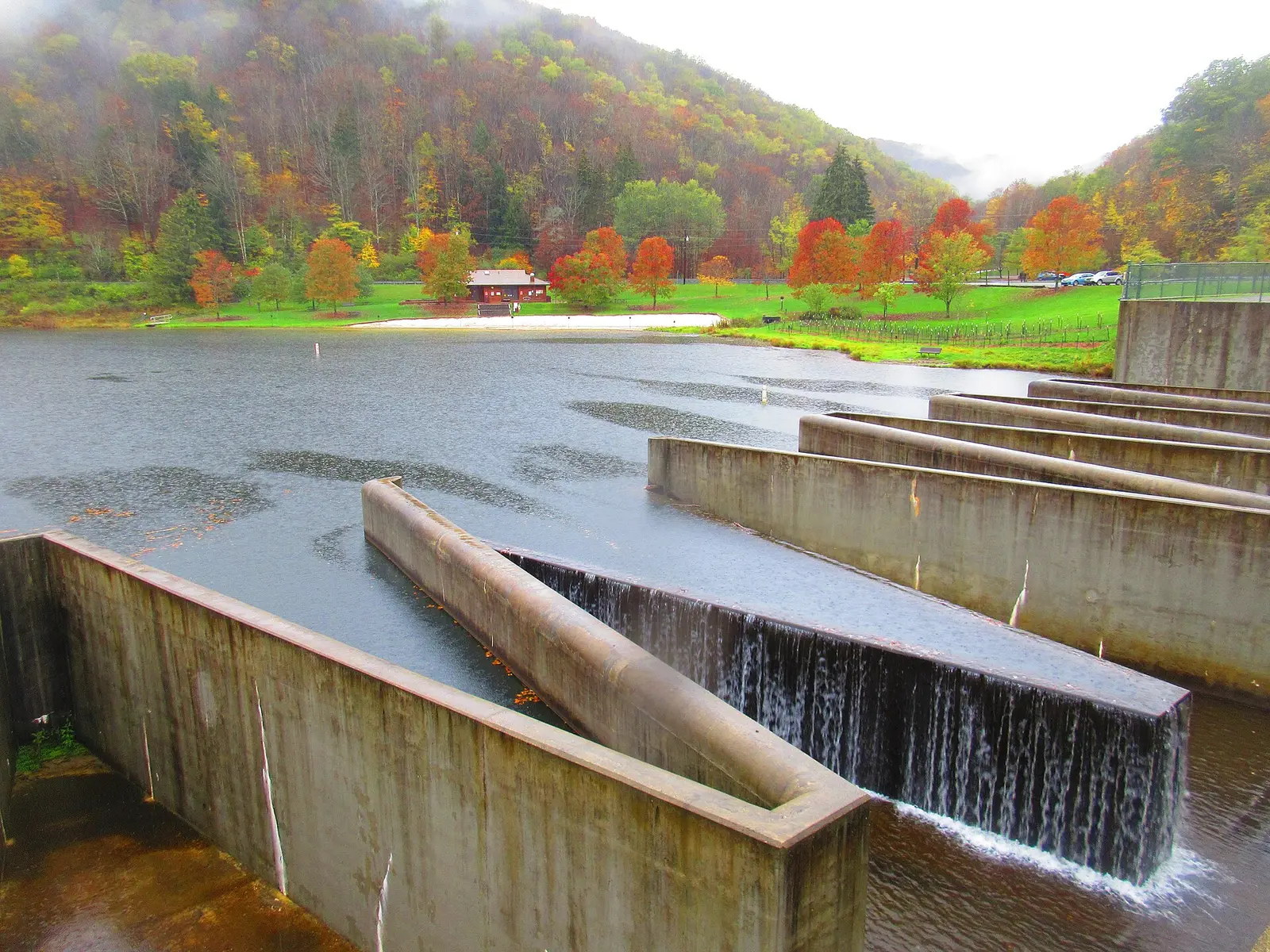

In Potter County, about 14 miles east of Coudersport, Lyman Run State Park covers about 712 acres.
Popular activities here are off-highway vehicle riding, snowmobiling, winter sports, hunting in season, and canoeing and kayaking. Its trail network totals roughly 6 miles, according to the park. On the water side, there is a swimming beach, a boat ramp, and boat or kayak rentals. Camping is available: 35 campsites, including RV sites and tent sites.
Hours
Park, gate, office and facility hours are listed separately because they often differ. Alerts above override normal hours.
| Facility | Days | Hours | Season |
|---|---|---|---|
| Park | Daily | sunrise – sunset | — |
Official wording
The park is open every day of the year, sunrise to sunset. Day use areas close at dusk. The park office is open specific hours. The beach, overnight areas, and other areas are open specific seasons and hours. Contact the park office for facility seasons and hours.
Source: official park page, checked Oct 29, 2026. Times are local to the park (America/New York).
Reservations
- Day use
- No day-use reservation requirement mentioned
- Booking system
- ReserveAmerica (Aspira), Pennsylvania State Parks contract
- Phone
- 888-PA-PARKS (888-727-2757)
We link to the official booking system rather than showing live availability, which changes minute to minute.
Pets
Dogs allowed
Pets are permitted on designated sites in both campgrounds.
Service animals are generally permitted where pets are not. Check with the park for specific areas.
Camping
| Campground or site type | Sites | Hookups / features | Price |
|---|---|---|---|
| Camping Season: The campgrounds are open from mid-April to mid-December. Lyman Run State Park Campground Map (PDF)
♿ Daggett Run and Lower campgrounds offer separate camping areas with a total of 35 RV and tent campsites. Each campsite contains a:
• Picnic table
• Fire ring
• Lantern hanger
Twenty-nine campsites have electricity. Six campsites are walk-ins. The campgrounds have modern shower houses with hot water, flush toilets, and showers. A sanitary dump station is in the Lower Campground.
The campgrounds are open from mid-April to mid-December.
Pets are permitted on designated sites in both campgrounds. | 35 | Twenty-nine campsites have electricity.Showers | — |
Camping details from the park
Camping
Lyman Run State Park Campground Map (PDF)
♿ Daggett Run and Lower campgrounds offer separate camping areas with a total of 35 RV and tent campsites. Each campsite contains a:
- Picnic table
- Fire ring
- Lantern hanger
Twenty-nine campsites have electricity. Six campsites are walk-ins. The campgrounds have modern shower houses with hot water, flush toilets, and showers. A sanitary dump station is in the Lower Campground.
The campgrounds are open from mid-April to mid-December.
Pets are permitted on designated sites in both campgrounds.
From the official park page, checked Oct 29, 2026. Site counts and prices can change; confirm when booking.
Things to do
HuntingOff-highway vehiclesGeocachingFishingPicnickingSwimmingWinter sportsSnowmobilingHikingBoatingCampingCanoeing and kayaking
Trails
| Trail | Length | Difficulty | Notes |
|---|---|---|---|
| Beehive Trail | 0.8 mi | More difficult | Recreations permitted: hiking Trailhead amenities: none Passing along the park border and into Susquehannock State Forest, the massive, old stumps along this trail show signs of ancient wildfires. Beehive Trail was built by the Civilian Conservation Corps (CCC) in the 1930s and connects Dagget Run Campground and Rock Run Road. Use Wildcat Trail to create a longer hike.Hiking |
| Lyman Run Trail | 3.8 mi | More difficult | Recreations permitted: hiking Trailhead amenities: modern restrooms, picnic tables Hike from one end of the park to the other following Lyman Run through many habitats and on a railroad trace. Lyman Run Trail can be accessed in Lower Campground, at the spillway, or where it intersects the Susquehannock Trail System. Until a bridge is installed, hikers must make a wet crossing of the creek between Lower Campground and the Spillway.Hiking |
| Rock Run Trail | 0.6 mi | More difficult | Recreations permitted: hiking Trailhead amenities: none The Rock Run Trail passes by a vista that showcases the Lyman Run Lake and Spill Way. The trial can be a loop by connecting to the Spur Line Trial.Hiking |
| Spur Line Trail | 0.75 mi | Easiest | Recreations permitted: hiking Trailhead amenities: none The bumps on this trail are the remains of old railroad ties from the Goodyear Brothers logging railroad that hauled tan bark and hemlock logs during the lumbering era. Spur Line Trail ascends slowly from Lower Campground up to Rock Run Road. To the right along Rock Run Road is Lyman Run Vista. Hikers can complete a loop by continuing on the road then turning right onto Rock Run Trail.Hiking |
| Wildcat Trail | 1.3 mi | More difficult | Recreations permitted: hiking Trailhead amenities: none Following an old haul road, this trail leads by large boulders and upland hemlock and bog area containing Northern cotton grass and several majestic old growth hemlocks. This trail connects to the Beehive Trail to make a large loop.Hiking |
Trail descriptions from the park
6 miles of trails
The hiking trails link to many miles of trails in Susquehannock State Forest. Unless noted below, all trails are marked with rectangular yellow blazes. There are trailhead and intersection signposts.
Lyman Run State Park Map
Susquehannock Trail System
Passing by the park, this 85-mile trail loop traverses some of the most rugged, mountainous terrain in northcentral Pennsylvania. This trail system also passes through Denton Hill State Park, Patterson State Park, and Ole Bull State Park.
Swimming
The 300-foot sand beach is open from late-May to mid-September, 8:00 A.M. to sunset. A modern bathhouse with flush toilets, changing rooms, snack bar, and boat rental is the centerpiece of the beach area.
Swim at your own risk.
Please read and follow posted rules for swimming.
Smoke-Free Beach
Smoking is prohibited on the beach and in the swimming area.
For visitors who smoke and still want to use the beach, designated areas adjacent to the beach are provided. The restriction includes:
- Cigarettes
- Pipes
- Cigars
- E-cigarettes
- Other handheld, lighted smoking devices
Amenities
Facilities
- Picnic areas
- Picnic shelters
Water
- Swimming beach
- Boat ramp
- Marina or boat slips
- Boat, canoe or kayak rentals
Camping
- Tent camping
- RV camping
✓ listed by the park · ✕ the park says it is not available. Anything not shown here isn’t mentioned by the official source — that means unknown, not unavailable.
Accessibility
Lyman Run State Park offers a range of accessibility accommodations to ensure all visitors can enjoy its natural beauty and recreational opportunities.
Lower Campground - Site 25
Lower Campground Site 25 has a gravel back-in driveway measuring 52 feet, accommodating vehicles up to 52 feet long. It includes modern 50-amp electric service and allows domestic pets.
Daggett Loop - Site 007
Daggett Loop Site 007 features a gravel back-in driveway that is 34 feet long, suitable for vehicles up to 34 feet. It offers modern 50-amp electric service.
Loaner Equipment
The public can borrow fishing rods, reels, and an equipped tackle box to try fishing. Check in at the park office.
- A valid ID must be provided by at least one adult in the group.
- Equipment is loaned on a first-come, first-served basis and can only be used within the park.
- Park staff may be available to give brief instructions upon request.
- All equipment must be returned at the agreed-upon place and by the agreed-upon time.
- Gear will be supplied, but bring your own bait with you.
- Those 16 years or older need to have a valid Pennsylvania Fishing License.
- Know what you can and can’t keep. All fishing regulations must be followed.
Official accessibility information
Conditions change. Contact the park to confirm specific accessible features before your visit.
Getting there
- Address
- 454 Lyman Run Road
Galeton, PA 16922-9301 - Nearest town
- Coudersport — about 14 mi east (straight line)
- Coordinates
- 41.7251, -77.7600
- Phone
- (814) 435-5010
- lymanrunsp@pa.gov
Google Maps directionsApple MapsOfficial park map (PDF)
Directions from the park
Lyman Run State Park is 15 miles east of Coudersport and seven miles west of Galeton on Lyman Run Road. GPS Decimal Degrees: Lat. 41.72511 Long. -77.76004 To avoid unpaved or non-maintained roads, change your GPS settings from shortest route to fastest route to use highways when possible or follow these directions to the park: • From the east (Route 6 West), turn left onto West Branch Road in Galeton and then right onto Lyman Run Road to the park. • From the west (Route 6 East), take Route 44 South in Sweden Valley towards Cherry Springs. Then take West Branch Road to Lyman Run Road to the park. • From the south, take Route 44 Noth towards Cherry Springs, then right onto West Branch Road and left onto Lyman Run Road to the park. • From the North, take 449 South to Route 6 East. Turn right onto West Branch Road in Galeton and then right onto Lyman Run Road to the park.
Nearby state parks
Sources and freshness
- Pennsylvania State Parks — park page — last checked Oct 29, 2026; page says updated Feb 9, 2026
- DCNR Find a Park: content-fragment JSON feed used by the pa.gov park finder
- Wikidata
- USGS PAD-US 4.1 (boundary and acreage)
- Photo: Lymandam.jpg — Public domain (released by the author)
“Last checked” is when our system last read the official source. No change has been detected since this page was first published. Hours, fees and rules can change without notice — confirm with the park before you go. Methodology