Leonard Harrison State Park
Also known as Grand Canyon of Pennsylvania
Notice: Seasonal Facility Hours and Closures — details
- Status
- Open (per official listing)Daily sunrise – sunset
- Entrance fee
- Not posted
- Day-use reservations
- None mentioned
- Dogs
- Dogs allowed
- Camping
- Yes
- Official site
- pa.gov(570) 724-3061
Official page last checked Oct 29, 2026. How we keep this current
Current alerts 1
Closure Seasonal Facility Hours and ClosuresPark Office: 8 AM – 4 PM. Closed Tuesdays and Wednesdays. Last full day of season = October 29. PA Wilds Store: 10 AM – 5 PM. Closed Wednesdays and… (more)
Park Office: 8 AM – 4 PM. Closed Tuesdays and Wednesdays. Last full day of season = October 29. PA Wilds Store: 10 AM – 5 PM. Closed Wednesdays and Thursdays. Last day of season = October 18. Visitor Center: 10 AM – 5 PM daily. Last day of season = October 30.
Posted by the park. Official alert
Overview
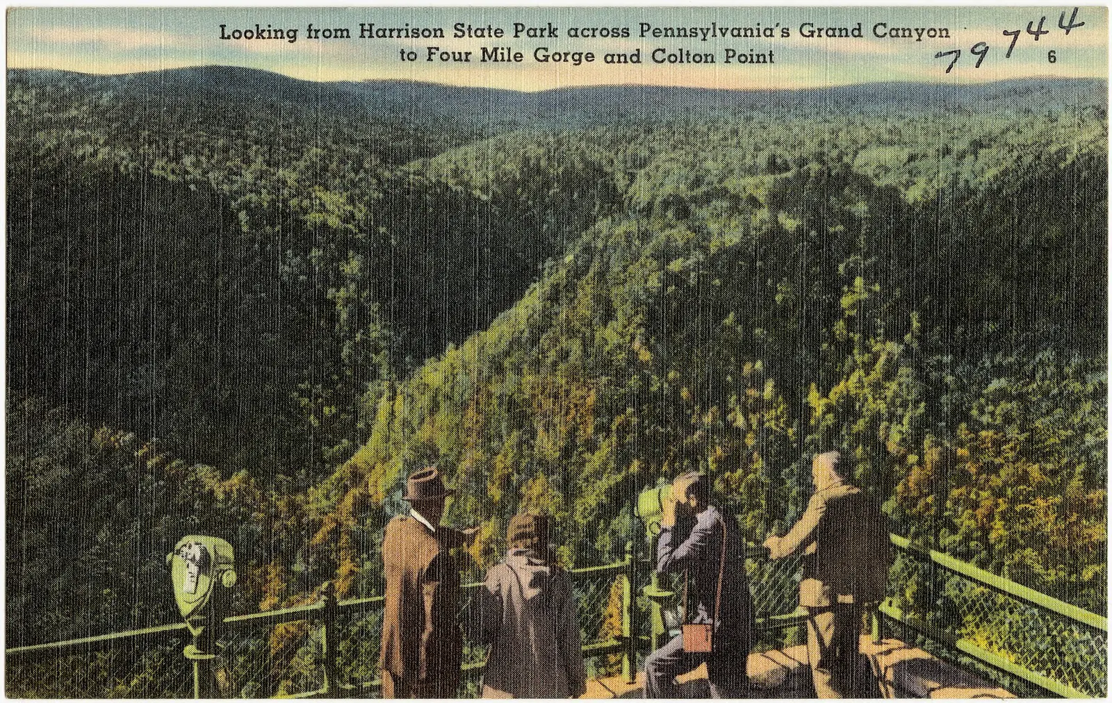

In Tioga County, about 8 miles west of Wellsboro, Leonard Harrison State Park covers about 565 acres.
The park supports hunting in season, fishing, picnicking, and hiking. The official site lists about 4.6 miles of trails. Overnight options include campsites, with RV sites and tent sites.
Hours
Park, gate, office and facility hours are listed separately because they often differ. Alerts above override normal hours.
| Facility | Days | Hours | Season |
|---|---|---|---|
| Park | Daily | sunrise – sunset | — |
Official wording
The park is open every day of the year, sunrise to sunset. Day use areas close at dusk. The park office is open specific hours. Overnight areas and other areas are open specific seasons and hours. Contact the park office for facility seasons and hours.
Source: official park page, checked Oct 29, 2026. Times are local to the park (America/New York).
Reservations
- Day use
- No day-use reservation requirement mentioned
- Booking system
- ReserveAmerica (Aspira), Pennsylvania State Parks contract
- Phone
- 888-PA-PARKS (888-727-2757)
We link to the official booking system rather than showing live availability, which changes minute to minute.
Pets
Dogs allowed
Pets are permitted on designated sites.
Service animals are generally permitted where pets are not. Check with the park for specific areas.
Camping
| Campground or site type | Sites | Hookups / features | Price |
|---|---|---|---|
| Camping Season: The campground is open from mid-April until mid-October. Leonard Harrison State Park Campground Map (PDF)
The campground is open from mid-April until mid-October. Picnic tables, fire rings, showers, flush toilets, and a sanitary dump station are provided.
Some sites have electricity.
Pets are permitted on designated sites. | — | Some sites have electricity.Showers | — |
Camping details from the park
Camping
Leonard Harrison State Park Campground Map (PDF)
The campground is open from mid-April until mid-October. Picnic tables, fire rings, showers, flush toilets, and a sanitary dump station are provided.
Some sites have electricity.
Pets are permitted on designated sites.
From the official park page, checked Oct 29, 2026. Site counts and prices can change; confirm when booking.
Things to do
PicnickingFishingHikingHuntingCamping
Trails
| Trail | Length | Difficulty | Notes |
|---|---|---|---|
| Overlook Trail | 0.6 mi | More difficult | Recreations permitted: hiking Trailhead amenities: modern restrooms The Overlook Trail at Leonard Harrison offers scenic views of the Pine Creek Gorge as well as historic structures from the Civilian Conservation Corps (CCC) era. Hikers will see the CCC monument, pavilion and a stone trash incinerator used by the workers while developing the park. This is a loop trail with an overlook to view the Pine Creek Gorge.Hiking |
| Pine Creek Rail Trail | 1 mi | Easiest | Recreations permitted: hiking, backpacking, biking, equestrian riding, cross-country skiing recommended Trailhead amenities: non-flush restrooms, benches Passing through the park along the floor of the canyon, the 62-mile Pine Creek Rail Trail is ideal for families and individuals for an easy path. While hikers may access this trail via the Turkey Path from Leonard Harrison, cyclists and other users must use one of many other accesses. The closest bicycle access is Darling Run, nine miles north of the park.HikingBackpackingBikingEquestrian ridingCross-country skiing recommended |
| Turkey Path Trail | 1 mi | Most difficult | Recreations permitted: hiking Trailhead amenities: modern restrooms, potable water, benches The Turkey Path Trail at Leonard Harrison offers scenic views of the Pine Creek Gorge as well as waterfalls. Hikers should wear suitable foot wear and be prepared for an 800 foot decent to the bottom of the canyon as well as the return hike to the top for a total of a 2-mile hike. This is a down and back trail and there are no rides out from the bottom. Caution! Hikers on the Turkey Path Trail should be in good physical condition, wear sturdy boots, and use caution due to slippery/wet conditions and steHiking |
Trail descriptions from the park
4.6 miles of trails
The trails lead to many beautiful vistas and waterfalls, but traverse very rugged terrain, pass close to many steep cliffs, and may have slippery surfaces.
Trails are subject to seasonal closure due to snow and ice, usually from December through April.
Leonard Harrison and Colton Point State Parks Map
Prepare for a Safe Hike
The following guidelines will help ensure a safe and enjoyable hiking experience while at the park:
- Always wear sturdy boots. Wearing sneakers, sandals, water shoes, and “street shoes” can lead to serious accidents in this park.
- Be prepared. Have proper clothing and equipment (compass, map, matches, water, food, flashlight, etc.) available in case of an emergency. This is especially important when traveling remote trails or when hiking during non-summer seasons.
- Give yourself plenty of time for your hike. The weather changes quickly in the park. Plan to be off the trails well before dark.
- Let someone know where you are hiking and when you should return.
- Stay on the trails. Leaving the trail causes damage to unique natural resources, promotes erosion, and can be dangerous. Stay behind the railings and fences. Avoid the temptation to get on rock overhangs for a better view.
- Don’t take shortcuts from one trail section to another. Taking shortcuts down switchbacks is dangerous and causes trail damage.
Amenities
Facilities
- Picnic areas
- Picnic shelters
Camping
- Tent camping
- RV camping
✓ listed by the park · ✕ the park says it is not available. Anything not shown here isn’t mentioned by the official source — that means unknown, not unavailable.
Accessibility
Leonard Harrison State Park offers a range of accessibility accommodations to ensure all visitors can enjoy its natural beauty and recreational opportunities.
Accessible Picnic Tables
There are ADA accessible picnic tables located at the Visitor Center.
Schloder Pavilion
Colorblind Viewfinder
A viewfinders fit with an EnChroma color blind lens is located at the main overlook.
The lenses are designed to enhance the color vision of those with a red-green color vision deficiency. Any park visitor can use the viewfinder to experience the colorful beauty of nature and to view foliage more vividly.
The main overlook is ADA accessible and provides a stunning view of the Pennsylvania Grand Canyon.
Official accessibility information
Conditions change. Contact the park to confirm specific accessible features before your visit.
Getting there
- Address
- 4797 Route 660
Wellsboro, PA 16901-8970 - Nearest town
- Wellsboro — about 8 mi west (straight line)
- Coordinates
- 41.7082, -77.4553
- Phone
- (570) 724-3061
- leonardharrisonsp@pa.gov
Google Maps directionsApple MapsOfficial park map (PDF)
Directions from the park
From the town of Wellsboro, follow Route 660 West 10 miles to Leonard Harrison State Park. Stay on the paved road of Route 660 West, 10 miles outside of Wellsboro, the road will dead end at the park. Be aware that GPS navigation will select a route through small, dirt roads unsuitable for large RVs and buses. The most direct route is to follow the paved road of Rt 660 West. There is no cell service in the park. Cell service is usually available 5 miles away from the park on Route 660 East. Non-coin operated emergency phones are available at the park for 911, local and toll-free calls. GPS Decimal Degrees: Lat. 41.70824 Long. -77.4553 Driving Directions: Directions Map to Colton Point State Park (PDF)
Nearby state parks
Sources and freshness
- Pennsylvania State Parks — park page — last checked Oct 29, 2026; page says updated Mar 17, 2026
- DCNR Find a Park: content-fragment JSON feed used by the pa.gov park finder
- Wikidata
- USGS PAD-US 4.1 (boundary and acreage)
- Photo: Looking from Harrison State Park across Pennsylvania's Grand Canyon to four mile gorge and Colton Point (79744).jpg — Public domain (copyright expired), "Tichnor Quality Views," Reg. U. S. Pat. Off. Made Only by Tichnor Bros., Inc., Boston, Mass.
“Last checked” is when our system last read the official source. No change has been detected since this page was first published. Hours, fees and rules can change without notice — confirm with the park before you go. Methodology