Fort Harrison State Park
- Status
- Open (per official listing)
- Entrance fee
- Statewide rule — see below
- Day-use reservations
- None mentioned
- Dogs
- Not stated — check with park
- Camping
- None listed
- Official site
- in.gov317-591-0904
Official page last checked Oct 29, 2026. How we keep this current
Current alerts 1
Partial closure SADDLE BARN TEMPORARILY CLOSEDThe saddle barn will be closed as the search for a new concessionaire contractor continues. Interested in DNR concessions? Learn more about available… (more)
The saddle barn will be closed as the search for a new concessionaire contractor continues. Interested in DNR concessions? Learn more about available opportunities.
Posted by the park. Official alert
Overview
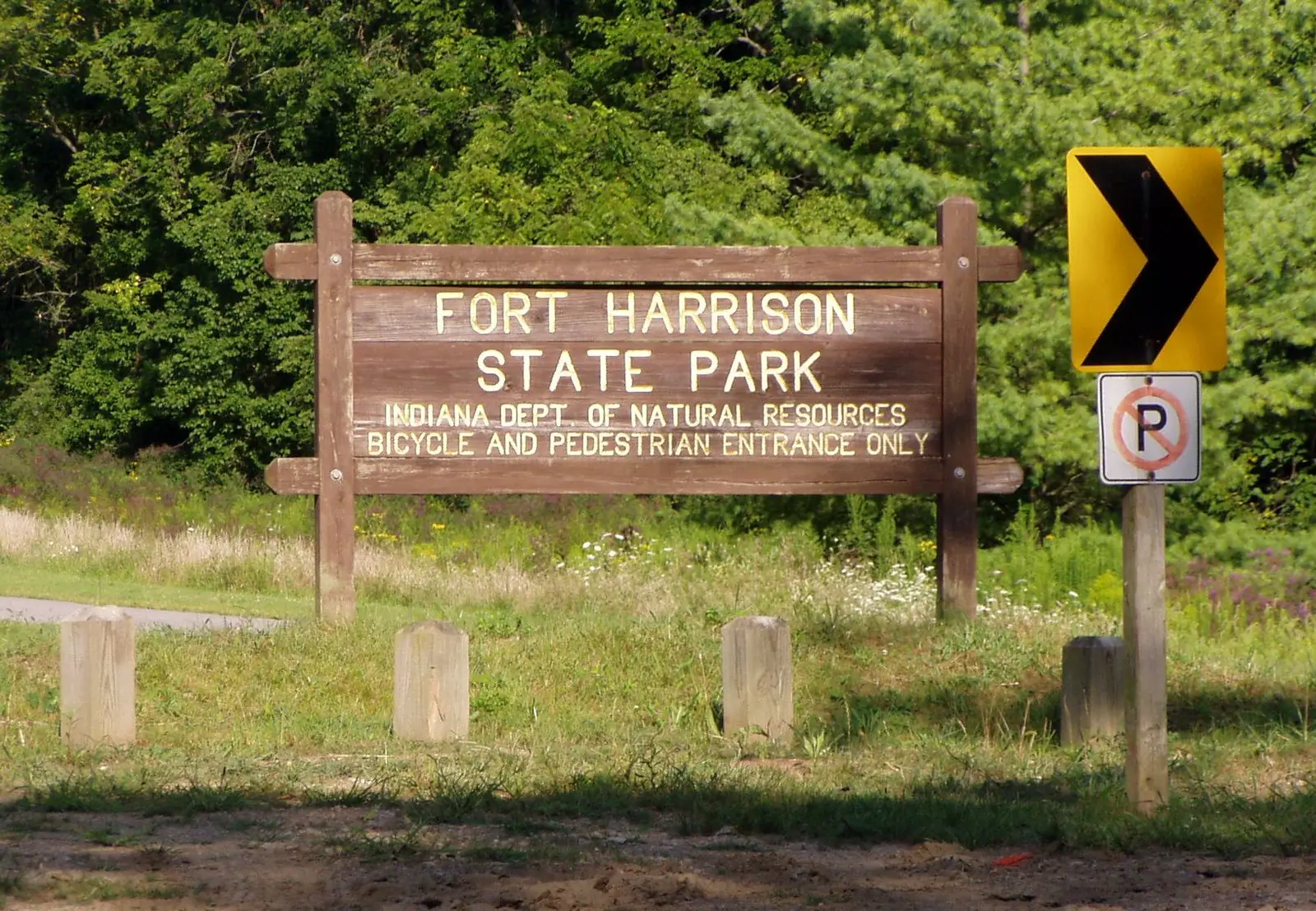

Fort Harrison State Park is a park in Marion County, in Lawrence.
The park supports cross-country skiing, ice fishing, golf, winter sports, and historic sites.
Fees and passes
Per vehicle daily gate fee: $7 Indiana plates / $15 out-of-state at state parks and state-managed lakes; exceptions Indiana Dunes ($7/$20), Prophetstown ($8/$16), Falls of the Ohio Interpretive Center ($9 adult/$7 child); $2 per person age 5+ on foot, bicycle or horseback.
Statewide fee rule from Indiana's park system; this park’s page doesn’t list its own fees.
Indiana park passes
- Annual Entrance Pass — $50. Noncommercial vehicle, driver and passengers at DNR properties that charge a gate fee Details
- Non-resident Annual Entrance Pass — $120. Non-Indiana resident noncommercial vehicles Details
- Golden Hoosier Passport — $25. Indiana residents 65+ or eligible for SS disability; vehicle, driver and passengers Details
- Disabled Hoosier Veteran Pass — $25. Persons eligible for a Disabled Hoosier Veteran plate Details
- SSDI Pass — $25. Indiana residents receiving or eligible for SSDI Details
From the Indiana state guide. Confirm which passes this park accepts.
Reservations
- Day use
- No day-use reservation requirement mentioned
- Booking system
- ReserveAmerica (Indiana State Parks) for camping, cabins, shelters, group camps; separate inn reservations
- Phone
- 1-866-622-6746 (camping, cabins, shelters, group camps); 1-877-563-4371 (inns and Brown County cabins)
We link to the official booking system rather than showing live availability, which changes minute to minute.
Pets
See the park’s wording
Dog Park FAQs
Service animals are generally permitted where pets are not. Check with the park for specific areas.
Things to do
PicnickingHikingBikingFishingIce fishingWinter sportsCross-country skiingHistoric sites and toursGolf
Trails
| Trail | Length | Difficulty | Notes |
|---|---|---|---|
| Harrison Trace Trail | — | Easy | 3.2 miles. This is an asphalt-surface trail for walkers, bicyclists, and joggers. The trail begins at the Delaware Lake picnic area. After passing Delaware Lake, the trail follows the rolling upland above Fall Creek. Expect some hills. Much of the trail is tree-covered, and wildflowers grow next to it during spring and summer. This is the easiest route to Duck Pond. Parts of this trail are wheelchair accessible. |
| Fall Creek Trail | 1 mi | Moderate | 1 mile to Duck Pond. Start this trail at the northeast corner of the Delaware Lake picnic area. The trail follows the lowlands along Fall Creek, then heads uphill as it nears Duck Pond. Overall distance can be shortened or varied by taking one of three cutoff trails that connect to Harrison Trace Trail. Excellent for birding, fishing access, and wildflower and tree identification. |
| Camp Creek Trail | 2 mi | Moderate | 2 miles. This trail begins off Harrison Trace near the eastern banks of Delaware Lake, eventually passing Duck Pond. This trail passes by an old army rubble pile and contains many beautiful vistas from the bluffs of the Camp Creek valley. |
| Lawrence Creek Trail | — | Difficult | 4.2 miles. Start this loop trail at either the Lawrence Creek Trailhead or the Walnut Trailhead parking area on the west side of the park. The trail winds through upland woods and ravines. This is an excellent choice for observing fall color. Northern sections tend to remain wet all summer, providing a wonderful wildflower show. This is a single-track, hiking, and bicycling trail. Bikers yield to hikers. |
| Tree ID Trail | 1 mi | Easy | 1 mile. This mowed trail follows the outer edge of Millennium Grove picnic area in Camp Glenn. Look for wooden posts with metal signs to help you identify each type of tree along the route. |
| Schoen Creek Trail | 3 mi | Difficult | 3 miles. Begin at the parking area east of the Millennium Grove Picnic Area road at Camp Glenn. This is a single-track, hiking and bicycling trail. Follow the mowed trail through wetland and prairie grasses. |
Trail descriptions from the park
Harrison Trace Trail: EASY—3.2 miles. This is an asphalt-surface trail for walkers, bicyclists, and joggers. The trail begins at the Delaware Lake picnic area. After passing Delaware Lake, the trail follows the rolling upland above Fall Creek. Expect some hills. Much of the trail is tree-covered, and wildflowers grow next to it during spring and summer. This is the easiest route to Duck Pond. Parts of this trail are wheelchair accessible.
Fall Creek Trail: MODERATE—1 mile to Duck Pond. Start this trail at the northeast corner of the Delaware Lake picnic area. The trail follows the lowlands along Fall Creek, then heads uphill as it nears Duck Pond. Overall distance can be shortened or varied by taking one of three cutoff trails that connect to Harrison Trace Trail. Excellent for birding, fishing access, and wildflower and tree identification.
Camp Creek Trail: MODERATE—2 miles. This trail begins off Harrison Trace near the eastern banks of Delaware Lake, eventually passing Duck Pond. This trail passes by an old army rubble pile and contains many beautiful vistas from the bluffs of the Camp Creek valley.
Lawrence Creek Trail: DIFFICULT—4.2 miles. Start this loop trail at either the Lawrence Creek Trailhead or the Walnut Trailhead parking area on the west side of the park. The trail winds through upland woods and ravines. This is an excellent choice for observing fall color. Northern sections tend to remain wet all summer, providing a wonderful wildflower show. This is a single-track, hiking, and bicycling trail. Bikers yield to hikers.
Tree ID Trail: EASY—1 mile. This mowed trail follows the outer edge of Millennium Grove picnic area in Camp Glenn. Look for wooden posts with metal signs to help you identify each type of tree along the route.
Schoen Creek Trail: DIFFICULT—3 miles. Begin at the parking area east of the Millennium Grove Picnic Area road at Camp Glenn. This is a single-track, hiking and bicycling trail. Follow the mowed trail through wetland and prairie grasses.
Fishing
Fishing
Ice Fishing
A state fishing license is usually required.
Amenities
Facilities
- Restrooms
- Picnic areas
- Nature center or museum
- Group facilities
- Dog park or off-leash area
Recreation
- Golf course
✓ listed by the park · ✕ the park says it is not available. Anything not shown here isn’t mentioned by the official source — that means unknown, not unavailable.
Getting there
- Address
- 5753 Glenn Road
Indianapolis, IN 46216 - Nearest town
- Lawrence
- Coordinates
- 39.8650, -86.0167
- Phone
- 317-591-0904
Google Maps directionsApple Maps
Directions from the park
Mapping Address: 6000 N. Post Road, Indianapolis, IN 46216
Nearby state parks
Sources and freshness
- Indiana State Parks — park page — last checked Oct 29, 2026
- Indiana State Parks 'Find A Park' property list + DNR ArcGIS site layers (coordinates)
- Wikidata
- Photo: Fort Ben - bike entrance.jpg — Public domain (released by the author), Mingusboodle
“Last checked” is when our system last read the official source. No change has been detected since this page was first published. Hours, fees and rules can change without notice — confirm with the park before you go. Methodology