Brown County State Park
- Status
- Open (per official listing)
- Entrance fee
- Statewide rule — see below
- Day-use reservations
- None mentioned
- Dogs
- Not stated — check with park
- Camping
- 693 campsites
- Official site
- in.gov812-988-6406
Official page last checked Oct 29, 2026. How we keep this current
Current alerts 2
Alert OVERSIZED AND HEAVY VEHICLES USE WEST GATEAll RVs and vehicles towing trailers MUST use the park's west entrance on State Road 46 two miles west of Nashville, Indiana. The park's north… (more)
All RVs and vehicles towing trailers MUST use the park's west entrance on State Road 46 two miles west of Nashville, Indiana. The park's north entrance east of Nashville has a historic covered bridge with a 9-foot height clearance and 3-ton weight limit. Oversized vehicles cannot use the north entrance.
Posted by the park. Official alert
Alert GPS DIRECTIONS MAY BE INCORRECTVisitors and campground users should note that GPS directions may not always send you to the correct entrances.
Posted by the park. Official alert
Overview
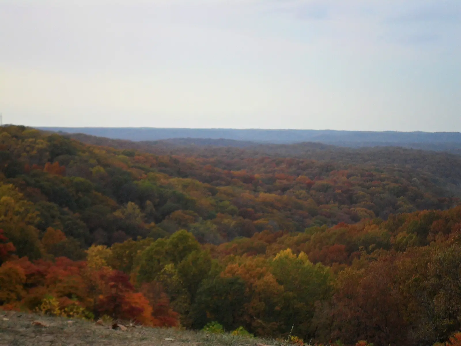

In Brown County, about 16 miles west of Columbus, Brown County State Park covers about 12,705 acres.
Things to do include horseback riding, ice fishing, mountain biking, swimming, and fishing. Facilities for water recreation include a swimming pool. For overnight stays there are 693 campsites across 5 camping areas (tent sites).
Fees and passes
Per vehicle daily gate fee: $7 Indiana plates / $15 out-of-state at state parks and state-managed lakes; exceptions Indiana Dunes ($7/$20), Prophetstown ($8/$16), Falls of the Ohio Interpretive Center ($9 adult/$7 child); $2 per person age 5+ on foot, bicycle or horseback.
Statewide fee rule from Indiana's park system; this park’s page doesn’t list its own fees.
Indiana park passes
- Annual Entrance Pass — $50. Noncommercial vehicle, driver and passengers at DNR properties that charge a gate fee Details
- Non-resident Annual Entrance Pass — $120. Non-Indiana resident noncommercial vehicles Details
- Golden Hoosier Passport — $25. Indiana residents 65+ or eligible for SS disability; vehicle, driver and passengers Details
- Disabled Hoosier Veteran Pass — $25. Persons eligible for a Disabled Hoosier Veteran plate Details
- SSDI Pass — $25. Indiana residents receiving or eligible for SSDI Details
From the Indiana state guide. Confirm which passes this park accepts.
Reservations
- Day use
- No day-use reservation requirement mentioned
- Booking system
- ReserveAmerica (Indiana State Parks) for camping, cabins, shelters, group camps; separate inn reservations
- Phone
- 1-866-622-6746 (camping, cabins, shelters, group camps); 1-877-563-4371 (inns and Brown County cabins)
We link to the official booking system rather than showing live availability, which changes minute to minute.
Camping
| Campground or site type | Sites | Hookups / features | Price |
|---|---|---|---|
| Electric | 401 | Electric | — |
| Non-Electric | 28 | — | |
| Rally | 60 | — | |
| Horsemen's – Electric | 118 | Electric | — |
| Horsemen's – Non-Electric | 86 | — |
Camping details from the park
• RVs Use West Gate • Electric / 401 sites • Non-Electric / 28 sites • Rally / 60 sites • Horsemen's - Entrance off 135 South • Electric / 118 sites • Non-Electric / 86 sites • Youth Tent Areas • Camp Store • Dumping Station
From the official park page, checked Oct 29, 2026. Site counts and prices can change; confirm when booking.
Things to do
HikingHorseback ridingPicnickingFishingIce fishingBikingMountain bikingSwimmingCamping
Trails
| Trail | Length | Difficulty | Notes |
|---|---|---|---|
| Lodge Trail (Trail 1) | 0.9 mi | Moderate | Joins with Trail 2 for a short distance to return near lodge. Walk through land wooded with oak, hickory, sassafras, beech and maple. |
| CCC TRAIL (Trail 2) | 2 mi | Moderate | CCC-built trail with impressive stone bridges, stairways and retaining walls. Starts and ends behind the lodge. Passes near Lower Shelter and North Lookout Tower. |
| Saddle Barn Loop Trail (Trail 3) | 1.25 mi | Moderate | Traverses a variety of topography. Passes saddle barn and amphitheater and returns to lodge. Varieties of ferns can be seen in the ravines and on the slopes. |
| Rally Campground Trail (Trail 4) | 1.25 mi | Moderate | Starts near the front of the Rally Campground and leads through upland terrain to a deep ravine at the headwaters of Ogle Lake. Joins Trail 7 for a short distance. Meets with Trail 5 at Ogle Hollow Nature Preserve. |
| Ogle Hollow Nature Preserve Trail (Trail 5) | 0.75 mi | Rugged | Self-guided trail starts near the parking lot for Rally Campground and follows a slope wooded with yellowwood trees, loops through the nature preserve and intersects with Trail 4 from Ogle Lake. |
| Strahl Lake Trail (Trail 6) | 0.75 mi | Easy/Rugged | Easy walk around Strahl Lake but challenging .5 mile-spur to the Nature Center. |
| Ogle Lake Trail (Trail 7) | 1.5 mi | Moderate | A hilly, wooded hike along the shores of Ogle Lake. |
| HHC TRAIL (Trail 8) | 3.5 mi | Moderate | Extends east from west lookout, continues to near Hesitation Point, and then southwest to parking area at Ogle Lake and Trail 7. Trail was improved by volunteers from the Hoosier Hikers Council 2002-2007. |
| Taylor Ridge Trail (Trail 9) | 3 mi | Rugged | Starts near site 324 in campground. No parking at trailhead. Travels ridge top beyond campground, dropping into adjacent valley to follow stream before looping back to ridge top. A 2.75-mile extension connects to Trail 7 near Ogle Lake. |
| Fire Tower Trail (Trail 10) | 2.2 mi | Rugged | Follows ridge behind fire tower before looping northward crossing deep ravines and hilltops. Passes CCC shelter. |
| Friends Trail | — | Easy | Short, easy, paved trail, with benches and vista on flat terrain. Constructed by the Friends of Brown County State Park. |
| Discovery Trail | 0.5 mi | Moderate | Self-guided nature trail. Brochure available at the trailhead at the south end of the Nature Center parking lot. |
Trail descriptions from the park
Brown County State Park offers a motorized wheelchair that can be taken on trails and around facilities. 1. LODGE TRAIL, Moderate, (.9 mile)—Joins with Trail 2 for a short distance to return near lodge. Walk through land wooded with oak, hickory, sassafras, beech and maple. 2. CCC TRAIL, moderate, (2 miles)—CCC-built trail with impressive stone bridges, stairways and retaining walls. Starts and ends behind the lodge. Passes near Lower Shelter and North Lookout Tower. 3. SADDLE BARN LOOP TRAIL, Moderate, (1.25 miles)—Traverses a variety of topography. Passes saddle barn and amphitheater and returns to lodge. Varieties of ferns can be seen in the ravines and on the slopes. 4. RALLY CAMPGROUND TRAIL, Moderate, (1.25 miles)—Starts near the front of the Rally Campground and leads through upland terrain to a deep ravine at the headwaters of Ogle Lake. Joins Trail 7 for a short distance. Meets with Trail 5 at Ogle Hollow Nature Preserve. 5. OGLE HOLLOW NATURE PRESERVE TRAIL, Rugged, (.75 mile)—Self-guided trail starts near the parking lot for Rally Campground and follows a slope wooded with yellowwood trees, loops through the nature preserve and intersects with Trail 4 from Ogle Lake. 6. STRAHL LAKE TRAIL, Easy/Rugged, (.75 mile)—Easy walk around Strahl Lake but challenging .5 mile-spur to the Nature Center. 7. OGLE LAKE TRAIL, Moderate, (1.5 miles)—A hilly, wooded hike along the shores of Ogle Lake. 8. HHC TRAIL, Moderate, (3.5 miles)—Extends east from west lookout, continues to near Hesitation Point, and then southwest to parking area at Ogle Lake and Trail 7. Trail was improved by volunteers from the Hoosier Hikers Council 2002-2007. 9. TAYLOR RIDGE TRAIL, Rugged, (3.0/2.75 miles)—Starts near site 324 in campground. No parking at trailhead. Travels ridge top beyond campground, dropping into adjacent valley to follow stream before looping back to ridge top. A 2.75-mile extension connects to Trail 7 near Ogle Lake. 10. FIRE TOWER TRAIL, Rugged, (2.2 miles)—Follows ridge behind fire tower before looping northward crossing deep ravines and hilltops. Passes CCC shelter. FRIENDS TRAIL, Easy—Short, easy, paved trail, with benches and vista on flat terrain. Constructed by the Friends of Brown County State Park. DISCOVERY TRAIL, Moderate, (.5 mile)—Self-guided nature trail. Brochure available at the trailhead at the south end of the Nature Center parking lot.
Swimming
Swimming / pool (policy). Call office for hours.
Fishing
Fishing / ice fishing
A state fishing license is usually required.
Amenities
Facilities
- Picnic areas
- Playground
- Nature center or museum
Water
- Swimming pool
Camping
- Tent camping
Recreation
- Horse trails
✓ listed by the park · ✕ the park says it is not available. Anything not shown here isn’t mentioned by the official source — that means unknown, not unavailable.
Getting there
- Address
- P.O. Box 608
Nashville, IN 47448 - Nearest town
- Columbus — about 16 mi west (straight line)
- Coordinates
- 39.1290, -86.1955
- Phone
- 812-988-6406
Entrances
- West Gate — 1405 S.R. 46 W.
- North Gate — 1801 S.R. 46 E.
- Horse Camp — 4800 S.R. 135 S.
Google Maps directionsApple MapsOfficial park map (PDF)
Directions from the park
• All RVs and vehicles towing trailers MUST use the park's west entrance on State Road 46 two miles west of Nashville, Indiana. The park's north entrance east of Nashville has a historic Covered Bridge with a 9-foot height clearance and 3-ton weight limit. Oversized vehicles cannot use the north entrance. Horsemen's Campground: For equestrian users, the Horsemen's Campground entrance is on S.R. 135, five miles south of the intersection with S.R. 46. • All campground users should note that GPS directions may not always send you to the correct entrances. Mapping Addresses: West Gate – 1405 S.R. 46 W. GPS: 39.17648001,-86.2657938 North Gate – 1801 S.R. 46 E. GPS: 39.19313325,-86.21656259 Horse Camp – 4800 S.R. 135 S. GPS: 39.12899036,-86.19548562 Nashville, IN 47448
Nearby state parks
Sources and freshness
- Indiana State Parks — park page — last checked Oct 29, 2026
- Indiana State Parks 'Find A Park' property list + DNR ArcGIS site layers (coordinates)
- Wikidata
- USGS PAD-US 4.1 (boundary and acreage)
- Photo: HesitationPoint1.JPG — Public domain (released by the author), MrGreenBean ( talk )
“Last checked” is when our system last read the official source. No change has been detected since this page was first published. Hours, fees and rules can change without notice — confirm with the park before you go. Methodology