Clifty Falls State Park
- Status
- Open (per official listing)
- Entrance fee
- Statewide rule — see below
- Day-use reservations
- None mentioned
- Dogs
- Not stated — check with park
- Camping
- 169 campsitesAlso lodge or inn rooms
- Official site
- in.gov812-273-8885
Official page last checked Oct 29, 2026. How we keep this current
Current alerts 1
Partial closure Brough’s Tunnel ClosedDue to an early spring rockslide and the possibility of additional large rocks falling near the entrance, the tunnel is closed for an indefinite… (more)
Due to an early spring rockslide and the possibility of additional large rocks falling near the entrance, the tunnel is closed for an indefinite period of time. The park is evaluating how to mitigate any future rockslides, with the intention of opening the tunnel in the future. Trail 5 remains open, but please avoid both tunnel entrances.
Posted by the park. Official alert
Overview
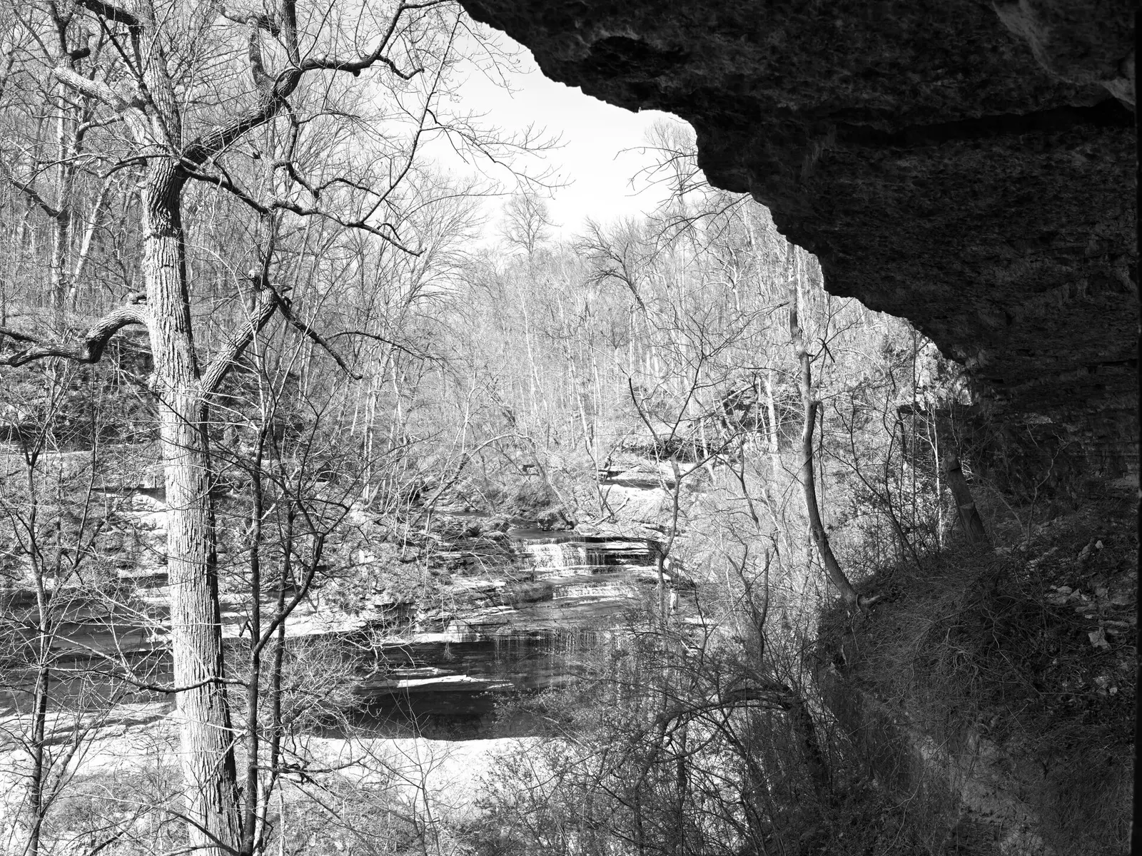
Covering about 1,150 acres, Clifty Falls State Park lies in Jefferson County, about 2 miles west of Madison.
The park supports swimming, picnicking, and hiking. On the water side, there is a swimming pool. Camping is available: 169 campsites across 2 camping areas, including tent sites. Roofed lodging includes lodge rooms.
Fees and passes
Per vehicle daily gate fee: $7 Indiana plates / $15 out-of-state at state parks and state-managed lakes; exceptions Indiana Dunes ($7/$20), Prophetstown ($8/$16), Falls of the Ohio Interpretive Center ($9 adult/$7 child); $2 per person age 5+ on foot, bicycle or horseback.
Statewide fee rule from Indiana's park system; this park’s page doesn’t list its own fees.
Indiana park passes
- Annual Entrance Pass — $50. Noncommercial vehicle, driver and passengers at DNR properties that charge a gate fee Details
- Non-resident Annual Entrance Pass — $120. Non-Indiana resident noncommercial vehicles Details
- Golden Hoosier Passport — $25. Indiana residents 65+ or eligible for SS disability; vehicle, driver and passengers Details
- Disabled Hoosier Veteran Pass — $25. Persons eligible for a Disabled Hoosier Veteran plate Details
- SSDI Pass — $25. Indiana residents receiving or eligible for SSDI Details
From the Indiana state guide. Confirm which passes this park accepts.
Reservations
- Day use
- No day-use reservation requirement mentioned
- Booking system
- ReserveAmerica (Indiana State Parks) for camping, cabins, shelters, group camps; separate inn reservations
- Phone
- 1-866-622-6746 (camping, cabins, shelters, group camps); 1-877-563-4371 (inns and Brown County cabins)
We link to the official booking system rather than showing live availability, which changes minute to minute.
Camping
| Campground or site type | Sites | Hookups / features | Price |
|---|---|---|---|
| Electric | 106 | Electric | — |
| Non-electric | 63 | — |
Camping details from the park
- Electric / 106 sites
- Non-electric / 63 sites
- Youth Tent Areas
- Dumping Station
From the official park page, checked Oct 29, 2026. Site counts and prices can change; confirm when booking.
Cabins and lodging
Clifty Inn and Restaurant
Things to do
PicnickingHikingSwimmingCamping
Trails
| Trail | Length | Difficulty | Notes |
|---|---|---|---|
| Trail 1 | 0.75 mi | Rugged | Starts at nature center parking lot, proceeds to Observation Tower overlooking Ohio River, then along canyon wall to park road. Long, steep grades in and out of canyon. |
| Trail 2 | 3 mi | Very rugged | One-way, no-outlet in North End. Continual water damage and rockslides have required the removal of this structure for everyone’s safety; therefore, access in and out of the canyon is available only via connecting trails 1, 4, 5, and 8. Trail 2 is primarily the stone bed of Clifty Creek and may be impassable during times of high water. Areas above and below all waterfalls are always OFF LIMITS. |
| Trail 3 | 1 mi | Rugged | Starts at park road just south of Poplar Grove. Long grade descends to midcanyon, then follows along canyon. Steep grades rise to Poplar Grove. Easy walking to near side of Beech Grove connecting with Trail 4. |
| Trail 4 | 0.75 mi | Rugged | Starts at Hoffman Falls parking lot. Short distance to spectacular falls overlook. Follows canyon to Lilly Memorial (spur connects to Clifty Creek), which has a long, steep staircase at Lilly Memorial. |
| Trail 5 | 0.875 mi | Rugged | Starts at Lilly Memorial, long, steep staircase to mid-canyon. Follows along canyon past tunnel entrances (spur connects to Clifty Creek), past Oak Grove to Tunnel Falls. Steep staircase from falls overlook to road. |
| Moderately (Trail 6) | 0.5 mi | Rugged | Starts at Hickory Grove, follows canyon just below rim to Lookout Point. Some very rocky footing. |
| Moderately (Trail 7) | 1.25 mi | Rugged | Starts at Clifty shelter, proceeds past Little Clifty Falls along rocky footing to Lookout Point. Returns to picnic area east of shelter via upper Little Clifty Creek gorge. |
| Trail 8 | 4.5 mi | Rugged | Starts just west of north gatehouse. Proceeds south along west rim of Clifty Canyon. Steep grades to Clifty Creek at north and south ends of trail. (Steep switchback connects to creek across from Oak Grove.) Exits south canyon to park road or Trail 1 to nature center. |
| Trail 9 | 1 mi | Moderate | Campground to nature center and Clifty Inn, via swimming pool. |
| Trail 10 | 0.75 mi | Easy | Starts at back of swimming pool parking lot, features old field ecology. |
Trail descriptions from the park
The Friends of Clifty Falls State Park and Jefferson County Library partnered to create a StoryWalk® on the paved walking loop that begins at the trailhead of Trail 7 near Clifty Shelter. This trail is easy and wheelchair accessible. Read a book while going for a short, easy walk! After completing the StoryWalk® you are welcome to pick up a sticker at the nature center.
1.*RUGGED (.75 mile)—Starts at nature center parking lot, proceeds to Observation Tower overlooking Ohio River, then along canyon wall to park road. Long, steep grades in and out of canyon.
2. VERY RUGGED (3 miles)—One-way, no-outlet in North End. Continual water damage and rockslides have required the removal of this structure for everyone’s safety; therefore, access in and out of the canyon is available only via connecting trails 1, 4, 5, and 8. Trail 2 is primarily the stone bed of Clifty Creek and may be impassable during times of high water. Areas above and below all waterfalls are always OFF LIMITS.
3.*RUGGED (1 mile)—Starts at park road just south of Poplar Grove. Long grade descends to midcanyon, then follows along canyon. Steep grades rise to Poplar Grove. Easy walking to near side of Beech Grove connecting with Trail 4.
4.*RUGGED (.75 mile)—Starts at Hoffman Falls parking lot. Short distance to spectacular falls overlook. Follows canyon to Lilly Memorial (spur connects to Clifty Creek), which has a long, steep staircase at Lilly Memorial.
5.*RUGGED (.875 mile)—Starts at Lilly Memorial, long, steep staircase to mid-canyon. Follows along canyon past tunnel entrances (spur connects to Clifty Creek), past Oak Grove to Tunnel Falls. Steep staircase from falls overlook to road.
6. MODERATELY RUGGED (.5 mile)—Starts at Hickory Grove, follows canyon just below rim to Lookout Point. Some very rocky footing.
7. MODERATELY RUGGED (1.25 miles)—Starts at Clifty shelter, proceeds past Little Clifty Falls along rocky footing to Lookout Point. Returns to picnic area east of shelter via upper Little Clifty Creek gorge.
8. RUGGED (4.5 miles)—Starts just west of north gatehouse. Proceeds south along west rim of Clifty Canyon. Steep grades to Clifty Creek at north and south ends of trail. (Steep switchback connects to creek across from Oak Grove.) Exits south canyon to park road or Trail 1 to nature center.
9. MODERATE (1 mile)—Campground to nature center and Clifty Inn, via swimming pool.
10.EASY (.75 mile)—Starts at back of swimming pool parking lot, features old field ecology.
*Brough’s Folly 1852 railroad path
Swimming
Swimming Pool / Waterslide (Policy) Check office for hours.
Amenities
Facilities
- Picnic areas
- Nature center or museum
- Restaurant or food service
Water
- Swimming pool
Camping
- Tent camping
Lodging
- Lodge or inn rooms
✓ listed by the park · ✕ the park says it is not available. Anything not shown here isn’t mentioned by the official source — that means unknown, not unavailable.
Accessibility
ADA Waterfall Overlook
ADA Colorblind viewers
Official accessibility information
Conditions change. Contact the park to confirm specific accessible features before your visit.
Getting there
- Address
- 2221 Clifty Drive
Madison, IN 47250 - Nearest town
- Madison — about 2 mi west (straight line)
- Coordinates
- 38.7704, -85.4363
- Phone
- 812-273-8885
Google Maps directionsApple MapsOfficial park map (PDF)
Directions from the park
Mapping Address: 2221 Clifty Drive Madison, IN 47250
Nearby state parks
Sources and freshness
- Indiana State Parks — park page — last checked Oct 29, 2026
- Indiana State Parks 'Find A Park' property list + DNR ArcGIS site layers (coordinates)
- Wikidata
- USGS PAD-US 4.1 (boundary and acreage)
- Photo: Public Lands Institute - Clifty Falls State Park - 001.tif — CC0 1.0 (public domain dedication), Public Lands Institute
“Last checked” is when our system last read the official source. No change has been detected since this page was first published. Hours, fees and rules can change without notice — confirm with the park before you go. Methodology