Charlestown State Park
- Status
- Status not posted
- Entrance fee
- Statewide rule — see below
- Day-use reservations
- None mentioned
- Dogs
- Not stated — check with park
- Camping
- 192 campsites
- Official site
- in.gov812-256-5600
Official page last checked Oct 29, 2026. How we keep this current
Overview
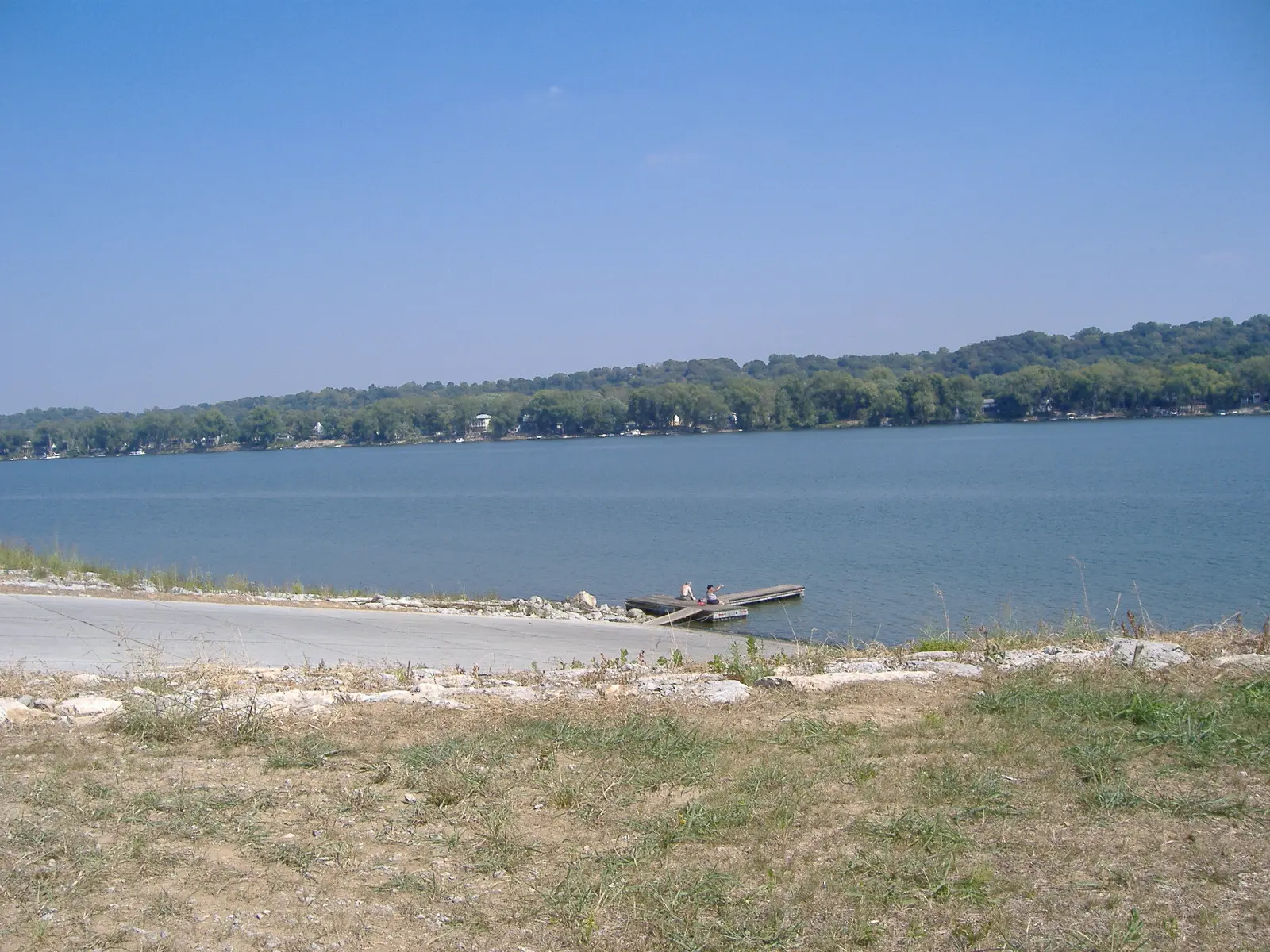

Charlestown State Park is a 3,684-acre park in Clark County, in Charlestown.
Visitors come for fishing, hiking, and picnicking. For overnight stays there are 192 campsites across 2 camping areas (RV sites with full hookups and tent sites).
Fees and passes
Per vehicle daily gate fee: $7 Indiana plates / $15 out-of-state at state parks and state-managed lakes; exceptions Indiana Dunes ($7/$20), Prophetstown ($8/$16), Falls of the Ohio Interpretive Center ($9 adult/$7 child); $2 per person age 5+ on foot, bicycle or horseback.
Statewide fee rule from Indiana's park system; this park’s page doesn’t list its own fees.
Indiana park passes
- Annual Entrance Pass — $50. Noncommercial vehicle, driver and passengers at DNR properties that charge a gate fee Details
- Non-resident Annual Entrance Pass — $120. Non-Indiana resident noncommercial vehicles Details
- Golden Hoosier Passport — $25. Indiana residents 65+ or eligible for SS disability; vehicle, driver and passengers Details
- Disabled Hoosier Veteran Pass — $25. Persons eligible for a Disabled Hoosier Veteran plate Details
- SSDI Pass — $25. Indiana residents receiving or eligible for SSDI Details
From the Indiana state guide. Confirm which passes this park accepts.
Reservations
- Day use
- No day-use reservation requirement mentioned
- Booking system
- ReserveAmerica (Indiana State Parks) for camping, cabins, shelters, group camps; separate inn reservations
- Phone
- 1-866-622-6746 (camping, cabins, shelters, group camps); 1-877-563-4371 (inns and Brown County cabins)
We link to the official booking system rather than showing live availability, which changes minute to minute.
Camping
| Campground or site type | Sites | Hookups / features | Price |
|---|---|---|---|
| Full Hookup | 60 | Full hookup | — |
| Electric | 132 | Electric | — |
Camping details from the park
- Full Hookup / 60 sites
- Electric / 132 sites
- Campground Reservations
From the official park page, checked Oct 29, 2026. Site counts and prices can change; confirm when booking.
Things to do
HikingPicnickingFishingCamping
Trails
| Trail | Length | Difficulty | Notes |
|---|---|---|---|
| Trail 1 | 2.4 mi | Rugged | — |
| Trail 2 | 1.4 mi | Moderate | — |
| Trail 3 | 2.1 mi | Rugged | — |
| Trail 4 | 2.9 mi | Rugged | — |
| Trail 5 | 1.2 mi | Moderate | — |
| Trail 6 | 2.3 mi | Rugged | — |
| Rose Island Loop (Trail 7) | 0.9 mi | Easy | — |
| 5K Course | 3.1 mi | Easy | — |
Trail descriptions from the park
Charlestown State Park offers a motorized wheelchair that can be taken on trails and around facilities.
1. RUGGED (2.4 miles) - Begins at the Trail 1 parking lot and follows an existing gravel road a short distance before turning to the left and slowly descending into the Fourteenmile Creek Valley. It then meanders through dense floodplain forest before climbing up the valley wall to wind along rock outcrops and abutments. A lower portion of the trail offers scenic views of Fourteenmile Creek before climbing again as it returns to the parking lot. Spring wildflowers along portions of this trail will treat the hiker to stunning displays. Wildlife, songbirds, and birds of prey may be seen along this trail.
2. MODERATE (1.4 miles) - Begins in the picnic area and follows several stream ravines as it circles back to return to the picnic area. The middle section of this trail runs along hillsides heavily forested with mixed deciduous hardwoods, bridges several small ravines, and offers scenic views of several small cascading falls and rock-bottom streams.
3. RUGGED (2.1 miles) - The trail begins with a very steep road grade that once led to a footbridge over Fourteenmile Creek. The bridge provided access to Rose Island, a 1920s amusement park. The Rose Island facilities were damaged beyond repair by the 1937 flood, and the bridge was removed once the Army bought the land in the 1940s. Good areas for stream-bank fishing can be reached by following the gravel portion of Trail 3 to Fourteenmile Creek. The middle section of this trail is very scenic with views of Fourteenmile Creek, rock cliffs high above the trail, abundant spring wildflowers, and mixed deciduous forests.
4. Rugged (2.9 miles) - Trail 4 begins at same parking lot as Trail 3. Beginning on gently rolling land, this trail soon begins to descend into mixed hardwood forests as it follows tributaries of Fourteenmile Creek. At about the halfway point, hikers will see commanding views of Fourteenmile Creek from a bluff more than 100 feet above the water. High quality woodlands and striking wildflower displays are found on this trail.
5. MODERATE (1.2 miles) - Conveniently located in the campground near site 17, this trail is easily accessed. Descending a wooded ravine, the trail ultimately comes to a platform overlooking Fourteenmile Creek. Winding back up the hillside, the trail ends where it started, so it’s a short walk back to your campsite. Non-campers can enjoy this trail by parking in the overflow lot and hiking the .3-mile leg to the main loop.
6. RUGGED (2.3 miles) -This scenic trail starts across the road from the Riverside Overlook and runs along the top of the river bluff. The bluff top offers glimpses of the Ohio River and Twelve mile Island, and overlooks the boat ramp. A bridge crosses a natural waterfall and descends to the old Charlestown Landing site, where locals used to send and receive goods by boat pre-1940s. From there it is a stroll back along the bluff bottom. Enjoy the towering bluffs. During spring, there is an abundance of wildflowers.
7. Rose Island Loop (.9 miles) - Easy To reach the Rose Island Loop Trail take Trail 3 southbound to the Portersville Bridge. Notice Trail 3 is a steep, paved .6 mile path. Those needing ADA assistance can call the park office to arrange transportation to the Rose Island Loop Trail. Rose Island was an amusement park in the 1920s. The site boasted a small zoo, pony rides, merry-go-round, Ferris wheel, roller coaster, shooting gallery, cafeteria, swimming pool, and more. After the Great Depression, attendance to Rose Island slowed, and the 1937 Flood damaged the park beyond repair. Despite its name, the park was not truly an island but a peninsula that visitors could only reach by steamer, bridge or ferry. Today, park visitors can reach Rose Island across the historic Portersville Bridge, which was dismantled from Dubois and Daviess counties and rebuilt at its present site between 2008 and 2011.
8. 5K Course (3.1 miles) - Easy The course is designed as a 5 kilometer loop that continuously leaves the central area through 8 feet wide mowed trails. When returning to the central area, keep the uncut grass to your right until you come to a new mowed trail. The course is marked with posts at all 5 kilometers and at each mile.
Fishing
Fishing, along 14 Mile Creek bank on Trail 3
A state fishing license is usually required.
Amenities
Facilities
- Picnic areas
- Playground
Camping
- Tent camping
- RV camping
- Electric hookups
- Water hookups
- Sewer hookups
✓ listed by the park · ✕ the park says it is not available. Anything not shown here isn’t mentioned by the official source — that means unknown, not unavailable.
Getting there
- Address
- 12500 Indiana 62
Charlestown, IN 47111 - Nearest town
- Charlestown
- Coordinates
- 38.4482, -85.6440
- Phone
- 812-256-5600
Google Maps directionsApple MapsOfficial park map (PDF)
Directions from the park
Mapping Address: 12500 Indiana 62 Charlestown, IN 47111
Nearby state parks
Sources and freshness
- Indiana State Parks — park page — last checked Oct 29, 2026
- Indiana State Parks 'Find A Park' property list + DNR ArcGIS site layers (coordinates)
- Wikidata
- USGS PAD-US 4.1 (boundary and acreage)
- Photo: Charlestown State Park Landing.jpg — Public domain (released by the author), Bedford at English Wikipedia
“Last checked” is when our system last read the official source. No change has been detected since this page was first published. Hours, fees and rules can change without notice — confirm with the park before you go. Methodology