Tyler State Park
- Status
- Open (per official listing)Daily 8 a.m. – sunset
- Entrance fee
- Not posted
- Day-use reservations
- None mentioned
- Dogs
- Not stated — check with park
- Camping
- None listed
- Official site
- pa.gov(215) 968-2021
Official page last checked Oct 29, 2026. How we keep this current
Current alerts 2
Alert Unmanned aerial vehicles (UAV), remotely piloted vehicles (RPV) or unmanned aircraft systems (UAS), all commonly referred to as DRONES, their commercial and general recreational use is not permitted in PA State Parks. Drones… (more)
raft systems (UAS), all commonly referred to as DRONES, their commercial and general recreational use is not permitted in PA State Parks. Drones create a variety of safety, wildlife impacts and privacy issues. Therefore, they are prohibited in Tyler State Park and all other PA State Parks.
Posted by the park. Official alert
Alert The PA Department of Environmental Protection has issued a Do Not Eat advisory for all fish in the Neshaminy Creek. Fish within this creek may contain Perfluoroctane Sulfonate (PFOS). You may still fish the Neshaminy Creek, but… (more)
or all fish in the Neshaminy Creek. Fish within this creek may contain Perfluoroctane Sulfonate (PFOS). You may still fish the Neshaminy Creek, but we recommend catch and release only. Trout stocking along the Neshaminy Creek will also be suspended until further notice.
Posted by the park. Official alert
Overview
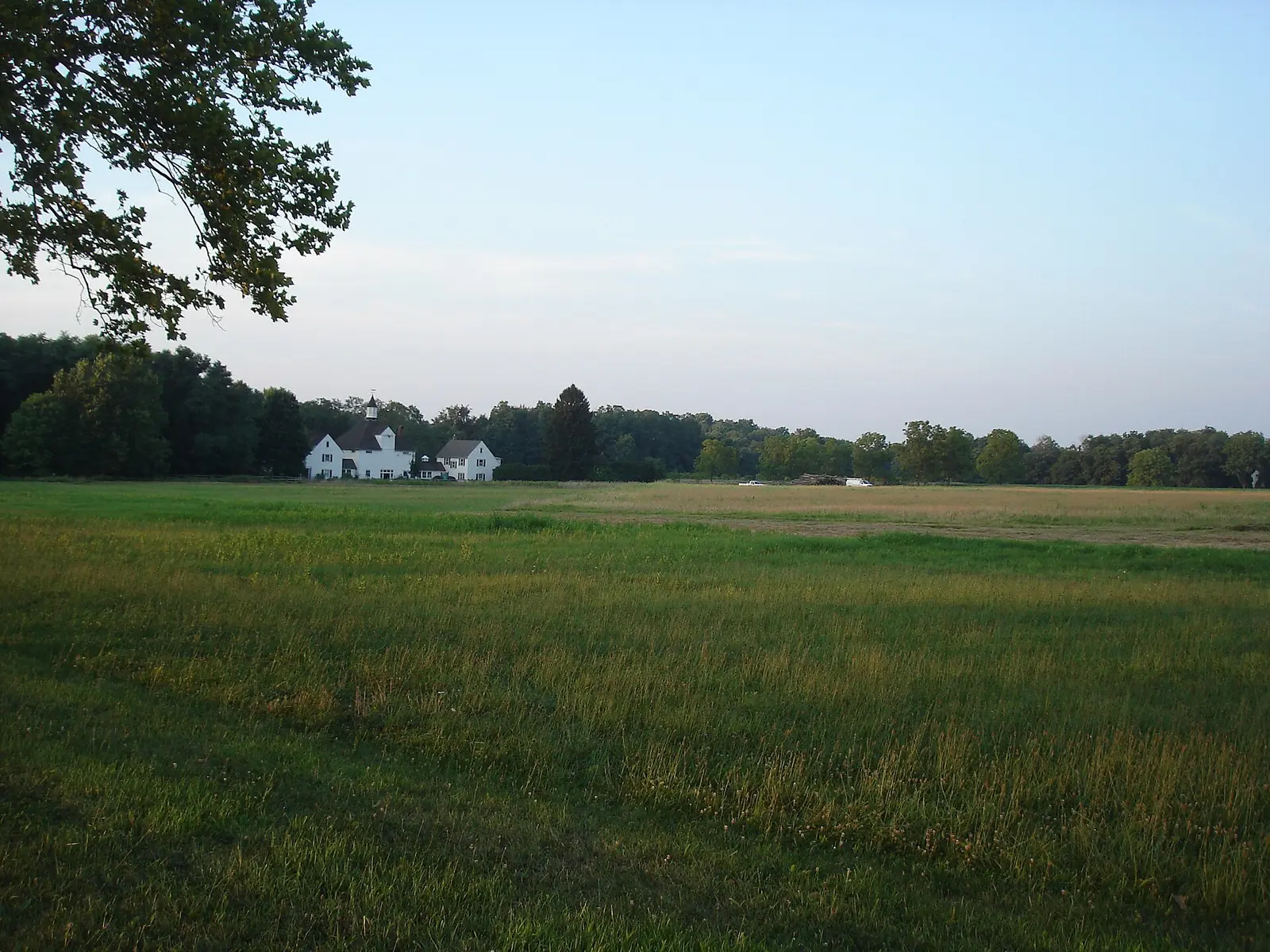

Tyler State Park is a 3,343-acre park in Bucks County, in Newtown.
The park supports cross-country skiing, golf, horseback riding, disc golf, and winter sports. Facilities for water recreation include a boat ramp and boat or kayak rentals.
Hours
Park, gate, office and facility hours are listed separately because they often differ. Alerts above override normal hours.
| Facility | Days | Hours | Season |
|---|---|---|---|
| Park | Daily | 8 a.m. – sunset | — |
Official wording
The park is open every day of the year, 8:00 A.M. to sunset. Day use areas close at dusk. The park office is open specific hours. Contact the park office for facility seasons and hours.
Source: official park page, checked Oct 29, 2026. Times are local to the park (America/New York).
Reservations
- Day use
- No day-use reservation requirement mentioned
- Booking system
- ReserveAmerica (Aspira), Pennsylvania State Parks contract
- Phone
- 888-PA-PARKS (888-727-2757)
We link to the official booking system rather than showing live availability, which changes minute to minute.
Things to do
PicnickingGolfDisc golfHikingBikingWinter sportsFishingBoatingCross-country skiingHorseback ridingCanoeing and kayaking
Trails
| Trail | Length | Difficulty | Notes |
|---|---|---|---|
| Betz Hill Trail | 1.9 mi | Easiest | Recreations permitted: hiking, biking Trailhead amenities: potable water, benches A paved trail begins along Twinning Ford Road / College Park Trail and passes along open farmed fields, warm season grasses, and woodlands. Sections of the trail offer views of the Neshaminy Creek. The trail and ends an intersection with a hilltop view of agricultural fields and forests. This trail connects with No 1. Lane Trail, Covered Bridge Trail, and Mill Dairy Trail along the way.HikingBiking |
| Buckman Trail | 0.7 mi | Easiest | Recreations permitted: hiking, biking Trailhead amenities: none This ADA accessible, paved trail begins at Fisherman's lot and ends at the boarder of Tyler State Park and the Newtown Middle School. The path is mostly flat and open, offering views of warm season grasses and agricultural fields. This trail connects to the southern end of Tyler Drive Trail, near the Mill Dam Parking Lot.HikingBiking |
| College Park Trail | 0.5 mi | Easiest | Recreations permitted: hiking, biking Trailhead amenities: none This paved trail connects Betz Hill Trail to No. 1 Lane Trail on the western side of the park.HikingBiking |
| Cooper Trail | 3 mi | More difficult | Recreations permitted: hiking, equestrian Trailhead amenities: picnic tables This unpaved trail is designated for equine riders and hikers. This trail begins and ends near the Center for the Arts parking lot and loops through mature forests and along agriculture fields. Several connector trails offer a route to other unpaved trails or different loops.HikingEquestrian |
| Covered Bridge Trail | 1.1 mi | Easiest | Recreations permitted: hiking, biking, equestrian Trailhead amenities: potable water, picnic tables, benches The Schofield Ford Covered Bridge crosses the Neshaminy Creek on the northern end of this trail, somewhat close to the parking lot. Parts of this trail are gravel or dirt near the Neshaminy Creek and Covered Bridge parking lot but are paved in other areas. Part of this trail includes a steep climb to a lovely hilltop view of agricultural fields and forests. This trail connects to White Pine Trail and to the Betz Hill Trail.HikingBikingEquestrian |
| Green Lane Trail | 0.3 mi | Easiest | Recreations permitted: hiking, biking Trailhead amenities: none This mostly shady and flat trail connects the Lower Plantation Area to the boarder of the park and a local middle school.HikingBiking |
| Hay Barn Grass Trail | 4.5 mi | More difficult | Recreations permitted: hiking, equestrian Trailhead amenities: picnic tables The trail starts and finishes at the Covered Bridge Parking Lot. It takes you through rolling agricultural fields, native warm-season grass fields, past the original farmhouses and barns, and along some sections of the Neshaminy Creek.HikingEquestrian |
| Mill Dairy Trail | 1.2 mi | Easiest | Recreations permitted: hiking, biking Trailhead amenities: benches Mill Dairy Trail connects Betz Hill Trail to Stable Mill Trail. The trail offers views of the Neshaminy Creek, the Meadow Restoration Project, and mature forested areas. The middle of this trail offers easy access to/from the Boathouse Picnic Area and the Nature Trail.HikingBiking |
| Nature Trail | 2 mi | More difficult | Recreations permitted: hiking Trailhead amenities: modern restrooms, picnic tables, benches This hiking-only trail begins across the Neshaminy Creek from the Boathouse Area, traversing along Porter Run Creek and offers excellent views of geologic features such as rock outcrops and large boulders. Combined with other trails, trail may be taken as a loop or lead out to connection points to No. 1 Lane Trail or Red Oak Trail. It also has connection points to the (unpaved) Cooper Trail and Neshaminy Creek Equine/hiking trails.Hiking |
| Neshaminy Creek Trail | 2.6 mi | More difficult | Recreations permitted: hiking, equestrian Trailhead amenities: picnic tables The trail follows the creek, beginning at the Fisherman’s Parking Lot and offers excellent views of the creek and geologic features before ending at the Schofield Ford Covered Bridge. This trail passes by both The Neshaminy Weir Dam (Boathouse Area) and the Spring Mill Garden Dam (lower dam). Many connector trails lead to other unpaved equestrian/hiking trails.HikingEquestrian |
| No. 1 Lane Trail | 1.2 mi | Easiest | Recreations permitted: hiking, biking Trailhead amenities: picnic table, benches This paved trail starts at the No. 1 Lane Parking Lot, is ADA accessible for 0.8 miles, and ends at Betz Hill Trail. It passes along open farmed fields, warm season grasses, and woodlands.HikingBiking |
| Quarry Trail | 0.3 mi | Easiest | Recreations permitted: hiking, biking Trailhead amenities: modern restrooms, picnic tables This paved, ADA accessible trail is a short connector between the Lower Plantation Picnic Area and Tyler Drive Trail. It is relatively flat and shady.HikingBiking |
| Red Oak Trail | 0.6 mi | Easiest | Recreations permitted: hiking, biking Trailhead amenities: benches The paved Red Oak Trail connects the middle of Stable Mill Trail to the middle of Mill Dairy Trail, there is also an access point to the Nature Trail. This trail runs through mature forested areas and along agricultural fields.HikingBiking |
| White Pine Trail | 0.5 mi | Easiest | Recreations permitted: hiking, biking, equestrian Trailhead amenities: none White Pine Trail connects part of Betz Hill Trail to an intersection with Covered Bridge Trail and the tail end of Betz Hill Trail. The intersection is at a scenic hilltop overlook of agriculture fields and forests.HikingBikingEquestrian |
| Woodfield Trail | 0.5 mi | Easiest | Recreations permitted: hiking, biking Trailhead amenities: none The paved, ADA accessible trail connects to two points along the southern end of Mill Dairy Trail. This pathway winds through old growth forests above the Neshaminy Creek and around a meadow habitat restoration area.HikingBiking |
Trail descriptions from the park
25 miles Park trails lead visitors through areas rich in historic and scenic interest. The trails provide excellent views of the park and surrounding countryside and can be used for short walks or long hikes covering many miles. Several parking lots near the outer perimeter of the park allow access to remote areas and trails. Tyler State Park Map
Amenities
Facilities
- Picnic areas
- Picnic shelters
Water
- Boat ramp
- Boat, canoe or kayak rentals
Recreation
- Golf course
- Disc golf
- Horse trails
✓ listed by the park · ✕ the park says it is not available. Anything not shown here isn’t mentioned by the official source — that means unknown, not unavailable.
Accessibility
Tyler State Park offers a range of accessibility accommodations to ensure all visitors can enjoy its natural beauty and recreational opportunities. Accessible Picnic Tables ADA picnic tables are located in the Boat House picnic area and the Maze picnic area. Hickory Nut Picnic Grove The Hickory Nut Picnic Grove can accommodate up to 100 people with 20 picnic tables. Domestic pets are allowed. Upper Plantation Pavilion The Upper Plantation Pavilion can accommodate up to 60 people with 11 picnic tables. Domestic pets are allowed. Buckman Trail 0.7 mile | Easiest hiking | Out-and-back trail | No blazes Recreations permitted: hiking, biking Trailhead amenities: none This ADA accessible, paved trail begins at Fisherman's lot and ends at the boarder of Tyler State Park and the Newtown Middle School. The path is mostly flat and open, offering views of warm season grasses and agricultural fields. This trail connects to the southern end of Tyler Drive Trail, near the Mill Dam Parking Lot. Buckman Trail 0.7 mile | Easiest hiking | Out-and-back trail | No blazes Recreations permitted: hiking, biking Trailhead amenities: none This ADA accessible, paved trail begins at Fisherman's lot and ends at the boarder of Tyler State Park and the Newtown Middle School. The path is mostly flat and open, offering views of warm season grasses and agricultural fields. This trail connects to the southern end of Tyler Drive Trail, near the Mill Dam Parking Lot. Hunting Tyler State Park hosts permit-only shotgun and archery deer hunts during hunting season on approximately 1500 acres. During the Special Regulation shotgun hunt, the entire park is closed to visitors. This park offers accessible hunting options for this special regulation hunt. Visitors holding a DCNR Mobility Device Permit can contact the park office for more information about accessible hunting locations within the park. DCNR permits visitors with a DCNR Mobility Device Permit to use powered mobility devices on designated state park and forest lands, including administrative roads and trails not normally open to standard motorized vehicles. Visitors interested in a DCNR Mobility Device Permit can fill out an application and submit it at any state park or forest office. Historic Place There are several historic places with ADA access at Tyler State Park. The Spring Garden Mill: Home to the Langhorne Players, Inc., the Spring Garden Mill was once a grain and feed mill. The Langhorne Players are a volunteer community theater company that has converted the mill into a small theater for the production of unusual, thought-provoking plays and cultural events. Tyler Park Center for the Arts: The Tyler Park Center for the Arts occupies a building that was once an equestrian and hay barn. The arts center converted the barn and surrounding buildings into artist dwellings, workshops, and studios. They offer classes and workshops. The annual Crafts in the Meadow Fall Invitational Craft Show helps support the arts center.
Official accessibility information
Conditions change. Contact the park to confirm specific accessible features before your visit.
Getting there
- Address
- 101 Swamp Road
Newtown, PA 18940-1151 - Nearest town
- Newtown
- Coordinates
- 40.2310, -74.9531
- Phone
- (215) 968-2021
- tylersp@pa.gov
Google Maps directionsApple MapsOfficial park map (PDF)
Directions from the park
The main entrance to the park is at the intersection of Swamp Road and PA 413 (Newtown Bypass). Take Exit 49, Newtown/Yardley, of I-95 and follow PA 413 North. The park entrance is on the left. For GPS units: 101 Swamp Road, Newtown, PA 18940 GPS DD: Lat. 40.23103 Long. -74.95315
Nearby state parks
Sources and freshness
- Pennsylvania State Parks — park page — last checked Oct 29, 2026; page says updated Sep 4, 2026
- DCNR Find a Park: content-fragment JSON feed used by the pa.gov park finder
- Wikidata
- USGS PAD-US 4.1 (boundary and acreage)
- Photo: Tyler-SP-craftsmen.JPG — Public domain (released by the author), User:Gplefka
“Last checked” is when our system last read the official source. No change has been detected since this page was first published. Hours, fees and rules can change without notice — confirm with the park before you go. Methodology