Prince Gallitzin State Park
- Status
- Status not postedDaily sunrise – sunset
- Entrance fee
- Not posted
- Day-use reservations
- None mentioned
- Dogs
- Dogs allowed, with restrictions
- Camping
- 84 campsitesAlso cabins, yurts
- Official site
- pa.gov(814) 674-1000
Official page last checked Oct 29, 2026. Details last changed Oct 29, 2026. How we keep this current
Overview
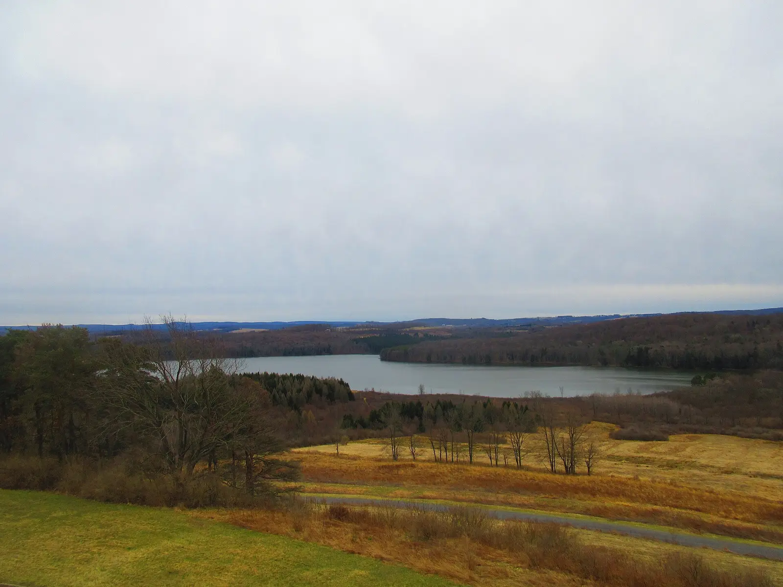

Prince Gallitzin State Park is a 7,245-acre park in Cambria County, about 13 miles northwest of Altoona.
Visitors come for snorkeling and diving, cross-country skiing, snowmobiling, horseback riding, and golf. The official site lists about 65 miles of trails. On the water side, there is a swimming beach, a boat ramp, a fishing pier, and boat or kayak rentals. Overnight options include 84 campsites across 2 camping areas, with RV sites with full hookups, tent sites, and group camping. Roofed lodging includes cabins and yurts.
Hours
Park, gate, office and facility hours are listed separately because they often differ. Alerts above override normal hours.
| Facility | Days | Hours | Season |
|---|---|---|---|
| Park | Daily | sunrise – sunset | — |
| Daily | 8 a.m. – 4 p.m. | — | |
| Sat–Sun | 2 p.m. – 4 p.m. | — |
Official wording
The park is open every day of the year, sunrise to sunset. Day use areas close at dusk. The park office is open year round from 8:00 A.M. to 4:00 P.M., Monday through Friday. Between Memorial Day and Labor Day, the office is also open Saturdays and Sundays from 2:00 P.M. to 4:00 P.M. Contact the park office for specific facility seasons and hours.
Source: official park page, checked Oct 29, 2026. Times are local to the park (America/New York).
Reservations
- Day use
- No day-use reservation requirement mentioned
- Booking system
- ReserveAmerica (Aspira), Pennsylvania State Parks contract
- Phone
- 888-PA-PARKS (888-727-2757)
We link to the official booking system rather than showing live availability, which changes minute to minute.
Pets
Dogs allowed, with restrictions
Not allowed in or on: the beach and swimming area.
Dogs are permitted in Cabins #1, #9, and #10, which permit up to two dogs. Pets are prohibited in the beach and swimming area. ADA guide dogs and service dogs are not considered pets.
Service animals are generally permitted where pets are not. Check with the park for specific areas.
Camping
| Campground or site type | Sites | Hookups / features | Price |
|---|---|---|---|
| Camping Season: ♿ A 398-site tent and trailer campground opens in mid-April and closes in late October. Prince Gallitzin State Park Campground Map (PDF)
♿ A 398-site tent and trailer campground opens in mid-April and closes in late October.
Many sites have electric hookup. Some sites have full-hookup, which includes sewer, water, and electricity.
Facilities and services offered in the campground include:
• Camp store with coin-operated laundry
• Swimming beach
• Boat mooring area
• Boat rental
• Playgrounds
• Paved sites
• Showers
• Flush toilets
• Sanitary dump stations
• Wi-Fi within the Crooked Run Campground for a fee
The Campground Beach is open during the summer.
Free Camping for Campgroun | 84 | Many sites have electric hookup. Some sites have full-hookup, which includes sewer, water, and electricity. • Camp store with coin-operated laundry The campground and marina host sites have amenities that include 50-amp electric service and water and sewer hookup.Showers | — |
| Organized Group Tenting Prince Gallitzin State Park Group Tenting Brochure (PDF)
A rustic tenting area may be reserved by organized adult and youth groups from Memorial Day weekend through Labor Day.
There are picnic tables, restrooms, and drinking water. A shower house is within easy walking distance. | — | Showers | — |
Camping details from the park
Camping
Prince Gallitzin State Park Campground Map (PDF)
♿ A 398-site tent and trailer campground opens in mid-April and closes in late October.
Many sites have electric hookup. Some sites have full-hookup, which includes sewer, water, and electricity.
Facilities and services offered in the campground include:
- Camp store with coin-operated laundry
- Swimming beach
- Boat mooring area
- Boat rental
- Playgrounds
- Paved sites
- Showers
- Flush toilets
- Sanitary dump stations
- Wi-Fi within the Crooked Run Campground for a fee
The Campground Beach is open during the summer.
Free Camping for Campground and Marina Hosts
Nine host positions
The campground and marina host sites have amenities that include 50-amp electric service and water and sewer hookup. The Crooked Run Campground has host sites on each of the seven main loops that have 43 to 84 campsites each. Each loop has its own shower house. The Prince Gallitzin and Beaver Valley marinas each have a host campsite overlooking the marina docks and launches.
The host is required to assist park personnel for 40 hours-per-week, with a two-week minimum stay. In the area assigned, host responsibilities include:
- Light maintenance tasks at campsites or marinas
- Litter pickup
- Evening checks of shower houses or docks
- Promoting good public relations with campers and boaters
Some loops are closed seasonally, reducing the number of hosts needed during the spring and fall.
Contact the park office for additional information and availability.
Organized Group Tenting
Prince Gallitzin State Park Group Tenting Brochure (PDF)
A rustic tenting area may be reserved by organized adult and youth groups from Memorial Day weekend through Labor Day.
There are picnic tables, restrooms, and drinking water. A shower house is within easy walking distance.
From the official park page, checked Oct 29, 2026. Site counts and prices can change; confirm when booking.
Cabins and lodging
- Modern Cabins: 10 units
- Camping Cottages: 3 units
- Deluxe Camping Cottages: 2 units
Modern Cabins
Prince Gallitzin State Park Cabin Map (PDF)
♿ Ten modern cabins are available for reservations year round. Cabins have:
- Living area
- Kitchen and dining area
- Bathroom/shower
- Two or three bedrooms depending on the type of cabin
- Heat and air conditioning
Two bedroom cabins sleep six people (one double bed and two bunks). Three bedroom cabins sleep eight people (one double bed and three bunks).
Dogs are permitted in Cabins #1, #9, and #10, which permit up to two dogs.
Cabins #1 and #7 are ADA accessible.
Camping Cottages
♿ Located in the campground, three camping cottages in the campground open in mid-April and close in late October.
Each cottage sleeps five people and has:
- Lake view
- Wooden walls and floors
- Windows
- Electric lights and outlets
- Electric heat
- Bunkbeds
- Porch
- Picnic table and fire ring
- Nearby shower house
Read more from the park
Cottage A is ADA accessible.
Deluxe Camping Cottages
Prince Gallitzin State Park Cottage Brochure (PDF)
♿ Located in the campground, two deluxe camping cottages in the campground open in mid-April and close in late October.
Each deluxe cottage sleeps five and has:
- Two rooms
- Four-burner electric range and a microwave oven
- Countertop and cabinets
- Refrigerator
- Table and chairs
- Wooden walls and floors
- Windows
- Electric lights and outlets
- Electric heat
- Bunk beds
- Porch
- Picnic table and fire ring
- Nearby shower house
Deluxe Cottage E is ADA accessible.
Things to do
HikingWinter sportsHorseback ridingGolfDisc golfSnorkeling and scubaSwimmingBoatingFishingCross-country skiingPicnickingSnowmobilingBikingHuntingMountain bikingCampingCanoeing and kayaking
Trails
| Trail | Length | Difficulty | Notes |
|---|---|---|---|
| Bollinger Trail | 4.1 mi | More difficult | Recreations permitted: hiking, mountain biking, equestrian, snowmobiling Trailhead amenities: modern restrooms, potable water, picnic tables, benches This trail stretches from Pickerel Pond to Glendale Dam, passing Beaver Valley Marina, the soccer fields in Flinton, and intersecting many trails.HikingMountain bikingEquestrianSnowmobiling |
| Campground Trail | 2.2 mi | Easiest | Recreations permitted: hiking, mountain biking Trailhead amenities: benches This trail follows the shoreline and topography around the campground. Benches along the trail are great for relaxing and viewing wildlife. This trail is popular for mountain biking and geocaching.HikingMountain biking |
| Deer Trail | 0.7 mi | Easiest | Recreations permitted: hiking, snowshoeing Trailhead amenities: benches Follow this trail into State Game Lands 108 to discover food plots for wildlife. Lucky hikers can see deer or other animals feeding. This trail intersects with Forest Trail and is a short family-friendly loop.HikingSnowshoeing |
| Footprint Trail | 1 mi | More difficult | Recreations permitted: hiking Trailhead amenities: benches Follow this loop for a fleeting view of the Wyerough Branch to the lake. Hikers can relax on the bench and scout for herons, osprey, and bald eagles.Hiking |
| Forest Trail | 0.4 mi | Easiest | Recreations permitted: hiking Trailhead amenities: benches This short loop is one of the easiest trails in the park. Watch scampering chipmunks and hear chattering red squirrels while strolling under a canopy of beech, maple, and hemlock trees.Hiking |
| Foster Run Trail | 1.7 mi | More difficult | Recreations permitted: hiking, mountain biking, equestrian, snowmobiling Trailhead amenities: benches This trail runs from the Bater Patch Trailhead south along a ridge and then down to the lake near Noel Run. This remote area of the park consists of thick brushy woods over rolling hills. The trail is used primarily for horseback riding, but it is also open to hiking, mountain biking, and snowmobiling.HikingMountain bikingEquestrianSnowmobiling |
| Hagaratty Trail | 1.5 mi | More difficult | Recreations permitted: hiking, mountain biking, equestrian, snowmobiling Trailhead amenities: benches Starts near the Glendale Dam from the Old Glendale Road Trail and follows along Snake Ridge before descending to meet Old Glendale Road Trail at the Bater Patch Trailhead.HikingMountain bikingEquestrianSnowmobiling |
| Herman Fields Trail | 0.7 mi | Easiest | Recreations permitted: hiking, mountain biking, equestrian, snowmobiling Trailhead amenities: none Starting at an old road gate along Beaver Valley Road (across from Beaver Valley Marina), this trail climbs the hill to join Rhody Trail and intersects with Westrick Trail along the way.HikingMountain bikingEquestrianSnowmobiling |
| Hughes Trail | 0.9 mi | More difficult | Recreations permitted: hiking, cross-country skiing recommended, snowshoeing recommended Trailhead amenities: modern restrooms, potable water This trail begins in the group tenting area and joins Troxell Point Trail, it is a relatively flat hike through beautiful hardwood forests and also provides good views of Glendale Lake and opportunities for cross-country skiing.HikingCross-country skiing recommendedSnowshoeing recommended |
| Lakeshore Trail | 0.75 mi | Easiest | Recreations permitted: hiking Trailhead amenities: modern restrooms, picnic tables, benches Starting at Muskrat Beach #1 Area, this trail serves as a connector between the modern cabin colony and Muskrat Beach swimming/picnic area. The trail entrance from the cabins colony is near Cabin number 8. This trail forms a 3-mile loops when hiked with Plessinger Trail, the gravel Muskrat Access Road and the paved Prince Gallitzin Marina walkway.Hiking |
| Long Road Connector Trail | 0.65 mi | Easiest | Recreations permitted: hiking, biking Trailhead amenities: none This gravel road can be accessed from the gate on Long Road or Headache Hill parking area. It connects to Point Trail after looping through a grove of apple trees.HikingBiking |
| McDermott Trail | 0.8 mi | Easiest | Recreations permitted: hiking Trailhead amenities: picnic tables This trail leads from a small parking area along Beaver Valley Road to Bosar Point, which is a great place to view waterfowl, the peninsula that separates the Killbuck and Mud Lick fingers of Glendale Lake.Hiking |
| Muskrat Access Road | 1.15 mi | Easiest | Recreations permitted: hiking, biking, cross-country skiing recommended Trailhead amenities: modern restrooms, picnic tables This gravel access road is a nice walk around Muskrat Beach Area. This path connects to various trail including Lakeshore, Plessinger, Hughes, and Muskrat Beach Trails.HikingBikingCross-country skiing recommended |
| Muskrat Beach Trail | 0.5 mi | Easiest | Recreations permitted: hiking, mountain biking, snowmobiling, cross-country skiing recommended, snowshoeing recommended Trailhead amenities: modern restrooms, potable water, picnic tables Leaving the upper corner of Muskrat Beach number 2 parking lot, this is a short connector trail with Plessinger Trail and Troxell Point Trail.HikingMountain bikingSnowmobilingCross-country skiing recommendedSnowshoeing recommended |
| Noel Run Connector Trail | 0.6 mi | More difficult | Recreations permitted: hiking, mountain biking, snowmobiling, equestrian Trailhead amenities: none This short, multi-use trail connects Foster Run Trail to Shomo Run Trail.HikingMountain bikingSnowmobilingEquestrian |
| Old Glendale Road Trail | 0.6 mi | Easiest | Recreations permitted: hiking, mountain biking, snowmobiling, equestrian Trailhead amenities: benches This is a beautiful walk through the woods with great opportunities to see birds and wildlife. The trail leads from the Glendale Dam across the dam and follows the shoreline along the Slate Lick arm of Glendale Lake to the Bater Patch Trailhead. Along the way it connects to Hagaratty Trail to make a 4-mile loop.HikingMountain bikingSnowmobilingEquestrian |
| ♿Pickerel Pond Walkway | 0.31 mi | Easiest | Recreations permitted: hiking Trailhead amenities: modern restrooms, picnic tables This walkway leads from the Pickerel Pond parking lot, down to the fishing pier with a paved 0.18-mile ADA accessible path. After the path crosses the pier it turns to a grass trail that loops up to the covered bridge, then back to Pickerel Pond parking area.Hiking |
| Plessinger Trail | 1.2 mi | More difficult | Recreations permitted: hiking, mountain biking, snowmobiling Trailhead amenities: picnic tables Beginning at the Prince Gallitzin Marina entrance road, this trail passes through Muskrat Beach Day Use Area #1. Hiking this trail combined with Lakeshore Trail, Muskrat Access Road, and the Prince Gallitzin Marina walkway is a 3-mile loop.HikingMountain bikingSnowmobiling |
| Poems Trail | 0.6 mi | Easiest | Recreations permitted: hiking Trailhead amenities: benches Learn about nature through poetry. Pick up a trail guide at the trailhead and follow this trail and read the poems that correspond with locations along the trail.Hiking |
| Point Trail | 2.8 mi | More difficult | Recreations permitted: hiking Trailhead amenities: benches This relatively rugged trail with lots of exposed roots begins at the Point Trailhead. The top loop of the trail follows Crooked Run Branch. The bottom loop of the trail follows the shoreline or a hillside. The trees are a mix of hemlock and hardwoods providing a shady walk with beautiful lake views.Hiking |
| ♿Prince Gallitzin Marina Walkway | 0.48 mi | Easiest | Recreations permitted: hiking, biking Trailhead amenities: modern restrooms, potable water, picnic tables, benches This paved, ADA-accessible walkway follows the shoreline around Prince Gallitzin Marina starting at the paved fishing pier and ending near Cabin number 1 in the cabin colony.HikingBiking |
| Reed Trail | 0.6 mi | More difficult | Recreations permitted: hiking, mountain biking, snowmobiling, equestrian, cross-country skiing recommended Trailhead amenities: none This short trail connects Westrick Trail to Rhody Trail.HikingMountain bikingSnowmobilingEquestrianCross-country skiing recommended |
| Rhody Trail | 1.1 mi | More difficult | Recreations permitted: hiking, mountain biking, snowmobiling, equestrian Trailhead amenities: none This trail takes you through Dixon Hollow starting along Swartz Road and ending at Wyerough Finger with a scenic view of Wyerough Cove. Make a loop by taking Herman Fields or Reed trails along the way.HikingMountain bikingSnowmobilingEquestrian |
| Shomo Run Trail | 2 mi | More difficult | Recreations permitted: hiking, mountain biking, snowmobiling, equestrian Trailhead amenities: none This shaded trail starts across the Marina Road from the Pennsylvania Game Commission parking area near Slate Lick Cove and leads to the Noel Run Connector Trail. Much of the trail follows along the curves of Shomo Run. It then loops through an area that was formerly Glendale Riding Trails.HikingMountain bikingSnowmobilingEquestrian |
| Troxell Point Trail | 3 mi | More difficult | Recreations permitted: hiking, cross-country skiing recommended, snowshoeing recommended Trailhead amenities: none This long trail begins at the parking lot along Marina Road near the PA Game Commission maintenance building and finishes at the end of the peninsula on a deck with a picnic table overlooking Glendale Lake and dam. This trail crosses the length of Haddie Buck Peninsula to Troxell Point. Many trails intersect Troxell Point Trail providing the opportunity for side loops and alternate pathways.HikingCross-country skiing recommendedSnowshoeing recommended |
| Turkey Ridge Trail | 1.2 mi | More difficult | Recreations permitted: hiking, cross-country skiing recommended, snowshoeing recommended Trailhead amenities: picnic tables This trail intersects Troxell Point Trail twice and passes through Day Use Area 3. Turkey Ridge Trail passes through a variety of habitats, offering the chance to see a wide variety of animal and bird species.HikingCross-country skiing recommendedSnowshoeing recommended |
| Westrick Trail | 0.7 mi | More difficult | Recreations permitted: hiking, mountain biking, snowmobiling, equestrian Trailhead amenities: modern restrooms, potable water, picnic tables This trail begins near Pavilion 1 at Pickerel Pond, crosses Beaver Valley Road and steadily climbs to Shomo Fields then intersects Herman Fields Trail.HikingMountain bikingSnowmobilingEquestrian |
| Wyerough Connector Trail | 0.25 mi | Easiest | Recreations permitted: hiking, mountain biking, snowmobiling, equestrian Trailhead amenities: non-flush restrooms This short trail branches off of the Campground Trail (near Hickory Loop) and connects to the back section of Wyerough Pontoon Mooring Area.HikingMountain bikingSnowmobilingEquestrian |
Trail descriptions from the park
32.65 miles of trails
The trails traverse a variety of habitats and provide views of the lake.
Prince Gallitzin State Park Map
Gates Trail
2.2 ;miles | More difficult hiking | Loop trail | Red blazes
Recreations permitted: hiking, mountain biking, equestrian, snowmobiling
Trailhead amenities: none
Accessed from Swartz Road (near the entrance to Glendale Yearound) or from Bollinger Trail near McKees Run Boat Launch, this trail loops around the hill above McKees Run.
Swimming
Muskrat beach is open from late-May to mid-September, from 8:00 A.M. until sunset.
Swim at your own risk. Please read and follow posted rules for swimming.
Pets are prohibited in the beach and swimming area. ADA guide dogs and service dogs are not considered pets.
Amenities in and around the swimming area are:
- Modern bathhouses
- Dressing rooms
- Disc golf
- Volleyball courts
- Large picnic area
Campers can swim at the Campground Beach in Maple Loop of Crooked Run Campground.
Smoke-Free Beach
Smoking is prohibited on the beach and in the swimming area. For visitors who smoke and still want to use the beach, designated areas adjacent to the beach are provided. The restriction includes:
- Cigarettes
- Pipes
- Cigars
- E-cigarettes
- Other handheld, lighted, smoking devices
Amenities
Facilities
- Picnic areas
- Picnic shelters
- Park or camp store
- Laundry
- Amphitheater
- Group facilities
Water
- Swimming beach
- Boat ramp
- Marina or boat slips
- Boat, canoe or kayak rentals
- Fishing pier
Camping
- Tent camping
- RV camping
- Electric hookups
- Water hookups
- Sewer hookups
- Group camping
Lodging
- Cabins
- Yurts
Recreation
- Golf course
- Disc golf
- Horse trails
✓ listed by the park · ✕ the park says it is not available. Anything not shown here isn’t mentioned by the official source — that means unknown, not unavailable.
Accessibility
Prince Gallitzin State Park offers a range of accessibility accommodations to ensure all visitors can enjoy its natural beauty and recreational opportunities.
Main Loop - Site54
Site 54 in the Main Loop offers a paved, back-in driveway with full hookups (50-amp) and a maximum vehicle length of 52 feet. Domestic pets are allowed.
Birch Loop - Site 291
Site 291 in the Birch Loop offers modern 50-amp electric service with a paved, back-in driveway and a maximum vehicle length of 64 feet. Domestic pets are allowed.
Birch Loop - Site 292
Site 292 in the Birch Loop offers modern 30-amp electric service with a paved, back-in driveway and a maximum vehicle length of 62 feet. Domestic pets are allowed.
Read more from the park
Birch Loop - Site 295
Site 295 in the Birch Loop offers modern 30-amp electric service with a paved, back-in driveway and a maximum vehicle length of 60 feet. Domestic pets are allowed.
Birch Loop - Site 296
Site 296 in the Birch Loop offers modern 30-amp electric service with a paved, back-in driveway and a maximum vehicle length of 58 feet. Domestic pets are allowed.
Birch Loop - Site 297
Site 297 in the Birch Loop offers modern 30-amp electric service with a paved, back-in driveway and a maximum vehicle length of 63 feet. Domestic pets are allowed.
Hemlock Loop - Site 162
Site 162 in the Hemlock Loop provides full hook-up service with 50 amps, featuring a paved, back-in driveway and a maximum vehicle length of 54 feet.
Hickory Loop - Site 211
Site 211 in the Hickory Loop offers modern 50-amp electric service with a paved, back-in driveway and a maximum vehicle length of 57 feet. Domestic pets are allowed.
Hickory Loop - Site 215
Site 215 in the Hickory Loop offers modern 50-amp electric service with a paved, back-in driveway and a maximum vehicle length of 63 feet. Domestic pets are allowed.
Pine Loop - Site 428
Site 428 in the Pine Loop offers modern 30-amp electric service with a paved, back-in driveway and a maximum vehicle length of 63 feet.
Pine Loop - Site 429
Site 429 in the Pine Loop provides full hook-up service with 50 amps, featuring a paved, back-in driveway and a maximum vehicle length of 51 feet.
Pine Loop - Site 430
Site 430 in the Pine Loop provides full hook-up service with 30 amps, featuring a paved, back-in driveway and a maximum vehicle length of 59 feet.
Red Oak Loop - Site 126
Site 126 in the Red Oak Loop offers modern 30-amp electric service with a paved, back-in driveway and a maximum vehicle length of 62 feet. Domestic pets are allowed.
Spruce Loop - Site 278
Site 278 in the Spruce Loop offers modern 50-amp electric service with a paved, back-in driveway and a maximum vehicle length of 60 feet.
Spruce Loop - Site 279
Site 279 in the Spruce Loop offers a modern non-electric site with a paved, back-in driveway and a maximum vehicle length of 65 feet.
Camping Cottage A
Camping Cottage A can accommodate up to 5 people. Visitors are reminded to bring their own linens, dishes, pots, and pans.
Deluxe Cottage E
Deluxe Cottage E can accommodate up to 5 people. Visitors are reminded to bring their own linens, dishes, pots, and pans.
Modern Cabin 1
Modern Cabin 1 can accommodate up to 6 people. Domestic pets are allowed. Visitors are reminded to bring their own linens, dishes, pots, and pans.
Modern Cabin 7
Modern Cabin 7 can accommodate up to 6 people. Visitors are reminded to bring their own linens, dishes, pots, and pans.
Accessible Picnic Tables
Accessible picnic tables are located at Muskrat Beach #2 Area, Pickerel Pond, and the Prince Gallitzin Marina area.
Marina Pavilion
The Marina pavilions can hold up to 80 people with 10 picnic tables. Domestic pets are allowed.
Water Access
The launch at the Prince Gallitzin Marina is ADA accessible.
The kayak launch at the Beverdam Launch is ADA accessible.
Fishing Access
An accessible fishing pier is located at Pickerel Pond.
At Prince Gallitzin Marina, there is a paved sidewalk that goes from a parking area around the marina area with a few paved spurs that enable anglers in wheelchairs to be right off the shoreline for access to fish.
At Beaver Valley Marina, there is a paved walkway that leads down from ADA parking spaces to picnic tables. This is not an ADA accessible fishing location, but those in assisted chairs can access the water to fish from this location.
.
Pickerel Pond Walkway
0.31 mile | Easiest hiking | Loop trail | No blazes
Recreations permitted: hiking
Trailhead amenities: modern restrooms, picnic tables
This walkway leads from the Pickerel Pond parking lot, down to the fishing pier with a paved 0.18-mile ADA accessible path. After the path crosses the pier it turns to a grass trail that loops up to the covered bridge, then back to Pickerel Pond parking area.
Hunting
This park offers accessible hunting options. Visitors holding a DCNR Mobility Device Permit can contact the park office for more information about accessible hunting locations within the park.
DCNR permits visitors with a DCNR Mobility Device Permit to use powered mobility devices on designated state park and forest lands, including administrative roads and trails not normally open to standard motorized vehicles.
Visitors interested in a DCNR Mobility Device Permit can fill out an application and submit it at any state park or forest office.
Swimming and Beaches
There are two ADA accessible sand beaches at Prince Gallitzin.
Muskrat beach is open from late-May to mid-September, from 8:00 A.M. until sunset.
An ADA beach chair is available at Muskrat Beach for water access for beach users with mobility disabilities.
Swim at your own risk. Please read and follow posted rules.
Campers can swim at the Campground Beach in Maple Loop of Crooked Run Campground.
An ADA beach chair is available at the Campground Beach for water access for beach users with mobility disabilities.
Marina Pontoon Boating Slips
The Beaver Valley Marina hosts many slips that are ADA accessible.
Boat Rental
An ADA accessible boat rental is available at the Prince Gallitzin Marina Boat Rental Concession.
Visitors can enjoy ADA accessible sightseeing and wildlife watching around the park office and the marina area.
Theaters and Amphitheaters
An accessible amphitheater is located in the campground.
Official accessibility information
Conditions change. Contact the park to confirm specific accessible features before your visit.
Getting there
- Address
- 966 Marina Road
Patton, PA 16668-6317 - Nearest town
- Altoona — about 13 mi northwest (straight line)
- Coordinates
- 40.6512, -78.5552
- Phone
- (814) 674-1000
- princegallitzinsp@pa.gov
Google Maps directionsApple MapsOfficial park map (PDF)
Directions from the park
Prince Gallitzin State Park is in northern Cambria County. From U.S. Route 219 North, take the Carrolltown Exit onto Plank Road and follow into the Borough of Carrolltown. Make a right turn at the church onto Carroll Road towards Patton. At the light in Patton, make a right turn. After you pass Sheetz, take the third left onto Glendale Lake Road. Follow for approximately 3 miles, and turn left onto Beaver Valley Road for the campground and west side of the park. Continue on Glendale Lake Road to Marina Road for the east side of the park, the Park Office, and Muskrat Beach. From U.S. Route 219 South, follow into the Borough of Carrolltown. Make a left turn at the church onto Carroll Road towards Patton. At the light in Patton, make a right turn. After you pass Sheetz take the third left onto Glendale Lake Road. Follow for approximately 3 miles, and turn left onto Beaver Valley Road for the campground and west side of the park. Continue on Glendale Lake Road to Marina Road for the east side of the park, the Park Office, and Muskrat Beach. From U.S. Route 22, Cresson Exit, follow PA 53 north. A left turn onto State Park Road, which becomes Marina Road, leads to the south and east sides of the park (including Muskrat Beach). A left turn onto Beaver Valley Road leads to the west side of the park and the campground. From Interstate 99, Exit 32, follow Pennsylvania Route 36 north, turn right in Ashville onto Pennsylvania Route 53 north. A left turn onto State Park Road, which becomes Marina Road, leads to the south and east sides of the park (including Muskrat Beach). A left turn onto Beaver Valley Road leads to the west side of the park and the campground. GPS Decimal Degrees: Latitude 40.65124 Longitude -78.55522
Nearby state parks
Sources and freshness
- Pennsylvania State Parks — park page — last checked Oct 29, 2026; page says updated Sep 3, 2026
- DCNR Find a Park: content-fragment JSON feed used by the pa.gov park finder
- Wikidata
- USGS PAD-US 4.1 (boundary and acreage)
- Photo: Prince Gallitzin from Water Tower.jpg — Public domain (released by the author)
“Last checked” is when our system last read the official source. “Last changed” (Oct 29, 2026) is when the information shown here last differed from the previous check. Hours, fees and rules can change without notice — confirm with the park before you go. Methodology