Canoe Creek State Park
- Status
- Status not postedDaily sunrise – sunset
- Entrance fee
- Not posted
- Day-use reservations
- None mentioned
- Dogs
- Not stated — check with park
- Camping
- None listedAlso cabins
- Official site
- pa.gov(814) 695-6807
Official page last checked Oct 29, 2026. Details last changed Oct 29, 2026. How we keep this current
Overview
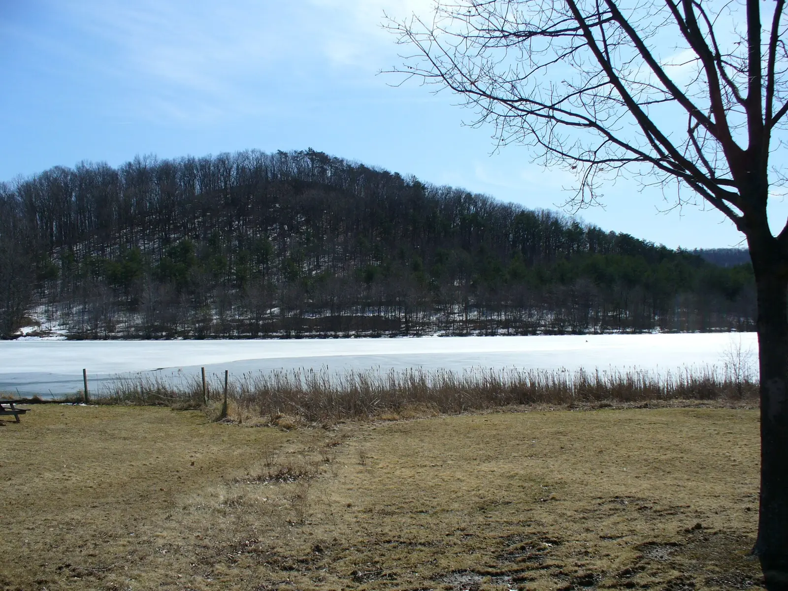

Canoe Creek State Park is a 959-acre park in Blair County, about 6 miles east of Altoona.
Things to do include snorkeling and diving, cross-country skiing, horseback riding, golf, and winter sports. Its trail network totals roughly 12 miles, according to the park. Water access includes a swimming beach, a boat ramp, and boat or kayak rentals. There are also cabins for rent.
Hours
Park, gate, office and facility hours are listed separately because they often differ. Alerts above override normal hours.
| Facility | Days | Hours | Season |
|---|---|---|---|
| Park | Daily | sunrise – sunset | — |
Official wording
The park is open every day of the year, sunrise to sunset. Day use areas close at dusk. The park office is open specific hours. The beach, overnight areas, the education center, and other areas are open specific seasons and hours. Contact the park office for facility seasons and hours.
Source: official park page, checked Oct 29, 2026. Times are local to the park (America/New York).
Reservations
- Day use
- No day-use reservation requirement mentioned
- Booking system
- ReserveAmerica (Aspira), Pennsylvania State Parks contract
- Phone
- 888-PA-PARKS (888-727-2757)
We link to the official booking system rather than showing live availability, which changes minute to minute.
Cabins and lodging
- Modern Cabins: 8 units
Modern Cabins
Canoe Creek State Park Cabin Map (PDF)
♿ Eight modern cabins overlook the lake and sleep six people.
Cabins offer:
- Electric heat
- Two bedrooms
- Living room/dining room
- Bathroom
- Kitchen
- Modern conveniences throughout
A fire ring and picnic table are by each cabin.
The cabins are within walking distance of the swimming area and are available for year-round rental. The rental period in the summer is one week. During the remainder of the year, they may be rented for a minimum of two days.
Things to do
FishingWinter sportsCross-country skiingSnorkeling and scubaHuntingSwimmingBikingHorseback ridingBoatingPicnickingHikingGolfDisc golfCanoeing and kayaking
Trails
| Trail | Length | Difficulty | Notes |
|---|---|---|---|
| Beaver Pond Trail | 0.9 mi | Easiest | Recreations permitted: hiking Trailhead amenities: modern restrooms, benches This easy trail takes visitors around the ponds located on the east side of the lake, through thickets and fields, and along gentle slopes. Great trail for birding and lake views.Hiking |
| Deer Trail | 0.5 mi | Most difficult | Recreations permitted: hiking, equestrian Trailhead amenities: none Challenging hikers with a steep climb from Canoe Creek almost to the ridge of Moore’s Hill, this steep trail connects Moore’s Hill Trail to Mattern Trail. The trail travels through dense hardwoods with opportunities to see birds and other wildlife.HikingEquestrian |
| Fisherman's Path | 1.44 mi | More difficult | Recreations permitted: hiking Trailhead amenities: none Visitors enjoy lake views as this trail meanders along the east shore day use area, through woods, and along Brumbaugh Dam. Anglers enjoy the many lakeside fishing opportunities.Hiking |
| Hartman Trail | 1.5 mi | More difficult | Recreations permitted: hiking Trailhead amenities: none Hartman Trail challenges hikers to climb the slope of Moore's Hill to the ridge where the trail becomes a narrow rocky path through scenic woodlands, overlooking Scotch Valley, and then back down over the old Blair Limestone Company quarry and limekilns before following Mattern Trail along Mary Ann's Creek.Hiking |
| ♿ Lakeside Trail | 0.9 mi | Easiest | Recreations permitted: hiking Trailhead amenities: none A visitor favorite, Lakeside Trail provides a scenic, winding, ADA accessible boardwalk along the lakefront, with benches and an observation blind for wildlife viewing. The trail continues along Marsh Road into the hardwood forest along the lake shore. This trail connects Marsh Road to Mattern Trail or Moore’s Hill Trail.Hiking |
| Limestone Trail | 1.1 mi | Easiest | Recreations permitted: hiking Trailhead amenities: modern restrooms, picnic tables This scenic trail is a visitor favorite. It follows the old railroad grade to the Blair Limestone Company kilns and along the beautiful corridor of Mary Ann's Creek. Several bridges provide opportunities for creek crossings. This is a great trail for woodland birds and wildflowers.Hiking |
| Mattern Trail | 2.15 mi | More difficult | Recreations permitted: hiking, backpacking, equestrian Trailhead amenities: none The loop trail traverses both field and forest, taking visitors almost to the ridge of Moore's Hill for scenic views and through diverse habitat on this multi-use trail.HikingBackpackingEquestrian |
| Moore's Hill Trail | 3.2 mi | Most difficult | Recreations permitted: hiking Trailhead amenities: none Visitors enjoy a more challenging hike as the trail follows along the circumference of Moore’s Hill and provides steep switchbacks before descending through scenic forest trails to meet Canoe Creek and the fields of lower Moore's Hill.Hiking |
| Red Bud Lane | 0.37 mi | More difficult | Recreations permitted: hiking Trailhead amenities: none This trail leads near some warm season grass fields where hikers may see some ring-neck pheasants or other field birds species. At the top of the knoll, there is a great view of Canoe Lake and Brumbaugh Dam.Hiking |
| Shale Road Connector | 0.35 mi | More difficult | Recreations permitted: hiking, equestrian Trailhead amenities: none This connector trail travels through some dense shrub habitat great for birding.HikingEquestrian |
| Smith Hillside Loop | 1.2 mi | Most difficult | Recreations permitted: hiking Trailhead amenities: none This narrow trail ascends the side of the slope on Smith Hillside, winding along the top of the ravine before descending through the woods and winding along Mary Ann's Creek.Hiking |
| Sugarloaf Trail | 0.97 mi | More difficult | Recreations permitted: hiking Trailhead amenities: benches Winding around Sugarloaf Hill, the trail provides scenic lake views, as well as a gentle to steep hike through the woods.Hiking |
Trail descriptions from the park
12 miles of trails
The beautiful and winding hiking trails of Canoe Creek State Park allow hikers to explore forests, fields, wetlands, shrubby areas, historic sites, and the lakeshore.
Hiking trails range from easy to difficult and provide ample opportunity for wildlife watching. Vistas atop Sugarloaf and Moore’s hills provide scenic views of the park and surrounding area. On a clear day, visitors can even catch a glimpse of Blue Knob State Park, more than 20 miles away.
Information on trails, wildlife, and geocaching can be obtained at the education center or the park office.
Hikers should be prepared for trail conditions and varied weather. Since Canoe Creek State Park is a multi-use park, hikers should wear fluorescent orange when hiking during hunting seasons.
Canoe Creek State Park Map
Swimming
The sand beach is open from late May to September, 8:00 A.M. until sunset, unless otherwise posted. A lap lane is marked with buoys.
Please read and follow posted rules for swimming. Swim at your own risk.
A modern bathhouse has showers and dressing booths.
A snack bar offers a variety of snack food and drink items and has a terrace that overlooks the lake.
Smoke-Free Beach
Smoking is prohibited on the beach and in the swimming area. For visitors who smoke and still want to use the beach, designated areas adjacent to the beach are provided. The restriction includes:
- Cigarettes
- Pipes
- Cigars
- E-cigarettes
- Other handheld, lighted smoking devices
Amenities
Facilities
- Picnic areas
- Picnic shelters
- Amphitheater
Water
- Swimming beach
- Boat ramp
- Marina or boat slips
- Boat, canoe or kayak rentals
Lodging
- Cabins
Recreation
- Golf course
- Disc golf
- Horse trails
✓ listed by the park · ✕ the park says it is not available. Anything not shown here isn’t mentioned by the official source — that means unknown, not unavailable.
Accessibility
Canoe Creek State Park offers a range of accessibility accommodations to ensure all visitors can enjoy its natural beauty and recreational opportunities.
Modern Cabin 3
Modern Cabin 3 can accommodate up to 6 people. Visitors are reminded to bring their own linens, dishes, pots, and pans.
Modern Cabin 8
Modern Cabin 8 can accommodate up to 6 people. Domestic pets are allowed. Visitors are reminded to bring their own linens, dishes, pots, and pans.
Accessible Picnic Tables
ADA accessible picnic tables are located behind the concession stand near the beach area. Visitors should park in the beach lot and use a paved path to access.
Pavilion 3
Pavilion 3 can accommodate up to 96 people with 12 picnic tables.
Read more from the park
Fishing Access
An accessible fishing pier is located on the east shore of the day use area, adjacent to Pavilion #3.
Lakeside Trail
0.9 mile | Easiest hiking | Connector trail | Orange blazes
Recreations permitted: hiking
Trailhead amenities: none
A visitor favorite, Lakeside Trail provides a scenic, winding, ADA accessible boardwalk along the lakefront, with benches and an observation blind for wildlife viewing. The trail continues along Marsh Road into the hardwood forest along the lake shore. This trail connects Marsh Road to Mattern Trail or Moore’s Hill Trail.
Hunting
This park offers accessible hunting options. Visitors holding a DCNR Mobility Device Permit can contact the park office for more information about accessible hunting locations within the park.
DCNR permits visitors with a DCNR Mobility Device Permit to use powered mobility devices on designated state park and forest lands, including administrative roads and trails not normally open to standard motorized vehicles.
Visitors interested in a DCNR Mobility Device Permit can fill out an application and submit it at any state park or forest office.
Swimming and Beaches
An ADA accessible sand beach is open from late May to September, 8:00 A.M. until sunset, unless otherwise posted.
There is a cement paved sidewalk to an ADA ramp into the swimming area.
Swim at your own risk. Please read and follow posted rules.
Boat Rental Concession
There is ADA parking at the Canoe Creek Boat Rental Concession. Boat Rental staff are able to assist renters with accomodation needs.
The boat rental is open Wednesday through Sunday and holidays from 11:00 A.M. to 7:00 P.M., conditions permitting, from the weekend preceding Memorial Day through the weekend after the Labor Day Holiday.
Advance reservations can be made by appointment by calling 814-696-3619.
A visitor favorite, Marsh Trail provides a scenic winding boardwalk along the lakefront, with benches and an observation blind for plenty of wildlife viewing. A 0.25-mile section of the trail is ADA accessible.
Visitors can enjoy an accessible scenic view from the deck of the Terry Wentz Education Center.
Theaters and Amphitheaters
An accessible amphitheater is located near the Terry Wentz Education Center. Access from ADA parking at Lot 6 and use the Limestone Trail (red blazes) to the amphitheater.
Historic Place
The Limestone Kilns are accessible. There is ADA parking nearby.
Official accessibility information
Conditions change. Contact the park to confirm specific accessible features before your visit.
Getting there
- Address
- 205 Canoe Creek Road
Hollidaysburg, PA 16648-9752 - Nearest town
- Altoona — about 6 mi east (straight line)
- Coordinates
- 40.4803, -78.2913
- Phone
- (814) 695-6807
- canoecreeksp@pa.gov
Google Maps directionsApple MapsOfficial park map (PDF)
Directions from the park
To reach Canoe Creek State Park, travel on US 22 to the small village of Canoe Creek (seven miles east of Hollidaysburg), turn north on the Turkey Valley Road for one half mile to the gate of Canoe Creek State Park, on the right. GPS DD: Lat. 40.48031 Long. -78.2913
Nearby state parks
Sources and freshness
- Pennsylvania State Parks — park page — last checked Oct 29, 2026; page says updated Sep 3, 2026
- DCNR Find a Park: content-fragment JSON feed used by the pa.gov park finder
- Wikidata
- USGS PAD-US 4.1 (boundary and acreage)
- Photo: Canoe Creek State Park, Blair County, Pennsylvania.jpg — Public domain (released by the author), No machine-readable author provided. CommonsHelper2 Bot assumed (based on copyright claims).
“Last checked” is when our system last read the official source. “Last changed” (Oct 29, 2026) is when the information shown here last differed from the previous check. Hours, fees and rules can change without notice — confirm with the park before you go. Methodology