Cook Forest State Park
- Status
- Open (per official listing)Daily sunrise – sunset
- Entrance fee
- Not posted
- Day-use reservations
- None mentioned
- Dogs
- Dogs allowed
- Camping
- 210 campsitesAlso cabins, lodge or inn rooms
- Official site
- pa.gov(814) 744-8407
Official page last checked Oct 29, 2026. Details last changed Oct 29, 2026. How we keep this current
Current alerts 1
Alert A pedestrian foot bridge at the intersections of Tom's Run trail and Longfellowtrail has been damaged and is no longer in service. Please utilize a park map and wayfinding signage to seek out alternative routes for these popular… (more)
trail has been damaged and is no longer in service. Please utilize a park map and wayfinding signage to seek out alternative routes for these popular trails.
Posted by the park. Official alert
Overview
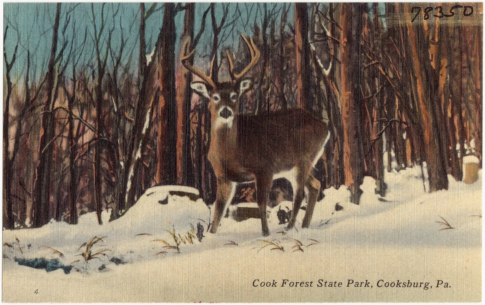

In Clarion County, about 12 miles northeast of Clarion, Cook Forest State Park covers about 10,970 acres.
The park supports cross-country skiing, horseback riding, winter sports, hunting in season, and canoeing and kayaking. The official site lists about 47 miles of trails. On the water side, there is a boat ramp and a fishing pier. For overnight stays there are 210 campsites across 3 camping areas (RV sites with full hookups, tent sites, and group camping). Roofed lodging includes cabins and lodge rooms.
Hours
Park, gate, office and facility hours are listed separately because they often differ. Alerts above override normal hours.
| Facility | Days | Hours | Season |
|---|---|---|---|
| Park | Daily | sunrise – sunset | — |
Official wording
The park is open every day of the year, sunrise to sunset. Day use areas close at dusk. The park office is open specific hours. Overnight areas and other areas are open specific seasons and hours. Contact the park office for facility seasons and hours.
Source: official park page, checked Oct 29, 2026. Times are local to the park (America/New York).
Reservations
- Day use
- No day-use reservation requirement mentioned
- Booking system
- ReserveAmerica (Aspira), Pennsylvania State Parks contract
- Phone
- 888-PA-PARKS (888-727-2757)
We link to the official booking system rather than showing live availability, which changes minute to minute.
Pets
Dogs allowed
Pets are permitted at designated sites for a fee. Up to two dogs are permitted in River Cabins 7, 11, 12, 14, and 15 for a fee.
Service animals are generally permitted where pets are not. Check with the park for specific areas.
Camping
| Campground or site type | Sites | Hookups / features | Price |
|---|---|---|---|
| Camping Cook Forest State Park Campground Map (PDF)
♿ The park has 210 campsites each with a picnic table and fire ring. Pets are permitted at designated sites for a fee. .Visitors can stay overnight in Ridge Campground from mid-April to mid-October.
Full-hookup campsites also have:
• On-site water
• 50 amp electric
• Sewage hookup
Electric-only sites are available with either 30 or 50 amp hook ups.
Modern restrooms with showers are available for the duration of the camping season, weather permitting. In the case of freezing temperatures, shower houses #3 & #4 will be closed.
There is a sanitary dump | 210 | Full-hookup campsites also have: • 50 amp electric • Sewage hookup Electric-only sites are available with either 30 or 50 amp hook ups.Showers | — |
| River Camping A canoe/kayak camping area with three sites is located at Thompson Eddy -- downstream of Gravel Lick Bridge.
This area is for individuals and groups traveling on the Clarion River by canoe or kayak. Use of this site is limited to one night and is for tent use only. Maximum group size is ten. | — | — | |
| Organized Group Tenting Organized groups can rent this rustic area year round. The four sites each accommodate 20 people.
Access in the winter months may be difficult.
Organized group tenting areas in Pennsylvania state parks can be reserved 11 months in advance to two days before arrival. Call 888-PA-PARKS (888-727-2757) to make a group tenting reservation. | — | — |
Camping details from the park
Camping
Cook Forest State Park Campground Map (PDF)
♿ The park has 210 campsites each with a picnic table and fire ring. Pets are permitted at designated sites for a fee. .Visitors can stay overnight in Ridge Campground from mid-April to mid-October.
Full-hookup campsites also have:
- On-site water
- 50 amp electric
- Sewage hookup
Electric-only sites are available with either 30 or 50 amp hook ups.
Modern restrooms with showers are available for the duration of the camping season, weather permitting. In the case of freezing temperatures, shower houses #3 & #4 will be closed.
There is a sanitary dump station and coin-operated laundry facilities.
Access is not guaranteed during severe winter weather.
River Camping
A canoe/kayak camping area with three sites is located at Thompson Eddy -- downstream of Gravel Lick Bridge.
This area is for individuals and groups traveling on the Clarion River by canoe or kayak. Use of this site is limited to one night and is for tent use only. Maximum group size is ten.
Organized Group Tenting
Organized groups can rent this rustic area year round. The four sites each accommodate 20 people.
Access in the winter months may be difficult.
Organized group tenting areas in Pennsylvania state parks can be reserved 11 months in advance to two days before arrival. Call 888-PA-PARKS (888-727-2757) to make a group tenting reservation.
From the official park page, checked Oct 29, 2026. Site counts and prices can change; confirm when booking.
Cabins and lodging
- Rustic Cabins
Rustic Cabins
♿ The River Cabins are on a hillside overlooking the Clarion River. The Indian Cabins are along Toms Run behind the park office.
The cabins are available for rent from mid-April to mid-December. The cabins must be rented for one week, except during the spring and fall rental season.
Indian Cabin 8, River Cabin 6, and River Cabin 7 are ADA accessible.
Up to two dogs are permitted in River Cabins 7, 11, 12, 14, and 15 for a fee.
Cabins sleep four, six, eight, or ten people.
Rustic cabins are minimally furnished. Each cabin has:
- Beds with mattresses
- Heat from a gas heater
- Refrigerator
- Stove
- Table and chairs
Occupants must provide their own:
- Bedding
- Cookware
- Tableware
Extra cots are not available.
Frost-free water faucets are outside. A shower house is nearby.
Firewood is not provided.
Alcoholic beverages are prohibited.
Things to do
BoatingFishingWinter sportsPicnickingCross-country skiingHorseback ridingBikingHikingHuntingCampingCanoeing and kayaking
Trails
| Trail | Length | Difficulty | Notes |
|---|---|---|---|
| Baker Trail/North Country National Scenic Trail | 12 mi | More difficult | Recreations permitted: hiking Trailhead amenities: none The 140-mile Baker Trail (blazed yellow) runs from Freeport through the Allegheny National Forest. The North Country Trail (blazed blue) stretches 4,600 miles from New York to North Dakota. They run through the Forest Cathedral, passing Seneca Point and meandering by the Clarion River past the bracket dam waterfall across from Hemlock Island.Hiking |
| Black Bear Trail | 1.1 mi | Easiest | Recreations permitted: hiking Trailhead amenities: picnic tables A flat, loop trail at the Sawmill Center for the Arts circles the Paved Trail. Look for black bear claw marks on the trees.Hiking |
| Browns Run Trail | 2 mi | More difficult | Recreations permitted: hiking Trailhead amenities: none This trail parallels Browns Run from Toms Run Road to Forest Road. Due to its low usage, it is a wonderful trail for wilderness hiking, hunting, and birding, particularly for the flute-like songster thrushes.Hiking |
| Camp Trail | 2 mi | Most difficult | Recreations permitted: hiking Trailhead amenities: none This steep trail links Ridge Campground to Breezemont Drive near the Log Cabin Education Center. Pay close attention at trail intersections as this trail splits near the campground.Hiking |
| Cook Trail | 2 mi | More difficult | Recreations permitted: hiking Trailhead amenities: modern restrooms, picnic tables, benches Self-guided trail signs indicate trees along the trail. A 1930 dynamite shack built by the Civilian Conservation Corps can be viewed from the trail. Access the trail from River Cabin 12, the River Picnic Area, or a short spur trail on Cemetery Road.Hiking |
| Corduroy Trail | 1.2 mi | More difficult | Recreations permitted: hiking Trailhead amenities: none This trail connects Ridge Campground to Liggett Trail along Tom’s Run. This pleasant hike crosses over Breezemont Drive, passing large American beech and Eastern hemlock. Pay attention at intersections as this trail connects with the Camp Trail.Hiking |
| Deer Meadow Trail | 1.5 mi | More difficult | Recreations permitted: hiking Trailhead amenities: none This trail unites the Browns Run Trail with the multi-use Hefren Run Trail. Sections of this trail go through old growth oak and hemlock forest and prime wildlife areas.Hiking |
| Deer Park Trail | 1.1 mi | More difficult | Recreations permitted: hiking Trailhead amenities: none This trail connects PA 36 and the Seneca Trail, also linking with Mohawk Trail. Hikers will pass through 1976 tornado damage area.Hiking |
| Hemlock Trail | 0.3 mi | More difficult | Recreations permitted: hiking Trailhead amenities: none This short trail joins the Longfellow Trail with the Deer Park Trail. It travels through one of the finest old growth hemlock forests in the eastern United States.Hiking |
| Liggett Trail | 1.5 mi | Easiest | Recreations permitted: hiking Trailhead amenities: none This trail begins at Breezemont Drive and travels a portion of the North Country Trail/Baker Trail along Tom’s Run, terminating at Tom’s Run Road. Listen for the elusive winter wren along the trail.Hiking |
| Mohawk Trail | 1.4 mi | More difficult | Recreations permitted: hiking Trailhead amenities: none This trail runs from the PA 36/Forest Road intersection near the Park Office, and ends at the exit of Fire Tower Road. It winds through magnificent old growth hemlock forest along the hilltop within the Fire Tower Road loop and the steep hillside overlooking the Clarion River. On this trail, you will walk amongst some of the tallest, largest, and oldest hemlocks (300 years) found in the park.Hiking |
| River Trail | 1.2 mi | Most difficult | Recreations permitted: hiking Trailhead amenities: non-flush restrooms, picnic tables, benches This steep trail runs along the Clarion River from the Fire Tower to Fire Tower Road. It is one of the most beautiful hikes in early summer when the mountain laurel and rhododendron bloom.Hiking |
| Seneca Trail | 0.9 mi | Most difficult | Recreations permitted: hiking Trailhead amenities: modern restroom, potable water, benches This trail climbs from PA 36 to the junction with the Deer Park Trail. It passes through old growth forest and offers an excellent view of the Clarion River. The greatest concentration of tall hemlocks in northeastern United States can be found here.Hiking |
| Sensory Trail | 0.2 mi | Easiest | Recreations permitted: hiking Trailhead amenities: picnic tables, benches, braille/raised letter signage, guide cable ♿ This trail is ADA accessible. The first sensory trail in Pennsylvania state parks, the Cook Forest Sensory Trail is a quarter-mile, paved loop that was customized for individuals with disabilities -- including low or limited vision -- and features braille/raised letter signage, a guide cable, sturdy benches, and a picnic area at the trailhead. The self-guided walking trail loops through a mature hardwood forest and features signs that point out new ways of experiencing natuHiking |
| Tobecco Trail | 7.5 mi | More difficult | Recreations permitted: hiking Trailhead amenities: none Following along the Wild and Scenic Clarion River from the Gateway Lodge on PA 36 to SR 899. This trail connects Cook Forest and Clear Creek State Parks. Most of the trail is located on or near the river bank, however, it does ascend to the ridge tops in two spots. There are three trailhead parking lots. • The Gateway Lodge parking lot is available on the western end of the trail • A small parking lot on SR 899 is marked by an information kiosk • The third parking area is on the eastern end of the trail in the Clear Creek State Park campgHiking |
| 1. Joyce Kilmer Trail | 1.1 mi | More difficult | Recreations permitted: hiking Trailhead amenities: none This trail runs from Cemetery Road to Indian Trail. Take special notice of the rock formations nestled among large hemlock and white pine.Hiking |
| 2. Rhododendron Trail | 1.2 mi | More difficult | Recreations permitted: hiking Trailhead amenities: modern restrooms, potable water This trail joins Indian Cabins 6 & 7 to Forest Drive via the Forest Cathedral. Ancient hemlocks, white pines, and large boulders can be found along this trail.Hiking |
| 3. Longfellow Trail | 1.2 mi | More difficult | Recreations permitted: hiking Trailhead amenities: modern restrooms, picnic tables, benches The most well known trail in the park, runs through the finest stand of old growth white pine forest in the northeastern United States. Begin at the Log Cabin Educational Center, travel past the Memorial Fountain and end on Forest Road.Hiking |
| 4. Tom’s Run Trail | 0.8 mi | Easiest | Recreations permitted: hiking Trailhead amenities: modern restrooms, potable water, picnic tables This flat trail connects the swinging bridge to the Log Cabin Education Center through the picturesque Tom’s Run Valley. Keep a lookout for remnants of bracket dams once used to move logs downstream.Hiking |
| 5. Birch Trail | 0.9 mi | Easiest | Recreations permitted: hiking Trailhead amenities: modern restrooms, potable water, picnic tables, benches This trail passes through a lovely stand of birch trees between the Children’s Fishing Pond and Shelter 1. For a loop hike, the swinging bridge links this trail with the Tom’s Run Trail.Hiking |
| 6. Indian Trail | 1 mi | Most difficult | Recreations permitted: hiking Trailhead amenities: modern restrooms, potable water, picnic tables, benches This steep trail starts on the north side of the Children’s Fishing Pond, deep into the Forest Cathedral before joining the Longfellow Trail. As the trail levels off, look for the transition from second growth to old growth forest.Hiking |
| 7. Red Eft Trail | 0.2 mi | Most difficult | Recreations permitted: hiking Trailhead amenities: none Connecting the Longfellow Trail to the Tom’s Run Trail, this steep trail traverses an old growth forested wetland through a series of bridges and stone steps.Hiking |
| 8. Ancient Forest Trail | 0.3 mi | More difficult | Recreations permitted: hiking Trailhead amenities: none This trail bisects the Longfellow Trail through the heart of the Forest Cathedral. Gaze above to the highest concentration of tall, old growth white pines in the northeastern United States.Hiking |
| Bridle Trail | 1.1 mi | Easiest | Recreations permitted: hiking, equestrian Trailhead amenities: none Starting 0.8 mile from the beginning of Forest Drive, this trail weaves through a 1930s CCC red pine plantation and terminates at the Old Logging Road within the Forest Cathedral. Continue onto the old Logging Road to bring you back to Forest Drive.HikingEquestrian |
| Equestrian Trail | 1.5 mi | Easiest | Recreations permitted: hiking, equestrian Trailhead amenities: none Starting 0.2 miles from the beginning of Forest Drive, this fairly flat, multi-use trail a 1930s CCC red pine plantation and then loops back onto Forest Drive. Look for hawks hunting along the trail.HikingEquestrian |
| Hefren Run Trail | 1.1 mi | More difficult | Recreations permitted: hiking, biking, equestrian Trailhead amenities: none This multi-use trail connects Tom’s Run Road with Forest Road. This serene trail crosses Hefren Run Valley along evidence of old bracket dams used to move logs downstream in the 1800s.HikingBikingEquestrian |
| Old Logging Road Trail | 0.6 mi | Easiest | Recreations permitted: hiking, equestrian Trailhead amenities: none This flat trail proceeds between Forest Drive and the Joyce Kilmer Trail. Watch for red and white pine orchards planted by the CCC from 1933-1937.HikingEquestrian |
Trail descriptions from the park
47 miles of trails
There are more than 47 miles of hiking trails and 4.3 miles of multi-use trails within Cook Forest State Park. An additional 24 miles of multi-use trails and eight miles of hiking trails are located within the Clarion River Lands.
The Cook Forest State Park Trail Guide (PDF) and Clarion River Lands Trail Guide (PDF) have trail descriptions for each trail. These guides are available in the park office.
Cook Forest State Park Trail Guide
Clarion River Lands Trail Guide
Trail Route Type
Loop -- Start and end at the same location and follow a single trail to form a loop.
Out-and-back -- Start and end at a trailhead and follow a single trail to an endpoint or specific point of interest, then return along the same route.
Point-to-point -- Trails are generally longer in distance and parks may often contain only a portion of the trail within their boundary. Hiker starts and ends in different locations, often requiring a shuttle.
Connector -- Begin and end in connection with another trail or trails but do not terminate at a trailhead.
Ridge Trail
0.7 mile | Most difficult hiking | Out-and-back trail | Yellow blazes
Recreations permitted: hiking
Trailhead amenities: none
This steep trail connects the Ridge Campground near site 32 to Forest Road by Shelter 1. Large oaks and black cherry trees (3 feet across and 140 feet high) are found near this path.
Forest Cathedral Trails, Cook Forest State Park: Hiking Only
The Forest Cathedral Natural Area is a registered National Natural Landmark. Numbers below correspond to the map on the Cook Forest State Park Hiking Trails brochure.
Cook Forest State Park: Multi-Use Trails
Multi-use trails are open to hiking, mountain biking, and horseback riding as designated. Please be aware and courteous of others.
Amenities
Facilities
- Picnic areas
- Picnic shelters
- Nature center or museum
- Group facilities
Water
- Boat ramp
- Fishing pier
Camping
- Tent camping
- RV camping
- Electric hookups
- Water hookups
- Sewer hookups
- Group camping
Lodging
- Cabins
- Lodge or inn rooms
Recreation
- Horse trails
✓ listed by the park · ✕ the park says it is not available. Anything not shown here isn’t mentioned by the official source — that means unknown, not unavailable.
Accessibility
Cook Forest State Park offers a range of accessibility accommodations to ensure all visitors can enjoy its natural beauty and recreational opportunities.
Front Section - Site 116
Front Section, Site 116 offers modern-rustic electric with 30-amp service and a back-in driveway that is 80 feet long. The maximum vehicle length is 30 feet. Domestic pets are allowed.
Front Section - Site 117
Front Section, Site 117 features modern-rustic electric with 30-amp service and a back-in driveway that is 40 feet long. The maximum vehicle length is 30 feet. Domestic pets are allowed.
Front Section - Site 119
Front Section, Site 119 features modern-rustic electric with 30-amp service and a back-in driveway that is 128 feet long. The maximum vehicle length is 30 feet. Domestic pets are allowed.
Read more from the park
Back Section - Site 209
Back Section, Site 209 offers modern-rustic electric with 30-amp service and a back-in driveway that is 50 feet long. The maximum vehicle length is 25 feet.
Back Section - Site 210
Back Section, Site 210 features modern-rustic electric with 30-amp service and a back-in driveway that is 54 feet long. The maximum vehicle length is 25 feet.
Back Section - Site 211
Back Section, Site 211 offers modern-rustic electric with 50-amp service and a back-in driveway that is 54 feet long. The maximum vehicle length is 30 feet.
Back Section - Site 212
Back Section, Site 212 features modern-rustic electric with 50-amp service and a back-in driveway that is 55 feet long. The maximum vehicle length is 25 feet.
Back Section - Site 213
Back Section, Site 213 offers modern-rustic electric with 30-amp service and a back-in driveway that is 55 feet long. The maximum vehicle length is 25 feet.
Back Section - Site 214
Back Section, Site 214 features full hook-up with 50-amp service and a back-in driveway that is 55 feet long. The maximum vehicle length is 25 feet.
River Cabin 6
River Cabin 6 sleeps 8 people and is in proximity to the waterfront. Visitors must bring bed linens, towels, dishes, pots and pans.
River Cabin 7
River Cabin 7 sleeps 8 people and is in proximity to the waterfront. Visitors must bring bed linens, towels, dishes, pots and pans.
Indian Cabin 8
Indian Cabin 8 sleeps 4 on two bunk beds. Visitors must bring bed linens, towels, dishes, pots and pans.
Picnic Shelter 1 - 1A
Picnic Shelter 1 is divided into two - 1A and 1B. Shelter 1, 1A has 9 tables and a 54-person capacity.
Picnic Shelter 1 - 1B
Picnic Shelter 1 is divided into two - 1A and 1B. Shelter 1, 1B has 9 tables and a 54-person capacity.
Picnic Shelter 2 - 2A
Picnic Shelter 2 is divided into two - 2A and 2B. Shelter 2, 2A has 8 tables and a 48-person capacity.
Picnic Shelter 2 - 2B
Picnic Shelter 2 is divided into two - 2A and 2B. Shelter 2, 2B has 8 tables and a 48-person capacity.
River Road Picnic Shelter
The River Road Picnic Shelter has 11 tables and a seating capacity of 60-people.
Fishing Access
A dedicated fishing pond stocked with trout is located by the park office and is available for use by children ages 15 and younger and people with disabilities. An ADA accessible pier provides access.
Sensory Trail
0.2 mile | Easiest hiking | Loop trail | Yellow blazes
Recreations permitted: hiking
Trailhead amenities: picnic tables, benches, braille/raised letter signage, guide cable
The first sensory trail in Pennsylvania state parks, the Cook Forest Sensory Trail is a quarter-mile, paved loop that was customized for individuals with disabilities -- including low or limited vision -- and features braille/raised letter signage, a guide cable, sturdy benches, and a picnic area at the trailhead.
Hunting
A designated ADA hunting area is available adjacent to the Route 36 Connector of the Tobecco Trail.
Visitors holding a DCNR Mobility Device Permit can contact the park office for more information about accessible hunting locations within the park.
DCNR permits visitors with a DCNR Mobility Device Permit to use powered mobility devices on designated state park and forest lands, including administrative roads and trails not normally open to standard motorized vehicles.
Visitors interested in a DCNR Mobility Device Permit can fill out an application and submit it at any state park or forest office.
Colorblind Viewfinder
A viewfinder fit with an EnChroma colorblind lens is located at Seneca Point Vista at Cook Forest State Park.
Note: The viewfinder is not ADA accessible.
The lenses are designed to enhance the color vision of those with a red-green color vision deficiency. Any park visitor can utilize the viewfinder to experience the colorful beauty of nature and to view foliage more vividly.
Theaters and Amphitheaters
The Verna Leith Sawmill Theatre offers ADA access and seating.
Environmental Learning Center
The Log Cabin Environmental Learning Center is ADA accessible.
Official accessibility information
Conditions change. Contact the park to confirm specific accessible features before your visit.
Getting there
- Address
- 100 Route 36
Cooksburg, PA 16217 - Nearest town
- Clarion — about 12 mi northeast (straight line)
- Coordinates
- 41.3329, -79.2091
- Phone
- (814) 744-8407
- cookforestsp@pa.gov
Google Maps directionsApple MapsOfficial park map (PDF)
Directions from the park
From the east, take Exit 78 off of I-80, then PA 36 north directly to the park in Cooksburg. From the west, take Exit 60 off of I-80, then take PA 66 north to Leeper. From Leeper, follow PA 36 south, seven miles to the park. GPS DD: Lat. 41.33292 Long. -79.20915
Nearby state parks
Sources and freshness
- Pennsylvania State Parks — park page — last checked Oct 29, 2026; page says updated Sep 3, 2026
- DCNR Find a Park: content-fragment JSON feed used by the pa.gov park finder
- Wikidata
- USGS PAD-US 4.1 (boundary and acreage)
- Photo: Cook Forest State Park, Cooksburg, Pa (78350).jpg — Public domain (copyright expired), Pub. by Thomas, Photographer & Jobber, Warren, PA. "Tichnor Quality Views," Reg. U. S. Pat. Off. Made Only by Tichnor Br
“Last checked” is when our system last read the official source. “Last changed” (Oct 29, 2026) is when the information shown here last differed from the previous check. Hours, fees and rules can change without notice — confirm with the park before you go. Methodology