Frontenac State Park
Notice: Current ranger station hours — details
- Status
- Open (per official listing)Daily 8 a.m. – 10 p.m.
- Entrance fee
- Statewide rule — see below
- Day-use reservations
- None mentioned
- Dogs
- Statewide rule — see below
- Camping
- 77 campsites
- Official site
- dnr.state.mn.us(651) 299-3000
Official page last checked Oct 29, 2026. How we keep this current
Current alerts 2
Partial closure Park closed 11/21-22 for special deer huntOn Saturday, November 21 and Sunday, November 22, the park will be closed to everyone except the hunters selected to participate in the lottery deer… (more)
On Saturday, November 21 and Sunday, November 22, the park will be closed to everyone except the hunters selected to participate in the lottery deer hunt. All roads and trails into the park will be closed for the duration of the hunt, though the ranger station will remain open. Call the park at 651-299-3000 if you have any questions or concerns.
Posted by the park 2026-10-29. Official alert
Closure Current ranger station hoursThursday 12:00 pm - 3:30 pm Friday 9:00 am - 7:30 pm Saturday 9:00 am - 7:30 pm Sunday 10:00 am - 4:30 pm Monday 12:00 pm - 3:30 pm Tuesday &… (more)
Thursday 12:00 pm - 3:30 pm Friday 9:00 am - 7:30 pm Saturday 9:00 am - 7:30 pm Sunday 10:00 am - 4:30 pm Monday 12:00 pm - 3:30 pm Tuesday & Wednesday CLOSED These hours are subject to change due to staff availability and holidays. Please call ahead to ensure we will be open before you make the trip. You can call the ranger station anytime at 651-299-3000 and park staff will get back to you as soon as we can. State Park vehicle permits can be purchased online before you arrive or using the QR codes found at the ranger station, if the office is not open. Firewood can be purchased at the ranger station when it is open, or online using Yodel.
Posted by the park 2026-10-29. Official alert
Overview
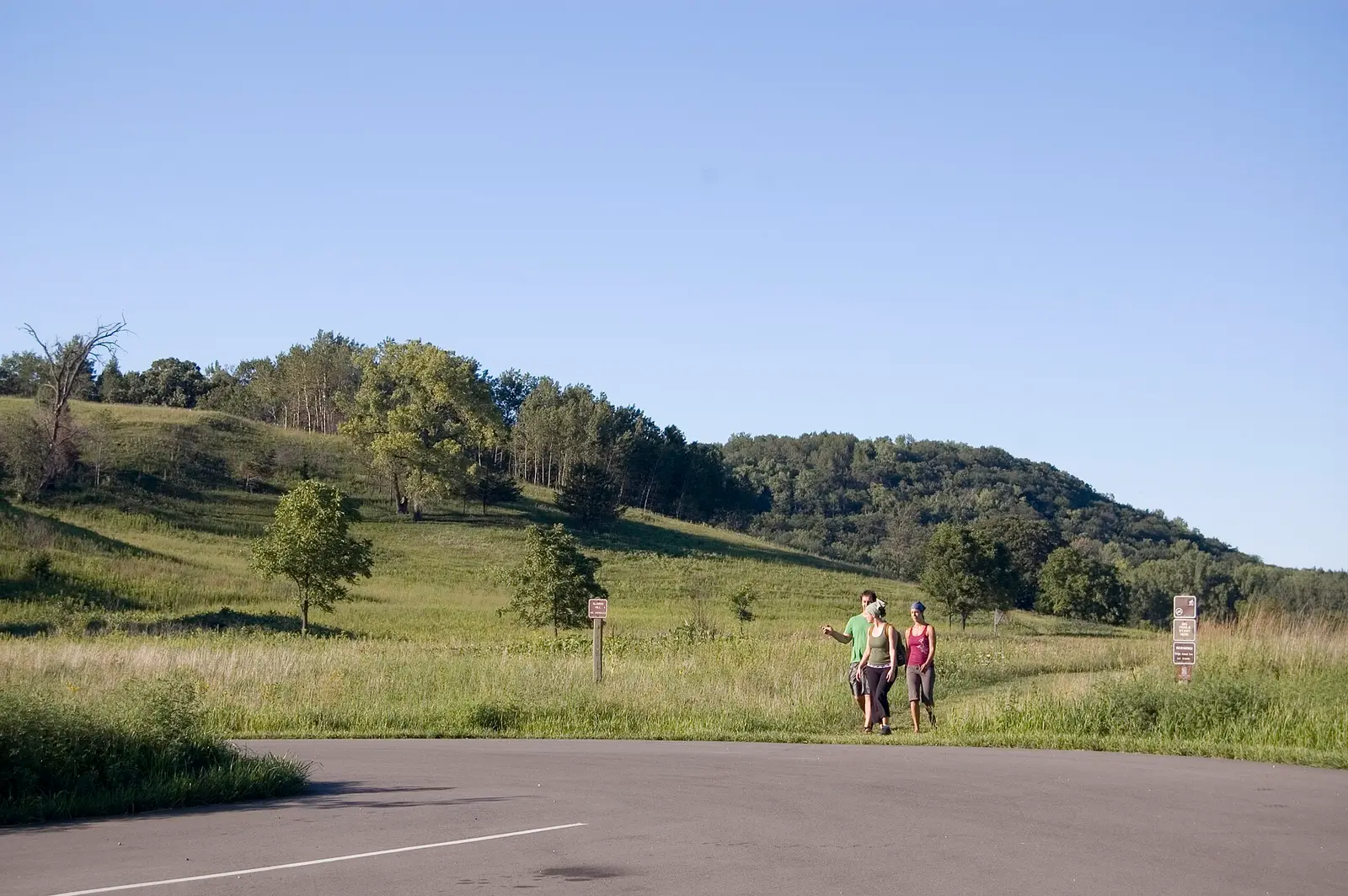

Frontenac State Park is a 2,367-acre park in Goodhue County, about 6 miles northwest of Lake City.
Visitors come for winter sports, historic sites, wildlife watching, ranger programs, and fishing. The official site lists about 18 miles of trails. For overnight stays there are 77 campsites across 5 camping areas (RV sites with electric hookups, tent sites, group camping, and showers).
Hours
Park, gate, office and facility hours are listed separately because they often differ. Alerts above override normal hours.
| Facility | Days | Hours | Season |
|---|---|---|---|
| Park | Daily | 8 a.m. – 10 p.m. | — |
| Office | Thu | noon – 3:30 p.m. | — |
| Fri | 9 a.m. – 7:30 p.m. | — | |
| Sat | 9 a.m. – 7:30 p.m. | — | |
| Sun | 10 a.m. – 4:30 p.m. | — | |
| Mon | noon – 3:30 p.m. | — |
Official wording
Daily from 8 a.m. until 10 p.m.
Thursday 12:00 pm - 3:30 pm Friday 9:00 am - 7:30 pm Saturday 9:00 am - 7:30 pm Sunday 10:00 am - 4:30 pm Monday 12:00 pm - 3:30 pm Tuesday & Wednesday CLOSED These hours are subject to change due to staff availability and holidays.
The park and campground are open year-round. All campsites are RESERVABLE online, by phone or in person when the office is open. You must camp in a designated campsite. We have a drive-in campground, drive-in group campground, cart-in campground, and backpack sites. We allow up to two shelters (2 tents or 1 tent 1 trailer) at each site. Please park vehicles in drive-in campground bumper to bumper on the gravel spur only (up to 2 vehicles max).
Programs: Check out our event page for scheduled programs! Bathrooms: The bathroom facilities are OPEN until late fall. There are vault toilets available throughout the park year-round. RVs: Please check the lengths of the campsite spurs. A few of our campsites are relatively small. Water: Water is ON in the campground and picnic area until late fall. Drinking water is available year-round behind the wood shed near the ranger station. Buildings: The ranger station is open to the public during business hours. The picnic shelter is open to the public on a first come, first served basis unless it is reserved; picnic shelter reservations can be made by calling the park office. The campground showers and restrooms are for use by registered campers only. Dump station: The dump station is currently OPEN until late fall. Electric sites: There are 19 Electric sites in the drive-in campground. All electric campsites offer both 20 amp and 30 amp service. Showers: The showers are currently OPEN until late fall. Trails: In summer, the park has 18 miles of hiking trails. One mile is paved, open to bikes, and wheelchair accessible; the other 17 miles are natural surface trails. In winter, the park maintains 9 miles of groomed cross-country ski trails, 9 miles of hiking trails, and a sledding hill. Drinking water: Water is ON in the campground and the picnic area until late fall. Drinking water is available year-round behind the wood shed near the ranger station. Campgrounds: The park and campground are open year-round. All campsites are RESERVABLE online, by phone or in person when the office is open. You must camp in a designated campsite. We have a drive-in campground, drive-in group campground, cart-in campground, and backpack sites. We allow up to two shelters (2 tents or 1 tent 1 trailer) at each site. Please park vehicles in drive-in campground bumper to bumper on the gravel spur only (up to 2 vehicles max). Rentals: Canoes, Kayaks, Snowshoes, Birding kits, Kid's Discovery Kits, GPS units, fishing equipment, and various board games are available to check out at the office.
Source: official park page, checked Oct 29, 2026. Times are local to the park (America/Chicago).
Pets
Pets allowed on a leash six feet or shorter (or in a portable enclosure) and personally attended; only service animals in buildings, lodging, camper cabins, yurts, tipis, tours and beach areas.
Statewide rule from Minnesota's park system (source). This park’s page doesn’t state its own pet rules, so check for local restrictions.
Fees and passes
Per vehicle: a state park vehicle permit (one-day $7 or year-round $35) is required for every vehicle; same price for residents and nonresidents. Four free park days per year. Iron Range OHV SRA states 'There is no entrance fee'.
Statewide fee rule from Minnesota's park system; this park’s page doesn’t list its own fees.
Minnesota park passes
- Year-round vehicle permit — $35. Unlimited visits to every Minnesota state park and recreation area for 12 months from the month of purchase Details
- One-day vehicle permit — $7. One day, one vehicle Details
- Additional year-round vehicle permit — $26. Additional vehicles owned by a year-round permit holder Details
- Year-round motorcycle permit — $30. Motorcycle, 12 months Details
- One-day group permit — $5. Group vehicles, one day Details
From the Minnesota state guide. Confirm which passes this park accepts.
Reservations
- Day use
- No day-use reservation requirement mentioned
- Booking system
- Reserve MN (US eDirect)
- Phone
- 866-857-2757
We link to the official booking system rather than showing live availability, which changes minute to minute.
Camping
| Campground or site type | Sites | Hookups / features | Price |
|---|---|---|---|
| Drive-in Sites 58 sites in four loops — Sites are fairly close together, but most are wooded and there is good screening between sites. Campground is located on the edge of the bluff, 430 feet above the water. Trails lead from the campground to the riverbank. | 58 | ShowersRVs up to 53 feet | — |
| Electric Sites 19 sites in the first two campground loops — These loops also contain non-electric sites. | 19 | ElectricShowersRVs up to 53 feet | — |
| Backpack Sites Two sites — Two backpack sites located one and one-quarter miles from the designated parking lot at the ranger station. Located on Pleasant Valley Lakelet/Prairie Loop Trail. Each site has primitive toilets. Staff try to make sure there is toilet paper and firewood available at the sites but visitors should call to confirm before staying. Neither site is good for hammock camping. Drinking water is available at the ranger station. These sites are secluded from other campsites, but campers will hear noises from the highway and trains. | — | Showers | — |
| Cart-in Sites Six sites, one-third mile from parking — A cart is available for campers to haul their gear. | — | Showers | — |
| Group Camp Accommodates up to 35 people — Rustic toilets, open picnic shelters, and water are available. | — | Showers | — |
Camping details from the park
Drive-in Sites — 58 sites in four loops: Sites are fairly close together, but most are wooded and there is good screening between sites. Campground is located on the edge of the bluff, 430 feet above the water. Trails lead from the campground to the riverbank.
Electric Sites — 19 sites in the first two campground loops: These loops also contain non-electric sites.
RV Length Limit — 53 feet: Length is measured from front of tow vehicle to rear of vehicle being towed.
Accessible Sites — 5: The campground has five accessible drive-in sites. Three have electric hookup.
Backpack Sites — Two sites: Two backpack sites located one and one-quarter miles from the designated parking lot at the ranger station. Located on Pleasant Valley Lakelet/Prairie Loop Trail. Each site has primitive toilets. Staff try to make sure there is toilet paper and firewood available at the sites but visitors should call to confirm before staying. Neither site is good for hammock camping. Drinking water is available at the ranger station. These sites are secluded from other campsites, but campers will hear noises from the highway and trains.
Cart-in Sites — Six sites, one-third mile from parking: A cart is available for campers to haul their gear.
Group Camp — Accommodates up to 35 people: Rustic toilets, open picnic shelters, and water are available.
From the official park page, checked Oct 29, 2026. Site counts and prices can change; confirm when booking.
Things to do
CampingWildlife viewing and birdingHikingWinter sportsRanger and interpretive programsHistoric sites and toursPicnickingFishing
Trails
| Trail | Length | Difficulty | Notes |
|---|---|---|---|
| Groomed Cross-Country Skiing Classic (winter) | 9 mi | — | 9 miles — Cross-country ski trails vary from flat, wooded, open prairie to steep ravines and range from easy to most difficult. The easiest ski trails are the Sand Point Loop and the Prairie Loop. Warming houses are located at the two trailheads.Groomed Cross-Country Skiing Classic |
| Snowshoe (winter) | — | — | Anywhere except on groomed trails — 4.7 miles of ungroomed snowshoe trails are available, or blaze your own trail anywhere in the park, except on trails groomed for another purpose. Snowshoe rentals are available from the ranger station.Snowshoe |
| Accessible (summer) | 1 mi | — | 1 mileAccessibleAccessible |
| Self-Guided (summer) | 0.75 mi | — | 0.75 miles — Interpretive signs are located along the self-guided trail.Self-Guided |
| Hiking (summer) | 19 mi | — | 19 miles — Trails range from easy to challenging, and pass through forested areas, along the bluff edge, through wooded ravines, across old fields and restored prairies, and through wetland riverine forests. Good places to see spring wildflowers and prairie flowers.Hiking |
| Paved Bike (summer) | 1 mi | — | 1 milePaved Bike |
Trail descriptions from the park
Winter — Groomed Cross-Country Skiing Classic — 9 miles: Cross-country ski trails vary from flat, wooded, open prairie to steep ravines and range from easy to most difficult. The easiest ski trails are the Sand Point Loop and the Prairie Loop.
Warming houses are located at the two trailheads.
Winter — Snowshoe — Anywhere except on groomed trails: 4.7 miles of ungroomed snowshoe trails are available, or blaze your own trail anywhere in the park, except on trails groomed for another purpose.
Snowshoe rentals are available from the ranger station.
Summer — Accessible — 1 mile
Summer — Self-Guided — 0.75 miles: Interpretive signs are located along the self-guided trail.
Summer — Hiking — 19 miles: Trails range from easy to challenging, and pass through forested areas, along the bluff edge, through wooded ravines, across old fields and restored prairies, and through wetland riverine forests. Good places to see spring wildflowers and prairie flowers.
Summer — Paved Bike — 1 mile
Trail conditions: In summer, the park has 18 miles of hiking trails. One mile is paved, open to bikes, and wheelchair accessible; the other 17 miles are natural surface trails. In winter, the park maintains 9 miles of groomed cross-country ski trails, 9 miles of hiking trails, and a sledding hill.
Fishing
Fishing — Lake Pepin and the Mississippi River
A state fishing license is usually required.
Amenities
Facilities
- Restrooms
- Flush toilets
- Vault or pit toilets
- Showers
- Picnic areas
- Picnic shelters
- Nature center or museum
- Park or camp store
- Group facilities
Camping
- RV dump station
- Tent camping
- RV camping
- Electric hookups
- Group camping
✓ listed by the park · ✕ the park says it is not available. Anything not shown here isn’t mentioned by the official source — that means unknown, not unavailable.
Accessibility
Accessible Sites — 5: The campground has five accessible drive-in sites. Three have electric hookup.
Showers — Accessible: Showers are in the main campground, and are available only to campers staying in the main campground, not to those staying in cart-in or group campsites. Accessible building.
Flush Toilets: The campground restroom is fully accessible, and may be used by any registered camper - not just those in the main campground. The restroom in the picnic shelter is generally accessible but not fully ADA compliant.
Vault Toilets — Throughout the park, some available year-round: Accessible vault toilets are in the main campground and in the picnic area.
Picnic Area — Accessible: Located along the edge of the bluffs with several beautiful, panoramic vistas of Lake Pepin and the Mississippi River Valley. Facilities include numerous picnic tables and in-ground fire rings.
Read more from the park
Picnic Shelter — Accessible - open shelter and enclosed shelter: The enclosed shelter is available year-round and has electricity and a woodstove. Modern restrooms are adjacent to the shelter, available seasonally. The enclosed shelter serves as a warming house in winter. Call the park to reserve. A small, open gazebo in the picnic area is available on a first-come, first-served basis.
Accessible — 1 mile
All-Terrain Track Chair: One all-terrain, electric powered chair that may be used on designated trails within the park.
- Reserve the chair
- Map of designated trails
- Learn more about track chairs
Official accessibility information
Conditions change. Contact the park to confirm specific accessible features before your visit.
Getting there
- Address
- 29223 County 28 Boulevard
Frontenac, MN 55026 - Nearest town
- Lake City — about 6 mi northwest (straight line)
- Coordinates
- 44.5218, -92.3433
- Phone
- (651) 299-3000
- frontenac.statepark@state.mn.us
Google Maps directionsApple MapsOfficial park map (PDF)
Directions from the park
Frontenac State Park is located approximately ten miles SE of Red Wing on Highway 61 or five miles northwest of Lake City, then one mile north on County Road 2.
Nearby state parks
Sources and freshness
- Minnesota State Parks and Trails — park page — last checked Oct 29, 2026; page says updated Oct 29, 2026
- MN DNR A-Z list of state parks and recreation areas (park IDs in server-rendered <noscript> links) + state waysides page; details from the compass feature_detail JSON API used by park.html
- Wikidata
- USGS PAD-US 4.1 (boundary and acreage)
- Photo: Great River Road - Hikers at Frontenac State Park - NARA - 7718840.jpg — Public domain (US federal government work), A. E. Crane, U.S. Department of Transportation
“Last checked” is when our system last read the official source. No change has been detected since this page was first published. Hours, fees and rules can change without notice — confirm with the park before you go. Methodology