Prophetstown State Park
2 notices: AQUATIC CENTER SEASONAL ALERT · NORTH 9TH ST. CLOSURE — details
- Status
- Open (per official listing)
- Entrance fee
- See fee details
- Day-use reservations
- None mentioned
- Dogs
- Not stated — check with park
- Camping
- Yes
- Official site
- in.gov765-567-4919
Official page last checked Oct 29, 2026. Details last changed Oct 29, 2026. How we keep this current
Current alerts 4
Closure AQUATIC CENTER SEASONAL ALERTThe Prophetstown aquatic center operates annually from the Saturday of Memorial Day weekend through Labor Day Monday. For guests booking August… (more)
The Prophetstown aquatic center operates annually from the Saturday of Memorial Day weekend through Labor Day Monday. For guests booking August stays, please note that the aquatic center is open on weekends only (Saturdays and Sundays). During Labor Day weekend, the center is open Saturday, Sunday, and Monday, then closes for the season. Hours of operation may vary and can change due to weather, maintenance needs, or lifeguard availability. For the most up-to-date information, please check with the park prior to your visit.
Posted by the park. Official alert
Alert WRONG DIRECTIONSMany mapping services (including Google Maps, MapQuest, and Apple Maps) provide incorrect driving directions to the park. Use Exit 178/S.R. 43 north… (more)
Many mapping services (including Google Maps, MapQuest, and Apple Maps) provide incorrect driving directions to the park. Use Exit 178/S.R. 43 north of Lafayette to access the park. Do not use S.R. 225. There is no park entrance, and the road has a one-lane bridge with a weight restriction.
Posted by the park. Official alert
Partial closure STATE ROAD 225 BRIDGE CLOSUREThere is NO access from old S.R. 25 onto S.R. 225. The S.R. 225 bridge is closed. The park’s visitors center can only be accessed off S.R. 225… (more)
There is NO access from old S.R. 25 onto S.R. 225. The S.R. 225 bridge is closed. The park’s visitors center can only be accessed off S.R. 225 (through Battle Ground). Also, there is NO access to the park itself off of S.R. 225.
Posted by the park. Official alert
Closure NORTH 9TH ST. CLOSUREN. 9th St. is closed between Davis Ferry Park Access Road to Swisher Road. Seek alternate route from N. River Road to Burnetts Road to N. 9th St.
Posted by the park. Official alert
Overview
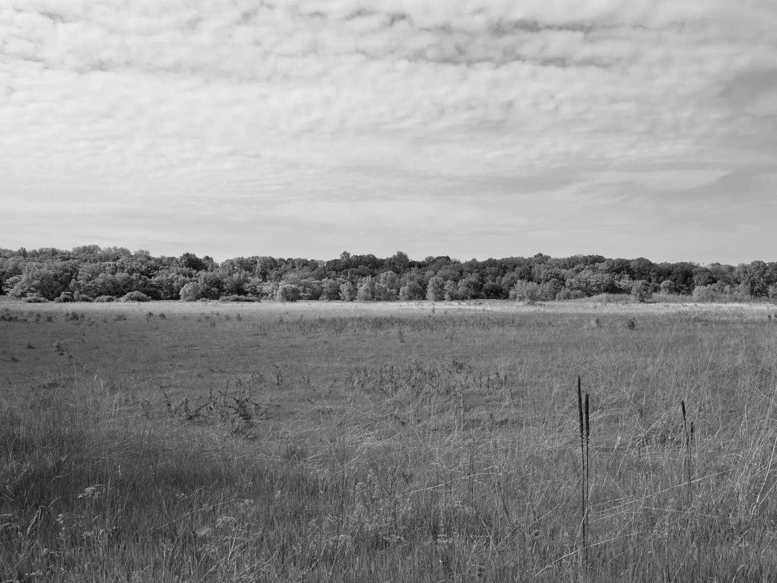
Prophetstown State Park is a 2,204-acre park in Tippecanoe County, in Battle Ground.
Popular activities here are biking and hiking. Facilities for water recreation include a swimming pool. For overnight stays there are campsites (tent sites).
Hours
Park, gate, office and facility hours are listed separately because they often differ. Alerts above override normal hours.
| Facility | Days | Hours | Season |
|---|---|---|---|
| Other — Property | Daily | 7 a.m. – 11 p.m. | — |
| Visitor center | Not stated | 8:30 a.m. – 4 p.m. | — |
Official wording
Property: Daily, 7 a.m. - 11 p.m.
Visitor Center: M-F, 8:30 a.m. - 4 p.m.
Aquatic Center: Seasonal, call office for details.
Source: official park page, checked Oct 29, 2026. Times are local to the park (America/Indiana/Indianapolis).
Fees and passes
| Item | Amount |
|---|---|
| Prophetstown State Park Gate Fee | $8 |
| $8 - noncommercial vehicles with Indiana license plates, every day including holidays. (resident) | $8 · bus |
| $16 - noncommercial vehicles with out-of-state license plates, every day including holidays. (nonresident) | $16 · bus |
Official wording
Prophetstown State Park Gate Fee $8 Prophetstown State Park Gate Fee $8 - noncommercial vehicles with Indiana license plates, every day including holidays. Includes combined entrance into the park and Historic Prophetstown. $16 - noncommercial vehicles with out-of-state license plates, every day including holidays. Includes combined entrance into the park and Historic Prophetstown.
Indiana park passes
- Annual Entrance Pass — $50. Noncommercial vehicle, driver and passengers at DNR properties that charge a gate fee Details
- Non-resident Annual Entrance Pass — $120. Non-Indiana resident noncommercial vehicles Details
- Golden Hoosier Passport — $25. Indiana residents 65+ or eligible for SS disability; vehicle, driver and passengers Details
- Disabled Hoosier Veteran Pass — $25. Persons eligible for a Disabled Hoosier Veteran plate Details
- SSDI Pass — $25. Indiana residents receiving or eligible for SSDI Details
From the Indiana state guide. Confirm which passes this park accepts.
Reservations
- Day use
- No day-use reservation requirement mentioned
- Booking system
- ReserveAmerica (Indiana State Parks) for camping, cabins, shelters, group camps; separate inn reservations
- Phone
- 1-866-622-6746 (camping, cabins, shelters, group camps); 1-877-563-4371 (inns and Brown County cabins)
We link to the official booking system rather than showing live availability, which changes minute to minute.
Camping
- Full hook-up: 55 sites
- Electric: 55 sites
- Dumping station
- Full hookup & electric map
- Reservations
From the official park page, checked Oct 29, 2026. Site counts and prices can change; confirm when booking.
Things to do
HikingBikingCamping
Trails
| Trail | Length | Difficulty | Notes |
|---|---|---|---|
| Trail 1 | 2.25 mi | Easy | — |
| Trail 2 | 1.9 mi | Moderate | — |
| Trail 3 | 3.5 mi | Moderate | — |
| Trail 4 | 2.1 mi | Easy | — |
| Bike / Hiking Trail | 3.5 mi | Easy | — |
Trail descriptions from the park
Parts of Trails 3 and 4 occasionally flood. Use caution and do not cross flooded areas. Do not walk "off-trail" around flooded areas because there are many wetlands. If you encounter flooding, turn around. For up-to-date information about trail status, contact the park office. For trail locations, view the property map.
Trail 1 EASY (2.25 miles) - Starts at the Meadow View family picnic parking lot and winds through a former Christmas tree plantation of Douglas Fir and then snakes its way through tallgrass prairie, adjacent to the Prairie View group picnic area, with big bluestem, Indian grass, little bluestem, side oats grama, and black-eyed Susan. The trail continues into a fen and meanders through this marshy area, where you may get your feet wet, before entering a field being invaded by osage orange, wild cherry, mulberry, and multiflora rose. The trail ends at the Meadow View family picnic area parking lot.
Trail 2 MODERATE (1.9 miles) - Begins on Trail 1, north of the Blazingstar picnic shelter in the Prairie View group picnic area. The trail meanders through the tallgrass prairie before entering a shaded path along scenic Harrison Creek. Spring and summer wildflowers treat hikers to a stunning display of color as the trail winds through a mixed deciduous forest, past a pond formed by Harrison Creek, and into the fen. The trail continues through a mature sycamore grove before merging with Trail 1 at the fen boardwalk north of the campground.
Trail 3 MODERATE (3.5 miles) - Begins off of trail 2 near the east end of the pond and follows a gravel road eventually leading to the confluence of the Wabash and Tippecanoe Rivers where the trail becomes a dirt path. Before reaching the rivers while walking through a large, floodplain prairie, a visitor will observe large wetland restoration projects, a large bottomland forest replacement tree planting, and a riverbank stabilization project along the Wabash River that was a joint effort between the DNR and INDOT. The trail will then lead along the Tippecanoe River, cross a bottomland prairie, and will lead hikers to a contour trail providing stunning overlooks of perched fens formed by many hillside seeps. The trail will end near the starting point of the trail just uphill from the north end of the pond. Note, this trail will be closed during flood events.
Trail 4 EASY (2.1 miles) - Begins at trail 3 near the Tippecanoe River and meanders through a heavily shaded floodplain forest following the river until entering into a floodplain prairie. The trail will lead hikers to the furthest northern boundary of the park where it will return upon the same path back to trail 3. Note, this trail will be closed during flood events.
BIKE / HIKING TRAIL EASY (3.5 miles) - This initial paved section starts near the park gatehouse and connects all the current facilities at the state park. The trailhead parking lot can accommodate 20 vehicles. The Meadow View family picnic parking lot serves as another trailhead, providing a modern restroom, water, and picnic shelter. Details about this and other accessible trails.
Amenities
Water
- Swimming pool
Camping
- Tent camping
✓ listed by the park · ✕ the park says it is not available. Anything not shown here isn’t mentioned by the official source — that means unknown, not unavailable.
Accessibility
Accessible Scenic Viewpoints
Official accessibility information
Conditions change. Contact the park to confirm specific accessible features before your visit.
Getting there
- Nearest town
- Battle Ground
- Coordinates
- 40.4974, -86.8425
- Phone
- 765-567-4919
Google Maps directionsApple Maps
Directions from the park
• WRONG DIRECTIONS: Many mapping services (including Google Maps, MapQuest, and Apple Maps) provide incorrect driving directions to the park. Use Exit 178/S.R. 43 north of Lafayette to access the park. Do not use S.R. 225. There is no park entrance, and the road has a one-lane bridge with a weight restriction. • STATE ROAD 225 BRIDGE CLOSURE: There is NO access from old S.R. 25 onto S.R. 225. The S.R. 225 bridge is closed until further notice. Repairs are scheduled to start in 2024. Access to the park’s visitor center ONLY off of S.R. 225 (through Battle Ground) remains open. There is NO access to enter the park off of S.R. 225. Address: Mailing: 4112 SR 225 E, West Lafayette, IN 47906 Mapping: 5545 Swisher Rd, West Lafayette, IN 47906 Routes from mapping services may be wrong. See directions.
Nearby state parks
Sources and freshness
- Indiana State Parks — park page — last checked Oct 29, 2026
- Indiana State Parks 'Find A Park' property list + DNR ArcGIS site layers (coordinates)
- Wikidata
- USGS PAD-US 4.1 (boundary and acreage)
- Photo: Public Lands Institute - Prophetstown State Park - 001.tif — CC0 1.0 (public domain dedication), Public Lands Institute
“Last checked” is when our system last read the official source. “Last changed” (Oct 29, 2026) is when the information shown here last differed from the previous check. Hours, fees and rules can change without notice — confirm with the park before you go. Methodology