Samuel P. Taylor State Park
Also known as Samuel P Taylor State Park, Samuel Taylor State Park
- Status
- Open (per official listing)Daily 8 a.m. – sunset
- Entrance fee
- $8 per dayAnnual pass available
- Day-use reservations
- None mentioned
- Dogs
- Dogs allowed, with restrictions6-ft leash
- Camping
- Yes
- Official site
- parks.ca.gov(415) 488-9897
Official page last checked Oct 29, 2026. How we keep this current
Overview
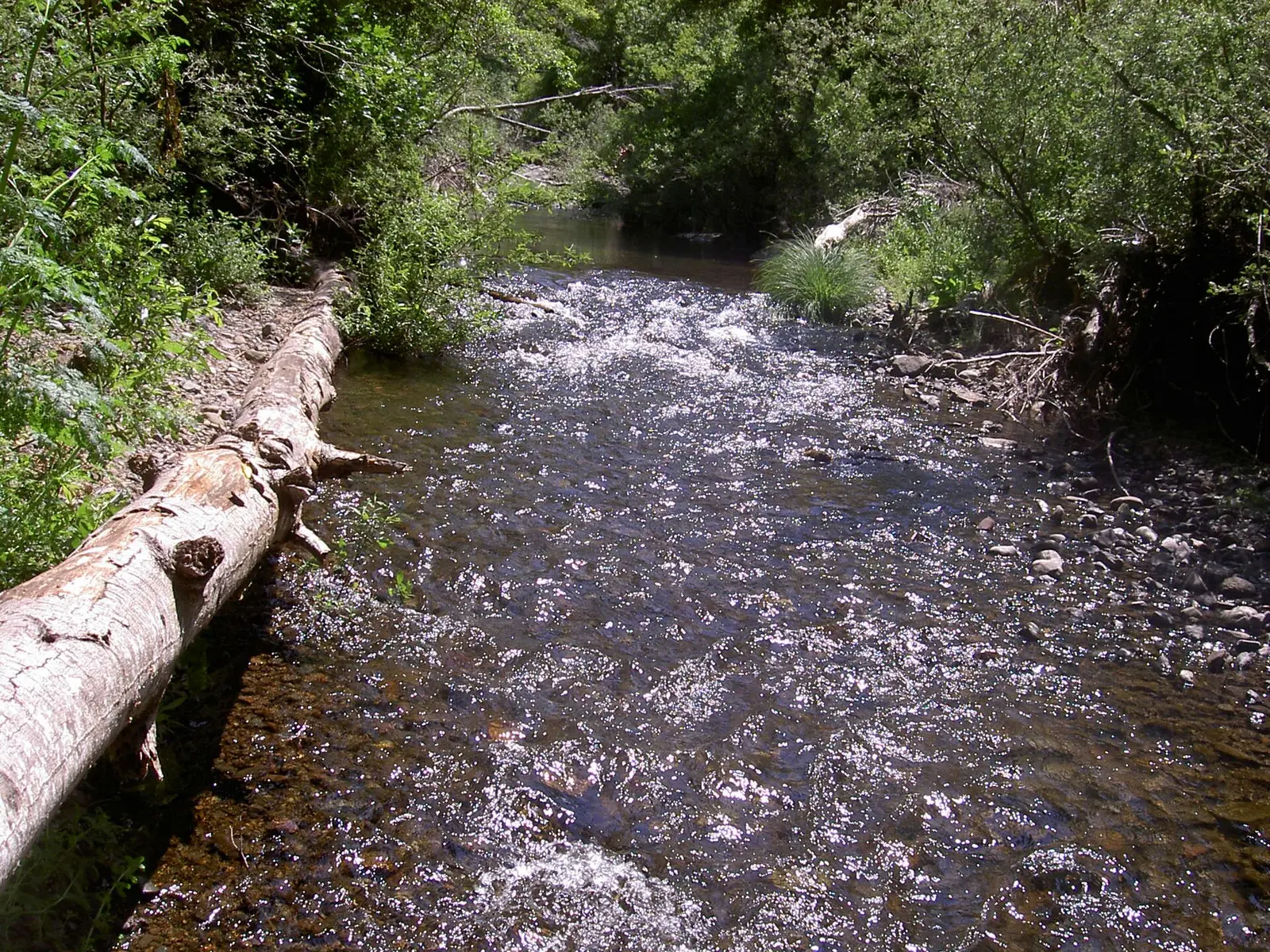

Covering about 2,616 acres, Samuel P. Taylor State Park lies in Marin County, about 8 miles west of Fairfax.
Popular activities here are horseback riding, historic sites, wildlife watching, geocaching, and biking. Overnight options include campsites, with RV sites, tent sites, group camping, equestrian camping, and showers.
Hours
Park, gate, office and facility hours are listed separately because they often differ. Alerts above override normal hours.
| Facility | Days | Hours | Season |
|---|---|---|---|
| Park | Daily | 8 a.m. – sunset | — |
Official wording
8am - SUNSET Creek access is closed from December 1st thru June 15th each year.
Source: official park page, checked Oct 29, 2026. Times are local to the park (America/Los Angeles).
Fees and passes
| Item | Amount |
|---|---|
| Vehicle Day Use | $8 |
| Group Day Use | $175 |
| Group Day Use - Peak | $225 |
Official wording
Special rates may apply for peak season, high demand holiday periods, and during weekends. Prices are subject to change without notice. • Vehicle Day Use: $8.00 • Group Day Use: $175.00 • Group Day Use - Peak: $225.00
California park passes
- California Explorer Annual Pass — $195. Vehicle day-use entry to 134 state parks incl. high-demand Southern California beaches Details
- Golden Poppy Annual Pass — $125. Vehicle day-use entry to 112 state parks Details
- Historian Passport — $50. Admission for up to four people at per-person-fee State Historic Parks Details
- Off-Highway Vehicle (OHV) Annual Pass — $50. Entry to State Vehicular Recreation Areas that collect day-use fees Details
- SNO-Park Pass — $40 season / $15 day. 18 SNO-PARK winter recreation areas Details
From the California state guide. Confirm which passes this park accepts.
Reservations
- Day use
- No day-use reservation requirement mentioned
- Booking system
- ReserveCalifornia
- Phone
- (800) 444-7275
We link to the official booking system rather than showing live availability, which changes minute to minute.
Pets
Dogs allowed, with restrictions · leash up to 6 feet
Not allowed in or on: the hike-and-bike site; the following areas: trails.
Are dogs allowed? Yes: Dogs allowed only in the picnic day-use area, campground, and on the Cross Marin Trail. Dogs not allowed in the hike-and-bike site, in the creek, in the cabins, and on any other trails or undeveloped areas. • Dogs - Pets must be on a six-foot or shorter leash and confined to a tent or vehicle at night. Dogs (except service animals) are allowed only in the following areas: • Dogs are not allowed in the following areas: Trails (except the Cross Marin Trail), Hike & Bike Campsite(s), Madrone Cabins, creeks, any other undeveloped areas, or open spaces. • Dogs - Pets must be on a six-foot or shorter leash and confined to a tent or vehicle at night. Dogs (except service animals) are allowed only in the following areas: • Dogs are not allowed in the following areas: Trails (except the Cross Marin Trail), Hike & Bike Campsite(s), Madrone Cabins, creeks, any other undeveloped areas, or open spaces. • Collecting - Animals, plants, rocks, dirt, and artifacts are protected by law and may not be disturbed or collected.
Service animals are generally permitted where pets are not. Check with the park for specific areas.
Camping
Camping
Information about tents, RV's, and cabins.
Overnight facilities: Equestrian Campsites, Tent Camping, Group Campsites, Hike-and-Bike Campsites, Remote Camping, RV Access
From the official park page, checked Oct 29, 2026. Site counts and prices can change; confirm when booking.
Things to do
Historic sites and toursPicnickingWildlife viewing and birdingGeocachingHikingBikingHorseback ridingCamping
Amenities
Facilities
- Restrooms
- Showers
- Drinking water
- Picnic areas
- Nature center or museum
- Group facilities
Camping
- Tent camping
- RV camping
- Group camping
- Equestrian camping
Recreation
- Horse trails
✓ listed by the park · ✕ the park says it is not available. Anything not shown here isn’t mentioned by the official source — that means unknown, not unavailable.
Accessibility
Overview
Samuel P. Taylor State Park has over 2,700 acres of wooded countryside with a unique mix of coast redwoods groves and open grassland in the rolling hills of Marin County north of San Francisco. The park is 3 miles west of Lagunitas, 15 miles west of San Rafael and about 8 miles east of Point Reyes Station (and seashore) on Sir Francis Drake Boulevard. Phone (415) 488-9897 for more information.
Camping
Orchard Hill: Campsites #30, #37, #39, and #58 are designated accessible and are usable in dry weather. Site #58 has an asphalt pad in the campsite. Assistance may be needed with the water, trash, and cooking facilities. An accessible combination restroom with showers is near site #37. An accessible unisex toilet and shower room is also near site 58. Accessible parking is near both restrooms.
Read more from the park
Creekside: Campsites #15 & #21 are designated accessible and are usable in dry weather. Site #21 has an asphalt pad in the campsite. Assistance may be needed with the water, trash and cooking facilities. An accessible restroom with showers is located near site #15. Accessible parking is near the restroom.
Madrone Cabins: The Madrone area, set at the bottom of the grassy hills of Mount Barnabe, features 5 rustic alternative camping cabins, 2 of which are accessible (cabin #4 and #5). Visit Access Northern California for detailed cabin accessibility information and photos.
Picnic Area
Azalea Picnic Area: This level shady area just beyond the entrance kiosk is on fairly compacted earth and may be usable in dry weather. Accessible restroom with showers and adjacent accessible parking are available.
Trails
The South Creek Trail is an ‘out-and-back’ accessible trail that is 0.82 miles each way that offers an intimate walk along Lagunitas Creek past the historic dam and paper mill sites. Seasonally, visitors can view spawning salmon in the creek from vantage points along the trail. The surface is compacted soil and is usable year-round. There are several armored crossings on the trail that water flows over the trail during rain events that might be challenging for some users. The trail is generally flat at less than 5% slopes with intermittent sections between 5% to 8%. Accessible parking is available at the Creekside Campground restroom building adjacent to the Cross Marin Trail.
The Cross Marin Trail is a paved and unpaved multiple-use trail operated by the Marin Water District that passes through the park for 3.5 miles. The trail is generally accessible and includes some interpretive panels at historic sites. Accessible parking is available at the Azalea day use and Redwood Grove group picnic areas.
Trail Name Running Slope Cross Slope Trail Width Trail Surface
South Creek Trail 3% Average 2% Average 5 FT Average Rock, Soil, & Wood
8% Maximum 3% Maximum 5 FT Minimum
Official accessibility information
Conditions change. Contact the park to confirm specific accessible features before your visit.
Rules and permits
Park Rules
Do your part to help protect Samuel P Taylor's natural resources and keep yourself safe. Follow all of the park's posted rules.
- Dogs - Pets must be on a six-foot or shorter leash and confined to a tent or vehicle at night. Dogs (except service animals) are allowed only in the following areas:
- Day-use Picnic Areas, campsites (excluding the Hike & Bike campsite and the cabin area), on the Cross Marin Trail
- Dogs are not allowed in the following areas: Trails (except the Cross Marin Trail), Hike & Bike Campsite(s), Madrone Cabins, creeks, any other undeveloped areas, or open spaces.
- Collecting - Animals, plants, rocks, dirt, and artifacts are protected by law and may not be disturbed or collected. Mushroom collecting is prohibited.
- Creek Closures - Lagunitas creek access/use is prohibited from December 1st through June 15th to protect spawning fish and their offspring.
- Fishing - is not permitted in Lagunitas Creek because it is home to threatened populations of coho salmon and steelhead trout.(Fishing is permitted in Tomales Bay and nearby lakes in the Marin Municipal Water District; a state fishing license is required.)
- Weapons - Weapons of any kind are prohibited.
- Speed Limit- 15 mph for all vehicles and bicycles.
- Bicycles - Bikes are allowed only on the Cross Marin Trail, fire roads and the seasonal trail, Bill's Trail. They are not allowed on single-track walking trails.
- Hammocks - May not be hung from trees; all trees and plants are protected.
- Poison Oak - can trigger a severe rash. Stay in developed areas to avoid the plant. For safety’s sake, stay on designated trails and don’t hike alone.
- Drinking Water - All water in the park is potable. Please help us conserve water and report any leaks to park employees. For more information on the State's water conservation efforts, visit saveourwater.com
- Smoking - Smoking is not allowed.
- Drones - The use of powered unmanned aircraft, drones, or other remotely controlled aerial devices is prohibited within the park boundaries in Bay
Read more from the park
Area District Parks (including S.P. Taylor S.P.) per Park Superintendent Order.
- Campfires - Build fires only in the campfire ring or picnic stoves provided. Do not gather dead wood. It enriches the soil for surrounding vegetation. You may purchase firewood at the ranger station or from the camp host.
Know Before You Go!
- North Creek Trail - This trail is not passable due to the washout of a portion of trail and a bridge. The trail can still be used to connect from Madrone Group Camp to Camp Taylor.
- Bill's Trail - This trail does close during the rainy season. The trail is typically closed November through April, but the dates may change depending on the weather and rain. Please call the Samuel P. Taylor Kiosk at 415-488-0953 to get the most up to date information regarding the trails.
All other trails are currently open. For the most current trail information or to report trail concerns please call the park at 415-488-9897.
Getting there
- Address
- 8888 Sir Francis Drake Blvd
Lagunitas, CA 94938 - Nearest town
- Fairfax — about 8 mi west (straight line)
- Coordinates
- 38.0196, -122.7296
- Phone
- (415) 488-9897
Entrances
- Directions point
Google Maps directionsApple MapsOfficial park map (PDF)
Directions from the park
The park is 15 miles west of San Rafael on Sir Francis Drake Boulevard.
Nearby state parks
Sources and freshness
- California State Parks — park page — last checked Oct 29, 2026
- California State Parks Listing page (one link per unit, page_id = officialId), unioned with the CSP Enterprise GIS 'ParkEntryPoints' ArcGIS layer (coords, address, county, unit number, management status) and the 'CSPParkUnit_CurrentStatus' layer (open/partial/full closure)
- Wikidata
- USGS PAD-US 4.1 (boundary and acreage)
- Photo: Lagunitas Creek in Samuel P. Taylor State Park.jpg — Public domain (released by the author), Stepheng3 ( talk )
“Last checked” is when our system last read the official source. No change has been detected since this page was first published. Hours, fees and rules can change without notice — confirm with the park before you go. Methodology