Babcock State Park
- Status
- Status not postedDaily 10 a.m. – 6 p.m.
- Entrance fee
- Statewide rule — see below
- Day-use reservations
- None mentioned
- Dogs
- Dogs allowed
- Camping
- 52 campsitesAlso cabins
- Official site
- wvstateparks.com304-438-3004
Official page last checked Oct 29, 2026. Details last changed Oct 29, 2026. How we keep this current
Overview
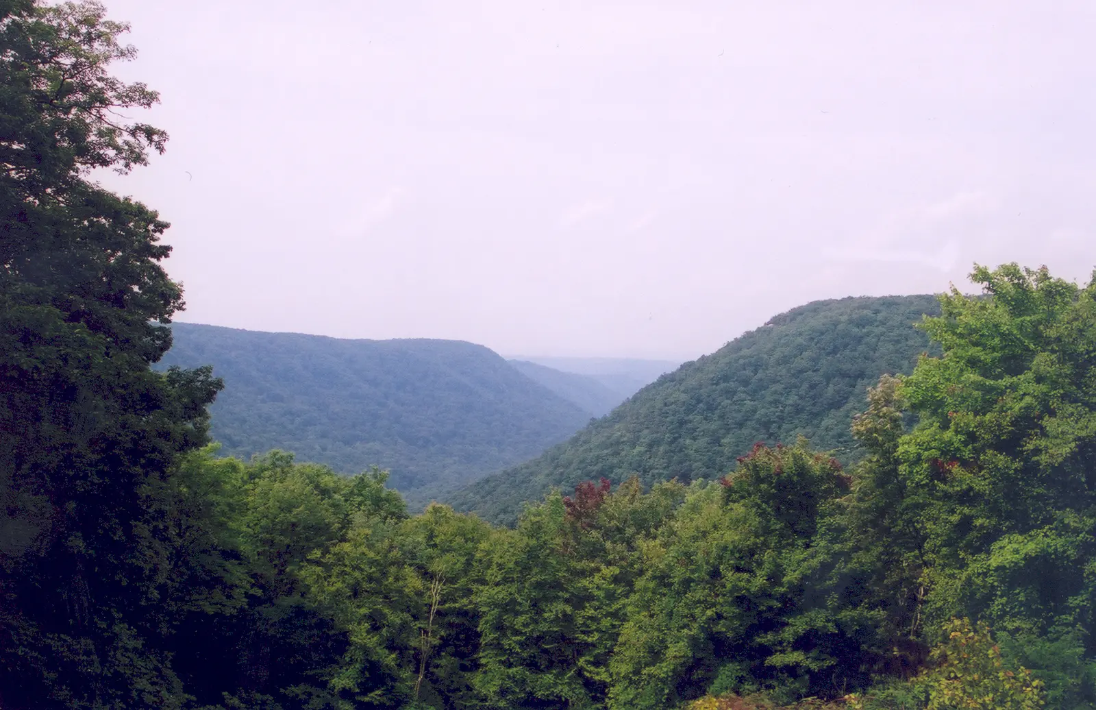

Babcock State Park is a 4,062-acre park in Fayette County, about 12 miles southeast of Oak Hill.
Things to do include hunting in season, canoeing and kayaking, boating, biking, and fishing. Its trail network totals roughly 20 miles, according to the park. For overnight stays there are 52 campsites (RV sites with electric hookups and tent sites). There are also cabins for rent.
Hours
Park, gate, office and facility hours are listed separately because they often differ. Alerts above override normal hours.
| Facility | Days | Hours | Season |
|---|---|---|---|
| Park | Daily | 10 a.m. – 6 p.m. | — |
Official wording
10 A.M. to 6 P.M.
The campground is open spring through fall, weather permitting.
Source: official park page, checked Oct 29, 2026. Times are local to the park (America/New York).
Fees and passes
Fees apply to lodging, camping, pools and activities.
Statewide fee rule from West Virginia's park system; this park’s page doesn’t list its own fees.
Reservations
- Day use
- No day-use reservation requirement mentioned
- Booking system
- WV State Parks reservations (Inntopia-based, reservations.wvstateparks.com)
We link to the official booking system rather than showing live availability, which changes minute to minute.
Pets
Dogs allowed
Specific cabins are designated as pet-friendly.
Service animals are generally permitted where pets are not. Check with the park for specific areas.
Camping
| Campground or site type | Sites | Hookups / features | Price |
|---|---|---|---|
| Camping Season: The campground is open from the third Friday in April until the fourth Monday in October, weather permitting. Babcock State Park’s 52-unit campground has 24 non-electric sites and 28 sites with electric hookups, four of which are accessible. The campground accommodates tents or trailers, and has a central bathhouse with coin-operated laundry machines, two water fill-up stations and two sewage dump facilities. Firewood and ice are available for purchase. Wireless Internet is available, and cell phone service is available from most major cell phone companies.
The campground is open from the third Friday in April until the fourth Monday in October, weather permitting. Campsites may be reserved between… | 52 | Babcock State Park’s 52-unit campground has 24 non-electric sites and 28 sites with electric hookups, four of which are accessible.Showers | — |
Camping details from the park
Babcock State Park’s 52-unit campground has 28 sites with electric hookups and 24 non-electric sites. The campground has a central bathhouse with coin-operated laundry machines, two water fill-up stations and two sewage dump facilities. Wireless Internet is available, and cell phone service is available from most major cell phone companies.
Babcock also offers a group tent camping area that can accommodate up to 20 tents and features a covered shelter with nine picnic tables, electric and a covered stone fireplace. The campground is open the third Friday in April until the fourth Monday in October, weather permitting.
From the official park page, checked Oct 29, 2026. Site counts and prices can change; confirm when booking.
Cabins and lodging
- Cabins: 13 units
Cabins
Babcock State Park has 13 legacy cabins along Glade Creek, five legacy frame cabins, eight economy cabins and two handicap-accessible vacation cabins. Each legacy cabin has a wood-burning fireplace, fully equipped kitchen and bath with shower. The economy cabins have a combination living/dining/bedroom with built-in double bunks or single-size bunks, small bath with shower, and a screened-in porch. The accessible vacation cabins have heating and air conditioning, a gas fireplace and HDTV. Specific cabins are designated as pet-friendly. All cabins have wi-fi, modern appliances and are stocked with cooking utensils, dishes, flatware, bed linens and bath towels. Cabins are open from the third Friday in April until the fourth Monday in October. So, book your reservations now!
Things to do
BikingBoatingCampingFishingGeocachingHikingHuntingCanoeing and kayaking
Trails
| Trail | Length | Difficulty | Notes |
|---|---|---|---|
| Connector Trail | — | Moderate | The trail head is located along the service road where Twin Hollow Trail crosses. This a short and steep trail connecting Twin Hollow Trail to Ridge Top Trail. Suitable for biking. Distance: 50 yards Difficulty: ModerateHikingBiking |
| Island-In-The-Sky Trail | 0.5 mi | Easy to moderate | The trailheads are at the grist mill and at a small parking lot in the sharp curve along the road to Boley Lake. The trail is mostly uphill if starting at the grist mill and mostly level if starting at the sharp curve. The trail has beautiful vistas and high cliff areas, so watch your children carefully. Distance: 0.5 mile Difficulty: Easy to moderate |
| Lake View Trail | 1 mi | Easy to moderate | The trailheads to this mostly level loop around Boley Lake are at the lake parking lot or at the gate above the grist mill. A spur from the grist mill gate is 0.5 mile, uphill and moderately difficult. The metal bridge along this spur was originally a gangplank from the showboat Rhododendron. Distance: 1 mile loop Difficulty: Easy to moderate |
| Manns Creek Gorge Trail | 2 mi | Moderate | The trailheads are across from Campsite 26 and at the first parking area at Camp Washington Carver. This is not a loop trail, so return along the same route or walk the Camp Washington Carver Road back to the campground. Suitable for mountain biking. Distance: 2 miles (one way) Difficulty: ModerateHikingBiking |
| Mountain Heath Trail | 0.25 mi | Easy | The trailhead is 300 yards north of the main intersection on the road leading to the Manns Creek picnic area. The parking spur is on the right side of the road, with the trailhead on the left. Numbered posts and a booklet available at park headquarters take you around this self-guided trail, which leads to the Natural Arch off from the right side of the parking spur. Distance: 0.25 mile Difficulty: Easy |
| The Natural Arch | — | — | Nature has a way of creating a natural wonder. It is an easy, short walk to this geologic fracture which can be combined with other trails such as Mountain Heath Trail for a longer walk. The Natural Arch is located approximately 75 yards from the parking area associated with Mountain Heath Trail. |
| Narrow Gauge Trail | 2.5 mi | Moderate | The trailheads are at the service road between the campground and economy cabins and on Sewell Road approximately 0.75 mile below Cabin 13. The gentle grade follows the bed of Manns Creek Railway that connected Clifftop with Sewell until its closure in 1956. Railroad ties, telegraph poles and other remnants of the old railway are still evident. Mountain bikes are permitted but must be carried around difficult sections of the trail. Distance: 2.5 miles (one way) Difficulty: Moderate |
| North Slope Trail | 0.5 mi | Moderate | The trailhead is shared with the Narrow Gauge Trail and is located next to Manns Creek Bridge on the service road. The first half of the trail is level and follows Manns Creek. The second half of the trail is very steep and is a difficult climb, connecting to the Ridge Top Trail. Suitable for biking. Distance: 0.5 mile (one way) Difficulty: ModerateHikingBiking |
| Old Pond Trail | 1.5 mi | Moderate | The trailheads are at the parking lot for the Natural Arch and at the gate before the intersection to the Manns Creek overlook. The trail has some uphill sections from either starting point. Suitable for biking. Distance: 1.5 miles (one way) Difficulty: ModerateHikingBiking |
| Ridge Top Trail | 2 mi | Moderate to difficult | The trailheads are across from the Short Cut Trail or past the Natural Arch parking area on the right, if coming from the main park entrance. The trail has steep uphill sections from either starting point. It follows along the crest of a ridge at some of the highest elevations at the park. Suitable for biking. Distance: 2 miles (one way) Difficulty: Moderate to difficultHikingBiking |
| Rocky Trail | 0.5 mi | Difficult | This short, steep trail connects Skyline Trail with Narrow Gauge Trail and is a stone staircase constructed by the Civilian Conservation Corps in the 1930s. It is much easier to walk downhill from the Skyline Trail. Distance: 0.5 mile Difficulty: Difficult |
| Short Cut Trail | — | Moderate | The trailhead is shared with the Ridge Top Trail parking area along Manns Creek Road. The trail has a fairly steep downhill section connecting to the Old Pond Trail. Suitable for biking. Distance: 300 yards Difficulty: ModerateHikingBiking |
| Skyline Trail | 2 mi | Moderate to difficult | The trailheads are at Manns Creek overlook in the picnic area and across the road from Cabin 5. Hikers must return along the same trail or by park roads. The trail follows a natural cliff line with spectacular vistas. It features a high cliff area, so watch your children carefully. Trail blaze is Yellow. Distance: 2 miles (one way) Difficulty: Moderate to difficult |
| Triple Creek Trail | 1 mi | Moderate to difficult | The trail begins at the former swimming pool parking lot and connects to the Wilderness Trail. It features three creek crossings. Suitable for mountain biking. Distance: 1 mile Difficulty: Moderate to difficultHikingBiking |
| Twin Hollow Trail | 0.5 mi | Moderate to difficult | The trailhead is at the gate before the Manns Creek intersection. The trail follows a beautiful hollow on the west side of the service road and main park road and has a few steep sections. Suitable for mountain biking. Distance: 0.5 mile (one way) Difficulty: Moderate to difficultHikingBiking |
| Wilderness Trail | 1.5 mi | Moderate | The trailhead is at the sharp curve on Boley Lake Road. It is a mostly level, remote, dead-end trail that connects with Triple Creek Trail. Suitable for mountain biking. Distance: 1.5 miles (one way) Difficulty: ModerateHikingBiking |
Trail descriptions from the park
No matter what kind of hiker you are, Babcock has something for you with more than 20 miles of hiking trails, from easy loops to challenging climbs. Stop by the park office to pick up a trail guide on your way out.
[trailcta]
Swimming
Nothing says "summer vacation" like a dip in the pool after a day of exploring. Babcock's pool is open from Memorial Day weekend through Labor Day. Call the office for exact times.
Boating and paddling
Hit the water for a nice relaxing day spent soaking up the sunshine. Boating is welcome at Babcock State Park, but proper license and stamps are required. Paddleboats, rowboats and canoes are also available for rent at the Boley Lake Marina, between Memorial Day weekend and Labor Day. Motors must be electric, and no boat launch area is available.
Fishing
Head on out for trout fishing on Boley Lake and Glade Creek and see if anything will bite! Anglers also have a good opportunity to catch largemouth bass, bluegill, trout and channel catfish. And within a 20-minute drive is the New River, which provides more fishing opportunities. West Virginia fishing licenses are available for purchase online.
Fishing in Babcock State Park
A state fishing license is usually required.
Amenities
Camping
- Tent camping
- RV camping
- Electric hookups
Lodging
- Cabins
✓ listed by the park · ✕ the park says it is not available. Anything not shown here isn’t mentioned by the official source — that means unknown, not unavailable.
Getting there
- Address
- 486 Babcock Road
Clifftop, WV 25831 - Nearest town
- Oak Hill — about 12 mi southeast (straight line)
- Coordinates
- 37.8839, -80.9792
- Phone
- 304-438-3004
- dnrbabcock@wv.gov
Nearby state parks
Sources and freshness
- West Virginia State Parks — park page — last checked Oct 29, 2026; page says updated Jun 29, 2025
- West Virginia State Parks park finder: window.parks JSON embedded in the /parks/ page (WordPress page + park post with ACF meta)
- Wikidata
- USGS PAD-US 4.1 (boundary and acreage)
- Photo: Midland Trail - Overlook View - NARA - 7720394.jpg — Public domain (US federal government work), A. E. Crane, U.S. Department of Transportation
“Last checked” is when our system last read the official source. “Last changed” (Oct 29, 2026) is when the information shown here last differed from the previous check. Hours, fees and rules can change without notice — confirm with the park before you go. Methodology