Snow Canyon State Park
- Status
- Open (per official listing)Daily 6 a.m. – 10 p.m.
- Entrance fee
- $15 per vehicle ($20 nonresident)Annual pass available
- Day-use reservations
- None mentioned
- Dogs
- Dogs allowed6-ft leash
- Camping
- Yes
- Official site
- stateparks.utah.gov(435) 628-2255
Official page last checked Oct 29, 2026. How we keep this current
Current alerts 2
Weather Saturday, November 14Snow Canyon Drive through the park will be closed between 7a.m. and Noon to accommodate the Snow Canyon Half Marathon and 10K in partnership with St.… (more)
Snow Canyon Drive through the park will be closed between 7a.m. and Noon to accommodate the Snow Canyon Half Marathon and 10K in partnership with St. George City. The paved Whiptail Trail will also be closed. Please plan your park visits accordingly. For more information on these events or closures, please phone park staff at 435-628-2255.
Posted by the park. Official alert
Weather General advisoryDesert Heat Preparedness Don’t let Snow Canyon’s name deceive you. This is a desert park and daytime temperatures during the summertime can range… (more)
Desert Heat Preparedness Don’t let Snow Canyon’s name deceive you. This is a desert park and daytime temperatures during the summertime can range from the low 100’s to 117°F (37-47°C). If you plan on a summer visit come prepared for hot, dry conditions and follow these safety tips: • Avoid hiking, biking or other activities between 11 a.m. and 7 p.m. The park is open from 6 a.m. to 10 p.m. daily so plan on getting an early start to your day. If you arrive late, plan on a driving tour and picnic lunch instead. • Every person in your group should drink a minimum of 32-ounces (1-liter) of water per hour. Everyone should carry their own water and drink frequently. Don’t wait until you feel thirsty. • Most park trails are fully exposed (i.e. there is no shade). Wear a hat and sunscreen. Long sleeve shirts can protect you from the most intense rays and a wet bandana or cooling cloth can provide some relief. • Check the local forecast. Excessive heat advisories are common and should be taken seriously. Don’t be fooled by the thermometer; If the air temperature reads 100°F (37°C), the surface temperature will be over 150°F (65.5°C). Not only will the sun be beating down on your head but…
Posted by the park. Official alert
Overview
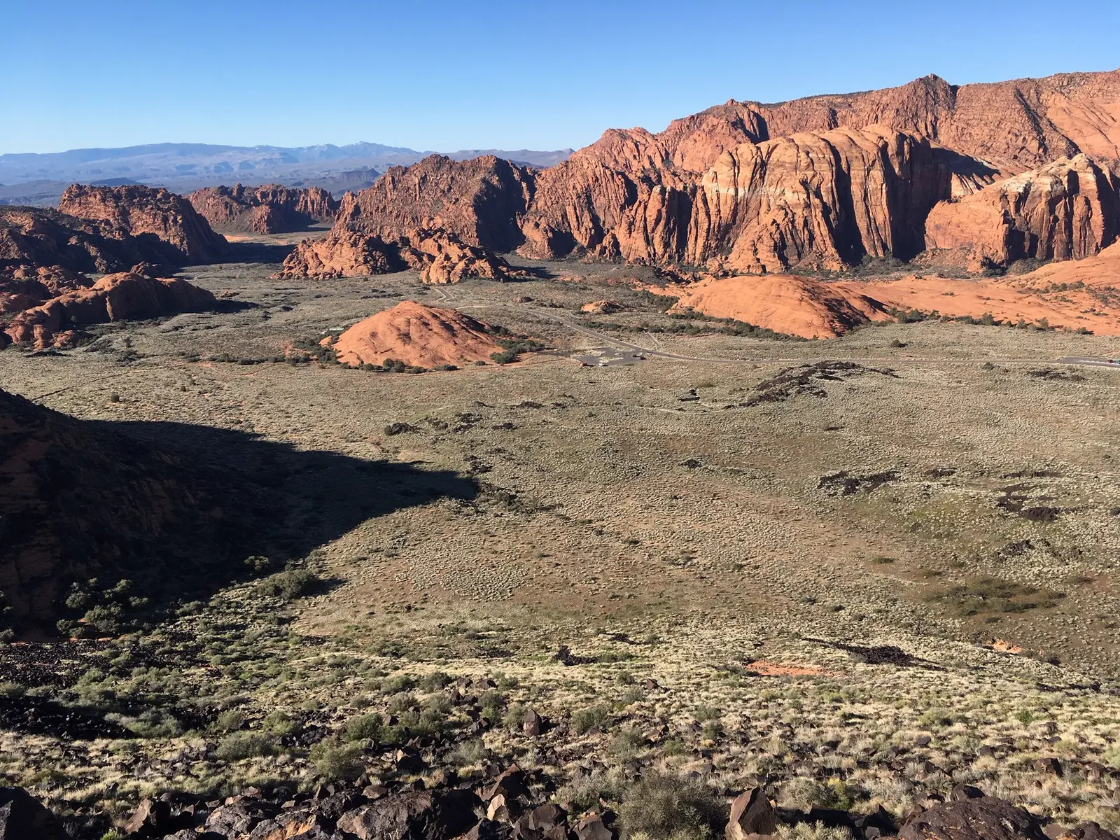

Covering about 7,930 acres, Snow Canyon State Park lies in Washington County, about 2 miles east of Ivins.
Visitors come for rock climbing, horseback riding, biking, ranger programs, and hiking. The official site lists about 38 miles of trails. Camping is available: 2 camping areas, including RV sites with full hookups and showers.
Hours
Park, gate, office and facility hours are listed separately because they often differ. Alerts above override normal hours.
| Facility | Days | Hours | Season |
|---|---|---|---|
| Park | Daily | 6 a.m. – 10 p.m. | — |
Official wording
Hours: 6 a.m. – 10 p.m. Daily
Source: official park page, checked Oct 29, 2026. Times are local to the park (America/Denver).
Fees and passes
| Item | Amount |
|---|---|
| Day-Use Fees: Utah Residents — Per vehicle (up to 8 people) (resident) | $15 |
| Day-Use Fees: Utah Residents - Seniors (65+) — Per vehicle (up to 8 people, with UT driver's license) (resident) | $10 |
| Day-Use Fees: Utah Residents - Pedestrian / Cyclist — Per person (resident) | $3 · walk-in |
| Day-Use Fees: Non-Residents — Per vehicle (up to 8 people) (nonresident) | $20 |
| Day-Use Fees: Non-Residents - Pedestrian / Cyclist — Per person (nonresident) | $3 · walk-in |
| Day-Use Fees: Commercial Use — Per person (commercial vehicles or groups 9+) | $4 · bus |
| Camping Fees: Non-Hookup Sites — Per night | $40 |
| Camping Fees: Hookup Sites (Water & Electric) — Per night | $45 |
| Camping Fees: Extra Vehicle Fee — Per night (one extra vehicle per site permitted) | $20 |
| Group Overnight Camping: Cottontail Group Campground — Per night (35 people maximum) | $175 |
| Group Overnight Camping: Quail Group Campground — Per night (50 people maximum) | $200 |
| Group Day-Use: Lower Galoot Day-Use Area — Up to 3 hours (Reservation/Permit required via phone/email) | $150 |
| Group Day-Use: Lower Galoot Day-Use Area (Additional Hour) — Per additional hour | $50 |
Official wording
Day-Use Fees: Utah Residents — Per vehicle (up to 8 people): $15 Day-Use Fees: Utah Residents - Seniors (65+) — Per vehicle (up to 8 people, with UT driver's license): $10 Day-Use Fees: Utah Residents - Pedestrian / Cyclist — Per person: $3 Day-Use Fees: Non-Residents — Per vehicle (up to 8 people): $20 Day-Use Fees: Non-Residents - Pedestrian / Cyclist — Per person: $3 Day-Use Fees: Commercial Use — Per person (commercial vehicles or groups 9+): $4 Camping Fees: Non-Hookup Sites — Per night: $40 Camping Fees: Hookup Sites (Water & Electric) — Per night: $45 Camping Fees: Extra Vehicle Fee — Per night (one extra vehicle per site permitted): $20 Group Overnight Camping: Cottontail Group Campground — Per night (35 people maximum): $175 Group Overnight Camping: Quail Group Campground — Per night (50 people maximum): $200 Group Day-Use: Lower Galoot Day-Use Area — Up to 3 hours (Reservation/Permit required via phone/email): $150 Group Day-Use: Lower Galoot Day-Use Area (Additional Hour) — Per additional hour: $50
Utah park passes
- Annual Day-Use Pass (Standard) — $125. Day-use entrance for cardholder + up to 7 guests in one private vehicle, 12 months; Utah residents only; excludes Jordan River OHV SP, This Is The Place Heritage Park and the $2 Antelope Island causeway fee Details
- Senior Annual Pass (65+) — $65. As above, Utah residents 65+ Details
- Veterans with Disabilities Honor Pass — Free. Day-use for qualifying Utah veterans + up to 7 guests in the same vehicle Details
- Digital Day-Use Pass — varies by park. Single-day entry for 1 private vehicle (up to 8 people), valid on the calendar date of purchase Details
From the Utah state guide. Confirm which passes this park accepts.
Reservations
- Day use
- No day-use reservation requirement mentioned
- Camping
- Recommended
- Booking system
- ReserveAmerica (utahstateparks.reserveamerica.com)
- Phone
- 800-322-3770
Camping is available year-round at the 38-unit campground; reservations are recommended during peak seasons and can be made by phoning 1-800-322-3770 or online at www.stateparks.utah.gov.
We link to the official booking system rather than showing live availability, which changes minute to minute.
Pets
Dogs allowed · leash up to 6 feet
Dogs in the park Are dogs allowed in the park? Dogs are permitted on all park trails and in the campground. Why do dogs have to stay on leash? The reserve and the park have a trail law, where people and pets need to stay on designated, mapped trails at all times. Off-leash dogs can disrupt habitat, vegetation and wildlife. • Tortoises cannot differentiate between domestic dogs and coyotes. An off-leash dog sniffing around causes significant distress to an already vulnerable species. An off-leash dog has a much higher chance of coming nose to nose with a venomous animal. • Dogs must be leashed (max 6 feet long) and under control at all times. Recreating with Dogs Rangers Kodiak and Franky want to let you know all the trails in the park are now dog friendly! To keep your pets safe, the park clean, and respect this shared space, we ask all visitors and their pups to follow the B.A.R.K. Bag (and dispose of) your pets waste. Dog feces can carry diseases that wild animals are more sensitive to than domestic animals. Snow Canyon is full of beauty, but also cliffs and wild animals that deserve their space. Even the best behaved of dogs can cause harmful amounts of stress to wildlife, such as the desert tortoise. In addition, Snow Canyon is a shared space, and you never know when another person or dog may be fearful of yours. For these reasons dogs are required to be on a leash at all times, and under the owners control. The presence of a dog may cause an animal to feel more threatened than a human alone. Even if they just approach the animal, it can do more harm than you realize. For example, tortoises may release their water reserve from their bladder as a self-defense mechanism when approached by a dog. This can leave the animal dangerously dehydrated. Off trail travel can collapse burrows, trapping animals underground. • Be a good steward of public lands: Protect native plants, animals, geology and the cultural resources of the site. • In areas that allow dogs, please keep dogs on a leash to avoid harassment of wildlife. • Respect other users by not allowing your dog to run around belayers and ropes, causing an unsafe distraction. What animals can I see and where and when can they be seen?
Service animals are generally permitted where pets are not. Check with the park for specific areas.
Camping
| Campground or site type | Sites | Hookups / features | Price |
|---|---|---|---|
| Non-Hookup Sites $40 Per night | — | Non-Hookup Sites | — |
| Hookup Sites (Water & Electric) $45 Per night | — | Hookup Sites (Water & Electric) | — |
Camping details from the park
Camping
Rules:
- Please - No Hiking or Scrambling on the Campground Cliffs.
Opportunities are available at Galoot Hill, the Petrified Dunes and Whiterocks areas (see park brochure).
- Quiet Hours: 10 p.m. to 7 a.m.
- Generator Hours: Noon to 4 p.m.
- Showers Closed for Cleaning: 11 a.m. to Noon.
- Check-out Time: 2 p.m; Renew by 10 a.m.
- Pets must be Leashed: (oft max) and under control.
Scoop your poop - Grab it, Bag it, Bin it!
- Avoid Skunks: Properly store all food and dispose of trash.
- The Dishwashing Station is adjacent to the shower building. Please help keep it clean.
- Tents on Tent Pads Only.
- Fires: Use designated fire pit/grill. Drown out your fire after use.
- Firewood gathering is prohibited.
General information:
Hookup Sites
- 1 - 14 include Water and Electric (30amp).
- Sites 15A, 15B, 17, 18 are Electric only (30amp).
Rates:
- $40 Per Night; Non-hookup Site
- $45 Per Night; Hookup Site
Reservations:
- Phone: 1-800-322-3770 (M-F, 8 a.m.-5 p.m.)
- Online: www.stateparks.utah.gov
- Reservations may be made up to 4-months in advance and minimum of 2-days in advance of arrival. Any unreserved sites are available on a first-come, first-serve basis after 10am on day of arrival. 14 night maximum stay.
Standard Sites
- 13 RV/Tent/Trailer campsites
•
Min Num of People: 1
•
Max Num of People: 8
•
Pets Allowed: Domestic
•
Max Num of Vehicles: 1
•
Fire Pit
•
Grills/Fire Ring
•
Picnic Table
Reserve
Standard Partial-Hookup
- 16 RV/Trailer only campsites
•
Electricity Hookup: 30
- Max Num of People: 8
•
Pets Allowed: Domestic
•
Max Num of Vehicles: 1
•
Water Hookup
Reserve
Tent Sites
- Site Access: Hike-In
- Hike In Distance to Site: 110 ft
- Min Num of People: 1
- Max Num of People: 5
- Pets Allowed: Domestic
- Grills/Fire Ring
- Picnic Table
- Tent Pad
- 9' x 9' is the largest tent size possible.
Reserve
Group Sites
Cottontail
•
Check-in Time: 3 p.m.
•
Check-out Time: 2 p.m.
•
Min Num of People: 1
•
Max Num of People: 35
•
Max Num of Vehicles: 8
•
Max Vehicle Length: 35
•
$175.00 Per Night, $10.25 reservation fee
Reserve
Quail
•
Check-in Time: 3 p.m.
•
Check-out Time: 2 p.m.
•
Electricity Hookup: 30
•
Min Num of People: 1
•
Max Num of People: 50
•
Max Num of Vehicles: 12
•
$200.00 Per Night, $10.25 reservation fee
Reserve
Camping and Hiking
Camping
Is there camping at Snow Canyon and should I make a reservation?
- YES. Camping is available year-round at the 38-unit campground; reservations are recommended during peak seasons and can be made by phoning 1-800-322-3770 or online at www.stateparks.utah.gov. Reservations can be made 48 hours to 4 months in advance online; Camping within 48 hours is walk up only.
Can I camp somewhere else in the park other than the campground?
- NO. Backcountry camping is not permitted in Snow Canyon.
Hiking
Why can’t I hike off-trail?
- Staying on the trail protects the park’s natural resources. Off-trail hiking damages fragile desert plants, disrupts cryptobiotic crust that holds the sandy soils in place and can collapse burrows wildlife depend on for shelter from the hot desert sun. Additionally, footprints remain for a long time and encourage other visitors to hike off trail – this eventually leads to a network of illegal trails that damages resources and detracts from the beauty of the park. Staying on designated trails is also safer for visitors.
- An off-trail dog has a much higher chance of coming nose to nose with a venomous animal.
Why is Johnson Canyon closed seasonally?
- The closure protects sensitive wildlife and the habitat critical to the area. The closures occur during active feeding and breeding seasons. Johnson Canyon is closed March 15th through September 14th except by ranger-guided hikes.
From the official park page, checked Oct 29, 2026. Site counts and prices can change; confirm when booking.
Things to do
HikingBikingCampingRock climbingHorseback ridingRanger and interpretive programsPicnicking
Trails
Hiking
Snow Canyon State Park Trail Guides provide visitors with an overview of some of our more popular trails. These downloadable Guides provide a description of the route, safety considerations, special features and applicable rules for each trail.
Easy
Berm Trail
- Trail Access: Berm Trailhead, 100 E in Ivins
- Allowable Uses: Hike, Bike, Equestrian
- Distance (round trip): 2 miles/3.2km
- Difficulty: Easy
- Hiking Time: 1 hour
- Printable Guide: Berm
Trail Description
From the Berm Trailhead, keep right to follow the trail along the top of the dike, enjoying views of sandstone mesas to the left and the city of Ivins to the right. Keep following the trail east–after about one mile, you will come upon a fork that branches to the right. This is where the Berm Trail converges with the Toe Trail. To continue on the Berm Trail, continue past this trail on the right and keep straight to head east towards Tuacahn Drive. The Berm Trail ends at Tuacahn Drive where it connects with a paved trail.
Read more from the park
Special Features
The Berm trailhead begins with a fork in the trail–keep right to follow the top of the dike or left to follow the maintenance road into the valley between the dike and the cliffs. Hikers can choose either of these paths, but must stay on the trail they choose during the hike. The top route is level and features a compact, crushed rock surface.
Safety and Considerations
Minimal shade may result in prolonged sun exposure. Wear appropriate footwear and clothing, and bring water.
Hidden Pinyon
- Trail Access: Hidden Pinyon Trailhead or Campground Picnic Area
- Allowable Uses: Hike
- Distance (round trip): 1.5 miles/2.4km
- Difficulty: Easy to Moderate
- Hiking Time: 45 minutes
- Printable Guide: Hidden Pinyon Trail Guide
Trail Description
From the signed trailhead, take a right onto the paved Whiptail trail and head uphill to the first signed left hand turn. From the Campground Picnic Area, cross the street and follow the trail, turn right onto the Whiptail trail heading north then left at the first signed turn. From this point, you will enter a winding rock passage with cliffs lined in lichen, moss and desert varnish. The passageway opens and the trail merges with Red Sands trail. Head north until the next intersection. Follow signage for Hidden Pinyon to the left. This leads across a sage flat, down through a boulder passage and into a hidden canyon framing views of the Petrified Dunes and white cliffs to the north. The trail soon reconnects with the Red Sands trail at a T-intersection. Take a right and follow this route along a sandstone ledge, past the "Hidden Pinyon" and back to the trailhead.
Special Features
Nineteen metal posts make educational stops along this self-guided nature trail. A trail guide is available at a trailside kiosk or visitor center for those hikers seeking a deeper understanding of plants and geologic features seen along the hike.
Safety and Considerations
Portions of this trail feature ledges or uneven rock surfaces. Wear suitable footwear.
Jenny’s Canyon
- Trail Access: Jenny’s Canyon Trailhead
- Allowable Uses: Hike
- Distance (round trip): 0.5 mile/0.8km
- Difficulty: Easy
- Hiking Time: 20 minutes
- Printable Guide: Jenny’s Canyon
- Trail Description
From the signed trailhead, head east along the sandy trail towards the visible shrub-like trees and rock cliffs. When you reach the dry wash, cross directly and follow the trail until you reach a T-intersection at the base of the cliffs. From here, choose to go left into the slot canyon or right to climb up to a scenic overlook.
Special Features
The differential erosion rates of the sandstone make for amazing textures in the slot canyon walls. Look closely at the wind-carved pockets higher in the slot. You may see signs of a nesting owl, raven or peregrine falcon. In spring, the approach to the slot canyon is flanked by bush penstemon and other colorful wildflowers.
Safety and Considerations
Portions of this trail feature deep sand or uneven rock surfaces. Wear suitable footwear.
Johnson Canyon
- Trail Access: Johnson Canyon Trailhead via Scout Cave Trail
- Allowable Uses: Hike
- Distance (round trip): 2 miles/3.2km
- Difficulty: Easy
- Hiking Time: 1 hour
- Printable Guide: Johnson Canyon
Trail Description
Access to Johnson Canyon is along a route shared with Scout Cave trail. Along the first 1/3 mile, hikers traverse a somewhat rugged lava field dotted with small craters and rises. Continue straight when reaching the first intersection 1/3 of a mile in where Scout Cave trail turns off to the right. From here, the trail leaves the lava field and heads directly across a dry stream bed skirting the edge of a small cliff. As the trail rounds the bend into Johnson Canyon, a wooden fence marks the view of Johnson's Arch. The hike ends shortly after at the rear of the canyon where a shady vegetated area makes for a perfect spot to rest and have a snack. Closed annually from March 15 to September 14 except by ranger guided hike.
Special Features
This popular trail leads to a verdant canyon important for wildlife and used by several human cultures throughout the history of the region. Hikers may see remnants of a historical pipe once used to transport water from Snow Spring to agricultural areas in Ivins. After steady rains, a 200 foot (60.96 meter) waterfall often flows at the end of the canyon creating a large pool. This hike is closed annually from March 15th to September 14th for wildlife and habitat protection.
Safety and Considerations
Portions of this trail feature uneven rock surfaces and drop-offs. Wear suitable footwear.
Pioneer Names
- Trail Access: Pioneer Names Trailhead
- Allowable Uses: Hike, Rock Climb, Scramble*
- Distance (round trip): 0.5 miles/0.8km
- Difficulty: Easy
- Hiking Time: 20 minutes
- Printable Guide: Pioneer Names
Trail Description
This trail has two access points along Snow Canyon Drive and a roadside connector that allows hikers to make a small loop. Starting from the northernmost parking area, the trail heads east towards three alcoves. A bit of scrambling (scrambling permitted on sandstone near the names) allows hikers to climb up to the smallest alcove on the left for views of the names and dates left behind by early pioneers. From here, the trail leads south along the bottom of the towering cliffs to a shaded area with hackberry trees, walls covered in resurrection moss and a small natural arch.
Special Features
This short trail features historical markers, rock climbing access and the most shade of any hike in the park. During and after rain, this trail has several waterfalls and a wall of vivid green moss that stands out brilliantly against the red sandstone.
Safety and Considerations
Hikers should be cautious of falling rocks. Wear suitable footwear.
Sand Dunes
- Trail Access: Sand Dunes Picnic Area
- Allowable Uses: Hike, Picnic
- Distance (round trip): 0.5 miles/0.8km
- Difficulty: Easy
- Hiking Time: 15 minutes
- Printable Guide: Sand Dunes
Trail Description
This trail begins at the Sand Dunes Picnic Area. From the Picnic area, head south towards the large expanse of red sand surrounded by basalt, sandstone, and sagebrush. Following this trail, you will hike through deep, shifting sands while seeing views of sandstone cliffs to the west and to the east. The mapped route leads from one edge of the sand dunes to the other, and ends at the outskirts of the dunes where the terrain turns from sand into rock, packed dirt and plants. At the end of the trail, you can head to the western edge of the dunes and join the paved Whiptail trail, or turn back towards the dunes.
Special Features
While on the sand dunes themselves, you do not have to stay on-trail or follow the mapped route. These dunes serve as a giant sandbox and play area for adults and children of all ages, so feel free to explore and relax. For visitors requiring a shorter, easier access point, a small roadside parking lot is available
Safety and Considerations
Deep sand, slopes, and minimal shade may make hiking difficult. Wear appropriate footwear and bring water.
Toe
- Trail Access: Toe Trailhead on Snow Canyon Dr. or Tuacahn Dr.
- Allowable Uses: Hike, Bike, Equestrian
- Distance (round trip): 2.2 miles/3.5km
- Difficulty: Easy
- Hiking Time: 1 hour
- Printable Guide: Toe Trail
Trail Description
At the Toe Trailhead (adjacent to Snow Canyon Drive), head west on the dirt path that lies on the northern edge of the neighborhood. The trail consists of level and evenly packed dirt as it curves between creosote bushes and other vegetation, with views of sandstone mesas on the right. After passing a bend that leads in a southwest direction, the trail becomes slightly more sandy. You may notice a few off-shoot trails branching towards the houses on the left–these are access points to nearby neighborhoods. Pass these off-shoots and continue west on the main trail. After crossing a wash, you’ll walk among very small, rolling mounds as you approach Tuacahn Drive. Head west to cross the street, rejoining the dirt trail on the other side as it leads you northwest towards the sandstone cliffs. The Toe Trail ends when it meets the Berm Trail.
Special Features
A family friendly stroll through sand sage and creosote habitat with views of Red Mountain. This is excellent wildlife habitat. Be alert; slow your speed; and share the trail with other user and wildlife. Protect sensitive habitat by staying to the mapped trail.
Safety and Considerations
Minimal shade may result in prolonged sun exposure. Wear appropriate clothing, and bring water.
Tortoise Walk
- Trail Access: Upper Galoot Picnic Area
- Allowable Uses: Hike, Bike
- Distance (round trip): 0.3 miles/0.5km
- Difficulty: Easy
- Hiking Time: 10 minutes
- Printable Guide: Tortoise Walk
- Trail Description
On the eastern side of the Upper Galoot Picnic Area between the restrooms and the picnic tables, a wide and level trail takes you past wayside exhibits that narrate the life and struggles of the Mojave desert tortoise. This compact, crushed rock trail ends in a seating area with a 4,200-pound tortoise sculpture carved out of granite, and sweeping views of basalt and sandstone cliffs.
Special Features
A family-friendly walk that is also ADA accessible.
Safety and Considerations
Minimal shade may result in prolonged sun exposure. Wear appropriate clothing and footwear, and bring water.
West Canyon Road
- Trail Access: Sand Dunes Picnic Area
- Allowable Uses: Hike, Bike, Equestrian
- Distance (round trip): 8 miles/12.9km
- Difficulty: Easy
- Hiking Time: 4 hours
- Printable Guide: West Canyon
Trail Description
This narrow gravel road is closed to most vehicles making it very popular for biking running and horseback riding. Beginning at the iron gate in the north end of the Sand Dunes picnic area, the road rolls along the valley bottom climbing slightly until reaching a dead-end near the base of towering white cliffs.
Special Features
Along the route users are treated to expansive views of the park's geologic features. Seven small wells adjacent to the road tap deep into the underlying sandstone and Navajo Aquifer, bringing drinking water to the park and surrounding communities.
Safety and Considerations
Maintenance trucks and emergency vehicles periodically share the road.
Whiptail
- Trail Access: Whiptail Trailhead
- Allowable Uses: Hike, Bike
- Distance (round trip): 6 miles/ km
- Difficulty: Easy
- Hiking Time: 3 hours
- Printable Guide: Whiptail
Trail Description
From the Upper Galoot parking lot, head west to cross the street and stay to the paved trail. After passing the Petrified Dunes spur on the right, the trail continues to descend southward, providing views of lava flows and ridges to the left (east) and sandstone cliffs to the right (west). You will notice various marked trails that connect to the paved trail, such as Hidden Pinyon on the right (west) and Pioneer Names on the left (east). After passing the Pioneer Names junction, the trail curves right towards the west and passes between sandstone cliffs and the Sand Dunes area. Once past the Sand Dunes, the trail bends east and crosses the road. The Snow Canyon portion of the Whiptail Trail ends just above the residential neighborhoods to the south. However, the paved trail continues out of the park and connects with a larger paved system that travels throughout the greater St. George area.
Special Features
Spanning ¾ of the length of the park, this trail is an excellent way to experience a wide variety of scenery that the park has to offer. This is a paved trail suitable for bikes and hikers. It runs alongside Snow Canyon Drive and, after leaving the park through the south entrance, the trail connects with a larger paved trail system maintained by the city. Follow posted speed limits and note that scooters and skateboards are not permitted.
Safety and Considerations
This trail is shared by hikers and bikers alike. Be conscious of bikes and people moving at different speeds.
Moderate
Butterfly
- Trail Access: Petrified Dunes/Butterfly Trailhead
- Allowable Uses: Hike
- Distance (round trip): 2 miles/3.2km
- Difficulty: Moderate
- Hiking Time: 1 hour
- Printable Guide: Butterfly
Trail Description
The hike begins at the trailhead shared with Petrified Dunes. From the parking area, head west towards the sandstone hills keeping straight at the first intersection. From here, the trail crosses the exposed sandstone and turns right, down a steep natural staircase towards a small thicket of scrub oak at the bottom. The trail follows along the base of the sandstone outcroppings in a northern direction before veering left across basalt lava flows and a dry creek bed. The hike ends at the T-intersection with the Lava Flow trail. Head left on the Lava Flow trail to see one of our two lava tubes.
Special Features
Hikers will notice the "Butterfly" rock, a sandstone slab split in half resembling a butterfly with its wings splayed. Hikers often combine this hike with the Lava Flow trail and Snow Canyon Drive to make a loop.
Safety and Considerations
This trail features steep slopes and uneven surfaces. Wear suitable footwear.
Lava Flow
- Trail Access: Lava Flow Trailhead
- Allowable Uses: Hike, Equestrian*
- Distance (round trip): 2.5 miles/4km
- Difficulty: Moderate
- Hiking Time: 1.5 hours
- Printable Guide: Lava Flow
Trail Description
From the Lava Flow trailhead, the trail follows a lava flow dotted with cactus, yucca, and ephedra before arriving at a dry wash bottom. From here, the trail leads directly across and climbs slightly to reach a high point along the expansive lava flow. Approximately 1/2 mile in, the Whiterocks trail enters from the right. Continuing straight along the sloping lava field, an education sign marks the entrance to the first of two lava tubes. Beyond this point, the trail gently heads downhill to a three way intersection, with the Butterfly trail entering from the left. Continue straight towards a pyramid shaped sandstone knoll.
Amenities
Facilities
- Restrooms
- Showers
- Drinking water
- Picnic areas
- Visitor center
- Restaurant or food service
Camping
- RV camping
- Electric hookups
- Water hookups
- Sewer hookups
Recreation
- Horse trails
✓ listed by the park · ✕ the park says it is not available. Anything not shown here isn’t mentioned by the official source — that means unknown, not unavailable.
Accessibility
- View Sites From a Distance: If a site is not accessible, you may be injured trying to reach it or you could cause damage to other sites and ecosystems along the way.
A family-friendly walk that is also ADA accessible.
Official accessibility information
Conditions change. Contact the park to confirm specific accessible features before your visit.
Rules and permits
Permits
Certain activities at Snow Canyon State Park require permits. If you find the activity you are interested in listed below, click the link for more information.
Special Use Permits Required for:
- Canyoneering
- Weddings at the Snow Canyon State Park
- Professional and Portrait Photography and Videography
- Drone Use (Personal and Commercial)
Canyoneering
Please note the following information before making your purchase:
- Canyoneering permits can be purchased up to four months in advance of outing (i.e. on a four-month rolling basis).
- Each permit is good for up to six individuals.
- Island in the Sky permits are available year round. Arch Canyon permits are only available between September 15th and March 14th annually.
- Your Safety is Your Responsibility. Before purchasing your permit, please take the time to research and review the Route Descriptions in the links below. Detailed maps and route descriptions can also be viewed at the park Visitor Center.
Read more from the park
Choose a route: To register for Arch Canyon or Island in the Sky, please go to: On-line Canyoneering Permits
Weddings and Professional Photography
Planning a Wedding at Snow Canyon
Learn More
Professional Portrait Photography/Videography
View Fees, Guidelines and Application
Drone Use
Recreational Drone Use
Recreational drone use is allowed at the Snow Canyon Scenic Overlook. An advance permit is required.
For recreational, non-commercial flights please fill out and email the Personal Drone Use Flight Permission Form a minimum of five days in advance of your preferred flight date.
Email the completed form to: snowcanyon@utah.gov
If your requested date is available a signed form and rules attachment will be emailed to you.
Personal Use Drone Application
Commercial Filming / Sporting Events / Charity Events / Etc.
Commercial Use Permit Requirements
Know Before You Go
Park Rules
With so much natural beauty found at Snow Canyon State Park, it’s important that we all continue working hard to protect the land and wildlife for current and future generations. Check out the information below on how you can help!
- Day-use fees can be paid with cash, card or contactless payment at our entrance stations or visitor center. Snow Canyon day-use fees are also valid at exterior lots including: Cinder Cone, Whiterocks, Gila, Snow Canyon Scenic Overlook and Chuckwalla. Passes, fee waivers, and scheduled visits are non-transferable.
- Follow the 25 mph posted speed limit.
- Recreate on designated trails only. Designated scrambling areas include Galoot Hill, Petrified Dunes, and Whiterocks area. As part of the Red Cliffs Desert Reserve, hiking is limited to designated, mapped trails only. Fee waivers do not grant special privileges. Refer to the park brochure for our trail system.
- Dogs must be leashed (max 6 feet long) and under control at all times. Scoop, bag, and bin all waste. See our B.A.R.K Ranger Code below for more information.
- Park in designated lots only including those located off of SR-18: Cinder Cone, Whiterocks, Gila, Snow Canyon Scenic Overlook and Chuckwalla.
- Lots that accommodate buses: Chuckwalla, Padre/Johnson Canyon, Sand Dunes Picnic, Campground, Upper Galoot Picnic and Gila.
- Lots that accommodate horse trailers: Chuckwalla, Padre/Johnson Canyon, Sand Dunes Picnic, Gila, and Snow Canyon Scenic Overlook.
- Some park areas are closed seasonally. Please obey all posted closures.
- Respect wildlife. Wildlife will not be approached or handled, with the exception of a Mojave Desert Tortoise if found on the park road. Follow instructions on the back of our park brochure for safe, legal relocation.
- Pack It In – Pack More Of It Out. Help us keep our park beautiful.
- Camping in designated campground only. Reservations can be made 48 hours to 4 months in advance online through the Reserve tab. Camping within 48 hours is walk up only.
- Fires in designated fire rings/grills only. Please follow current fire restrictions.
- Do not modify park resources. This includes moving rocks; cutting or trimming plants; writing on rocks; etc. All plants, wildlife, rocks and natural features are protected.
- Drones and canyoneering by advance permit only. Please visit our Permit tab for more information.
For Professional Photography, Weddings, and Elopements; Please visit our Permit tab for information and scheduling.
- Prohibited: Skateboards, rollerblades, and scooters.
Cycling Etiquette and Safety
Cycling is one of the best ways to experience Snow Canyon State Park. However, before hopping on your bike and hitting the trail, watch this video first. These tips will help ensure your ride goes as smoothly as possible – and that you, other visitors, wildlife and the land can all continue to thrive. Watch the cycling safety video here.
Recreating with Dogs
Meet the B.A.R.K Rangers: B.A.R.K. Rangers Kodiak and Franky want to let you know all the trails in the park are now dog friendly! Snow Canyon is a special place to so many of us, and we want you to share it with your furry friends. To keep your pets safe, the park clean, and respect this shared space, we ask all visitors and their pups to follow the B.A.R.K. Ranger code.
B. Bag (and dispose of) your pets waste.
Dog feces can carry diseases that wild animals are more sensitive to than domestic animals. Not to mention, no one wants to hike around trying to while avoiding stepping in
A. Always wear a leash.
Snow Canyon is full of beauty, but also cliffs and wild animals that deserve their space. Even the best behaved of dogs can cause harmful amounts of stress to wildlife, such as the desert tortoise. In addition, Snow Canyon is a shared space, and you never know when another person or dog may be fearful of yours. For these reasons dogs are required to be on a leash at all times, and under the owners control. Leashes must be under 6ft.
R. Respect wildlife.
Rattlesnakes, gila monsters and coyotes, oh my! The presence of a dog may cause an animal to feel more threatened than a human alone. Maintaining your distance from wildlife will help keep your pup safe and wildlife unharmed. Even if they just approach the animal, it can do more harm than you realize. For example, tortoises may release their water reserve from their bladder as a self-defense mechanism when approached by a dog. This can leave the animal dangerously dehydrated.
K. Know where you can go.
Snow Canyon is a designated trail park. This means that off-trail hiking is not allowed. Always refer to your map to make sure that you are on a legal trail. Off trail travel can collapse burrows, trapping animals underground. So bring all your paws and boots to the trail!
Protect Our Past
- Leave All Artifacts: Moving or taking artifacts, even just one, can destroy the ability for archaeologists to learn from a site. Descendant groups often prefer for artifacts to remain in place.
- Guide Children Through Sites: Teach children to stay on trails and respect archaeological sites.
- View Sites From a Distance: If a site is not accessible, you may be injured trying to reach it or you could cause damage to other sites and ecosystems along the way.
- Don't Touch or Rock Imagery or Make Your Own: Touching rock imagery can leave oils from your hands on the rock that increase erosion and cause damage.
- Historic Artifacts Aren't Trash: Trash from more than 50 years ago is considered archaeology and archaeologists can learn about past people from it.
- Avoid Building Cairns: Land managers have created trail markers and signs, making additional cairns is unnecessary.
Climber Code of Ethics
As climbers we have a unique opportunity to be stewards of the environment we spend so much time in, and leaders in guaranteeing the preservation of it, and our ability to access our treasured outdoor resources. Help keep access to climbing sites and public lands open by doing the following:
1. Access
- Be aware of and observe seasonal closures, access requirements and agreements.
- Communicate to other climbers and user groups concerning these issues to make everyone aware.
- Carefully consider the consequences of your actions and the enjoyment of future visitors to the site.
- Check with the managing land agency (State Parks, National Parks, BLM, etc) before developing new routes or installing fixed hardware; permission or permits are typically required.
2. Impact
- Be a good steward of public lands: Protect native plants, animals, geology and the cultural resources of the site.
- Help reduce impact and preserve a safe climbing environment by keeping groups to six or fewer climbers.
- Respect other site users, both climbers and non-climbers by not sprawling your gear everywhere, or piling your gear and packs on top of other's gear and packs.
- Educate your group, particularly kids, about respecting others space and keeping noise down.
- Be respectful: Keep music low or turn it off if asked.
- Watch your language around other climbers or climbers with children.
- Protect sensitive sandstone: Wait at least 24-hours following rainstorms to climb.
- Avoid any actions that cause unnecessary erosion or impacts to fragile cryptobiotic soils.
- Use existing trails or washes and do not leave unnecessary cairns or markers.
- Avoid blazing new trails.
- Do not disturb nesting birds.
- Do not remove existing vegetation from a cliff.
- Don't manufacture holds or chip rock.
- In areas that allow dogs, please keep dogs on a leash to avoid harassment of wildlife.
- Respect other users by not allowing your dog to run around belayers and ropes, causing an unsafe distraction.
3. Waste
- Pack it in, pack it out (this includes human waste).
- Dispose of garbage and human waste in a hygienic and responsible manner.
- If you see rubbish left by other users please take it out too.
- Pay particular attention to the small things (cigarette butts, fruit labels and silver foil).
- They are an unsightly degradation to the climbing site.
- Use toilets where provided.
- If they are not available, bury human waste at least 6 to 8 inches deep and at least 200 steps from any water source, wash or access trail.
- Better yet, use a WAG Bag and carry out human waste and toilet paper.
4. Fire
- Fire is a serious threat to both safety and ecology.
- Avoid all risk of fire.
- Only light fires in designated fire rings in well-cleared areas.
- Think about where you are using your fuel stove and be responsible with its use.
- Observe all seasonal fire restrictions.
- Remember restrictions apply to fuel stoves and smokers.
5. Traditions
- Consider ethical issues established for the area you are using.
- Check in with local climbing shops, Federal (BLM, NPS, US Forest Service) or State Park headquarters if you are unsure about the use of chalk, placing fixed hardware, proper access to climbing sites, etc.
- In other words, ASK FIRST.
- Avoiding climber conflicts by respecting established climbing traditions related to specific sites.
- Avoid indiscriminate and excessive use of fixed hardware.
- Don't modify existing climbs.
- This includes retro bolting, chipping holds and adding holds.
- Preserve climbs in the spirit of the first ascent.
- Sometimes unsafe or outdated hardware may need replacement.
- Please check with the managing land agency before replacing or removing.
6. Safety
- A helmet can save your life.
- Your safety is your responsibility.
- Climbing is a high-risk activity and rock can be unstable.
- Pay attention to the age and use of your equipment and use good judgment when climbing.
- Alert uninformed or new climbers to potential dangers.
- Resolve any emerging disputes in a civilized manner.
- Keep noise levels to a minimum to ensure that all climbers can communicate with each other.
- Proper climbing checks and calls ensure that climbers at a cliff base are less likely to be in danger from falling rocks and climbing equipment, like dropped gear and pulled ropes.
- Communication between lead climber and belayer is essential.
- Screaming and yelling indiscriminately by other persons is a distraction and may cause an accident.
- If you are climbing with kids, educate them about the dangers of playing too near the drop zone where climbing is occurring.
- If you have a portable crib, DO NOT set it up where any potential rock fall, climber fall, rope fall, etc. might occur.
7. Commercial Use
- A Commercial Use Permit is required if you conduct commercial, for-profit activities on public land.
- This includes guided outings, therapeutic activities or other services rendered.
- Check with the managing land agency (NPS, BLM, State Parks, etc.) for more information.
Park wildlife (Desert Tortoise, Rattlesnakes, etc.)
What animals can I see and where and when can they be seen?
- Spring and fall are the best seasons for viewing wildlife. Wildlife most commonly seen throughout the park are rock squirrels, antelope ground squirrels, desert cottontails, ravens, scrub jays, turkey vultures, whiptail lizards and side-blotched lizards. Less frequently seen wildlife residents are desert tortoises, Gila monsters, snakes, falcons and owls.
Where can I see a desert tortoise?
- Tortoises are occasionally encountered throughout the park. Spring and fall are the best seasons for encounters since tortoises are in underground burrows during summer and winter. Keep an eye on the roadway and follow the posted speed limit signs. Baby tortoises are small and can look like rocks!
There’s a tortoise in the road, what do I do?
It is unlawful to harass or collect tortoises, but if you see one crossing the road and can safely move it out of harm’s way, please follow these steps:
- Stop your car in a safe place.
- Slowly approach the tortoise, noting the direction of travel.
- Pick it up using both hands and hold it in its normal walking position, level to the ground.
- Carefully carry it across the road in the same direction, taking it at least 50 feet from the roadway.
- Report your observations to park staff.
Are there rattlesnakes in the park?
- There are 11 species of snakes in the park. Only two are venomous species: The Great Basin rattlesnake and Mojave sidewinder. Snake encounters in the canyon are rare. Snakes are typically just as afraid of people as most people are of them and will attempt to flee unless they feel threatened.
Biking in the park (Rentals, E-Bikes and Trails)
Can I rent bicycles in the park? NO, but there are multiple bike rental companies throughout St. George and Ivins.
Are e-bikes allowed? YES. All posted speed limits apply. Riders are encouraged to watch our online safety and etiquette video and follow seasonally posted signs.
More information about E-bikes in Utah.
Where can I ride my bike?
In the main canyon: Snow Canyon Drive; the paved Whiptail trail; and West Canyon.
In Paradise Canyon: All trails except for the interior portion of the Gila trail which is impassable to bikes.
Note: Bikes are not allowed on the Johnson Canyon trail.
Sunrises, sunsets and petroglyphs
Photographing Sunrises and Sunsets: Where is the best spot for photographing sunrises and sunsets?
The best place in the park is at the Snow Canyon Scenic Overlook off of SR-18. The overlook is located one mile south of the north exit of the park on the west side of SR-18.
Petroglyphs: There are several sites along the Gila Trail, however, it is an 8-mile roundtrip hike.
The best places to see petroglyphs are on Federal BLM lands: Interagency Office at 345 East Riverside Dr. (St. George).
Phone 435-688-3200 for more information.
Getting there
- Nearest town
- Ivins — about 2 mi east (straight line)
- Coordinates
- 37.1800, -113.6447
- Phone
- (435) 628-2255
- snowcanyon@utah.gov
Nearby state parks
Sources and freshness
- Utah State Parks — park page — last checked Oct 29, 2026; page says updated Oct 29, 2026
- Utah State Parks WordPress REST API, custom post type 'parks', top-level posts with acf.page_type = 'parent' (50 = 46 state parks + 4 State Monuments)
- Wikidata
- USGS PAD-US 4.1 (boundary and acreage)
- Photo: Snow Canyon Utah March 2019.jpg — CC0 1.0 (public domain dedication), Wilson44691
“Last checked” is when our system last read the official source. No change has been detected since this page was first published. Hours, fees and rules can change without notice — confirm with the park before you go. Methodology