Table Rock State Park
Also known as Table Rock
- Status
- Open (per official listing)Daily 7 a.m. – 7 p.m.
- Entrance fee
- $6 per adultAnnual pass available
- Day-use reservations
- None mentioned
- Dogs
- Dogs allowed, with restrictions6-ft leash
- Camping
- 94 campsitesAlso cabins
- Official site
- southcarolinaparks.com(864) 878-9813
Official page last checked Oct 29, 2026. How we keep this current
Current alerts 1
Partial closure Park NewsPARK ADVISORY Table Rock began construction on the new Nature Center deck and Carrick Creek Fall's access improvement project on 7-27-2026. The… (more)
PARK ADVISORY Table Rock began construction on the new Nature Center deck and Carrick Creek Fall's access improvement project on 7-27-2026. The Nature Center and trailhead restrooms are now closed to the public. Hikers should plan to follow the arrows through the parking lots to the Concessions Area in order to register for hiking, have access to restrooms, and reaching the temporary trail access point. The Nature Center and trailhead restrooms will remain closed until the deck and Carrick Creek Falls access improvement project is complete. We apologize for any inconvenience as we work to improve the park. We ask all campers and cabin guests to check-in upon arrival. Please check-in at the park Visitor Center, 158 E. Ellison Lane, Pickens, SC 29671. All pets must remain leashed while in the park; this includes any pets on hiking trails.
Posted by the park. Official alert
Overview
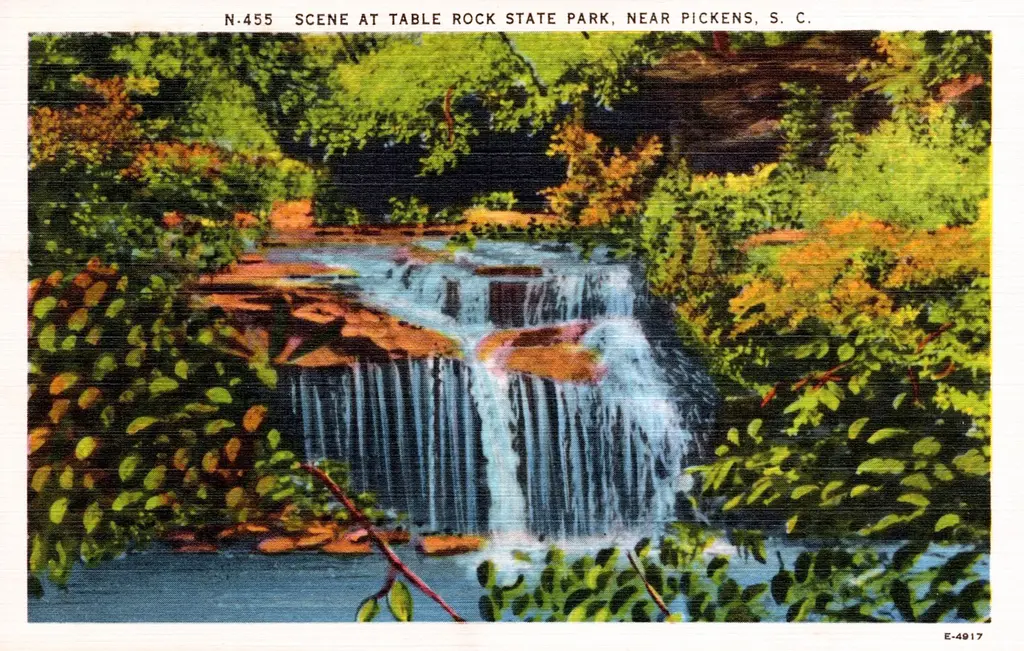

In Pickens County, about 15 miles south of Brevard, Table Rock State Park covers about 2,850 acres.
Things to do include historic sites, canoeing and kayaking, boating, swimming, and fishing. Its trail network totals roughly 12 miles, according to the park. Camping is available: 94 campsites, including RV sites and tent sites. There are also cabins for rent.
Hours
Park, gate, office and facility hours are listed separately because they often differ. Alerts above override normal hours.
| Facility | Days | Hours | Season |
|---|---|---|---|
| Park | Daily | 7 a.m. – 7 p.m. | — |
| Daily | 7 a.m. – 9 p.m. | — | |
| Office | Not stated | 8 a.m. – 6 p.m. | Winter hours |
| Not stated | 9 a.m. – 5 p.m. | Winter hours |
Official wording
Hours are Su-Th 7 a.m. - 7 p.m. (extended to 9 p.m. F and Sa). Su-Th 7 a.m. - 9 p.m. (extended to 10 p.m. F and Sa), during Daylight Saving Time.
M-Su 8 a.m. - 6 p.m. Seasonal winter hours M-Su 9 a.m. - 5 p.m.
Source: official park page, checked Oct 29, 2026. Times are local to the park (America/New York).
Fees and passes
| Item | Amount |
|---|---|
| $6 adults; | $6 · adult |
| $3.75 SC seniors (age 65 & older); | $3.75 · senior |
| $3.50 children ages 6-15; ages 5 and under, free. | $3.50 · child |
Official wording
$6 adults; $3.75 SC seniors (age 65 & older); $3.50 children ages 6-15; ages 5 and under, free.
South Carolina park passes
- ALL Park Passport — $99 Details
From the South Carolina state guide. Confirm which passes this park accepts.
Reservations
- Day use
- No day-use reservation requirement mentioned
- Booking system
- SC State Parks reservation system (reserve.southcarolinaparks.com)
- Phone
- 1-866-345-PARK (7275)
We link to the official booking system rather than showing live availability, which changes minute to minute.
Pets
Dogs allowed, with restrictions · leash up to 6 feet
Not allowed in or on: any other cabins.
Pets are allowed in cabins 4, 9, 10 and 11. Pets are not allowed in any other cabins, indoor areas or on the swim beach at Table Rock State Park. Pets are allowed in most other outdoor areas provided they are kept under physical restraint or on a leash not longer than six feet. Pets are allowed in cabins 4, 9, 10 and 11. Pets are not allowed in any other cabins, indoor areas or on the swim beach at Table Rock State Park. Pets are allowed in most other outdoor areas provided they are kept under physical restraint or on a leash not longer than six feet.
Service animals are generally permitted where pets are not. Check with the park for specific areas.
Camping
| Campground or site type | Sites | Hookups / features | Price |
|---|---|---|---|
| Standard Sites with Elec. & Water 94 sites
Primitive Tent Sites: Pine Point camping area is a designated primitive tent camping area, located near the visitor center. This area includes six primitive tent sites. No access to flush toilets or power. Hike to site is 880 yards. | 94 | Standard Sites with Elec. & WaterShowersRVs up to 40 | — |
Camping details from the park
Camping Information: The park provides a 69-site camping area, located near the park entrance, and a 25-site camping area, located near White Oaks picnic area. Each site has individual water and electrical hookups, and picnic table. Some sites accommodate RVs up to 40 feet. Both campgrounds are convenient to restrooms with hot showers.
The park has a primitive walk-in camping area with central water, located near Lake Oolenoy.
Standard Sites with Elec. & Water: 94 sites
Primitive Tent Sites: Pine Point camping area is a designated primitive tent camping area, located near the visitor center. This area includes six primitive tent sites. No access to flush toilets or power. Hike to site is 880 yards.
Primitive Group Area: Three primitive areas with central water and privy are available for organized groups. Fox Hill Group site includes six tent pads. Owl Tree Group Site includes eleven tent pads. Bobcat Creek Group site includes seven tent pads. No access to flush toilets or power. Hike to site is 1/2 mile.
Reservations are accepted. To make a primitive group camping reservation, contact the park directly. Note: Rates are subject to change.
PLEASE NOTE: Camping within the park trail system is prohibited. The park gates lock each night and hikers must be off the trails before the gates are closed. Camping is allowed only on the Foothills Trail outside of the park boundary after blaze marks change from yellow/white to only white.
From the official park page, checked Oct 29, 2026. Site counts and prices can change; confirm when booking.
Cabins and lodging
- Cabins/Villas: 14 units
Lodging Information: Fourteen cabins are completely furnished, heated, air-conditioned, and supplied with bath and bed linens, basic cooking and eating utensils, automatic coffee maker, refrigerator, stove, microwave, and include a screened porch and fireplace. Cabin 9 and Cabin 16 is user-friendly for the physically impaired. Pets are not permitted in the cabins or cabin area.
One, two and three-bedroom cabins are available.
Tents are not permitted in the cabin areas. Pop-up sun canopies may be used over the picnic tables in the outdoor living areas.
Length of Stay: Rentals are typically accepted for a two-night minimum, however, during busier periods and on holidays a minimum stay of 3 to 5 nights may be required.
Read more from the park
One Bedroom Cabin/Villa: Each one-bedroom cabin sleeps up to four people. Cabins 1, 2 and 7 include one full bath, a full-size bed, and a sleeper sofa in the den. Cabin 16 is handicap accessible for the physically impaired. It includes one full bath, a queen bed and a sleeper sofa in the den.
Two Bedroom Cabin/Villa: We have nine two-bedroom cabins. Cabin 3 has two full baths and two queen beds and sleeps up to four people. Cabins 9, 10 and 11 have one full bath and two queen beds and also sleeps up to four people. Cabins 4 and 5 have one full bath, two full beds and one sleeper sofa in the den and sleeps up to six people. Cabins 6, 8 and 15 have one full bath, one full bed, one queen bed and one sleeper sofa in the den and sleeps up to six. Cabin 9 is handicap accessible for the physically impaired.
Three Bedroom Cabin/Villa: Cabin 12 is the only three-bedroom cabin on the park. The cabin sleeps eight and includes two full baths, three full bed, and a sleeper sofa in the den.
Cabins/Villas: 14
Things to do
FishingBoatingCanoeing and kayakingPicnickingWildlife viewing and birdingHikingHistoric sites and toursCampingSwimming
Trails
| Trail | Length | Difficulty | Notes |
|---|---|---|---|
| Overnight Parking for Foothills Trail/Palmetto Trail | — | — | — |
| Foothills Trail Hikers Plan Ahead and Prepare | — | — | — |
| Hiking Trails | — | — | — |
| Lakeside Trail | 1.9 mi | Easy | Length: 1.9 mile loopHiking |
| Carrick Creek Trail | 2 mi | Moderate | Length: 2 mile loopHiking Trail |
| Mill Creek Pass Trail | 0.6 mi | Easy | Length: 0.6 milesHiking Trail |
| Pinnacle Mountain Trail | 4.2 mi | Very Strenuous | Length: 4.2 miles one wayHiking Trail |
| Ridge Trail | 1.9 mi | Moderate to Strenuous | Length: 1.9 milesHiking Trail connecting Pinnacle Mountain and Table Rock Trails |
| Table Rock Trail | 3.6 mi | Very Strenuous | Length: 3.6 miles one wayHiking |
| Stool Mountain Trail | 2.7 mi | Strenuous to Very Strenuous | Length: 2.7 miles one wayHiking |
Trail descriptions from the park
Hikers: Please register at the trailhead kiosk or Nature Center at 620 Table Rock State Park Rd., Pickens, SC. Fill out one card per group. Hikers must be off trails before sunset. Camping is prohibited within the park trail system. Park gates lock each night. Please keep dogs on a 6-ft. maximum length leash at all times.
Overnight Parking for Foothills Trail/Palmetto Trail
Hikers must display a valid parking permit on cars parked overnight. The permit may be purchased at the Visitors Center during normal business hours. Foothills Trail hikers permitted to camp after trail blaze turns from yellow/white to WHITE ONLY.
Foothills Trail Hikers Plan Ahead and Prepare
- Check Foothills Trail Guidebook and map for guidance in planning your hike. These resources have distances between road crossings along with camping locations, water locations and elevation profiles. · Visit the Foothills Trail Conservancy website at foothillstrail.org to utilize online resources in planning your hike. This website also has information on trail safety and trail conditions.
- Park staff can answer questions about overnight parking permits, hiker registration, trail conditions within the park and general information questions. Hikers should consult online and printed resources to plan the specifics of their trip according to their own hiking style, pace and preferences.
- In case of emergency on the trail; hikers should call 911. This will allow the appropriate agencies and resources to respond.
Hiking Trails
The extensive trail system leads hikers by streams, waterfalls and scenic views along the way to the top of Table Rock and Pinnacle mountains. When hiking the trails, you enter the natural habitat of wildlife. Please respect all animals and plants by not disturbing them in any way. Local wildlife includes black bear, white-tailed deer, raccoon, gray fox, bobcat, wild turkey and many other species of smaller mammals, birds, reptiles and amphibians. Stay on the trail avoiding shortcuts to prevent erosion and the risk of injury.
Lakeside Trail
Length: 1.9 mile loop
Type: Hiking
Difficulty: Easy
Description: This trail is marked with purple blazes and offers a bit of history, great views of the mountain, and a family friendly alternative to hiking up the steeper mountain trails. The Civil Conservation Corps started this trail in the mid-1930's and the loop was completed in 2011. The east section around Pinnacle Lake is .75 mile and begins near the boat house and leads hikers past an old stone boat landing, below the historic Lodge, and by the dam and spillway, all of which the CCC constructed. A small parking area serves as an optional trail access at the dam. The trail drops down below the spillway to where a bridge crosses the creek. From the bridge, the newest section around the west side of the lake is more level and leads .8 mile to the parking area near the picnic shelters. The walk between the two main trail heads located at the shelters and the boat house is .3 mile and passes through the main day use parking area and by the swimming beach to complete the entire loop. Completing a hiking registration card is not necessary for this trail.
Carrick Creek Trail
Length: 2 mile loop
Type: Hiking Trail
Difficulty: Moderate
Description: This 2 mile trail loop provides some breathtaking views of Table Rock State Park. A circuit of the Carrick Creek Trail will take you about one hour to complete, and is clearly marked with green blazes on tree trunks throughout the trail. You begin your hike at an elevation of 1,160 feet at the Nature Center, and rise to 1,520 feet with numerous views of cascading waterfalls as you pass through a forest that includes a dominant oak-hickory forest, scattered pines, and hemlock. An observation deck less than 100 yards up the trail at Carrick Creek Falls allows outdoor enthusiasts to be a part of the great South Carolina outdoors.
Mill Creek Pass Trail
Length: 0.6 miles
Type: Hiking Trail
Difficulty: Easy
Description:Mill Creek Pass does not begin at the Nature Center. It is a connector trail linking Pinnacle Mountain Trail with the Ridge Trail. If you ascend Pinnacle Mountain Trail a half mile above the spur trail to Mill Creek Falls, you can turn right and follow Mill Creek Pass to Ridge Trail. Follow blue blazes as you wind through rhododendron thickets on this lightly traveled path. You will intersect with Ridge Trail about midway between Pinnacle Mountain summit and Table Rock Trail. You can turn left at the junction and climb to the summit or go right and hike one mile to the next intersection from which you can access Table Rock Mountain or return back to the Nature Center. Mill Creek Pass provides hikers with various options for longer loop treks using Pinnacle Mountain, Ridge, and Table Rock Trails.
Pinnacle Mountain Trail
Length: 4.2 miles one way
Type: Hiking Trail
Difficulty: Very Strenuous
Description: You will follow yellow blazes on this less trodden trail with several creek crossings and small footbridges amid the hardwoods and rhododendron that line the steep mountain slopes. The Foothills Trail follows the same route indicated by white blazes.You will encounter a small waterfall to the right and pass beneath a giant rock ledge, before you reach the junction of a 0.4 mile spur trail that leads to Mill Creek Falls. The spur ends at a wooden bridge where you can view the falls. Return to the junction and continue towards Bald Knob Overlook. After a steep ascension, the trail levels and joins the Mill Creek Trail. Continue hiking uphill to the huge sloping Bald Knob outcrop. Your reward is the view as you look out over the distant mountains to see Greenville and beyond. To continue to Pinnacle Mountain, walk uphill to the top of the outcrop and turn right into the forest. At 4 miles, the Foothills Trail will branch off sharply to the left marked by white blazes only. Going straight, you will ascend steeply to the tree-enclosed apex of Pinnacle Mountain. You can return the way you came, or follow the less strenuous, wooded Ridge Trail, to the Table Rock Trail and back to the Nature Center.
Ridge Trail
Length: 1.9 miles
Type: Hiking Trail connecting Pinnacle Mountain and Table Rock Trails
Difficulty: Moderate to Strenuous
Description: The Ridge Trail does not begin at the Nature Center as it is a connector trail linking Pinnacle Mountain summit to the Table Rock Trail. If you ascend Pinnacle Mountain Trail to the summit, the Ridge Trail offers an alternate descent. Follow the orange blazes along the winding, narrow path for a quiet walk along this less used trail. Reaching the summit of Pinnacle Mountain is .2 mile shorter going up Table Rock Trail to the Ridge Trail but it involves many more staircases along the way. About half way along the Ridge Trail you will see Mill Creek Pass Trail that connects to the Pinnacle Mountain Trail at 3 miles from the Nature Center.
Table Rock Trail
Length: 3.6 miles one way
Type: Hiking
Difficulty: Very Strenuous
Description: The red-blazed, 3.6-mile Table Rock Trail is a very rugged hike within the scenic and popular Table Rock State Park in the northwest corner of South Carolina. There are over 12 miles of trails in the park, but only the Table Rock National Recreation Trail ascends 2,000 feet to the summit of the imposing granite dome, Table Rock Mountain (3,124 feet). The hike begins at the Nature Center and ascends steeply through an open forest strewn with boulders. Along the way, you will see vegetation typical of the Southern Appalachians: dominant oak and hickory trees with scattered pines and hemlock. As you might guess, the strenuous hike offers the reward of spectacular views from the higher rock outcrops.
Stool Mountain Trail
Length: 2.7 miles one way
Type: Hiking
Difficulty: Strenuous to Very Strenuous
Description: The Stool Mountain Trail is a strenuous to very strenuous hike, gaining over 1,500 feet in elevation as it climbs through stream valleys, boulder fields, and rock overhangs to the summit of Stool Mountain. The elevation at the summit of Stool Mountain is 2,615 feet. The trail provides unique perspectives of the main face of Table Rock Mountain as you hike. Once at the summit, spectacular views of the Table Rock Reservoir spread out before you. The trail is approximately 2.7 miles in length (5.4 miles total hiking to the summit and back). The hike begins at the Table Rock Nature Center before splitting off from the Carrick Creek Trail. Blue over white paint blazes mark the trail all the way to the Summit of Stool Mountain and back.
Swimming
Swimming: The swimming area is “swim at your own risk," daily from 7 a.m. to 6 p.m. Swimming is not permitted from park boats. Pets are not allowed in the lake or on the swim beach per DHEC regulations. Wading is allowed in the stream near the Carrick Creek Falls observation deck.
Boating and paddling
Boating and Boat Access: A boat ramp provides private boat access to 67-acre Lake Oolenoy. No gas motors are allowed. Electric trolling motors and paddle powered boats are permitted. The Lake Oolenoy access is open from 7 a.m. to 7 p.m. during eastern standard time (extended to 7 a.m. to 9 p.m. daylight savings time). Private boats must be put in at the boat ramp, launching from the shoreline is not permitted. Private boats must be removed from Lake Oolenoy before the park closes. Private boats are allowed on 36-acre Lake Pinnacle. Private boats may not be launched through the swimming area or from the park’s rental dock. Fishing boats, canoes, kayaks and pedal boats are available for rent at the park to use on Lake Pinnacle. Boaters are required to pay the daily park admission in order to launch their craft or to use boats rented from the park.
Read more from the park
Canoe/Kayak Rentals: Rental canoes and kayaks are available to use on Lake Pinnacle for $5/ half hour year round. Canoes and kayaks may be rented from the park visitor center year round and seasonally from the Lake Pinnacle boathouse. Life jackets must be worn at all times.
Pedal Boat Rentals: Pedal boats are available to rent on Lake Pinnacle for $7/per half hour seasonally from March 1 through the Sunday after Thanksgiving. Boats may be rented from the park visitor center year round and seasonally at the Lake Pinnacle boathouse. Life jackets must be worn at all times.
Boats may be rented daily from 9 a.m. to 4:30 p.m. during Eastern Standard Time and 8 a.m. to 5:30 p.m. during Daylight Savings Time. Boats may be rented year round at the park visitor center and seasonally at the Lake Pinnacle boathouse. For all rentals, a person of at least 16 years of age must be present in the boat at all times. The park supplies life vests that must be worn at all times. Day-use visitors who are renting boats are required to pay the daily admission. Swimming is not permitted from boats. All rentals are weather dependent and subject to availability. Please contact the park before you make final plans.
Fishing
Fishing Information: Anglers enjoy fishing in Pinnacle Lake (36 acres) and Lake Oolenoy (67 acres) for bass, bream and catfish. A South Carolina fishing license is required.
Fishing Pier: A fishing pier accessible to the physically impaired is located on Lake Oolenoy.
Fishing Boat Rentals: Non-motorized fishing boats are available to rent on Lake Pinnacle for $15/day, year round. Boats may be rented from the park visitor center year round and seasonally at the Lake Pinnacle boathouse. Life jackets must be worn at all times.
A state fishing license is usually required.
Amenities
Facilities
- Picnic shelters
- Playground
- Wi-Fi
- Laundry
- Group facilities
Water
- Swimming beach: not available (stated by the park)
Camping
- RV dump station
- Tent camping
- RV camping
Lodging
- Cabins
✓ listed by the park · ✕ the park says it is not available. Anything not shown here isn’t mentioned by the official source — that means unknown, not unavailable.
Getting there
- Address
- 158 Ellison Ln
Pickens, SC 29671 - Nearest town
- Brevard — about 15 mi south (straight line)
- Coordinates
- 35.0359, -82.7059 (from Wikidata)
- Phone
- (864) 878-9813
- tablerock@scprt.com
Nearby state parks
Sources and freshness
- South Carolina State Parks — park page — last checked Oct 29, 2026
- South Carolina State Parks Park Finder (JSON embedded in #park-finder-component data-parks)
- Wikidata
- USGS PAD-US 4.1 (boundary and acreage)
- Photo: South Carolina - Scene at Table Rock State Park.jpg — Public domain (copyright expired), Asheville Post Card Co.
“Last checked” is when our system last read the official source. No change has been detected since this page was first published. Hours, fees and rules can change without notice — confirm with the park before you go. Methodology