Swatara State Park
- Status
- Status not postedDaily sunrise – sunset
- Entrance fee
- Not posted
- Day-use reservations
- None mentioned
- Dogs
- Not stated — check with park
- Camping
- None listed
- Official site
- pa.gov(717) 865-6470
Official page last checked Oct 29, 2026. How we keep this current
Overview
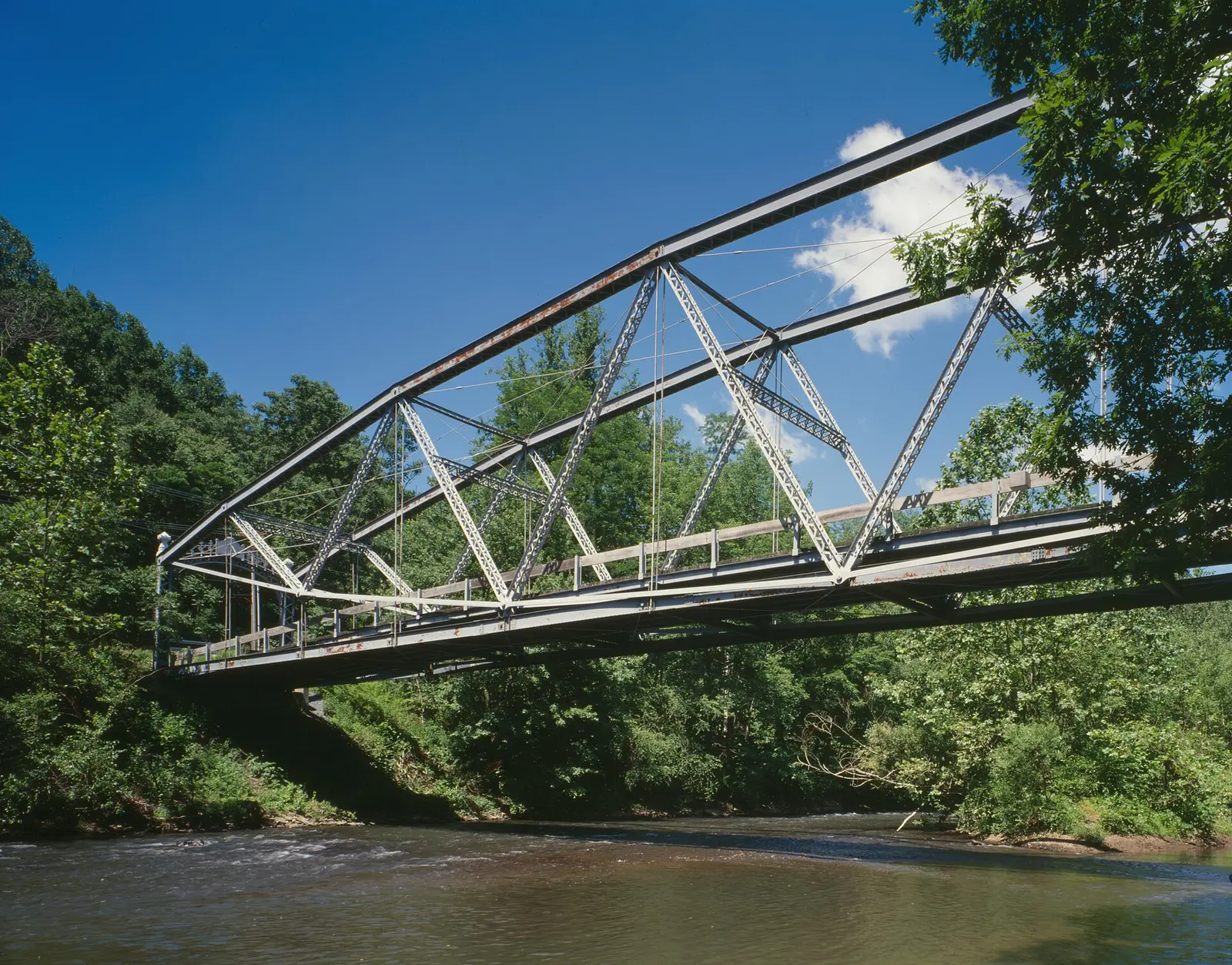

In Lebanon County, about 12 miles northwest of Lebanon, Swatara State Park covers about 3,517 acres.
Things to do include cross-country skiing, horseback riding, mountain biking, winter sports, and hunting in season. Its trail network totals roughly 34 miles, according to the park. On the water side, there is a boat ramp.
Hours
Park, gate, office and facility hours are listed separately because they often differ. Alerts above override normal hours.
| Facility | Days | Hours | Season |
|---|---|---|---|
| Park | Daily | sunrise – sunset | — |
Official wording
The park is open every day of the year, sunrise to sunset. Day use areas close at dusk. Areas of the park are open specific seasons and hours. Contact Memorial Lake State Park office for facility seasons and hours.
Source: official park page, checked Oct 29, 2026. Times are local to the park (America/New York).
Reservations
- Day use
- No day-use reservation requirement mentioned
- Booking system
- ReserveAmerica (Aspira), Pennsylvania State Parks contract
- Phone
- 888-PA-PARKS (888-727-2757)
We link to the official booking system rather than showing live availability, which changes minute to minute.
Things to do
BikingBoatingWinter sportsCross-country skiingFishingHikingHorseback ridingHuntingMountain bikingCanoeing and kayaking
Trails
| Trail | Length | Difficulty | Notes |
|---|---|---|---|
| Appalachian Trail | 2.4 mi | Most difficult | Recreations permitted: hiking, backpacking Trailhead amenities: benches The Appalachian Trail runs from Main to Georgia briefly passing through Swatara State Park. After passing under the Interstate 81 bridges, it follows a section of Old State Road, passes by an old historic silver mine, a historic canal lock and then crosses the Swatara Creek via the historic Waterville Bridge.HikingBackpacking |
| Bear Hole Trail | 4.8 mi | More difficult | Recreations permitted: hiking, biking, equestrian, cross-country skiing recommended, snowshoeing recommended Trailhead amenities: picnic tables, benches Running along the southern side of Swatara Creek, Bear Hole Trail is a wide, rolling trail for hiking and biking. Horses are permitted on the eastern side of Bear Hole Trail between Swopes Valley Road and Sand Siding Trail. The Bordner Cabin and Aycrigg's Falls area are located around the midpoint of the trail.HikingBikingEquestrianCross-country skiing recommendedSnowshoeing recommended |
| Mifflin Trail | 0.3 mi | More difficult | Recreations permitted: hiking, cross-country skiing recommended, snowshoeing recommended Trailhead amenities: none The trail follows the old access road to Lock 5 of the Union Canal Company's Branch Canal and the lock tender's house.HikingCross-country skiing recommendedSnowshoeing recommended |
| Moonshine Trail | 0.8 mi | Easiest | Recreations permitted: hiking, biking, cross-country skiing recommended, snowshoeing recommended Trailhead amenities: benches This trail was formerly State Route 443 and provides access from the intersection of present day State Route 443 and State Route 72 to Trout Run, the Swatara Rail Trail and the Swatara Creek.HikingBikingCross-country skiing recommendedSnowshoeing recommended |
| Mountain Bike Trail | 9.5 mi | Most difficult | Recreations permitted: hiking, mountain biking, snowshoeing recommended Trailhead amenities: picnic tables There are six trails that are all single track consisting of natural features (dirt trail surfaces, roots, logs, and natural stream crossings. They are accessible form the State Park Lane parking lots. Horses are prohibited on these trails.HikingMountain bikingSnowshoeing recommended |
| Pennsylvania Equine Council (PEC) Trail | 3.1 mi | More difficult | Recreations permitted: hiking, equestrian Trailhead amenities: none This trail begins and ends on the Swatara Rail Trail. It passes through forested and agricultural land.HikingEquestrian |
| PEC Connector Trail | 0.8 mi | More difficult | Recreations permitted: hiking, equestrian Trailhead amenities: none This trail begins and ends at the equine parking lot along State Route 443, east of Twin Grove Park. It passes through forested and agricultural lands. It provides a connection from the parking lot to the PEC Trail via the Swatara Rail Trail.HikingEquestrian |
| Portage Trail | 0.4 mi | Easiest | Recreations permitted: hiking, biking Trailhead amenities: none The trail connects State Park Lane to Moonshine Trail and the Swatara Rail Trail.HikingBiking |
| Round About Loop | 0.5 mi | Easiest | Recreations permitted: hiking, biking, snowshoeing recommended Trailhead amenities: none Access this trail from Lickdale Trailhead parking lot. This wide, flat, gravel hiking and biking trail loops around wetland habitat adjacent to the Swatara Creek and offers an excellent opportunity to listen to spring peepers.HikingBikingSnowshoeing recommended |
| Sand Siding Trail | 0.4 mi | Easiest | Recreations permitted: hiking, biking, equestrian, cross-country skiing recommended Trailhead amenities: benches The trail crosses over the Swatara Creek between Swatara Rail Trail and Bear Hole Trail. The trail includes the Sand Siding Bridge and is open to hiking, biking and horseback riding. Mounting blocks are provided on either end of the Sand Siding Bridge; horseback riders are asked to dismount and lead their horses across the bridge.HikingBikingEquestrianCross-country skiing recommended |
| State Park Lane Trail | 0.5 mi | More difficult | Recreations permitted: hiking, biking, cross-country skiing recommended, snowshoeing recommended Trailhead amenities: benches This trail runs southeast from the State Park Lane parking lot to the Swatara Rail Trail. The hiking and biking trail is wide, paved and steep. The trail intersects with Portage Trail and Swatara Rail Trail.HikingBikingCross-country skiing recommendedSnowshoeing recommended |
| Swatara Rail Trail | 10 mi | Easiest | Recreations permitted: hiking, biking, equestrian, cross-country skiing recommended, snowshoeing recommended Trailhead amenities: benches Swatara Rail Trail is ten miles in length from the Lickdale Interchange (Exit 90) of I-81 to the Pine Grove Interchange (Exit 100) of I-81. The trail grade is relatively flat, with variable surfaces (dirt, gravel, and pavement) requiring wide tires.HikingBikingEquestrianCross-country skiing recommendedSnowshoeing recommended |
| Trout Run Trail | 0.5 mi | More difficult | Recreations permitted: hiking, biking, snowshoeing recommended Trailhead amenities: non-flush restrooms, picnic tables, benches This half-mile hiking and biking trail is accessible from Trout Run Trailhead and intersects with Moonshine Trail on either end. The trail is narrow and multi-surface.HikingBikingSnowshoeing recommended |
Trail descriptions from the park
34 miles of trails
Park trails are generally flat and wide. Many small, connector trails allow hikers to create loops of various distances. Hikers can also hike the additional 9.8 miles of trails in the Mountain Biking Complex. Below are the main trails in the park.
Swatara State Park Map
Amenities
Facilities
- Picnic areas
Water
- Boat ramp
Recreation
- Horse trails
✓ listed by the park · ✕ the park says it is not available. Anything not shown here isn’t mentioned by the official source — that means unknown, not unavailable.
Accessibility
Swatara State Park offers a range of accessibility accommodations to ensure all visitors can enjoy its natural beauty and recreational opportunities.
Accessible Picnic Tables
ADA accessible picnic tables are located in the Trout Run Day Use Area. There is also an ADA restroom.
Hunting
Areas of the park provide accessible hunting via Bear Hole Trail.
Visitors holding a DCNR Mobility Device Permit can contact the park office for more information about accessible hunting locations within the park.
DCNR permits visitors with a DCNR Mobility Device Permit to use powered mobility devices on designated state park and forest lands, including administrative roads and trails not normally open to standard motorized vehicles.
Visitors interested in a DCNR Mobility Device Permit can fill out an application and submit it at any state park or forest office.
Bear Hole Trail is open to vehicles on the second Friday and Saturday of the month from March -November. Some additional dates may apply, please contact the park office.
On the days the trail is open to vehicles, a volunteer will open the gate for you. Access via the Swopes Valley Trailhead.
Official accessibility information
Conditions change. Contact the park to confirm specific accessible features before your visit.
Getting there
- Address
- 1450 Suedburg Road
Pine Grove, PA 17963 - Nearest town
- Lebanon — about 12 mi northwest (straight line)
- Coordinates
- 40.4830, -76.5456
- Phone
- (717) 865-6470
- memorialsp@pa.gov
Google Maps directionsApple MapsOfficial park map (PDF)
Directions from the park
Swatara State Park is in Lebanon and Schuylkill counties, 14 miles north of Lebanon and three miles west of Pine Grove. The park is easily reached from I-81. At Exit 90, Lickdale, follow PA 72 north; at Exit 100, take PA 443 west. GPS DD: Lat. 40.48305 Long. -76.54564
Nearby state parks
Sources and freshness
- Pennsylvania State Parks — park page — last checked Oct 29, 2026; page says updated Sep 4, 2026
- DCNR Find a Park: content-fragment JSON feed used by the pa.gov park finder
- Wikidata
- USGS PAD-US 4.1 (boundary and acreage)
- Photo: Waterville Bridge in Swatara State Park HAER 462-14.jpg — Public domain (US federal government work), Joseph Elliott, cropped by User:Ruhrfisch
“Last checked” is when our system last read the official source. No change has been detected since this page was first published. Hours, fees and rules can change without notice — confirm with the park before you go. Methodology