Ridley Creek State Park
Notice: Ridley Creek State Park will be holding its annual controlled deer hunts on 12/3 — details
- Status
- Open (per official listing)Daily sunrise – sunset
- Entrance fee
- Not posted
- Day-use reservations
- None mentioned
- Dogs
- Not stated — check with park
- Camping
- Yes
- Official site
- pa.gov(610) 892-3900
Official page last checked Oct 29, 2026. How we keep this current
Current alerts 3
Closure Ridley Creek State Park will be holding its annual controlled deer hunts on 12/3and 12/10 for the 2026 season to help control the local deer population. The entire park and part of Gradyville Road will be shutdown except for… (more)
and 12/10 for the 2026 season to help control the local deer population. The entire park and part of Gradyville Road will be shutdown except for those participating in the controlled shotgun hunt. These closures will remain in effect for the entire day on both 12/3 and 12/10. Please plan accordingly.
Posted by the park. Official alert
Alert As moon bounces become a more popular activity for children's parties- please note, these are not an approved form of recreation in the park and are not permitted.
Posted by the park. Official alert
Alert Please contact the park office with a request to hold an organized event (i.e.,a race) prior to reserving a pavilion.
Posted by the park. Official alert
Overview
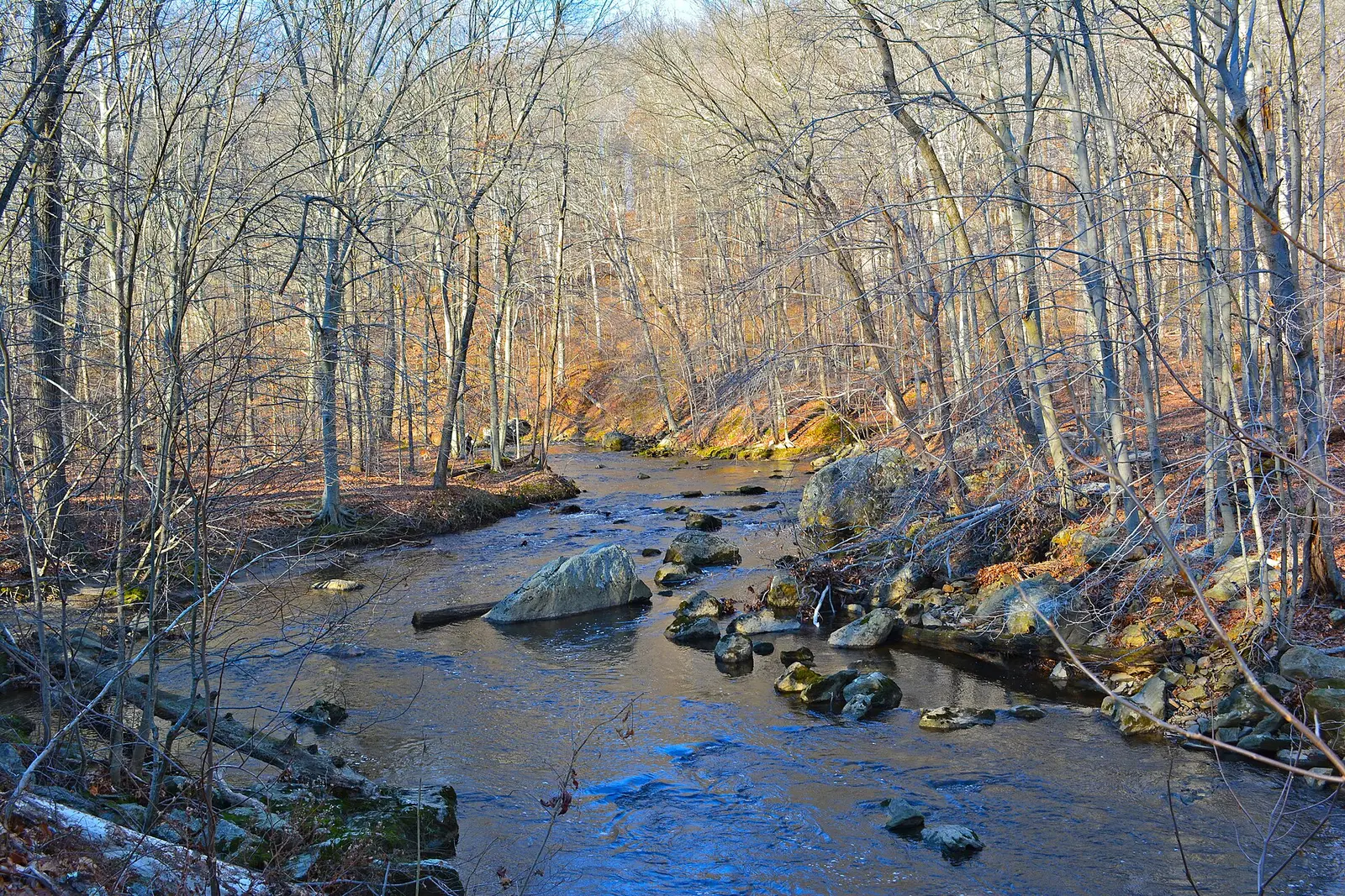

In Delaware County, about 4 miles northwest of Media, Ridley Creek State Park covers about 5,208 acres.
Visitors come for cross-country skiing, horseback riding, winter sports, hunting in season, and biking. The official site lists about 13 miles of trails. Facilities for water recreation include a fishing pier. Camping is available: campsites, including tent sites and group camping. The park says there are no showers.
Hours
Park, gate, office and facility hours are listed separately because they often differ. Alerts above override normal hours.
| Facility | Days | Hours | Season |
|---|---|---|---|
| Park | Daily | sunrise – sunset | — |
Official wording
The park is open every day of the year, sunrise to sunset, including the restrooms in picnic area 7 and 17. Day use areas close at dusk. The park office is open specific hours. Contact the park office for facility seasons and hours.
Source: official park page, checked Oct 29, 2026. Times are local to the park (America/New York).
Reservations
- Day use
- No day-use reservation requirement mentioned
- Booking system
- ReserveAmerica (Aspira), Pennsylvania State Parks contract
- Phone
- 888-PA-PARKS (888-727-2757)
We link to the official booking system rather than showing live availability, which changes minute to minute.
Camping
| Campground or site type | Sites | Hookups / features | Price |
|---|---|---|---|
| Organized Group Tenting Qualified organized groups can use the 120-person area from April to October. A restroom with flush toilets, but no showers, is available. | — | Showers | — |
Camping details from the park
Organized Group Tenting
Qualified organized groups can use the 120-person area from April to October. A restroom with flush toilets, but no showers, is available.
From the official park page, checked Oct 29, 2026. Site counts and prices can change; confirm when booking.
Things to do
PicnickingHikingWinter sportsCross-country skiingHuntingBikingHorseback ridingFishingCamping
Trails
| Trail | Length | Difficulty | Notes |
|---|---|---|---|
| Blue Trail | 3.7 mi | More difficult | Recreations permitted: hiking Trailhead amenities: modern restrooms, picnic tables Beginning near Picnic Area 9, this trail offers woodland scenery as it travels through the park and has a small loop near Picnic Area 14.Hiking |
| Bridle Trail | 4.7 mi | More difficult | Recreations permitted: hiking, equestrian Trailhead amenities: benches Beginning at the horse stables near the center of the park, the Bridle Trail follows two distinct loops through the northern section of the park.HikingEquestrian |
| Fishermans Trail | 0.34 mi | More difficult | Recreations permitted: hiking Trailhead amenities: picnic tables Beginning near Picnic Area 4, this trail provides access to great fishing areas.Hiking |
| Mansion Gardens Trail | 1 mi | Easiest | Recreations permitted: hiking Trailhead amenities: modern restroom, benches This paved loop is accessed near the parking lot at the mansion and travels around the historic gardens and mansion area.Hiking |
| Orange Trail | 2 mi | More difficult | Recreations permitted: hiking Trailhead amenities: none Traveling south from Gradyville Road, this trail is on the east side of Ridley Creek.Hiking |
| Sycamore Mills Road Trail | 4.3 mi | Easiest | Recreations permitted: hiking, biking Trailhead amenities: modern restroom, picnic tables, benches This paved, multiuse trail travels through the woods, by the agricultural fields, and next to Ridley Creek. It offers great views, easy exercising, and great fishing opportunities.HikingBiking |
| White Trail | 4.3 mi | More difficult | Recreations permitted: hiking Trailhead amenities: modern restroom, picnic tables, benches This meandering trail loops through the park and can be used to link to other trails.Hiking |
| Yellow Trail | 3.7 mi | More difficult | Recreations permitted: hiking Trailhead amenities: modern restroom, picnic tables, benches Accessed from Picnic Area 16 or the park office/mansion area, this trail meanders throughout a majority of the park and intersects many other trails.Hiking |
Trail descriptions from the park
13 miles of trails
The trails pass through a variety of habitats throughout the central portion of the park.
Ridley Creek State Park Map
Amenities
Facilities
- Picnic areas
- Picnic shelters
- Playground
- Group facilities
- Showers: not available (stated by the park)
Water
- Fishing pier
Camping
- Tent camping
- Group camping
Recreation
- Horse trails
✓ listed by the park · ✕ the park says it is not available. Anything not shown here isn’t mentioned by the official source — that means unknown, not unavailable.
Accessibility
Ridley Creek State Park offers a range of accessibility accommodations to ensure all visitors can enjoy its natural beauty and recreational opportunities.
Accessible Picnic Tables
ADA accessible picnic tables are located near the ADA fishing pier. Access these via Barren Road gate entrance and park at the ADA fishing pier.
Pavilion 11A
Pavilion 11A can accommodate up to 80 people with 10 picnic tables. Domestic pets are available.
Pavilion 11B
Pavilion 11B can accommodate up to 80 people with 10 picnic tables. Domestic pets are allowed.
Fishing Access
An accessible fishing platform is located off of Sycamore Mills Road Trail.
Sycamore Mills Road Trail
4.3 miles | Easiest hiking | Loop trail | No blazes
Read more from the park
Recreations permitted: hiking, biking
Trailhead amenities: modern restroom, picnic tables, benches
This paved, multiuse trail travels through the woods, by the agricultural fields, and next to Ridley Creek. It offers great views, easy exercising, and great fishing opportunities.
The trail can be accessed from any of the following parking areas: mansion, area 11, 12, 14, 15, 17.
Sycamore Mills Road Trail
4.3 miles | Easiest hiking | Loop trail | No blazes
Recreations permitted: hiking, biking
Hunting
This park offers accessible hunting options. Visitors holding a DCNR Mobility Device Permit can contact the park office for more information about accessible hunting locations within the park.
DCNR permits visitors with a DCNR Mobility Device Permit to use powered mobility devices on designated state park and forest lands, including administrative roads and trails not normally open to standard motorized vehicles.
Visitors interested in a DCNR Mobility Device Permit can fill out an application and submit it at any state park or forest office.
Sensory Playground
A sensory playground is located in Area 8. Access from South Sandy Flash Drive, Area 8 is to the left.
Note: this sensory playground is not ADA accessible.
Communication Board
A communication board, a large visual aid that uses pictures and words to help non-verbal individuals express their needs, thoughts, and feelings, is located at the playground in Area 8.
Take the accessible Sycamore Mills Road Trail to access many wildlife viewing opportunities throughout the park.
Official accessibility information
Conditions change. Contact the park to confirm specific accessible features before your visit.
Getting there
- Address
- 400 Gradyville Road
Newton Square, PA 19073 - Nearest town
- Media — about 4 mi northwest (straight line)
- Coordinates
- 39.9507, -75.4518
- Phone
- (610) 892-3900
- ridleycreeksp@pa.gov
Google Maps directionsApple MapsOfficial park map (PDF)
Directions from the park
The main entrance to Ridley Creek State Park is Sandy Flash Drive South at Gradyville Road. For GPS directions, use Ridley Creek State Park Entrance GPS Decimal Degrees: Latitude 39.95065 Longitude -75.45175
Nearby state parks
Sources and freshness
- Pennsylvania State Parks — park page — last checked Oct 29, 2026; page says updated Sep 4, 2026
- DCNR Find a Park: content-fragment JSON feed used by the pa.gov park finder
- Wikidata
- USGS PAD-US 4.1 (boundary and acreage)
- Photo: Ridley Creek in SP Tgiving.JPG — CC0 1.0 (public domain dedication), Smallbones
“Last checked” is when our system last read the official source. No change has been detected since this page was first published. Hours, fees and rules can change without notice — confirm with the park before you go. Methodology