Kings Gap Environmental Education Center
- Status
- Status not postedDaily sunrise – sunset
- Entrance fee
- Not posted
- Day-use reservations
- None mentioned
- Dogs
- Not stated — check with park
- Camping
- Yes
- Official site
- pa.gov(717) 486-5031
Official page last checked Oct 29, 2026. How we keep this current
Overview
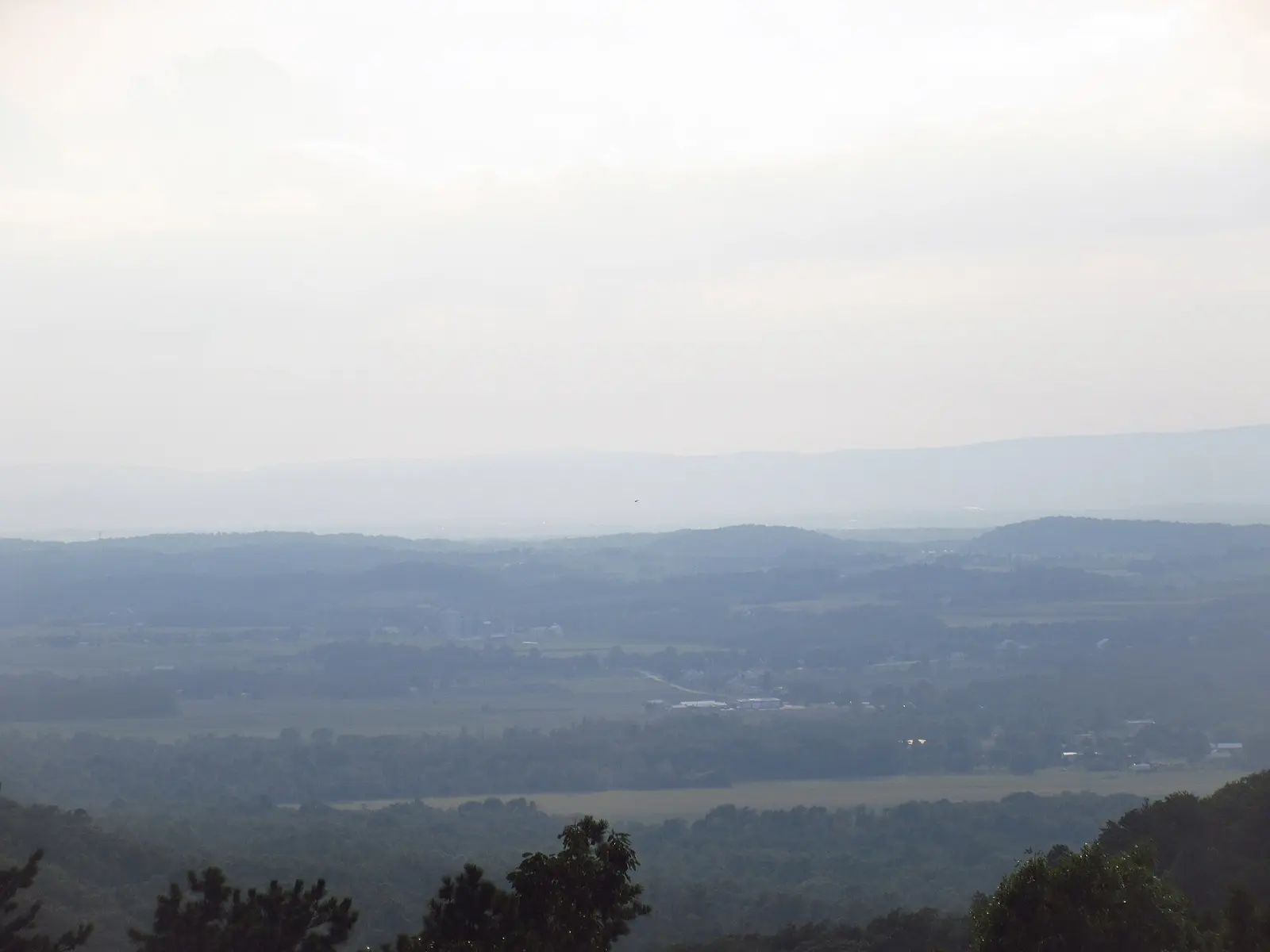

Covering about 2,324 acres, Kings Gap Environmental Education Center lies in Cumberland County, about 8 miles southwest of Carlisle.
Visitors come for hunting in season, hiking, and picnicking. The official site lists about 25 miles of trails. Overnight options include campsites, with tent sites and group camping.
Hours
Park, gate, office and facility hours are listed separately because they often differ. Alerts above override normal hours.
| Facility | Days | Hours | Season |
|---|---|---|---|
| Park | Daily | sunrise – sunset | — |
Official wording
The park is open every day of the year, sunrise to sunset. Day use areas close at dusk. The center office is open specific hours. Contact the center office for facility seasons and hours.
Source: official park page, checked Oct 29, 2026. Times are local to the park (America/New York).
Reservations
- Day use
- No day-use reservation requirement mentioned
- Booking system
- ReserveAmerica (Aspira), Pennsylvania State Parks contract
- Phone
- 888-PA-PARKS (888-727-2757)
We link to the official booking system rather than showing live availability, which changes minute to minute.
Camping
| Campground or site type | Sites | Hookups / features | Price |
|---|---|---|---|
| Organized Group Tenting This wooded area located in the Kings Gap Hollow Use Area has one site with a capacity of 30 people and may be reserved mid-April to mid-November by organized adult or youth groups.
Make reservations online up until three days in advance. Reservations two days or less in advance can be made by contacting the center’s office at 717-486-5031, 8:00 A.M. - 4:00 P.M., Monday to Friday. | — | — |
Camping details from the park
Organized Group Tenting
This wooded area located in the Kings Gap Hollow Use Area has one site with a capacity of 30 people and may be reserved mid-April to mid-November by organized adult or youth groups.
Make reservations online up until three days in advance. Reservations two days or less in advance can be made by contacting the center’s office at 717-486-5031, 8:00 A.M. - 4:00 P.M., Monday to Friday.
From the official park page, checked Oct 29, 2026. Site counts and prices can change; confirm when booking.
Things to do
HikingHuntingPicnickingCamping
Trails
| Trail | Length | Difficulty | Notes |
|---|---|---|---|
| 1. Pines Trail | 0.6 mi | Easiest | Recreations permitted: hiking Trailhead amenities: non-flush restrooms, picnic tables, benches This loop trail on soft pine needles takes hikers through the heart of the 42-acre coniferous forest which was planted in the 1950s.Hiking |
| 2. Whispering Pines Trail | 0.3 mi | Easiest | Recreations permitted: hiking Trailhead amenities: non-flush restrooms, picnic tables, benches ♿ This paved, ADA accessible trail takes hikers into the pine forest. Self-guided signs along the way teach about the history of the forest and the trees that grow there.Hiking |
| 3. Rock Scree Trail | 1.9 mi | More difficult | Recreations permitted: hiking Trailhead amenities: none This linear trail connects the Pines and Mansion areas by crossing over the ridge and rocky outcrop where Antietam quartzite was quarried to construct the mansion.Hiking |
| 4. Ridge Overlook | 0.8 mi | Most difficult | Recreations permitted: hiking Trailhead amenities: none This linear, ridge-top trail with boulder outcrops and a view of the valley below presents a more challenging hike. Rock Scree and Kings Gap Hollow trails provide access to Ridge Overlook Trail.Hiking |
| 5. Forest Heritage Trail | 1.8 mi | More difficult | Recreations permitted: hiking Trailhead amenities: none This loop trail reveals another part of the area's rich history, passing several charcoal hearths that have been unused for over 100 years. Maple Hollow and Rock Scree trails provide access to Forest Heritage Trail.Hiking |
| 6. Maple Hollow Trail | 1.3 mi | More difficult | Recreations permitted: hiking Trailhead amenities: picnic tables, benches This loop trail traverses a hollow with rich soils, plentiful water, and resulting maple forest.Hiking |
| 7. Woodland Ecology Trail | 0.6 mi | Easiest | Recreations permitted: hiking Trailhead amenities: benches Signs placed along this mossy loop trail help hikers to interpret forest ecology and identify plants. Hikers can enjoy wild azalea and mountain laurel blooming in May.Hiking |
| 8. Scenic Vista Trail | 2.5 mi | More difficult | Recreations permitted: hiking Trailhead amenities: non-flush restrooms at Kings Gap Hollow Area, picnic tables, benches Traveling between the Scenic Vista parking area and the Kings Gap Hollow Days Use Area, the trail through the forest has a scenic vista mid-way along the trail.Hiking |
| 9. White Oaks Trail | 0.3 mi | Easiest | Recreations permitted: hiking Trailhead amenities: non-flush restrooms, picnic tables, benches This paved trail has educational signs about the ecology of the forest.Hiking |
| 10. Watershed Trail | 1.9 mi | More difficult | Recreations permitted: hiking Trailhead amenities: non-flush restrooms at Kings Gap Hollow Day Use Area, picnic tables, benches From the Kings Gap Hollow Day Use Area, this trail wanders along a bubbling creek then loops around through the forest. Watershed Trail also connects to the pond and Pond Parking Area.Hiking |
| 11. Boundary Trail | 2.4 mi | Most difficult | Recreations permitted: hiking Trailhead amenities: none Listen for birds and enjoy the solitude of the forest as you hike one of the park's most challenging trails.Hiking |
| 12. Kings Gap Hollow Trail | 2.4 mi | More difficult | Recreations permitted: hiking Trailhead amenities: modern restrooms, potable water, picnic tables, and benches in Mansion Day Use Area From the Mansion Use Area, the trail first leads through an oak forest. The trail then wanders along Kings Gap Hollow Run, a clear stream full of tiny waterfalls, to the Pump House Parking Area.Hiking |
| 13. Locust Point Trail | 1 mi | Most difficult | Recreations permitted: hiking Trailhead amenities: none This trail is an alternative route off Boundary Trail. It travels through woods to an opening created by fallen locust trees and offers a scenic view of Kings Gap Hollow in the winter.Hiking |
| 14. Buck Ridge Trail | 1.8 mi | Most difficult | Recreations permitted: hiking Trailhead amenities: modern restrooms, potable water, picnic tables, and benches in Mansion Day Use Area This challenging, rocky trail overlaps with Scenic Vista Trail until splitting off into Michaux State Forest. The trail then follows a network of foot paths and old logging roads leading to Pine Grove Furnace State Park for a total of 6.0 miles.Hiking |
| 15. Black Gum Trail | 1.1 mi | More difficult | Recreations permitted: hiking Trailhead amenities: picnic tables, benches This linear trail with an abundance of black gum (tupelo) trees follows the southwestern contour of the mountainside near the Mansion Area. For a longer hike, continue hiking on Kings Gap Hollow Trail or Forest Heritage Trail.Hiking |
| 16. Nature Trail | 0.2 mi | Easiest | Recreations permitted: hiking Trailhead amenities: modern restrooms, potable water, picnic tables, benches This short trail loops around the Education Building, guiding walkers on a mostly level circuit through open forest and berried understory.Hiking |
| 17. Cold Spring Overlook Trail | 0.5 mi | Easiest | Recreations permitted: hiking Trailhead amenities: none This out-and-back trail travels up from the Scenic Vista Trail, and then turns along the center's eastern boundary providing great views down to Cold Springs Hollow. The trail ends abruptly before an area with steep elevation.Hiking |
| 18. Upper Irish Gap Hollow Trail | 0.4 mi | Easiest | Recreations permitted: hiking Trailhead amenities: picnic tables This trail meanders along the idyllic Irish Gap Hollow Run, with many wooden bridges and natural stone crossings.Hiking |
| 19. Two Hollows Trail | 0.9 mi | More difficult | Recreations permitted: hiking Trailhead amenities: none This trail links the Lower Irish Gap Trail with the Boundary Trail for a longer hike.Hiking |
| 20. Lower Irish Gap Hollow Trail | 0.6 mi | More difficult | Recreations permitted: hiking Trailhead amenities: picnic tables From the Pine Brook Day Use Parking Area, hike down to the creek and find the remains of an old rock dam.Hiking |
| 21. Forest Pools Trail | 1.2 mi | Easiest | Recreations permitted: hiking Trailhead amenities: picnic tables, benches This trail loops through mixed forest in the Forest Pools Area, taking the hiker by several vernal pools. Educational kiosks explain the methods used to restore these special habitats.Hiking |
Trail descriptions from the park
25 miles of trails
Sturdy footwear is recommended due to the rocky footing on most trails.
Trails are well marked, but taking a trail map on your hike is strongly recommended. Maps are available at the trailhead parking areas and the center office. Distances listed are one-way.
Kings Gap Environmental Education Center Map
Amenities
Facilities
- Picnic areas
- Picnic shelters
- Visitor center
- Nature center or museum
- Group facilities
Camping
- Tent camping
- Group camping
✓ listed by the park · ✕ the park says it is not available. Anything not shown here isn’t mentioned by the official source — that means unknown, not unavailable.
Accessibility
Kings Gap Environmental Education Center offers a range of accessibility accommodations to ensure all visitors can enjoy its natural beauty and recreational opportunities.
Mansion - Kings Gap Suite
The Kings Gap Suite in the Mansion can accommodate 4 people.
Accessible Picnic Tables
ADA accessible picnic tables are available throughout the Mansion Use Area and the Kings Gap Hollow Area.
Mansion Pavilion
The Mansion Pavilion can accommodate up to 48 people with 6 picnic tables.
Hiking
Whisptering Pines Trail
0.3 mile | Easiest hiking | Loop trail | No blazes
Recreations permitted: hiking
Trailhead amenities: non-flush restrooms, picnic tables, benches
This paved, ADA accessible trail takes hikers into the pine forest. Self-guided signs along the way teach about the history of the forest and the trees that grow there.
Read more from the park
Hunting
The Whispering Pines Trail, a paved ADA accessible trail, offers access to areas of the park where bow hunting is permitted. Contact the park office for more information.
The Education Building offers an accessible bird watching station.
Enjoy a driving tour along the park's main road which offers grand views, a pass through the park’s historic buildings, and glimpses into the a variety of forested wildlife habitat.
Environmental Education and Visitor Centers
In the Training Center, the Irish Gap Room and the Kings Gap Room are ADA accessible.
In the Kings Gap Environmental Education Center, the Jennings Room and the Kings Gap Room are ADA accessible.
Official accessibility information
Conditions change. Contact the park to confirm specific accessible features before your visit.
Getting there
- Address
- 500 Kings Gap Road
Carlisle, PA 17015-9306 - Nearest town
- Carlisle — about 8 mi southwest (straight line)
- Coordinates
- 40.0932, -77.2683
- Phone
- (717) 486-5031
- kingsgapsp@pa.gov
Google Maps directionsApple MapsOfficial park map (PDF)
Directions from the park
From Interstate 81, take Exit 37. • Travel south on PA 233 for about 2.3 miles. • Turn left onto Pine Road and continue 2.2 miles. • Turn right onto Kings Gap Road. The Cameron-Masland Mansion is 3.5 miles from the center’s entrance. Follow the winding, paved road to the top of the mountain. In the Mansion Area, bear left to follow the one-way directional signs. Parking is available in several lots adjacent to the education building and mansion. GPS DD: Lat. 40.09321 Long. -77.2683
Nearby state parks
Sources and freshness
- Pennsylvania State Parks — park page — last checked Oct 29, 2026; page says updated Jan 28, 2026
- DCNR Find a Park: content-fragment JSON feed used by the pa.gov park finder
- Wikidata
- USGS PAD-US 4.1 (boundary and acreage)
- Photo: KingsGapoverlook.JPG — Public domain (released by the author)
“Last checked” is when our system last read the official source. No change has been detected since this page was first published. Hours, fees and rules can change without notice — confirm with the park before you go. Methodology