South Mountains State Park
Notice: Clear Creek Access (Day Use Only) – Closed for Construction — details
- Status
- Open (per official listing)
- Entrance fee
- Statewide rule — see below
- Day-use reservations
- None mentioned
- Dogs
- Dogs allowed6-ft leash
- Camping
- Yes
- Official site
- ncparks.gov(828) 433-4772
Official page last checked Oct 29, 2026. How we keep this current
Current alerts 2
Closure Clear Creek Access (Day Use Only) – Closed for Constructionclosed
Posted by the park. Official alert
Partial closure Bike & Bridle Trails: Open/ClosedEquestrian trails at Jacob Fork access are open. Clear Creek access is closed due to construction. There is no trail access for mountain biking at… (more)
Equestrian trails at Jacob Fork access are open. Clear Creek access is closed due to construction. There is no trail access for mountain biking at this time.
Posted by the park. Official alert
Overview
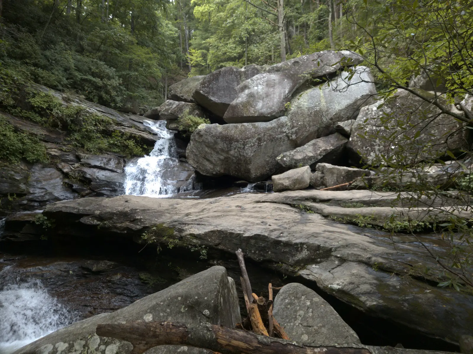

South Mountains State Park is a park in Burke County, about 12 miles southeast of Morganton.
Visitors come for horseback riding, canoeing and kayaking, biking, fishing, and hiking. The official site lists about 50 miles of trails.
Hours
Park, gate, office and facility hours are listed separately because they often differ. Alerts above override normal hours.
| Facility | Days | Hours | Season |
|---|---|---|---|
| Other — January | Daily | 7 a.m. – 7 p.m. | — |
| Other — March | Daily | 7 a.m. – 9 p.m. | — |
| Other — May | Daily | 7 a.m. – 10 p.m. | — |
| Other — November | Daily | 7 a.m. – 8 p.m. | — |
| Park | The park is closed on Christmas Day. The park is open during all other holidays. | ||
| Visitor center | Daily | 8 a.m. – 5 p.m. | — |
Official wording
January: 7 a.m. to 7 p.m.
February: 7 a.m. to 7 p.m.
March: 7 a.m. to 9 p.m.
April: 7 a.m. to 9 p.m.
May: 7 a.m. to 10 p.m.
June: 7 a.m. to 10 p.m.
July: 7 a.m. to 10 p.m.
August: 7 a.m. to 10 p.m.
September: 7 a.m. to 10 p.m.
October: 7 a.m. to 9 p.m.
November: 7 a.m. to 8 p.m.
December: 7 a.m. to 7 p.m.
The park is closed on Christmas Day. The park is open during all other holidays.
Visitor Center: Open daily from 8 a.m. to 5 p.m.
Open daily from 8 a.m. to 5 p.m.
Source: official park page, checked Oct 29, 2026. Times are local to the park (America/New York).
Fees and passes
Free entry at most parks ('Most state parks are free to enter'); per-vehicle day-use fees at the reservoir SRAs (Falls Lake, Jordan Lake, Kerr Lake) and fees for swimming, boat launches, rentals, ferries and camping.
Statewide fee rule from North Carolina's park system; this park’s page doesn’t list its own fees.
North Carolina park passes
- Annual Pass for Reservoirs — $70 Details
- Annual Pass — $100 Details
- Annual Pass with 4WD Beach Access — $200. Annual Pass benefits plus four-wheel-drive beach access Details
From the North Carolina state guide. Confirm which passes this park accepts.
Reservations
- Day use
- No day-use reservation requirement mentioned
- Booking system
- ReserveAmerica (northcarolinastateparks.reserveamerica.com)
- Phone
- 1-877-722-6762
We link to the official booking system rather than showing live availability, which changes minute to minute.
Pets
Dogs allowed · leash up to 6 feet
Pets are allowed at the park and at campsites. Pets must be on an attended leash of no longer than 6 feet at all times.
Service animals are generally permitted where pets are not. Check with the park for specific areas.
Camping
Camping
- Tent sites (including backpacking sites)
- Trailer and RV sites (some with electric hookups)
- Equestrian campsites
- Showers
- Firewood
Camping facilities are located at the Jacob Fork access only. There are currently no camping facilities at Clear Creek access.
Camping
Camping
SVG
Make a Camping Reservation
Find and book a campsite online at ncparks.gov/reservations or call 1-877-722-6762
From the official park page, checked Oct 29, 2026. Site counts and prices can change; confirm when booking.
Things to do
HikingBikingHorseback ridingFishingPicnickingCanoeing and kayaking
Trails
| Trail | Length | Difficulty | Notes |
|---|---|---|---|
| Chestnut Knob Trail | 2.6 mi | Strenuous | 2.6-mile one way; Blaze: white diamondsHiking only |
| Hemlock Nature Trail | 0.3 mi | Easy | 0.3-mile one way; Blaze: white trianglesHiking only |
| Hidden Cove Trail | 1.5 mi | Moderate | 1.5-mile one way; Blaze: orange diamondsHiking only |
| High Shoals Falls Loop Trail | 2.7 mi | Strenuous | 2.7-mile loop; Blaze: blue circlesHiking only |
| Jacob Branch Trail | 1.1 mi | Moderate | 1.1-mile one way; Blaze: red hexagonHiking only |
| Possum Trail | 1.8 mi | Strenuous | 1.8-mile one way; Blaze: red squaresHiking only |
| River / K.I.P. Track Trail | 0.5 mi | Easy | 0.5-mile one way; Blaze: red trianglesHiking only |
| Shinny Trail | 2.6 mi | Strenuous | 2.6-mile one way; Blaze: blue diamondsHiking only |
| Headquarters Trail | 1.9 mi | Strenuous | 1.9-mile one way; Blaze: orange hexagonsBikingHiking |
| Fox Trail | 3.6 mi | Strenuous | 3.6-mile one way; Blaze: white hexagonsBridleHiking |
| Horseridge Trail | 3.3 mi | Strenuous | 3.3-mile one way; Blaze: orange squaresBridleHiking |
| Little River Trail | 2.1 mi | Moderate | 2.1-mile one way; Blaze: blue trianglesBridleHiking |
| Saddleback Trail | 3.4 mi | Moderate | 3.4-mile one way; Blaze: red circlesBridleHiking |
| Sawtooth Trail | 2.2 mi | Strenuous | 2.2-mile one way; Blaze: blue hexagonsBridleHiking |
| Turkey Ridge Trail | 1.7 mi | Moderate | 1.7-mile one way; Blaze: orange circlesBridleHiking |
| Upper CCC Trail | 1.6 mi | Moderate | 1.6-mile one way; Blaze: red diamondsBridleHiking |
| Benn Knob Trail | 3 mi | Moderate | 3-mile one way; Blaze: orange trianglesBikingBridleHiking |
| Lower CCC Trail | 2.5 mi | Moderate | 2.5-mile one way; Blaze: blue squaresBikingBridleHiking |
| Raven Rock Trail | 5.2 mi | Strenuous | 5.2-mile one way; Blaze: white circlesBikingBridleHiking |
| Upper Falls Trail | 3.7 mi | Strenuous | 3.7-mile one way; Blaze: white squaresBikingBridleHiking |
| Lake View Trail | 1.3 mi | Moderate | 1.3-mile loop; Blaze: red rectanglesHiking only |
| Clear Creek Trail | 2.2 mi | Strenuous | 2.2-mile one way; Blaze: white circlesBridleHiking |
| Bridle Ride: Saddleback Loop | 7.9 mi | Easy to Strenuous | 7.9-mile loop; Blaze: yellow outline in bridle trails mapBridleHiking |
| Bridle Ride: Fox Loop | 14.4 mi | Easy to Strenuous | 14.4-mile loop; Blaze: blue outline in bridle trails mapBridleHiking |
| Bridle Ride: Perimeter Loop | 19 mi | Easy to Strenuous | 19-mile loop; Blaze: purple outline in bridle trails mapBridleHiking |
| Bridle Ride: Sawtooth Loop | 10.3 mi | Moderate to Strenuous | 10.3-mile loop; Blaze: green outline in bridle trails mapBridleHiking |
| Bridle Ride: Upper Falls In and Back | 9.6 mi | Moderate to Strenuous | 9.6-mile loop; Blaze: orange outline in bridle trails mapBridleHiking |
Trail descriptions from the park
Hiking Trails: Mostly Open. Headquarters, Shinny, Possum, and High Shoals Falls Loop trails at Jacob Fork access remain closed. Clear Creek access is closed due to construction.
Bike & Bridle Trails: Open/Closed. Equestrian trails at Jacob Fork access are open. Clear Creek access is closed due to construction. There is no trail access for mountain biking at this time.
Chestnut Knob Trail (2.6-mile one way; Blaze: white diamonds), Strenuous, Hiking only
Hemlock Nature Trail (0.3-mile one way; Blaze: white triangles), Easy, Hiking only
Hidden Cove Trail (1.5-mile one way; Blaze: orange diamonds), Moderate, Hiking only
High Shoals Falls Loop Trail (2.7-mile loop; Blaze: blue circles), Strenuous, Hiking only
Jacob Branch Trail (1.1-mile one way; Blaze: red hexagon), Moderate, Hiking only
Possum Trail (1.8-mile one way; Blaze: red squares), Strenuous, Hiking only
River / K.I.P. Track Trail (0.5-mile one way; Blaze: red triangles), Easy, Hiking only
Shinny Trail (2.6-mile one way; Blaze: blue diamonds), Strenuous, Hiking only
Headquarters Trail (1.9-mile one way; Blaze: orange hexagons), Strenuous, Biking/hiking
Fox Trail (3.6-mile one way; Blaze: white hexagons), Strenuous, Bridle/hiking
Horseridge Trail (3.3-mile one way; Blaze: orange squares), Strenuous, Bridle/hiking
Little River Trail (2.1-mile one way; Blaze: blue triangles), Moderate, Bridle/hiking
Saddleback Trail (3.4-mile one way; Blaze: red circles), Moderate, Bridle/hiking
Sawtooth Trail (2.2-mile one way; Blaze: blue hexagons), Strenuous, Bridle/hiking
Turkey Ridge Trail (1.7-mile one way; Blaze: orange circles), Moderate, Bridle/hiking
Upper CCC Trail (1.6-mile one way; Blaze: red diamonds), Moderate, Bridle/hiking
Benn Knob Trail (3-mile one way; Blaze: orange triangles), Moderate, Biking/bridle/hiking
Lower CCC Trail (2.5-mile one way; Blaze: blue squares), Moderate, Biking/bridle/hiking
Raven Rock Trail (5.2-mile one way; Blaze: white circles), Strenuous, Biking/bridle/hiking
Upper Falls Trail (3.7-mile one way; Blaze: white squares), Strenuous, Biking/bridle/hiking
Lake View Trail (1.3-mile loop; Blaze: red rectangles), Moderate, Hiking only
Clear Creek Trail (2.2-mile one way; Blaze: white circles), Strenuous, Bridle/hiking
Bridle Ride: Saddleback Loop (7.9-mile loop; Blaze: yellow outline in bridle trails map), Easy to Strenuous, Bridle/hiking
Bridle Ride: Fox Loop (14.4-mile loop; Blaze: blue outline in bridle trails map), Easy to Strenuous, Bridle/hiking
Bridle Ride: Perimeter Loop (19-mile loop; Blaze: purple outline in bridle trails map), Easy to Strenuous, Bridle/hiking
Bridle Ride: Sawtooth Loop (10.3-mile loop; Blaze: green outline in bridle trails map), Moderate to Strenuous, Bridle/hiking
Bridle Ride: Upper Falls In and Back (9.6-mile loop; Blaze: orange outline in bridle trails map), Moderate to Strenuous, Bridle/hiking
Boating and paddling
Paddling
Fishing
Fishing
Fishing
A state fishing license is usually required.
Amenities
Facilities
- Picnic areas
- Picnic shelters
- Visitor center
- Nature center or museum
- Parking
- Amphitheater
Recreation
- Horse trails
✓ listed by the park · ✕ the park says it is not available. Anything not shown here isn’t mentioned by the official source — that means unknown, not unavailable.
Getting there
- Address
- 5999 Branstrom Orchard St.
Morganton, NC 28655 - Nearest town
- Morganton — about 12 mi southeast (straight line)
- Coordinates
- 35.5963, -81.6000
- Phone
- (828) 433-4772
- south.mountains@ncparks.gov
Entrances
- Jacob Fork Access and Visitor Center — 3001 South Mountain Park Ave., Connelly Springs, NC 28612
- Clear Creek Access (Day Use Only) – Closed for Construction — 5999 Branstrom Orchard St., Morganton, NC 28655
Nearby state parks
Sources and freshness
- North Carolina State Parks — park page — last checked Oct 29, 2026
- NC State Parks 'Catalog: Find a State Park Access' (paged Drupal view, ?page=0..6)
- Wikidata
- Photo: Big Bear Falls.png — CC0 1.0 (public domain dedication), Porotoman99
“Last checked” is when our system last read the official source. No change has been detected since this page was first published. Hours, fees and rules can change without notice — confirm with the park before you go. Methodology