Indian Cave State Park
- Status
- Open (per official listing)
- Entrance fee
- Not posted
- Day-use reservations
- None mentioned
- Dogs
- Not stated — check with park
- Camping
- Yes
- Official site
- outdoornebraska.gov(402) 883-2575
Official page last checked Oct 29, 2026. How we keep this current
Overview
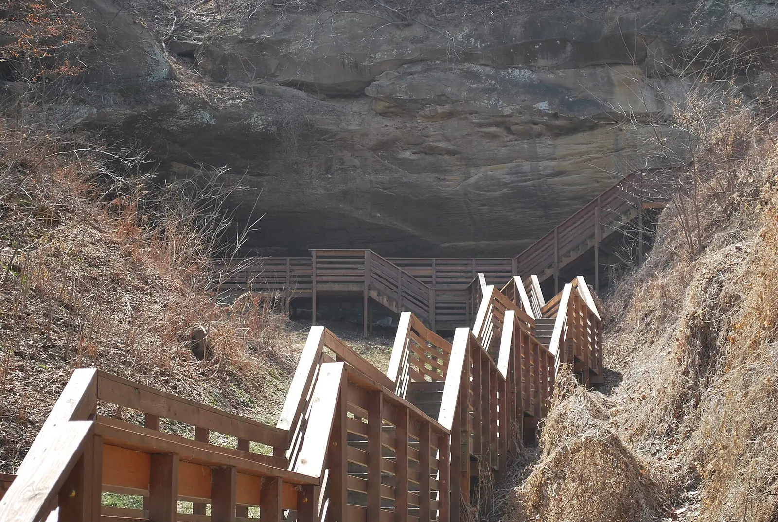

Covering about 6,654 acres, Indian Cave State Park lies in Nemaha & Richardson County, about 11 miles south of Rock Port.
Popular activities here are horseback riding, historic sites, hunting in season, boating, and fishing. Water access includes a boat ramp. Overnight options include campsites, with tent sites and showers.
Camping
| Campground or site type | Sites | Hookups / features | Price |
|---|---|---|---|
| Camping Park-level flags from NGPC GIS; individual campgrounds and site counts not published in this source. | — | ElectricShowers | — |
Camping details from the park
Camping: Yes. Site types: pads with electric, non-pad sites with electric, non-pad sites without electric. Facilities in park: showers, dump station, drinking water, modern restrooms.
From the official park page, checked Oct 29, 2026. Site counts and prices can change; confirm when booking.
Things to do
CampingBoatingFishingPicnickingHikingHorseback ridingBikingHuntingWildlife viewing and birdingHistoric sites and tours
Trails
| Trail | Length | Difficulty | Notes |
|---|---|---|---|
| East Fishing Access Trail | 0.02 mi | — | Status: Open Restricted (lengths summed from GIS segments)HikeMountain BikeDog SledSnowshoeCross Country SkiNative Material surface |
| West Fishing Access Trail | 0.1 mi | — | Status: Open Restricted (lengths summed from GIS segments)HikeMountain BikeDog SledSnowshoeCross Country SkiNative Material surface |
| North Ridge Trail | 1.6 mi | — | Status: Open Restricted (lengths summed from GIS segments)HikeMountain BikeDog SledSnowshoeCross Country SkiNative Material surface |
| Lincoln Bend Wetland Trail | 1.69 mi | — | Status: Open Restricted (lengths summed from GIS segments)HikeMountain BikeDog SledSnowshoeCross Country SkiNative Material surface |
| Cave Trail | 0.95 mi | — | Status: Open Restricted (lengths summed from GIS segments)HikeMountain BikeDog SledSnowshoeCross Country SkiNative Material surface |
| Lower Rock Bluff Run Trail | 0.5 mi | — | Status: Open Restricted (lengths summed from GIS segments)HikeMountain BikeDog SledSnowshoeCross Country SkiNative Material surface |
| East Ridge Trail | 1.14 mi | — | Status: Open Restricted (lengths summed from GIS segments)HikeMountain BikeDog SledSnowshoeCross Country SkiNative Material surface |
| Hardwood Trail | 8.55 mi | — | Status: Open Restricted (lengths summed from GIS segments)HikeMountain BikeDog SledSnowshoeCross Country SkiEquestrianNative Material surface |
| Rock Bluff Run Trail | 4.11 mi | — | Status: Open Restricted (lengths summed from GIS segments)HikeMountain BikeEquestrianDog SledSnowshoeCross Country SkiNative Material surface |
| St. Deroin Trail | 0.1 mi | — | Status: Open Restricted (lengths summed from GIS segments)HikeCross Country SkiHard Surface surface |
| North Loop Trail | 0.94 mi | — | Status: Open Restricted (lengths summed from GIS segments)HikeMountain BikeDog SledSnowshoeCross Country SkiNative Material surface |
| History Trail | 2.3 mi | — | Status: Open Restricted (lengths summed from GIS segments)HikeMountain BikeDog SledSnowshoeCross Country SkiNative Material surface |
Trail descriptions from the park
East Fishing Access Trail (0.02 mi) West Fishing Access Trail (0.1 mi) North Ridge Trail (1.6 mi) Lincoln Bend Wetland Trail (1.69 mi) Cave Trail (0.95 mi) Lower Rock Bluff Run Trail (0.5 mi) East Ridge Trail (1.14 mi) Hardwood Trail (8.55 mi) Rock Bluff Run Trail (4.11 mi) St. Deroin Trail (0.1 mi) North Loop Trail (0.94 mi) History Trail (2.3 mi)
Boating and paddling
Boating, Boat ramp
Fishing
Fishing
A state fishing license is usually required.
Amenities
Facilities
- Restrooms
- Flush toilets
- Vault or pit toilets
- Showers
- Drinking water
- Picnic areas
- Picnic shelters
- Playground
Water
- Boat ramp
Camping
- RV dump station
- Tent camping
Recreation
- Horse trails
✓ listed by the park · ✕ the park says it is not available. Anything not shown here isn’t mentioned by the official source — that means unknown, not unavailable.
Getting there
- Address
- 65296 720 Rd
Shubert, NE 68437-9801 - Nearest town
- Rock Port — about 11 mi south (straight line)
- Coordinates
- 40.2591, -95.5563
- Phone
- (402) 883-2575
- ngpc.Indian.Cave@nebraska.gov
Nearby state parks
Sources and freshness
- Nebraska State Parks — park page — last checked Oct 29, 2026; page says updated Sep 30, 2016
- NGPC ArcGIS feature service Parks_Locations (owner NGPC.GISAdmin) + TrailsNewmap layer 8
- Wikidata
- USGS PAD-US 4.1 (boundary and acreage)
- Photo: Indian Cave.jpg — CC0 1.0 (public domain dedication), DickClarkMises
“Last checked” is when our system last read the official source. No change has been detected since this page was first published. Hours, fees and rules can change without notice — confirm with the park before you go. Methodology