State Parks Near Loganville, Georgia
9 state park units lie within 50 miles of Loganville. The closest is Fort Yargo State Park, about 14 mi northeast of town. 3 parks are within 25 miles, close enough for an evening visit.
- Closest park
- Fort Yargo State Park14 mi northeast
- Within 25 miles
- 3of 9 within 50 mi
- With camping
- 87 with cabins
- Dog-friendly
- 1pets allowed
State parks near Loganville, nearest first
Straight-line distance from central Loganville; driving distance is usually longer.
Fort Yargo State Park
Popular activities here are golf, disc golf, canoeing and kayaking, boating, and swimming. Its trail network totals roughly 20.5 miles, according to the park. Facilities for water recreation include a swimming beach and a boat ramp.
Hours, fees and rules for Fort Yargo State Park →Hard Labor Creek State Park
Visitors come for off-highway vehicle riding, horseback riding, golf, canoeing and kayaking, and boating. The official site lists about 24 miles of trails. Facilities for water recreation include a swimming beach and a boat ramp.
Hours, fees and rules for Hard Labor Creek State Park →Panola Mountain State Park
The park supports rock climbing, archery, biking, wildlife watching, and fishing. Overnight options include 1 campsites, with tent sites.
Hours, fees and rules for Panola Mountain State Park →Don Carter State Park
The park supports horseback riding, winter sports, canoeing and kayaking, boating, and swimming. The official site lists about 14.5 miles of trails. Water access includes a swimming beach and a boat ramp.
Hours, fees and rules for Don Carter State Park →Indian Springs State Park
Things to do include golf, canoeing and kayaking, boating, biking, and fishing. Facilities for water recreation include a boat ramp. Camping is available: 77 campsites across 2 camping areas, including RV sites and group camping.
Hours, fees and rules for Indian Springs State Park →Sweetwater Creek State Park
Popular activities here are historic sites, canoeing and kayaking, boating, wildlife watching, and fishing. Its trail network totals roughly 15 miles, according to the park. Water access includes a boat ramp and a fishing pier.
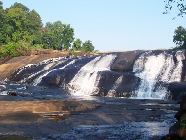
Hours, fees and rules for Sweetwater Creek State Park →High Falls State Park
Visitors come for canoeing and kayaking, boating, fishing, geocaching, and hiking. Facilities for water recreation include a boat ramp.
Hours, fees and rules for High Falls State Park →Dahlonega Gold Museum State Historic Site
In Lumpkin County, in Dahlonega, Dahlonega Gold Museum State Historic Site covers about 1 acres.
Hours, fees and rules for Dahlonega Gold Museum State Historic Site →Watson Mill Bridge State Park
The park supports horseback riding, canoeing and kayaking, biking, fishing, and geocaching. The official site lists about 5 miles of trails. On the water side, there is boat or kayak rentals.
Hours, fees and rules for Watson Mill Bridge State Park →
Best picks by activity
Camping near Loganville
- Fort Yargo State Park 14 mi northeast · 55 campsites
- Hard Labor Creek State Park 21 mi southeast · 81 campsites
- Panola Mountain State Park 22 mi southwest · 1 campsites
- Don Carter State Park 39 mi north · 60 campsites
- Indian Springs State Park 41 mi south · 77 campsites
+ 3 more in the list above
Cabins and lodging near Loganville
- Fort Yargo State Park 14 mi northeast · Cabins or other roofed stays
- Hard Labor Creek State Park 21 mi southeast · Cabins or other roofed stays
- Don Carter State Park 39 mi north · Cabins or other roofed stays
- Indian Springs State Park 41 mi south · Cabins or other roofed stays
- Sweetwater Creek State Park 43 mi west · Cabins or other roofed stays
+ 2 more in the list above
Dog-friendly state parks near Loganville
- Dahlonega Gold Museum State Historic Site 48 mi north · Pets allowed under park rules
Swimming near Loganville
- Fort Yargo State Park 14 mi northeast · Beach, pool or swim area
- Hard Labor Creek State Park 21 mi southeast · Beach, pool or swim area
- Don Carter State Park 39 mi north · Beach, pool or swim area
Hiking near Loganville
- Fort Yargo State Park 14 mi northeast · Hiking trails listed
- Hard Labor Creek State Park 21 mi southeast · Hiking trails listed
- Panola Mountain State Park 22 mi southwest · Hiking trails listed
- Don Carter State Park 39 mi north · Hiking trails listed
- Indian Springs State Park 41 mi south · Hiking trails listed
+ 3 more in the list above
Fishing near Loganville
- Fort Yargo State Park 14 mi northeast · Fishing listed
- Hard Labor Creek State Park 21 mi southeast · Fishing listed
- Panola Mountain State Park 22 mi southwest · Fishing listed
- Don Carter State Park 39 mi north · Fishing listed
- Indian Springs State Park 41 mi south · Fishing listed
+ 3 more in the list above
Questions about state parks near Loganville
What is the closest state park to Loganville?
Fort Yargo State Park is the closest, about 14 miles northeast of Loganville in a straight line. Next are Hard Labor Creek State Park and Panola Mountain State Park.
How many state parks are near Loganville?
9 state park units are within 50 miles, and 3 within 25 miles. That includes parks, recreation areas, historic sites and natural areas run by the state.
Which state parks near Loganville have camping?
8 parks list camping, the nearest being Fort Yargo State Park, Hard Labor Creek State Park and Panola Mountain State Park. Check each park page for site types, hookups and how to reserve.
Are dogs allowed at state parks near Loganville?
Yes, at 1 park, including Dahlonega Gold Museum State Historic Site. Dogs usually must be leashed, and some areas such as beaches or buildings may be off-limits.
Are there free state parks near Loganville?
None of the nearby parks list free entry; most charge a daily vehicle fee or accept an annual pass. Fees are on each park page.
State parks near other cities
- Near Winder, GA15 mi northeast
- Near Sandy Springs, GA28 mi west
- Near Stockbridge, GA29 mi southwest
- Near Atlanta, GA31 mi west
- Near Athens-Clarke County, GA31 mi east
- Near Gainesville, GA32 mi north
- Near Canton, GA44 mi northwest
- Near Acworth, GA48 mi west
Or see all Georgia state parks or every city we cover.
Built from official park data and updated as parks change; this list was last rebuilt Oct 30, 2026. Features shown are those the official source lists. Filter these parks on the map.