State Parks Near Herndon, Virginia
24 state park units lie within 50 miles of Herndon, including 18 parks across the line in Maryland. The closest is Seneca Creek State Park, about 14 mi northeast of town. 2 parks are within 25 miles, close enough for an evening visit.
- Closest park
- Seneca Creek State Park14 mi northeast
- Within 25 miles
- 2of 24 within 50 mi
- With camping
- 11parks list campsites
- Dog-friendly
- 19pets allowed
State parks near Herndon, nearest first
Straight-line distance from central Herndon; driving distance is usually longer.
Seneca Creek State Park
The official site lists about 50 miles of trails.
Hours, fees and rules for Seneca Creek State Park →Mason Neck State Park
The park supports canoeing and kayaking, boating, biking, hiking, and picnicking. Facilities for water recreation include a boat ramp and boat or kayak rentals.
Hours, fees and rules for Mason Neck State Park →Patuxent River State Park
Covering about 6,700 acres, Patuxent River State Park lies in Montgomery County, about 10 miles northeast of Gaithersburg.
Hours, fees and rules for Patuxent River State Park →Leesylvania State Park
Things to do include canoeing and kayaking, boating, hiking, and picnicking. On the water side, there is a boat ramp. Camping is available: campsites, including tent sites, group camping, and showers.
Hours, fees and rules for Leesylvania State Park →Chapman State Park
In Charles County, about 3 miles northeast of Indian Head, Chapman State Park covers about 2,100 acres.
Hours, fees and rules for Chapman State Park →Sweet Run State Park
The park supports horseback riding, hiking, and picnicking.
Hours, fees and rules for Sweet Run State Park →Smallwood State Park
For overnight stays there are campsites (tent sites).
Hours, fees and rules for Smallwood State Park →Sky Meadows State Park
Visitors come for horseback riding, biking, hiking, and picnicking. The official site lists about 22 miles of trails. Camping is available: 15 campsites across 2 camping areas, including tent sites and group camping.
Hours, fees and rules for Sky Meadows State Park →Gathland State Park
Gathland State Park is a 4-acre park about 6 miles north of Brunswick.
Hours, fees and rules for Gathland State Park →Rosaryville State Park
Covering about 982 acres, Rosaryville State Park lies in Prince George's County, about 7 miles southeast of District Heights.
Hours, fees and rules for Rosaryville State Park →South Mountain Battlefield
In Frederick County, about 5 miles west of Middletown, South Mountain Battlefield covers about 161 acres.
Hours, fees and rules for South Mountain Battlefield →Gambrill State Park
The official site lists about 16 miles of trails.
Hours, fees and rules for Gambrill State Park →Monocacy Natural Resources Management Area
Covering about 132 acres, Monocacy Natural Resources Management Area lies in Charles County, about 9 miles southeast of Dumfries.
Hours, fees and rules for Monocacy Natural Resources Management Area →Widewater State Park
Visitors come for canoeing and kayaking, boating, hiking, and picnicking. On the water side, there is a boat ramp.
Hours, fees and rules for Widewater State Park →Washington Monument State Park
Camping is available: campsites, including tent sites and group camping.
Hours, fees and rules for Washington Monument State Park →Patapsco Valley State Park
Its trail network totals roughly 200 miles, according to the park.
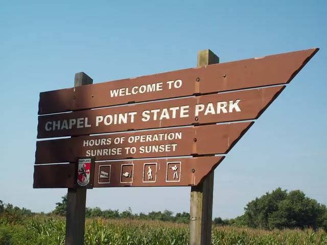
Hours, fees and rules for Patapsco Valley State Park →Chapel Point State Park
Chapel Point State Park is a park in Charles County, about 6 miles southwest of La Plata.
Hours, fees and rules for Chapel Point State Park →Greenbrier State Park
Overnight options include campsites, with tent sites.
Hours, fees and rules for Greenbrier State Park →Merkle Natural Resources Management Area
Covering about 113 acres, Merkle Natural Resources Management Area lies in Calvert County, about 8 miles west of Chesapeake Beach.
Hours, fees and rules for Merkle Natural Resources Management Area →South Mountain State Park
Covering about 9,076 acres, South Mountain State Park lies in Washington County, about 9 miles northwest of Middletown.
Hours, fees and rules for South Mountain State Park →Morgan Run Natural Environment Area
Covering about 287 acres, Morgan Run Natural Environment Area lies in Anne Arundel County, about 8 miles northwest of Annapolis.
Hours, fees and rules for Morgan Run Natural Environment Area →Cunningham Falls State Park
Cunningham Falls State Park is a park in Frederick County, about 3 miles southwest of Thurmont.
Hours, fees and rules for Cunningham Falls State Park →Caledon State Park
The park supports biking, hiking, and picnicking. Camping is available: campsites, including tent sites and group camping.
Hours, fees and rules for Caledon State Park →Franklin Point State Park
In Anne Arundel County, about 9 miles north of Chesapeake Beach, Franklin Point State Park covers about 499 acres.
Hours, fees and rules for Franklin Point State Park →
Best picks by activity
Camping near Herndon
- Mason Neck State Park 24 mi southeast · Campground listed
- Leesylvania State Park 27 mi south · Campground listed
- Sweet Run State Park 29 mi northwest · Campground listed
- Smallwood State Park 31 mi south · Campground listed
- Sky Meadows State Park 31 mi west · 15 campsites
+ 6 more in the list above
Dog-friendly state parks near Herndon
- Seneca Creek State Park 14 mi northeast · Pets allowed under park rules
- Patuxent River State Park 26 mi northeast · Pets allowed under park rules
- Chapman State Park 28 mi southeast · Pets allowed under park rules
- Smallwood State Park 31 mi south · Pets allowed under park rules
- Sky Meadows State Park 31 mi west · Pets allowed under park rules
+ 14 more in the list above
Hiking near Herndon
- Mason Neck State Park 24 mi southeast · Hiking trails listed
- Leesylvania State Park 27 mi south · Hiking trails listed
- Sweet Run State Park 29 mi northwest · Hiking trails listed
- Sky Meadows State Park 31 mi west · Hiking trails listed
- Widewater State Park 38 mi south · Hiking trails listed
+ 1 more in the list above
Questions about state parks near Herndon
What is the closest state park to Herndon?
Seneca Creek State Park is the closest, about 14 miles northeast of Herndon in a straight line. Next are Mason Neck State Park and Patuxent River State Park.
How many state parks are near Herndon?
24 state park units are within 50 miles, and 2 within 25 miles. That includes parks, recreation areas, historic sites and natural areas run by the state.
Which state parks near Herndon have camping?
11 parks list camping, the nearest being Mason Neck State Park, Leesylvania State Park and Sweet Run State Park. Check each park page for site types, hookups and how to reserve.
Are dogs allowed at state parks near Herndon?
Yes, at 19 parks, including Seneca Creek State Park, Patuxent River State Park and Chapman State Park. Dogs usually must be leashed, and some areas such as beaches or buildings may be off-limits.
Are there free state parks near Herndon?
None of the nearby parks list free entry; most charge a daily vehicle fee or accept an annual pass. Fees are on each park page.
State parks near other cities
- Near Gaithersburg, MD16 mi northeast
- Near Manassas, VA16 mi south
- Near Alexandria, VA19 mi southeast
- Near Takoma Park, MD21 mi east
- Near Frederick, MD32 mi north
- Near Bowie, MD35 mi east
- Near Winchester, VA45 mi west
- Near Martinsburg, WV46 mi northwest
Or see all Virginia state parks, Maryland state parks or every city we cover.
Built from official park data and updated as parks change; this list was last rebuilt Oct 30, 2026. Features shown are those the official source lists. Filter these parks on the map.