Castlewood State Park
- Status
- Status not posted
- Entrance fee
- Statewide rule — see below
- Day-use reservations
- None mentioned
- Dogs
- Statewide rule — see below
- Camping
- None listed
- Official site
- mostateparks.com(636) 227-4433
Official page last checked Oct 29, 2026. How we keep this current
Overview
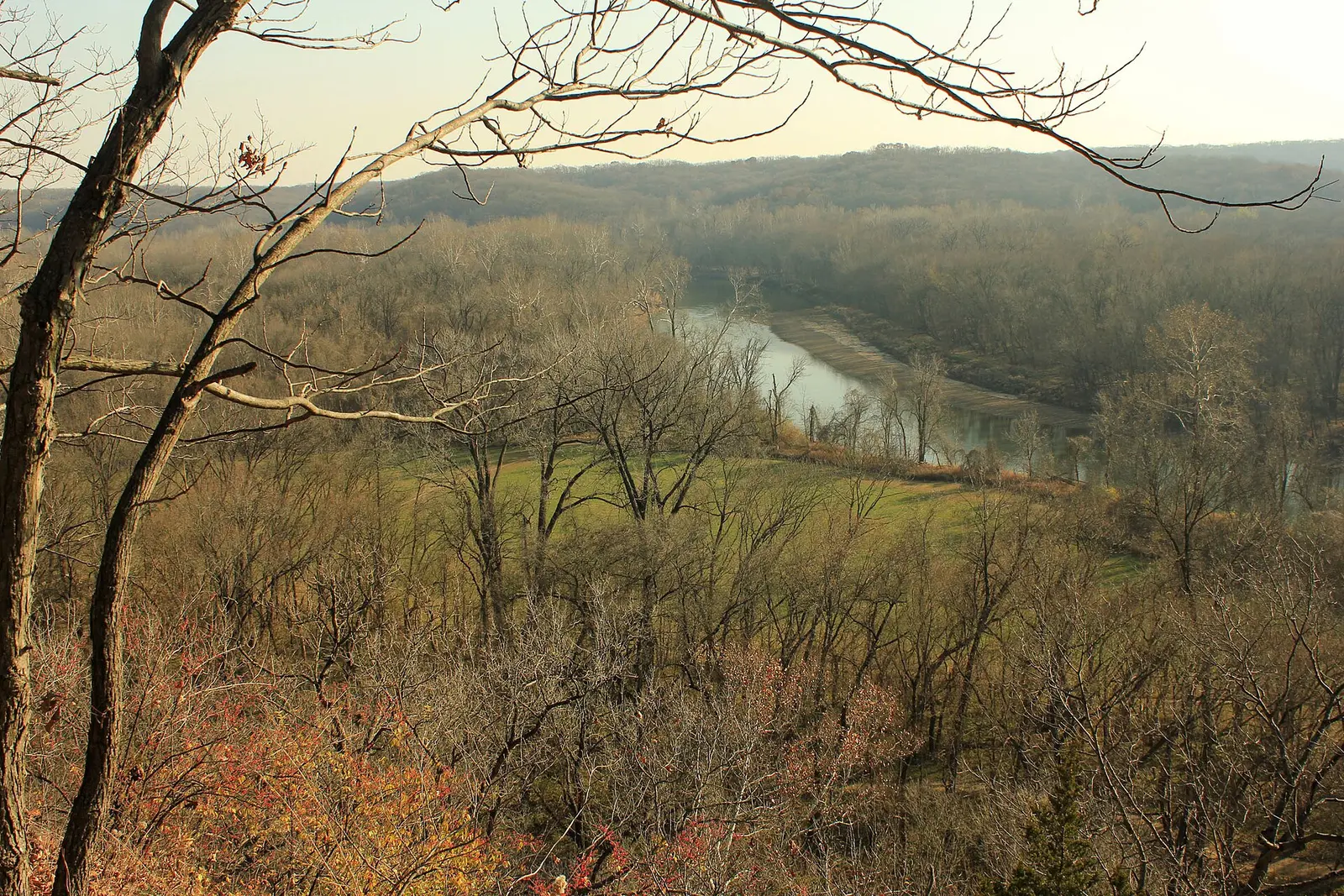

In St. Louis County, about 3 miles west of Valley Park, Castlewood State Park covers about 1,769 acres.
The park supports mountain biking, horseback riding, biking, fishing, and hiking.
Hours
Park, gate, office and facility hours are listed separately because they often differ. Alerts above override normal hours.
| Facility | Days | Hours | Season |
|---|---|---|---|
| Park | Park Grounds: 7 a.m. to one-half hour after sunset, year-round Park gates open and close at these times. | ||
| Other — March | Sat–Sun | 9 a.m. – noon | — |
| Wed–Sun | 9 a.m. – noon | Apr 1 – Oct 31 | |
| Other — November | Sat–Sun | 9 a.m. – noon | — |
Official wording
Park Grounds: 7 a.m. to one-half hour after sunset, year-round Park gates open and close at these times.
March: 9 a.m. to noon, Saturday and Sunday April through October (On-Season): 9 a.m. to noon, Wednesday through Sunday
November: 9 a.m. to noon, Saturday and Sunday December through February (Off-Season): The office telephone is monitored Monday through Friday. The office door is unlocked when staff is available.
2025-2026 State Holidays: On the following days (actual or observed), staff will not be available and park buildings will be closed: Thanksgiving Day; Nov. 28, 2025; Christmas Eve; Christmas Day; New Year’s Eve; New Year’s Day; Martin Luther King Jr. Day; Lincoln’s Birthday; and Washington's Birthday.
Source: official park page, checked Oct 29, 2026. Times are local to the park (America/Chicago).
Pets
Pets welcome; leash no longer than 10 feet at all times; no more than two dogs per campsite recommended; pets not allowed in buildings (except Cabins for Canines units), public swimming areas or waters reserved for fishing.
Statewide rule from Missouri's park system (source). This park’s page doesn’t state its own pet rules, so check for local restrictions.
Fees and passes
Fees apply to camping, lodging and some tours (e.g. cave tours).
Statewide fee rule from Missouri's park system; this park’s page doesn’t list its own fees.
Reservations
- Day use
- No day-use reservation requirement mentioned
- Booking system
- Missouri State Parks reservation system (UseDirect / Tyler, 'ICampMO')
- Phone
- 877-422-6766 (877-ICampMO)
We link to the official booking system rather than showing live availability, which changes minute to minute.
Things to do
HikingBikingMountain bikingHorseback ridingPicnickingFishing
Trails
| Trail | Length | Difficulty | Notes |
|---|---|---|---|
| Al Foster Trail | — | — | Trail information: https://mostateparks.com/media/pdf/trail-details-al-foster |
| Castlewood Loop Trail | — | — | Trail information: https://mostateparks.com/media/pdf/trail-details-castlewood-loop |
| Cedar Bluff Loop | — | — | Trail information: https://mostateparks.com/media/pdf/trail-details-cedar-bluff |
| Chubb Trail | — | — | Trail information: https://mostateparks.com/media/pdf/trail-details-chubb |
| Grotpeter Trail | — | — | Trail information: https://mostateparks.com/media/pdf/trail-details-grotpeter |
| Lone Wolf Trail | — | — | Trail information: https://mostateparks.com/media/pdf/trail-details-lone-wolf |
| River Scene Trail | — | — | Trail information: https://mostateparks.com/media/pdf/trail-details-river-scene |
| Stinging Nettle Trail | — | — | Trail information: https://mostateparks.com/media/pdf/trail-details-stinging-nettle |
Trail descriptions from the park
Castlewood State Park Trails
Al Foster Trail
- Trail Map
- Trail Information
Castlewood Loop Trail
- Trail Map
- Trail Information
Cedar Bluff Loop
- Trail Map
- Trail Information
Chubb Trail
- Trail Map
- Trail Information
Grotpeter Trail
- Trail Map
- Trail Information
Lone Wolf Trail
- Trail Map
- Trail Information
River Scene Trail
- Trail Map
- Trail Information
Stinging Nettle Trail
- Trail Map
- Trail Information
Amenities
Facilities
- Picnic areas
- Picnic shelters
- Playground
Recreation
- Horse trails
✓ listed by the park · ✕ the park says it is not available. Anything not shown here isn’t mentioned by the official source — that means unknown, not unavailable.
Accessibility
Park Office
You'll see the office on your right as you enter the park. A handicap parking space provides access to a paved path leading to the porch. An information board is here for your convenience.
West Day-Use Area
This day-use area is sunny and level with a central paved parking lot surrounded by a grassy field. Two handicap parking spaces are offered. A paved pathway leads you past a drinking fountain to a shelter overlooking Kiefer Creek. Here you may enjoy group picnicking with extended-end tables and group grills while watching sand volleyball. The shelter accommodates 100 people.
Across the parking lot from the shelter is a path leading past an information board, a restroom and three picnic sites to the playground. Beyond the playground is another picnic site. All amenities in this area have been constructed or modified to be enjoyed by all visitors.
Read more from the park
Directly across the main road is the trailhead. The trailhead kiosk is connected to a new vault toilet by a paved pathway. These are served by an asphalt parking lot with two handicap spaces.
A second shelter and restroom have not yet been modified for accessibility.
East Day-Use Area
This river bottom area is heavily wooded and has not been modified for accessibility. It contains several picnic sites and restrooms. The rest of the area is quite level and parking should not be a problem.
Official accessibility information
Conditions change. Contact the park to confirm specific accessible features before your visit.
Getting there
- Address
- 1401 Kiefer Creek Road
Ballwin, MO 63021-7338 - Nearest town
- Valley Park — about 3 mi west (straight line)
- Coordinates
- 38.5545, -90.5424
- Phone
- (636) 227-4433
Nearby state parks
Sources and freshness
- Missouri State Parks — park page — last checked Oct 29, 2026
- Quick List of Parks and Historic Sites (HTML) + MoDNR ArcGIS boundary layer for coordinates
- Wikidata
- Photo: Castlewoodscenic.JPG — CC0 1.0 (public domain dedication), Archbob
“Last checked” is when our system last read the official source. No change has been detected since this page was first published. Hours, fees and rules can change without notice — confirm with the park before you go. Methodology