Mille Lacs Kathio State Park
2 notices: Park alert · Park alert — details
- Status
- Open (per official listing)Daily 8 a.m. – 10 p.m.
- Entrance fee
- Statewide rule — see below
- Day-use reservations
- None mentioned
- Dogs
- No dogs
- Camping
- YesAlso cabins, glamping or camper cabins
- Official site
- dnr.state.mn.us(320) 532-3523
Official page last checked Oct 29, 2026. How we keep this current
Current alerts 6
Closure Park alert• The Interpretive/Visitor Center will be CLOSED for the rest of 2026, due to building construction. NOTE: The park will still have programs through… (more)
• The Interpretive/Visitor Center will be CLOSED for the rest of 2026, due to building construction. NOTE: The park will still have programs through MEA Weekend. Programs will be outside but may be canceled due to rain or inclement weather.
Posted by the park 2026-10-20. Official alert
Weather Park alert• Please practice bear safety while visiting.
Posted by the park 2026-10-20. Official alert
Fire restriction Park alert• The fire tower is open
Posted by the park 2026-10-20. Official alert
Alert Park alert• Horse trails are open from May 1st through to November 1st.
Posted by the park 2026-10-20. Official alert
Water quality Park alert• Water will be turned off for the season on Monday 19th October 2026.
Posted by the park 2026-10-20. Official alert
Alert Park alert• The traditional playground has been removed. We are currently working on a replacement.
Posted by the park 2026-10-20. Official alert
Overview
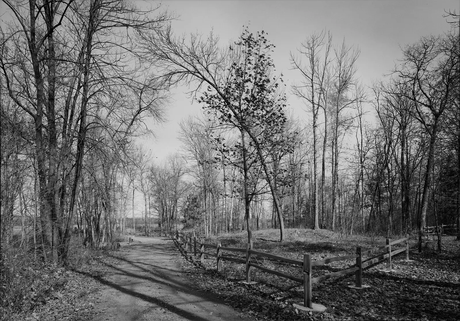

Mille Lacs Kathio State Park is a 9,682-acre park in Mille Lacs County, about 27 miles southeast of Brainerd.
Visitors come for cross-country skiing, historic sites, winter sports, canoeing and kayaking, and swimming. The official site lists about 19 miles of trails. Facilities for water recreation include a swimming beach. Camping is available: 7 camping areas, including RV sites with electric hookups, tent sites, group camping, equestrian camping, and showers. Roofed lodging includes cabins and camper cabins or similar shelters.
Hours
Park, gate, office and facility hours are listed separately because they often differ. Alerts above override normal hours.
| Facility | Days | Hours | Season |
|---|---|---|---|
| Park | Daily | 8 a.m. – 10 p.m. | — |
| Office | Daily | 8:30 a.m. – 3:30 p.m. | — |
| Park | Electric sites: During the winter season we plow out three of the pull-through campsites. Campsites # 41, 43 and 46 are available to rent year-round. In the summer, there are 22 electric sites, all in the Petaga camping area. RVs: Please note that we do NOT have water/sewer hookups at our sites. Rentals: Snowshoes and cross country ski rental will begin pending sufficient snowfall. Trails: Horse trails are closed on November 1st 2026 Bathrooms: Restrooms are available at the Trail Center. Pit toilets are available throughout the park. Programs: See our events calendar for more details. Showers: Shower facilities are closed until Spring 2027 Drinking water: You can find drinking water at the Park entrance and the Trail Center Building. Buildings: The Fire Tower is open. Water: Water has been turned off for the season until Spring 2027. Dump station: The dump station is now closed for the season until Spring 2027. | ||
Official wording
Daily from 8 a.m. until 10 p.m.
Office hours are 8:30am to 3:30pm Monday to Sunday, staff permitting
Electric sites: During the winter season we plow out three of the pull-through campsites. Campsites # 41, 43 and 46 are available to rent year-round. In the summer, there are 22 electric sites, all in the Petaga camping area. RVs: Please note that we do NOT have water/sewer hookups at our sites. Rentals: Snowshoes and cross country ski rental will begin pending sufficient snowfall. Trails: Horse trails are closed on November 1st 2026 Bathrooms: Restrooms are available at the Trail Center. Pit toilets are available throughout the park. Programs: See our events calendar for more details. Showers: Shower facilities are closed until Spring 2027 Drinking water: You can find drinking water at the Park entrance and the Trail Center Building. Buildings: The Fire Tower is open. Water: Water has been turned off for the season until Spring 2027. Dump station: The dump station is now closed for the season until Spring 2027.
Source: official park page, checked Oct 29, 2026. Times are local to the park (America/Chicago).
Fees and passes
Per vehicle: a state park vehicle permit (one-day $7 or year-round $35) is required for every vehicle; same price for residents and nonresidents. Four free park days per year. Iron Range OHV SRA states 'There is no entrance fee'.
Statewide fee rule from Minnesota's park system; this park’s page doesn’t list its own fees.
Minnesota park passes
- Year-round vehicle permit — $35. Unlimited visits to every Minnesota state park and recreation area for 12 months from the month of purchase Details
- One-day vehicle permit — $7. One day, one vehicle Details
- Additional year-round vehicle permit — $26. Additional vehicles owned by a year-round permit holder Details
- Year-round motorcycle permit — $30. Motorcycle, 12 months Details
- One-day group permit — $5. Group vehicles, one day Details
From the Minnesota state guide. Confirm which passes this park accepts.
Reservations
- Day use
- No day-use reservation requirement mentioned
- Booking system
- Reserve MN (US eDirect)
- Phone
- 866-857-2757
We link to the official booking system rather than showing live availability, which changes minute to minute.
Pets
No dogs
No pets allowed.
Service animals are generally permitted where pets are not. Check with the park for specific areas.
Camping
| Campground or site type | Sites | Hookups / features | Price |
|---|---|---|---|
| Drive-in Sites The park has a total of 70 secluded and shaded drive-in sites.
19 semi-modern sites are walking distance to the shower building.
26 rustic sites are one and one-half miles from the shower building, with vault toilets and water nearby. | — | ShowersRVs up to 60 feet, measured from front of tow vehicle to rear of the vehicle being towed. | — |
| Pull-Through Sites Three pull-through sites, all in the Petaga Campground electric loop. | — | Showers | — |
| Electric Sites 22 electric sites, all located in Petaga Campground. Each site has 30 amp/125 volt and 20 amp/110 volt outlets. | — | ElectricShowersRVs up to 60 feet, measured from front of tow vehicle to rear of the vehicle being towed. | — |
| Backpack Sites The park has four backpack sites.
Glacial Ridge Campsite is adjacent to a large beaver pond on a wooded glacial ridge, a 0.75 mile walk from the dump station parking area.
Kanketanka Campsite overlooks a woodland pond, a 1.75 mile walk from the trail center.
Black Bass Campsite is located on the south shore of Black Bass Lake, a 2 mile walk from the dump station parking area.
Sunset Meadow Campsite is located in an oak and maple forest on the edge of a meadow of sedges and other wetland plants, a 1.5 mile walk from the trail center. | — | Showers | — |
| Walk-in Sites Three private, wooded walk-in sites located approximately 100 yards from parking. Each site has a fire ring, picnic table and level area for a tent. The Petaga Campground shower building is within walking distance. | — | Showers | — |
| Horse Camp The horse camp has ten sites with picket lines, and accommodates a maximum of 40 horses. There are flush toilets and water, but no showers. | — | Showers | — |
| Group Camp There are two tent-only group camp areas along the Rum River, about 100 feet from parking. Each has vault toilets and a hand pump for water. No showers. The first site accommodates 15 people and the second site accommodates 45. | — | Showers | — |
Camping details from the park
Drive-in Sites: The park has a total of 70 secluded and shaded drive-in sites. 19 semi-modern sites are walking distance to the shower building. 26 rustic sites are one and one-half miles from the shower building, with vault toilets and water nearby. Pull-Through Sites: Three pull-through sites, all in the Petaga Campground electric loop. Electric Sites: 22 electric sites, all located in Petaga Campground. Each site has 30 amp/125 volt and 20 amp/110 volt outlets. RV Length Limit: 60 feet, measured from front of tow vehicle to rear of the vehicle being towed. Accessible Sites — 2: Two accessible drive-in sites, located in the Petaga Campground electric loop. Backpack Sites: The park has four backpack sites. Glacial Ridge Campsite is adjacent to a large beaver pond on a wooded glacial ridge, a 0.75 mile walk from the dump station parking area. Kanketanka Campsite overlooks a woodland pond, a 1.75 mile walk from the trail center. Black Bass Campsite is located on the south shore of Black Bass Lake, a 2 mile walk from the dump station parking area. Sunset Meadow Campsite is located in an oak and maple forest on the edge of a meadow of sedges and other wetland plants, a 1.5 mile walk from the trail center. Walk-in Sites: Three private, wooded walk-in sites located approximately 100 yards from parking. Each site has a fire ring, picnic table and level area for a tent. The Petaga Campground shower building is within walking distance. Horse Camp: The horse camp has ten sites with picket lines, and accommodates a maximum of 40 horses. There are flush toilets and water, but no showers. Group Camp: There are two tent-only group camp areas along the Rum River, about 100 feet from parking. Each has vault toilets and a hand pump for water. No showers. The first site accommodates 15 people and the second site accommodates 45.
From the official park page, checked Oct 29, 2026. Site counts and prices can change; confirm when booking.
Cabins and lodging
- Camper Cabins: 5 units5 Cabins — Five camper cabins are available year-round. All have electricity, heat and a screened porch. One camper cabin is accessible and sleeps five; the other four cabins each sleep six. No pets allowed.
Accessible Lodging — 1 accessible camper cabin: Camper cabin 4 is accessible. Camper Cabins — 5 Cabins: Five camper cabins are available year-round. All have electricity, heat and a screened porch. One camper cabin is accessible and sleeps five; the other four cabins each sleep six. No pets allowed. Camper Cabins — 5 Cabins: Five camper cabins are available year-round. All have electricity, heat and a screened porch. One camper cabin is accessible and sleeps five; the other four cabins each sleep six. No pets allowed.
Things to do
Ranger and interpretive programsCampingSwimmingHistoric sites and toursWinter sportsCross-country skiingPicnickingCanoeing and kayakingFishingBoating
Trails
| Trail | Length | Difficulty | Notes |
|---|---|---|---|
| Groomed Cross-Country Skiing Classic (winter) | 19.8 mi | — | 19.8 miles — The park has 19.8 miles (32 km) of trails for skiers of all levels: 10.9 km easy; 12.4 km moderate and 8.7 km difficult trails. All trails go through wooded terrain. A Great Minnesota Ski Pass is required on groomed ski trails for skiers age 16 and up. Ski rental is available at the ranger station.Groomed Cross-Country Skiing Classic |
| Snowmobile (winter) | — | — | 19 miles of trails pass through wooded hills, connecting at various points with the 13,000 mile grant-in-aid statewide snowmobile trail system.Snowmobile |
| Snowshoe (winter) | — | — | Multiple trails are marked for snowshoers, for a total of almost eight miles. These trails take you to some great scenic areas. Snowshoers may also explore any area of the park but must stay off groomed ski trails. Snowshoe rentals are available at the ranger station.Snowshoe |
| Other (winter) | — | — | Stop at the ranger station to rent snowshoes or cross-country skis.Other |
| Accessible (summer) | 1.5 mi | — | 1.5 miles — A one-mile out-and-back accessible trail goes to the Cooper and Wilford historic sites. The half mile Touch the Earth Trail is also accessible.AccessibleAccessible |
| Self-Guided (summer) | — | — | The one-half mile Touch the Earth Trail is self-guided and includes a boardwalk that takes you through a tamarack bog. The one-mile long Landmark Trail offers a picturesque woodland walk along the shore of Ogechie Lake and commemorates the park as a National Historic Landmark.Self-Guided |
| Hiking (summer) | — | — | 35 miles of wooded trails take you to river, lake and beaver pond overlooks and through rolling glacial moraines. Many trails are minimum maintenance during summer months.Hiking |
| Boardwalk (summer) | — | — | . — The boardwalk is part of the self-guided Touch the Earth Trail. The trail loop begins at the visitor center.Boardwalk |
| Horse (summer) | — | — | The park has 27 miles of horse trails. The best riding is in September and October, when fall leaf color is vibrant and bugs are at a minimum. Horse trails are minimum maintenance and can be very buggy during summer months. In spring - or anytime after a big rainfall - trails are muddy. Horse trails are generally open May 1 to November 1, depending on trail conditions, and will be closed any time they are covered with snow. Riders 16 and older are required to carry a current horse pass.Horse |
| Other (summer) | — | — | The 3.2-mile Hiking Club Trail winds past Ogechie Lake, two historic village sites and through some of the park's most scenic backcountry.Other |
Trail descriptions from the park
Winter — Groomed Cross-Country Skiing Classic — 19.8 miles: The park has 19.8 miles (32 km) of trails for skiers of all levels: 10.9 km easy; 12.4 km moderate and 8.7 km difficult trails. All trails go through wooded terrain. A Great Minnesota Ski Pass is required on groomed ski trails for skiers age 16 and up. Ski rental is available at the ranger station. Winter — Snowmobile: 19 miles of trails pass through wooded hills, connecting at various points with the 13,000 mile grant-in-aid statewide snowmobile trail system. Winter — Snowshoe: Multiple trails are marked for snowshoers, for a total of almost eight miles. These trails take you to some great scenic areas. Snowshoers may also explore any area of the park but must stay off groomed ski trails. Snowshoe rentals are available at the ranger station. Winter — Other: Stop at the ranger station to rent snowshoes or cross-country skis. Summer — Accessible — 1.5 miles: A one-mile out-and-back accessible trail goes to the Cooper and Wilford historic sites. The half mile Touch the Earth Trail is also accessible. Summer — Self-Guided: The one-half mile Touch the Earth Trail is self-guided and includes a boardwalk that takes you through a tamarack bog. The one-mile long Landmark Trail offers a picturesque woodland walk along the shore of Ogechie Lake and commemorates the park as a National Historic Landmark. Summer — Hiking: 35 miles of wooded trails take you to river, lake and beaver pond overlooks and through rolling glacial moraines. Many trails are minimum maintenance during summer months. Summer — Boardwalk — .: The boardwalk is part of the self-guided Touch the Earth Trail. The trail loop begins at the visitor center. Summer — Horse: The park has 27 miles of horse trails. The best riding is in September and October, when fall leaf color is vibrant and bugs are at a minimum. Horse trails are minimum maintenance and can be very buggy during summer months. In spring - or anytime after a big rainfall - trails are muddy. Horse trails are generally open May 1 to November 1, depending on trail conditions, and will be closed any time they are covered with snow. Riders 16 and older are required to carry a current horse pass. Summer — Other: The 3.2-mile Hiking Club Trail winds past Ogechie Lake, two historic village sites and through some of the park's most scenic backcountry. Trail conditions: Horse trails are closed on November 1st 2026
Swimming
Swimming Beach: The park doesn't have a beach, but there is a shallow swimming hole near the river.
Boating and paddling
Boat Access: There is a drive-in access for smaller boats on the Rum River, and another access on Shakopee Lake. The park does not have boat access to Mille Lacs Lake. Boat Docks Canoe Access: There is a drive-in access located on the Rum River.
Fishing
Fishing: Fish in the lakes or the scenic Rum River. The best place to fish from shore is the former dam location, located by the picnic area.
A state fishing license is usually required.
Amenities
Facilities
- Restrooms
- Flush toilets
- Vault or pit toilets
- Showers
- Picnic areas
- Picnic shelters
- Visitor center
- Park or camp store
- Group facilities
Water
- Swimming beach
- Marina or boat slips
Camping
- RV dump station
- Tent camping
- RV camping
- Electric hookups
- Group camping
- Equestrian camping
Lodging
- Cabins
- Glamping or camper cabins
Accessibility
- Accessible cabins or lodging
✓ listed by the park · ✕ the park says it is not available. Anything not shown here isn’t mentioned by the official source — that means unknown, not unavailable.
Accessibility
- Accessible cabins or lodging
Visitor Center: Located near the picnic grounds. You'll find exhibits that highlight the park's natural and human history and information on interpretive programs, demonstrations, school field trips and other customized programs for groups. The building, bathrooms and trail down to the amphitheater are all accessible. Accessible Sites — 2: Two accessible drive-in sites, located in the Petaga Campground electric loop. Accessible Lodging — 1 accessible camper cabin: Camper cabin 4 is accessible. Camper Cabins — 5 Cabins: Five camper cabins are available year-round. All have electricity, heat and a screened porch. One camper cabin is accessible and sleeps five; the other four cabins each sleep six. No pets allowed. Showers: Accessible showers are available in the Petaga Campground from May through mid-October. Flush Toilets: Accessible restrooms in the picnic area and in Petaga Campground are open from May through mid-October, and year-round in the trail center. Accessible — 1.5 miles: A one-mile out-and-back accessible trail goes to the Cooper and Wilford historic sites. The half mile Touch the Earth Trail is also accessible. All-Terrain Track Chair: The park has an all-terrain, electric powered track chair that may be used on designated trails within the park.
Official accessibility information
Conditions change. Contact the park to confirm specific accessible features before your visit.
Getting there
- Address
- 15066 Kathio State Park Road
Onamia, MN 56359 - Nearest town
- Brainerd — about 27 mi southeast (straight line)
- Coordinates
- 46.1354, -93.7245
- Phone
- (320) 532-3523
- millelacskathio.statepark@state.mn.us
Google Maps directionsApple MapsOfficial park map (PDF)
Directions from the park
Go to mile post marker #221 on US Hwy 169, about 8 miles north of Onamia. Watch for the Kathio Arrowhead sign and take County Road 26 for about a mile, to the park entrance.
Nearby state parks
Sources and freshness
- Minnesota State Parks and Trails — park page — last checked Oct 29, 2026; page says updated Oct 20, 2026
- MN DNR A-Z list of state parks and recreation areas (park IDs in server-rendered <noscript> links) + state waysides page; details from the compass feature_detail JSON API used by park.html
- Wikidata
- USGS PAD-US 4.1 (boundary and acreage)
- Photo: Kathiomounds.jpg — Public domain (US federal government work), Jet Lowe
“Last checked” is when our system last read the official source. No change has been detected since this page was first published. Hours, fees and rules can change without notice — confirm with the park before you go. Methodology