Beaver Creek Valley State Park
- Status
- Open (per official listing)Daily 8 a.m. – 10 p.m.
- Entrance fee
- Statewide rule — see below
- Day-use reservations
- None mentioned
- Dogs
- No dogs
- Camping
- 58 campsitesAlso cabins, glamping or camper cabins
- Official site
- dnr.state.mn.us(507) 724-2107
Official page last checked Oct 29, 2026. How we keep this current
Current alerts 1
Alert Special huntA muzzleloader hunt will take place December 5 and 6. Applicants can check for the results of the lottery online.
Posted by the park 2026-10-22. Official alert
Overview
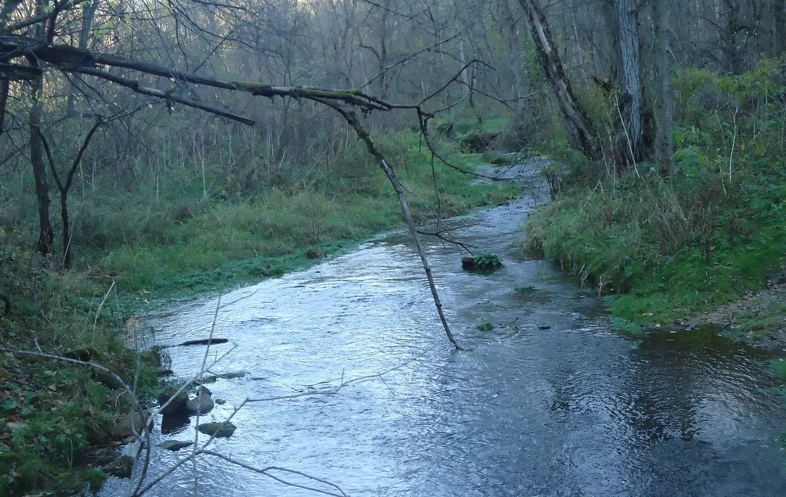

In Houston County, about 3 miles west of Caledonia, Beaver Creek Valley State Park covers about 744 acres.
Visitors come for fishing, wildlife watching, hiking, and picnicking. Camping is available: 58 campsites across 3 camping areas, including RV sites with electric hookups, tent sites, and showers. If you'd rather not camp, the park offers cabins and camper cabins or similar shelters.
Hours
Park, gate, office and facility hours are listed separately because they often differ. Alerts above override normal hours.
| Facility | Days | Hours | Season |
|---|---|---|---|
| Park | Daily | 8 a.m. – 10 p.m. | — |
Official wording
Daily from 8 a.m. until 10 p.m.
Please email the park at beavercreek.statepark@state.mn.us
Campground opens April 1st. Campground will close November 8.
Showers: Showers will close October 31 or later if weather allows. Buildings: Reservable enclosed picnic shelter with 9 picnic tables and a wood stove. Maximum occupancy is 50 people. $45 for the day. Drinking water: Water will be turned off October 31 or later if weather allows. Bathrooms: Vault toilets are available in the park year-round. Electric sites: There are 16 electric sites. Please do not park on the grass. Extra vehicles should be parked in the picnic parking lot. Dump station: The dump station opens April 1st. Other: Playground area, sand volleyball, trout fishing, reservable enclosed picnic shelter. Trails: The park has a variety of trails. Biking is not allowed on park trails. Easier walking trails follow Beaver Creek with more difficult trails going up and down the bluffs with some scenic overlooks. Hiking Club trail is 5.8 miles long. Campgrounds: Campground opens April 1st. Campground will close November 8. Water: Water will be turned off October 31 or later if weather allows. RVs: Please park vehicles that do not fit on your gravel spur in the main picnic area. Do not park on the grass at your site.
Source: official park page, checked Oct 29, 2026. Times are local to the park (America/Chicago).
Fees and passes
Per vehicle: a state park vehicle permit (one-day $7 or year-round $35) is required for every vehicle; same price for residents and nonresidents. Four free park days per year. Iron Range OHV SRA states 'There is no entrance fee'.
Statewide fee rule from Minnesota's park system; this park’s page doesn’t list its own fees.
Minnesota park passes
- Year-round vehicle permit — $35. Unlimited visits to every Minnesota state park and recreation area for 12 months from the month of purchase Details
- One-day vehicle permit — $7. One day, one vehicle Details
- Additional year-round vehicle permit — $26. Additional vehicles owned by a year-round permit holder Details
- Year-round motorcycle permit — $30. Motorcycle, 12 months Details
- One-day group permit — $5. Group vehicles, one day Details
From the Minnesota state guide. Confirm which passes this park accepts.
Reservations
- Day use
- No day-use reservation requirement mentioned
- Booking system
- Reserve MN (US eDirect)
- Phone
- 866-857-2757
We link to the official booking system rather than showing live availability, which changes minute to minute.
Pets
No dogs
No pets.
Service animals are generally permitted where pets are not. Check with the park for specific areas.
Camping
| Campground or site type | Sites | Hookups / features | Price |
|---|---|---|---|
| Drive-in Sites 42 sites — Maximum of one tent, six people, and one car per site. Book an additional site if you need more than one tent. Do not park on the campsite grass -- vehicles that do not fit on the gravel spurs may park in the picnic parking lot. | 42 | ShowersRVs up to 55 feet | — |
| Electric Sites 16 sites | 16 | ElectricShowersRVs up to 55 feet | — |
| Cart-in Sites Nine sites — Must be able to carry in your camping gear (wheelbarrows provided). Sites are located 100-180 yards from parking. | — | Showers | — |
Camping details from the park
Drive-in Sites — 42 sites: Maximum of one tent, six people, and one car per site. Book an additional site if you need more than one tent. Do not park on the campsite grass -- vehicles that do not fit on the gravel spurs may park in the picnic parking lot.
Electric Sites — 16 sites
RV Length Limit — 55 feet: Length measures from front of tow vehicle to rear of vehicle being towed.
Accessible Sites — One accessible drive-in site: The site has electric hookup.
Cart-in Sites — Nine sites: Must be able to carry in your camping gear (wheelbarrows provided). Sites are located 100-180 yards from parking.
From the official park page, checked Oct 29, 2026. Site counts and prices can change; confirm when booking.
Cabins and lodging
- Camper Cabins1 — One accessible camper cabin, available seasonally. No pets. More information on camper cabins.
Accessible Lodging — 1 accessible camper cabin
Camper Cabins — 1: One accessible camper cabin, available seasonally. No pets. More information on camper cabins.
Things to do
CampingFishingHikingWildlife viewing and birdingPicnicking
Trails
| Trail | Length | Difficulty | Notes |
|---|---|---|---|
| Snowshoe (winter) | — | — | Snowshoeing is allowed on any of the trails.Snowshoe |
| Hiking (summer) | 8 mi | — | Eight milesHiking |
Trail descriptions from the park
Winter — Snowshoe: Snowshoeing is allowed on any of the trails.
Summer — Hiking — Eight miles
Trail conditions: The park has a variety of trails. Biking is not allowed on park trails. Easier walking trails follow Beaver Creek with more difficult trails going up and down the bluffs with some scenic overlooks. Hiking Club trail is 5.8 miles long.
Fishing
Fishing — Trout fishing in the stream
A state fishing license is usually required.
Amenities
Facilities
- Restrooms
- Vault or pit toilets
- Showers
- Picnic areas
- Picnic shelters
- Playground
- Nature center or museum
- Park or camp store
Camping
- RV dump station
- Tent camping
- RV camping
- Electric hookups
Lodging
- Cabins
- Glamping or camper cabins
Accessibility
- Accessible cabins or lodging
✓ listed by the park · ✕ the park says it is not available. Anything not shown here isn’t mentioned by the official source — that means unknown, not unavailable.
Accessibility
- Accessible cabins or lodging
Accessible Sites — One accessible drive-in site: The site has electric hookup.
Accessible Lodging — 1 accessible camper cabin
Camper Cabins — 1: One accessible camper cabin, available seasonally. No pets. More information on camper cabins.
Vault Toilets — Accessible: Available year-round in picnic area and campground.
Warming House — Accessible: Enclosed picnic shelter doubles as a winter warming house.
Picnic Area — Accessible: Located near the stream.
Picnic Shelter — Accessible: Enclosed shelter with a fireplace and electricity. Call the park to reserve.
Official accessibility information
Conditions change. Contact the park to confirm specific accessible features before your visit.
Getting there
- Address
- 15954 County 1
Caledonia, MN 55921 - Nearest town
- Caledonia — about 3 mi west (straight line)
- Coordinates
- 43.6460, -91.5550
- Phone
- (507) 724-2107
- beavercreek.statepark@state.mn.us
Google Maps directionsApple MapsOfficial park map (PDF)
Directions from the park
From I-90, take State Highway 76 south for 24 miles, then take Houston County 1 west for 4 miles.
Nearby state parks
Sources and freshness
- Minnesota State Parks and Trails — park page — last checked Oct 29, 2026; page says updated Oct 22, 2026
- MN DNR A-Z list of state parks and recreation areas (park IDs in server-rendered <noscript> links) + state waysides page; details from the compass feature_detail JSON API used by park.html
- Wikidata
- USGS PAD-US 4.1 (boundary and acreage)
- Photo: Branchoverhangingbrook.jpg — CC0 1.0 (public domain dedication), Archbob
“Last checked” is when our system last read the official source. No change has been detected since this page was first published. Hours, fees and rules can change without notice — confirm with the park before you go. Methodology