Shakamak State Park
- Status
- Status not posted
- Entrance fee
- Statewide rule — see below
- Day-use reservations
- None mentioned
- Dogs
- Not stated — check with park
- Camping
- 174 campsitesAlso cabins
- Official site
- in.gov812-665-2158
Official page last checked Oct 29, 2026. How we keep this current
Overview
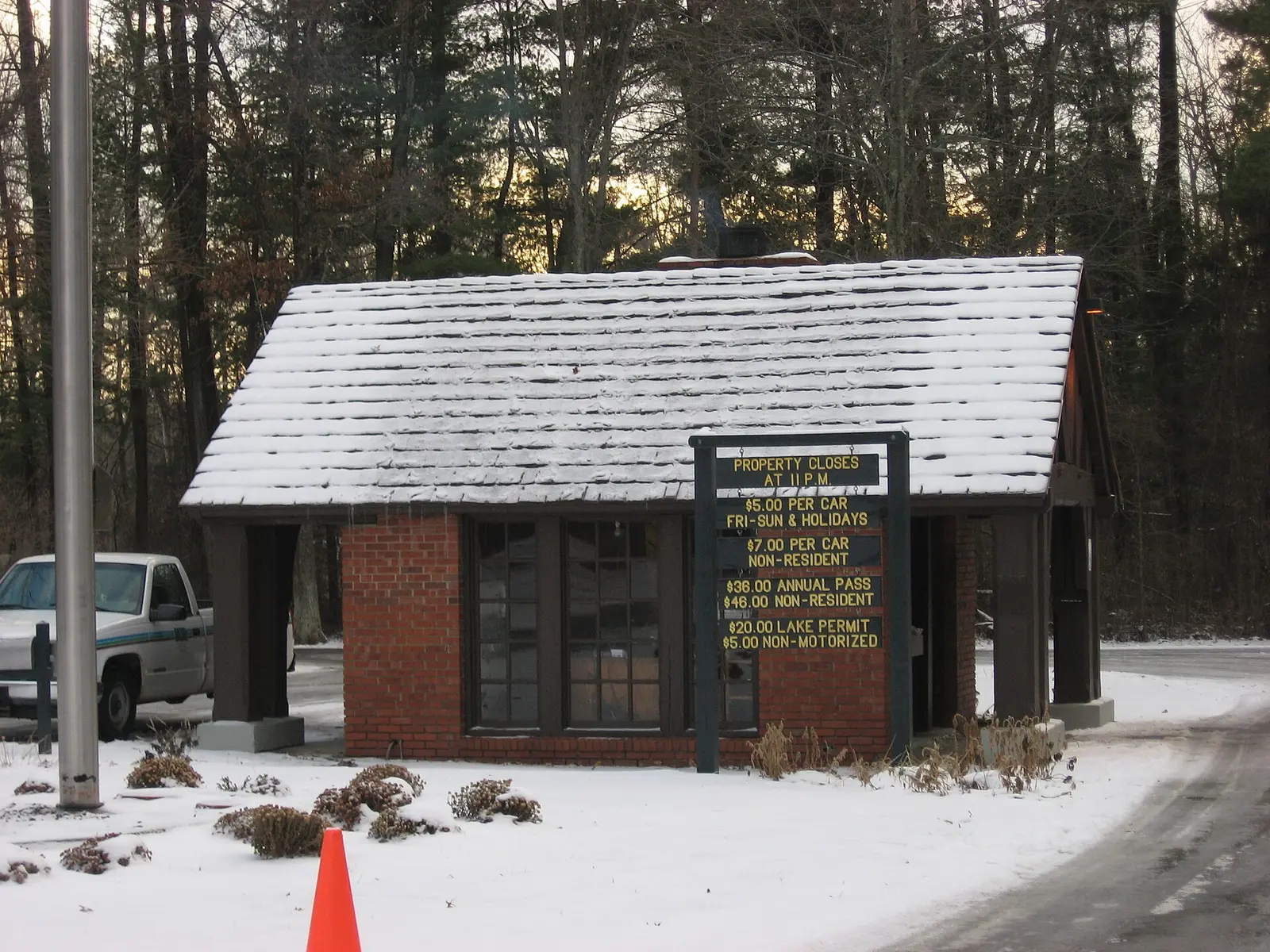

Shakamak State Park is a 27-acre park in Clay County, about 2 miles northwest of Jasonville.
Things to do include ice fishing, canoeing and kayaking, boating, swimming, and fishing. Facilities for water recreation include a swimming pool and a boat ramp. Camping is available: 174 campsites across 4 camping areas, including RV sites with full hookups. Roofed lodging includes cabins.
Fees and passes
Per vehicle daily gate fee: $7 Indiana plates / $15 out-of-state at state parks and state-managed lakes; exceptions Indiana Dunes ($7/$20), Prophetstown ($8/$16), Falls of the Ohio Interpretive Center ($9 adult/$7 child); $2 per person age 5+ on foot, bicycle or horseback.
Statewide fee rule from Indiana's park system; this park’s page doesn’t list its own fees.
Indiana park passes
- Annual Entrance Pass — $50. Noncommercial vehicle, driver and passengers at DNR properties that charge a gate fee Details
- Non-resident Annual Entrance Pass — $120. Non-Indiana resident noncommercial vehicles Details
- Golden Hoosier Passport — $25. Indiana residents 65+ or eligible for SS disability; vehicle, driver and passengers Details
- Disabled Hoosier Veteran Pass — $25. Persons eligible for a Disabled Hoosier Veteran plate Details
- SSDI Pass — $25. Indiana residents receiving or eligible for SSDI Details
From the Indiana state guide. Confirm which passes this park accepts.
Reservations
- Day use
- No day-use reservation requirement mentioned
- Booking system
- ReserveAmerica (Indiana State Parks) for camping, cabins, shelters, group camps; separate inn reservations
- Phone
- 1-866-622-6746 (camping, cabins, shelters, group camps); 1-877-563-4371 (inns and Brown County cabins)
We link to the official booking system rather than showing live availability, which changes minute to minute.
Camping
| Campground or site type | Sites | Hookups / features | Price |
|---|---|---|---|
| Full hook-up | 8 | Full hookup | — |
| Electric | 114 | Electric | — |
| Non-electric | 42 | — | |
| Maple Loop with two paved, accessible sites | 10 | — |
Camping details from the park
• Full hook-up / 8 sites • Electric / 114 sites • Non-electric / 42 sites • Maple Loop / 10 sites with two paved, accessible sites • Group Camp • Dumping Station • Camp Store
From the official park page, checked Oct 29, 2026. Site counts and prices can change; confirm when booking.
Cabins and lodging
Cabins
Things to do
PicnickingBoatingFishingIce fishingHikingCanoeing and kayakingSwimmingCamping
Trails
| Trail | Length | Difficulty | Notes |
|---|---|---|---|
| Trail 1 | 3.95 mi | Moderate | Begins and ends near the pool area and follows the shoreline of Lake Shakamak. This is an interesting trail on which to see waterfowl and shorebirds. |
| Trail 2 | 1.5 mi | Moderate | Joins with Trail 1 east of the pool parking lot and proceeds through an oak forest and pine plantings, past an abandoned coal mine and returns to Trail 1, south of the group camp. |
| Trail 3 | 1.4 mi | Moderate | Trail 3 goes through oak woods along the north shore of Lake Lenape, to the camp store (formerly the saddle barn). Native white-tailed deer have been observed on this trail. |
| Trail 4 | 1.6 mi | Moderate | Joins with Trail 3. Goes through oak trees and pines. Bridges and stairs add to the beauty. This trail takes you out to the campground. |
| Trail 5 | 2.2 mi | Moderate | — |
| Trail 6 | 1.08 mi | Easy | This multi-use trail can be used for hiking or biking. There are no bridges or stair structures. The trail winds through an oak and pine forest. |
| Trail 7 | 1.6 mi | Easy | This multi-use trail can be used for hiking or biking. There are no bridges or stair structures. The trail winds through an oak and pine forest, and white-tailed deer have been observed on the trail. |
Trail descriptions from the park
1. MODERATE (3.95 miles)—Begins and ends near the pool area and follows the shoreline of Lake Shakamak. This is an interesting trail on which to see waterfowl and shorebirds. 2. MODERATE (1.50 miles)—Joins with Trail 1 east of the pool parking lot and proceeds through an oak forest and pine plantings, past an abandoned coal mine and returns to Trail 1, south of the group camp. 3. MODERATE (1.40 miles)—Trail 3 goes through oak woods along the north shore of Lake Lenape, to the camp store (formerly the saddle barn). Native white-tailed deer have been observed on this trail. 4. MODERATE (1.60 miles)—Joins with Trail 3. Goes through oak trees and pines. Bridges and stairs add to the beauty. This trail takes you out to the campground. 5. MODERATE (2.2 Miles)- Hike along the scenic shore and Dam of Lake Kickapoo. Take in the beautiful aquatic view of Lake Kickapoo while bird watching for waterfowl and shorebirds. 6. EASY MULTI-USE (1.08 miles)– This multi-use trail can be used for hiking or biking. There are no bridges or stair structures. The trail winds through an oak and pine forest. 7. EASY MULTI-USE (1.60 miles) – This multi-use trail can be used for hiking or biking. There are no bridges or stair structures. The trail winds through an oak and pine forest, and white-tailed deer have been observed on the trail.
Swimming
Swimming / Pool / Water slide (Policy). Contact office for hours.
Boating and paddling
Boat Launch Ramp Boating Motor / Elect. trolling only Rental - Paddleboat, Rowboat, Kayak
Fishing
Fishing / Ice Fishing
A state fishing license is usually required.
Amenities
Facilities
- Picnic areas
- Nature center or museum
Water
- Swimming pool
- Boat ramp
Camping
- RV camping
- Electric hookups
- Water hookups
- Sewer hookups
Lodging
- Cabins
✓ listed by the park · ✕ the park says it is not available. Anything not shown here isn’t mentioned by the official source — that means unknown, not unavailable.
Accessibility
Maple Loop / 10 sites with two paved, accessible sites
Official accessibility information
Conditions change. Contact the park to confirm specific accessible features before your visit.
Getting there
- Address
- 6265 W. State Road 48
Jasonville, IN 47438 - Nearest town
- Jasonville — about 2 mi northwest (straight line)
- Coordinates
- 39.1763, -87.2345
- Phone
- 812-665-2158
Google Maps directionsApple MapsOfficial park map (PDF)
Directions from the park
Address: 6265 W. State Road 48 Jasonville, IN 47438
Nearby state parks
Sources and freshness
- Indiana State Parks — park page — last checked Oct 29, 2026
- Indiana State Parks 'Find A Park' property list + DNR ArcGIS site layers (coordinates)
- Wikidata
- USGS PAD-US 4.1 (boundary and acreage)
- Photo: Shakamak State Park gatehouse.jpg — Public domain (released by the author), Nyttend
“Last checked” is when our system last read the official source. No change has been detected since this page was first published. Hours, fees and rules can change without notice — confirm with the park before you go. Methodology