Chain O'Lakes State Park
Also known as Chain O' Lakes State Park
- Status
- Open (per official listing)
- Entrance fee
- Statewide rule — see below
- Day-use reservations
- None mentioned
- Dogs
- Not stated — check with park
- Camping
- 426 campsitesAlso cabins
- Official site
- in.gov260-636-2654
Official page last checked Oct 29, 2026. How we keep this current
Current alerts 1
Water quality BLUE-GREEN ALGAEFound in lakes year round. Don't drink the water. Shower after you swim. More information.
Posted by the park. Official alert
Overview
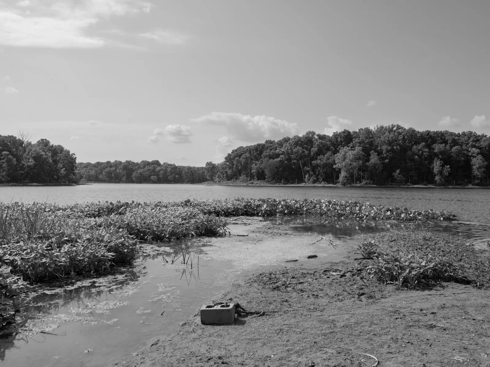
Covering about 2,215 acres, Chain O'Lakes State Park lies in Noble County, about 10 miles southwest of Kendallville.
Popular activities here are cross-country skiing, ice fishing, historic sites, winter sports, and canoeing and kayaking. On the water side, there is a swimming beach, a boat ramp, a fishing pier, and boat or kayak rentals. Camping is available: 426 campsites across 6 camping areas, including tent sites and primitive or hike-in sites. Roofed lodging includes cabins.
Fees and passes
Per vehicle daily gate fee: $7 Indiana plates / $15 out-of-state at state parks and state-managed lakes; exceptions Indiana Dunes ($7/$20), Prophetstown ($8/$16), Falls of the Ohio Interpretive Center ($9 adult/$7 child); $2 per person age 5+ on foot, bicycle or horseback.
Statewide fee rule from Indiana's park system; this park’s page doesn’t list its own fees.
Indiana park passes
- Annual Entrance Pass — $50. Noncommercial vehicle, driver and passengers at DNR properties that charge a gate fee Details
- Non-resident Annual Entrance Pass — $120. Non-Indiana resident noncommercial vehicles Details
- Golden Hoosier Passport — $25. Indiana residents 65+ or eligible for SS disability; vehicle, driver and passengers Details
- Disabled Hoosier Veteran Pass — $25. Persons eligible for a Disabled Hoosier Veteran plate Details
- SSDI Pass — $25. Indiana residents receiving or eligible for SSDI Details
From the Indiana state guide. Confirm which passes this park accepts.
Reservations
- Day use
- No day-use reservation requirement mentioned
- Booking system
- ReserveAmerica (Indiana State Parks) for camping, cabins, shelters, group camps; separate inn reservations
- Phone
- 1-866-622-6746 (camping, cabins, shelters, group camps); 1-877-563-4371 (inns and Brown County cabins)
We link to the official booking system rather than showing live availability, which changes minute to minute.
Camping
| Campground or site type | Sites | Hookups / features | Price |
|---|---|---|---|
| Electric | 331 | Electric | — |
| Non-Electric | 49 | — | |
| Primitive | 33 | — | |
| Rally Camp | 4 | — | |
| Canoe Camp | 4 | — | |
| Youth Tent Areas | 5 | — |
Camping details from the park
- Electric / 331 sites
- Non-Electric / 49 sites
- Primitive / 33 sites
- Rally Camp / 4 sites
- Canoe Camp / 4 sites
- Youth Tent Areas / 5 sites
- Campground Reservations
- Camp Store
- Dumping Station
From the official park page, checked Oct 29, 2026. Site counts and prices can change; confirm when booking.
Cabins and lodging
Cabins
Family Cabin brochure
Things to do
Historic sites and toursBoatingHikingFishingIce fishingRanger and interpretive programsCanoeing and kayakingWinter sportsSwimmingCampingCross-country skiingPicnicking
Trails
| Trail | Length | Difficulty | Notes |
|---|---|---|---|
| Trail 1 | 1.5 mi | Moderate | Begins north of campground, follows a ridge through the woods before dropping down in a valley, crosses two channels as it circles around the north side of Dock Lake, and returns to the campground. |
| Trail 2 | 1 mi | Moderate | Begins at the parking lot on the north shore of Bowen Lake, drops down and follows the lakeshore through the woods, and returns to the parking lot. |
| Trail 3 | 1.3 mi | Easy | Connects campground to the beach and nature center. |
| Trail 4 | 5.7 mi | Moderate | Passes four lakes, wooded areas, swamps, and open fields. |
| Trail 5 | 1.3 mi | Easy | Follows shore around Sand Lake; flat and wooded. |
| Trail 6 | 3 mi | Moderate | Trail 6 can be accessed from the cabins, campground, or Dock Lake boat ramp. Follows the southern shoreline of both Dock and Long lakes, and the channel between the two. |
| Trail 7 | 1.8 mi | Easy | Begins at Sand Lake fishing pier, follows the channel to Bowen Lake, turns west to connect with Weber Lake, and returns along the channel to Sand Lake. It winds through lowlands, along two different channels, and through an upland forest. |
| Trail 8 | 1.5 mi | Moderate | A self-guided nature trail, begins at Stanley Schoolhouse, circles Finster Lake and crosses a glacial kame, and returns to the schoolhouse. Map. |
| Trail 9 | 1.3 mi | Rugged | Starts at the schoolhouse parking area, travels through the Henslow’s sparrow restoration area open field, through a wetland, to the top of wooded glacial hill, and around Kreiger Lake, a beautiful small kettle lake. |
| Trail 10 | 2.5 mi | Moderate | This trail travels through open rolling hills, making it excellent for cross-country skiing in the winter. |
| Trail 11 | 4 mi | Easy | Connects the Stanley Schoolhouse and Youth Group Tent/Rally campgrounds. This turf-covered trail is excellent for cross-country running or skiing. |
| Trail 12 | 3.5 mi | Moderate | Begins and ends at beach, travels through glacial topography, hardwood forest, and follows ridgeline of a deep ravine with a meandering stream. |
Trail descriptions from the park
DESCRIPTION OF HIKING TRAILS
Chain O’Lakes State Park offers a motorized wheelchair that can be taken on trails and around facilities.
1. MODERATE (1.5 miles)—Begins north of campground, follows a ridge through the woods before dropping down in a valley, crosses two channels as it circles around the north side of Dock Lake, and returns to the campground.
2. MODERATE (1 mile)—Begins at the parking lot on the north shore of Bowen Lake, drops down and follows the lakeshore through the woods, and returns to the parking lot.
3. EASY (1.3 miles)—Connects campground to the beach and nature center.
4. MODERATE (5.7 miles)— Passes four lakes, wooded areas, swamps, and open fields.
5. EASY (1.3 miles)—Follows shore around Sand Lake; flat and wooded.
6. MODERATE (3 miles)—Trail 6 can be accessed from the cabins, campground, or Dock Lake boat ramp. Follows the southern shoreline of both Dock and Long lakes, and the channel between the two.
7. EASY (1.8 miles)—Begins at Sand Lake fishing pier, follows the channel to Bowen Lake, turns west to connect with Weber Lake, and returns along the channel to Sand Lake. It winds through lowlands, along two different channels, and through an upland forest.
8. MODERATE (1.5 miles)—A self-guided nature trail, begins at Stanley Schoolhouse, circles Finster Lake and crosses a glacial kame, and returns to the schoolhouse. Map.
9. RUGGED (1.3miles)—Starts at the schoolhouse parking area, travels through the Henslow’s sparrow restoration area open field, through a wetland, to the top of wooded glacial hill, and around Kreiger Lake, a beautiful small kettle lake.
10. MODERATE (2.5 miles)—This trail travels through open rolling hills, making it excellent for cross-country skiing in the winter.
11. EASY (4 miles)—Connects the Stanley Schoolhouse and Youth Group Tent/Rally campgrounds. This turf-covered trail is excellent for cross-country running or skiing.
12. MODERATE (3.5 miles)—Begins and ends at beach, travels through glacial topography, hardwood forest, and follows ridgeline of a deep ravine with a meandering stream.
Swimming
Swimming / beach - open the Saturday before Memorial Day - Labor Day
Boating and paddling
Discover this small boater’s paradise while enjoying the natural landscape from the unique vantage point of your boat
Boat launch ramps - Long, Dock, Sand, Miller, and Norman lakes
Boating / electric motor only
Rental - canoe, paddleboat, kayak, and rowboat. Canoe rental on weekends & holidays by the hour only.
Canoe Camp / 4 sites
Fishing
Fish on one of the 13 kettle lakes—try ice fishing in the winter
Fishing / Ice fishing. Fish cleaning station.
A state fishing license is usually required.
Amenities
Facilities
- Picnic areas
- Nature center or museum
Water
- Swimming beach
- Boat ramp
- Boat, canoe or kayak rentals
- Fishing pier
- Fish cleaning station
Camping
- RV dump station
- Tent camping
- Primitive or backcountry camping
Lodging
- Cabins
✓ listed by the park · ✕ the park says it is not available. Anything not shown here isn’t mentioned by the official source — that means unknown, not unavailable.
Getting there
- Address
- 2355 E. 75 S.
Albion, IN 46701 - Nearest town
- Kendallville — about 10 mi southwest (straight line)
- Coordinates
- 41.3413, -85.4015
- Phone
- 260-636-2654
Google Maps directionsApple MapsOfficial park map (PDF)
Directions from the park
Address: 2355 E. 75 S. Albion, IN 46701
Nearby state parks
Sources and freshness
- Indiana State Parks — park page — last checked Oct 29, 2026
- Indiana State Parks 'Find A Park' property list + DNR ArcGIS site layers (coordinates)
- Wikidata
- USGS PAD-US 4.1 (boundary and acreage)
- Photo: Public Lands Institute - Chain O'Lakes State Park - 001.tif — CC0 1.0 (public domain dedication), Public Lands Institute
“Last checked” is when our system last read the official source. No change has been detected since this page was first published. Hours, fees and rules can change without notice — confirm with the park before you go. Methodology