Talcott Mountain State Park
- Status
- Status not postedDaily 8 a.m. – sunset
- Entrance fee
- $15 ($10 nonresident)Annual pass available
- Day-use reservations
- None mentioned
- Dogs
- Not stated — check with park
- Camping
- None listed
- Official site
- ctparks.com(860) 242-1158
Official page last checked Oct 29, 2026. How we keep this current
Overview
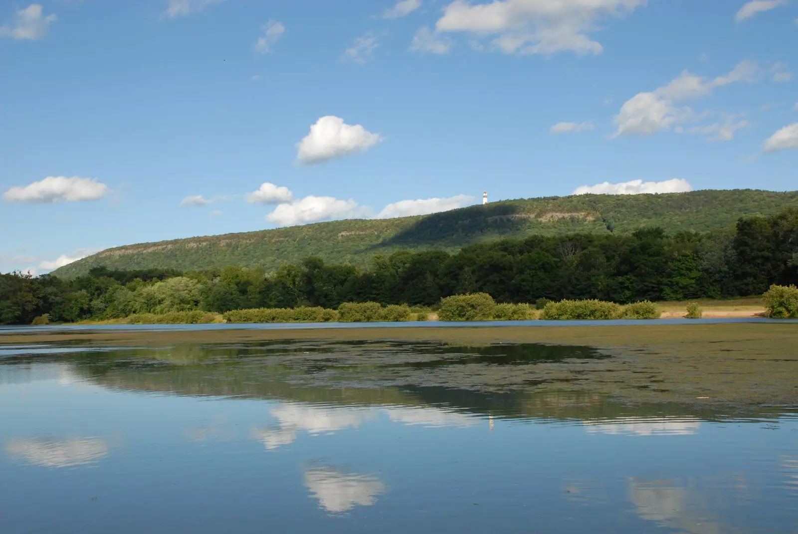

Talcott Mountain State Park is a park in Capitol Planning Region County, about 7 miles northwest of Hartford.
Things to do include historic sites, biking, hiking, and picnicking.
Hours
Park, gate, office and facility hours are listed separately because they often differ. Alerts above override normal hours.
| Facility | Days | Hours | Season |
|---|---|---|---|
| Park | Daily | 8 a.m. – sunset | — |
Official wording
Open Daily (8:00 a.m. – Sunset)
Source: official park page, checked Oct 29, 2026. Times are local to the park (America/New York).
Fees and passes
| Item | Amount |
|---|---|
| FREE – In-State Registered Vehicles (resident) | Free |
| $15 – Out-of-State Vehicles (Weekends/Holidays) (nonresident) | $15 |
| $10 – Out-of-State Vehicles (Weekdays) (nonresident) | $10 |
| $112 – Out-of-State Vehicles (Season Pass) (nonresident) | $112 · year |
Official wording
FREE – In-State Registered Vehicles $15 – Out-of-State Vehicles (Weekends/Holidays) $10 – Out-of-State Vehicles (Weekdays) $112 – Out-of-State Vehicles (Season Pass)
Connecticut park passes
- Passport to the Parks — free parking for CT-registered vehicles (funded by an $8/yr vehicle registration fee from July 1, 2025). Day-use parking at all CT State Parks and Forests Details
- Out-of-state vehicle season pass — $112. Season parking for out-of-state vehicles (as listed on park fee boxes) Details
From the Connecticut state guide. Confirm which passes this park accepts.
Reservations
- Day use
- No day-use reservation requirement mentioned
- Booking system
- ReserveAmerica (connecticutstateparks.reserveamerica.com)
- Phone
- 1-877-668-CAMP (2267)
We link to the official booking system rather than showing live availability, which changes minute to minute.
Things to do
BikingHikingHistoric sites and toursPicnicking
Trails
Around four miles of trails wind through the park, including a section of the blue-blazed Metacomet Trail, but the vast majority of visitors head up the main path to Heublein Tower.
The Tower Trail (Yellow Blaze)
- 2.5-mile out-and-back trail to the Tower with scenic views
- Level of difficult: Moderate
- By far the park’s main event, this trail takes you up Talcott Mountain to Heublein Tower. After a quick, but initial climb, the trail levels out and follows along a ridge rewarding you with sweeping vistas of Simsbury and Avon. Continue uphill on the main path to reach the summit, where Heublein Tower sits. Take a breather to appreciate the views, then make your way up the six flights to the top floor observation deck for panoramic views of the Hartford skyline, Farmington River Valley, and surrounding areas.
- Trail Map
- Trail Map - Mobile
Amenities
Facilities
- Picnic areas
✓ listed by the park · ✕ the park says it is not available. Anything not shown here isn’t mentioned by the official source — that means unknown, not unavailable.
Accessibility
No vehicular access to Heublein Tower.
Official accessibility information
Conditions change. Contact the park to confirm specific accessible features before your visit.
Rules and permits
- The museum opens Memorial Day weekend and closes for the season after October 31st
- During the season, the museum is open 10 a.m. to 4 p.m. on Fridays, Saturdays, Sundays and Mondays and closed Tuesday - Thursday
- Buses seating more than 30 passengers are not allowed at this park
- Trail Map
- Trail Map - Mobile
- Friends of Heublein Tower
Getting there
- Address
- Summit Ridge Drive
Simsbury, CT 06070 - Nearest town
- Hartford — about 7 mi northwest (straight line)
- Coordinates
- 41.8355, -72.7909
- Phone
- (860) 242-1158
Nearby state parks
Sources and freshness
- Connecticut State Parks and Forests — park page — last checked Oct 29, 2026
- DEEP 'Find a Park or Forest by Name' list (portal.ct.gov) merged with the ctparks.com ParkFinder search service
- Wikidata
- Photo: Talcott Mountain-9172007.jpg — Public domain (released by the author), Mentzelia
“Last checked” is when our system last read the official source. No change has been detected since this page was first published. Hours, fees and rules can change without notice — confirm with the park before you go. Methodology