The Forest of Nisene Marks State Park
Also known as Forest of Nisene Marks SP, Forest of Nisene Marks State Park, The Forest of Nisene Marks SP
- Status
- Open (per official listing)Daily sunrise – sunset
- Entrance fee
- $8 per dayAnnual pass available
- Day-use reservations
- None mentioned
- Dogs
- Statewide rule — see below6-ft leash
- Camping
- Yes
- Official site
- parks.ca.gov(831) 763-7063
Official page last checked Oct 29, 2026. How we keep this current
Overview
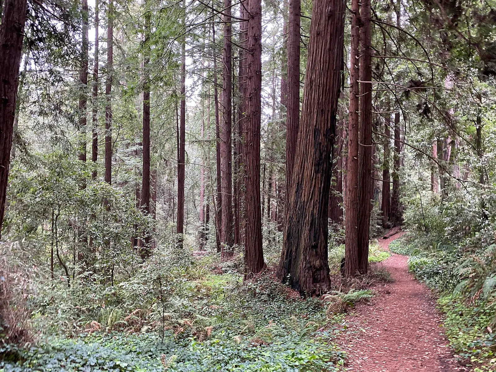

In Santa Cruz County, about 3 miles east of Capitola, The Forest of Nisene Marks State Park covers about 9,980 acres.
The park supports historic sites, geocaching, picnicking, and hiking. The official site lists about 30 miles of trails. For overnight stays there are campsites (tent sites).
Hours
Park, gate, office and facility hours are listed separately because they often differ. Alerts above override normal hours.
| Facility | Days | Hours | Season |
|---|---|---|---|
| Park | Daily | sunrise – sunset | — |
Official wording
Sunrise to Sunset
Source: official park page, checked Oct 29, 2026. Times are local to the park (America/Los Angeles).
Fees and passes
| Item | Amount |
|---|---|
| Vehicle Day Use | $8 |
| Bus, Large | $100 |
| Bus, Small | $50 |
Official wording
Special rates may apply for peak season, high demand holiday periods, and during weekends. Prices are subject to change without notice. • Vehicle Day Use: $8.00 • Bus, Large: $100.00 • Bus, Small: $50.00
California park passes
- California Explorer Annual Pass — $195. Vehicle day-use entry to 134 state parks incl. high-demand Southern California beaches Details
- Golden Poppy Annual Pass — $125. Vehicle day-use entry to 112 state parks Details
- Historian Passport — $50. Admission for up to four people at per-person-fee State Historic Parks Details
- Off-Highway Vehicle (OHV) Annual Pass — $50. Entry to State Vehicular Recreation Areas that collect day-use fees Details
- SNO-Park Pass — $40 season / $15 day. 18 SNO-PARK winter recreation areas Details
From the California state guide. Confirm which passes this park accepts.
Reservations
- Day use
- No day-use reservation requirement mentioned
- Booking system
- ReserveCalifornia
- Phone
- (800) 444-7275
We link to the official booking system rather than showing live availability, which changes minute to minute.
Pets
See the park’s wording · leash up to 6 feet
Are dogs allowed? Yes: Dogs allowed below Porter Picnic Area. DOGS are only allowed on Aptos Creek fire Road and the four single-track trails below the steel bridge (named above). Except for service animals, dogs are prohibited beyond the gate at the Porter picnic area parking lot. Dogs must be attended and on leashes no longer than six feet at all times. For a list of locations that you can take your dog to in Santa Cruz County, view Where Can I Take My Dog?
Service animals are generally permitted where pets are not. Check with the park for specific areas.
Camping
Crumb Clean Campaign
This park is Crumb Clean! Watch this short video to learn about the marbled murrelet, an endangered bird that nests in the park, and how you can protect it. Vea el video en español aquí.
Overnight facilities: Remote Camping
From the official park page, checked Oct 29, 2026. Site counts and prices can change; confirm when booking.
Things to do
Historic sites and toursPicnickingGeocachingHikingCamping
Trails
Limited Road and Trail Access
- West Ridge Trail Camp
- Aptos Creek Trail
- The Trail to Five Finger Falls closed at the Big Slide Trail/ Aptos Creek Trail intersect
Volunteer with the Trail Crew
Visit nisene.org for details.
The Nisene Marks Volunteer Trail Crew helps make it possible for everyone to safely enjoy the beauty of our park. The Trail Crew meets the third Sunday of each month at 9:30am at the entrance kiosk, rain or shine. A typical workday lasts until mid-afternoon. Please bring your own work gloves, lunch, and water. Gain a unique perspective of The Forest of Nisene Marks State Park; enjoy a lively and productive experience with others who share a love of these redwood forests. Learn the satisfaction of participating in a vital part of the park's ability to educate and inspire the public! Event made possible by the Advocates of Nisene Marksand the Nisene Marks Trail Crew.
Amenities
Facilities
- Restrooms
- Picnic areas
- Nature center or museum
- Parking
Camping
- Tent camping
✓ listed by the park · ✕ the park says it is not available. Anything not shown here isn’t mentioned by the official source — that means unknown, not unavailable.
Accessibility
Overview
The park offers rugged semi-wilderness, rising from sea level to steep coastal mountains of more than 2,600 feet. Once the site of logging operations until the 1920s, visitors can still find evidence of logging operations, mill sites and trestles in the park. The land was donated to the state by the Marks family in 1963. The park is four miles north of Aptos on Aptos Creek Road. Phone (831) 763-7062 for more information.
Picnic Area
The Entrance Station/Emmett Reed Picnic Area has an accessible picnic area at the trailhead to the Waggoner Overlook Trail. Accessible pit restrooms and parking are located in this area.
The George’s Picnic Area has accessible pit restrooms and accessible parking.
Read more from the park
Trails
Accessible Trails
The Waggoner Overlook Trail provides a 0.12 mile Trail experience through redwood forest to an overlook of Aptos Creek. An accessible picnic area is located at the overlook.
Fire and Service Roads
The Aptos Creek Fire Road is a service road that are used by park visitors for hiking. The first 0.12 miles of the service road is generally accessible. Beyond the 0.12 miles the service road running grades increase up to 25%. Some sections of the road contain features that could be challenging for some users, including cross slopes and minor ruts in the road surface. Trailhead and accessible parking are located at the nearby Porter Family Picnic Area.
Official accessibility information
Conditions change. Contact the park to confirm specific accessible features before your visit.
Getting there
- Address
- 1700 Aptos Creek Road
Aptos, CA 95003 - Nearest town
- Capitola — about 3 mi east (straight line)
- Coordinates
- 36.9856, -121.9050
- Phone
- (831) 763-7063
- SCD.specialevents@parks.ca.gov
Entrances
- Directions point
Google Maps directionsApple MapsOfficial park map (PDF)
Directions from the park
The park is four miles north of Aptos on Aptos Creek Road.
Nearby state parks
Sources and freshness
- California State Parks — park page — last checked Oct 29, 2026
- California State Parks Listing page (one link per unit, page_id = officialId), unioned with the CSP Enterprise GIS 'ParkEntryPoints' ArcGIS layer (coords, address, county, unit number, management status) and the 'CSPParkUnit_CurrentStatus' layer (open/partial/full closure)
- Wikidata
- USGS PAD-US 4.1 (boundary and acreage)
- Photo: The Forest of Nisene Marks State Park April 2022 02.jpg — CC0 1.0 (public domain dedication), Thomson200
“Last checked” is when our system last read the official source. No change has been detected since this page was first published. Hours, fees and rules can change without notice — confirm with the park before you go. Methodology