Prairie Creek Redwoods State Park
- Status
- Open (per official listing)Open daily; hours not posted
- Entrance fee
- $8 per dayAnnual pass available
- Day-use reservations
- None mentioned
- Dogs
- Dogs allowed, with restrictions
- Camping
- Yes
- Official site
- parks.ca.gov(707) 464-6101
Official page last checked Oct 29, 2026. How we keep this current
Overview
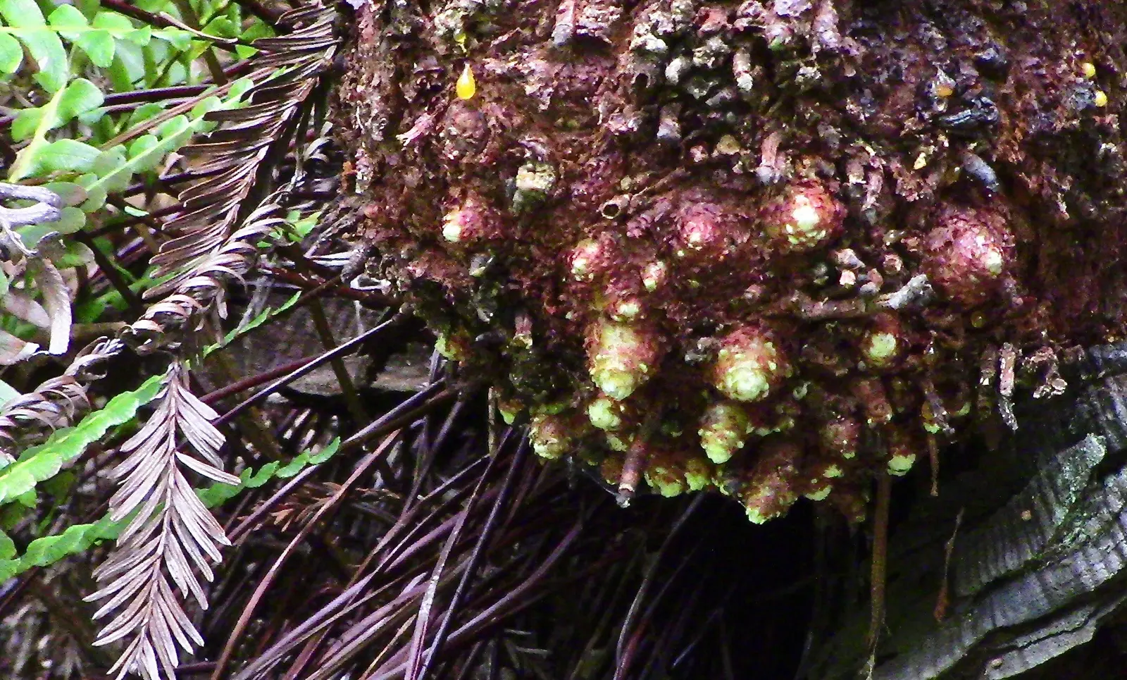

Covering about 13,211 acres, Prairie Creek Redwoods State Park lies in Humboldt County, about 29 miles south of Crescent City.
Visitors come for surfing, historic sites, fishing, geocaching, and picnicking. For overnight stays there are campsites (RV sites, tent sites, and showers).
Hours
Park, gate, office and facility hours are listed separately because they often differ. Alerts above override normal hours.
| Facility | Days | Hours | Season |
|---|---|---|---|
| Park | Open daily (hours not posted) | ||
| Day use | Daily | sunrise – sunset | — |
Official wording
Open year-round
Day use hours: Sunrise - Sunset
707-832-1527
Source: official park page, checked Oct 29, 2026. Times are local to the park (America/Los Angeles).
Fees and passes
| Item | Amount |
|---|---|
| Vehicle Day Use | $8 |
Official wording
Special rates may apply for peak season, high demand holiday periods, and during weekends. Prices are subject to change without notice. • Vehicle Day Use: $8.00
California park passes
- California Explorer Annual Pass — $195. Vehicle day-use entry to 134 state parks incl. high-demand Southern California beaches Details
- Golden Poppy Annual Pass — $125. Vehicle day-use entry to 112 state parks Details
- Historian Passport — $50. Admission for up to four people at per-person-fee State Historic Parks Details
- Off-Highway Vehicle (OHV) Annual Pass — $50. Entry to State Vehicular Recreation Areas that collect day-use fees Details
- SNO-Park Pass — $40 season / $15 day. 18 SNO-PARK winter recreation areas Details
From the California state guide. Confirm which passes this park accepts.
Reservations
- Day use
- No day-use reservation requirement mentioned
- Booking system
- ReserveCalifornia
- Phone
- (800) 444-7275
We link to the official booking system rather than showing live availability, which changes minute to minute.
Pets
Dogs allowed, with restrictions
Not allowed in or on: trails.
Are dogs allowed? Yes: Except for service animals, dogs not allowed on trails.
Service animals are generally permitted where pets are not. Check with the park for specific areas.
Camping
Overnight facilities: Tent Camping, Hike-and-Bike Campsites, Remote Camping, RV Access
From the official park page, checked Oct 29, 2026. Site counts and prices can change; confirm when booking.
Things to do
Historic sites and toursPicnickingFishingSurfingGeocachingHikingCamping
Amenities
Facilities
- Restrooms
- Showers
- Drinking water
- Picnic areas
- Visitor center
- Nature center or museum
- Parking
Camping
- Tent camping
- RV camping
✓ listed by the park · ✕ the park says it is not available. Anything not shown here isn’t mentioned by the official source — that means unknown, not unavailable.
Accessibility
Overview
Prairie Creek is a 14,000 acre sanctuary of old growth coast redwood set aside as a state park in the 1920s. Managed cooperatively by the National Park Service and California State Parks, it is 50 miles north of Eureka and 25 miles south of Crescent City on Newton B. Drury Scenic Parkway off Highway 101. Phone (707) 464-6101 ext. 5301 for more information.
Camping
Elk Prairie Campground: Sites 6, 22, 23, and 69 are designated accessible. All are generally level with paved parking. Sites 22 and 23 have accessible tables placed on firm surfaces, and accessible campfire rings. All four cabins within the campground are accessible, including parking and routes. Electricity is available within the cabins. There are no restrooms in the cabins.
Read more from the park
Restrooms/Showers: Both restroom/shower buildings in the campground are generally accessible and are a short distance from the campsites and cabins. Generally accessible parking adjacent to site 69 is a short distance from the south loop restroom/shower building.
Gold Bluffs Beach Campground: This small campground features accessible sites on hard packed dirt and gravel. Accessible combination restrooms with showers are available. Restroom/shower parking is paved; however the route to the restroom is on hard packed dirt and gravel.
Trails
The Big Tree Trail is a 60 foot long accessible connector trail between the Big Tree parking area and the Foothill Trail. The surface is compacted aggregate. The trail is generally flat at less than 5% slopes. Additional accessible trailhead parking and an accessible restroom are planned for the Big Tree parking area.
The Campfire Center Trail is a 0.34 mile accessible trail through the redwoods from the visitor center to the campfire center. The surface is compacted aggregate. The trail is generally flat at less than 5% slopes. Potable water, accessible restrooms and accessible parking are at various locations along the trail.
The Karl Knapp Trail aka Prairie Creek Trail is an ‘out-and-back’ accessible trail that is 1.19 miles each way through the redwoods from the visitor center. The surface is compacted aggregate, rock, & wood. There are several armored crossings on the trail that water flows over the trail during rain events that might be challenging for some users. The trail is generally flat at less than 5% slopes with intermittent sections between 5% to 8% and one section for 12 feet at 9%. Accessible parking is located at the visitor center.
The Redwood Access Trail is a 0.53 mile accessible trail through the redwoods from the visitor center to the Campfire center and Elk Prairie Creek Campground. The trail is generally flat at less than 5% slopes with intermittent sections between 5% to 8%. Accessible parking is located at the visitor center.
The Revelation Trail is a 0.26 mile accessible loop trail providing close-up views through the old growth redwoods between the Campfire Center Trail and the Redwood Access Trail. The surface is compacted aggregate. The trail is generally flat at less than 5% slopes. Accessible restrooms and parking are provided along the Campfire Center Trail.
The Cathedral Trees Trail is a 0.42 mile accessible trail from the visitor center to Elk Prairie Trail. The surface is compacted aggregate. The trail is generally flat at less than 5% slopes with intermittent sections between 5% to 8%. Accessible parking at the visitor center.
The Foothill Trail is a 0.93 mile accessible trail from the Cathedral Trail to Newton B. Drury Parkway. Users can continue from the end of the trail at Newton B. Drury Parkway to the Prairie Creek trail via short connector trail. The trail accesses spectacular old growth forest to include the big tree area. The surface is compacted aggregate. There are several armored crossings on the trail that water flows over the trail during rain events that might be challenging for some users. The trail is generally flat at less than 5% slopes with intermittent sections between 5% to 8% and one section for 4 feet at 9%. Additional accessible trailhead parking and an accessible restroom are planned for the Big Tree parking area.
The Elk Prairie Trail is a 1.64 mile accessible trail connecting the Elk Prairie Campground to the Cathedral Trees Trail. Departing from the campground (near campsite 63), visitors will experience hiking along Prairie Creek through woodland riparian vegetation, followed by a short hike up and around the prairie landscape. The trail crosses the Newton B. Drury Parkway, climbs up into the redwood groves with views looking over the prairie, and then along Boyes Creek through more woodland riparian vegetation. The surface is compacted aggregate, rock, and wood. There are several armored crossings on the trail that water flows over the trail during rain events that might be challenging for some users. The trail is generally flat at less than 5% slopes with intermittent sections between 5% to 8%. Accessible parking is available at the trailhead in the campground.
The Elk Prairie Trail is temporarily closed and not accessible between the campground and Newton B Drury Parkway due to utility construction work. Closure of this section is anticipated through May 2025. The open section of the trail can still be accessed via the Cathedral Trees Trail.
Trail Name Running Slope Cross Slope Trail Width Trail Surface
Big Tree Trail 5 FT Average Aggregate
5% Maximum 5% Maximum 5 FT Minimum
Campfire Center Trail 5 FT Average Aggregate
5% Maximum 5% Maximum 5 FT Minimum
Karl Knapp Trail 3% Average 5 FT Average Aggregate, Wood, & Rock
9% Maximum 5% Maximum 5 FT Minimum
Redwood Access Trail 3% Average 5 FT Average Aggregate
8% Maximum 5% Maximum 5 FT Minimum
Revelation Trail 2% Average 5 FT Average Aggregate
5% Maximum 5% Maximum 5 FT Minimum
Cathedral Trees Trail 2% Average 2.3% Average 5 FT Average Aggregate
8% Maximum 5% Maximum 5 FT Minimum
Foothill Trail 3% Average 5 FT Average Aggregate, Rock, & Wood
9% Maximum 5% Maximum 5 FT Minimum
Elk Prairie Trail 4% Average 2.4% Average 5 FT Average Aggregate, Rock, & Wood
8% Maximum 5% Maximum 5 FT Minimum
Beach/Shore Access
A beach wheelchair is available for check-out at the Gold Bluffs Beach Campground kiosk. Phone (707) 601-4634 for more information.
Within the Redwood National and State Park system, The Thomas H. Kuchel Visitor Center in Orick may also have beach wheelchairs available. Phone (707) 465-7331 for more information.
Official accessibility information
Conditions change. Contact the park to confirm specific accessible features before your visit.
Getting there
- Address
- Redwood Highway
Orick, CA 95555 - Nearest town
- Crescent City — about 29 mi south (straight line)
- Coordinates
- 41.3638, -124.0209
- Phone
- (707) 464-6101
Entrances
- Directions point
Google Maps directionsApple MapsOfficial park map (PDF)
Directions from the park
The park is located 50 miles north of Eureka and 25 miles south of Crescent City on Newton B. Drury Scenic Parkway off of Highway 101. The visitor center & Elk Prairie Campground are located at the southern end of the Parkway. Gold Bluffs Beach Campground and Fern Canyon are accessed by Davison Road, which is, located 3 miles north of Orick off of Highway 101. 50 miles from Eureka and Crescent City. Davison Road, the access road to Fern Canyon and Gold Bluffs Beach, has vehicle limitations 8' wide and 24' long. No trailers are allowed.
Nearby state parks
Sources and freshness
- California State Parks — park page — last checked Oct 29, 2026
- California State Parks Listing page (one link per unit, page_id = officialId), unioned with the CSP Enterprise GIS 'ParkEntryPoints' ArcGIS layer (coords, address, county, unit number, management status) and the 'CSPParkUnit_CurrentStatus' layer (open/partial/full closure)
- Wikidata
- USGS PAD-US 4.1 (boundary and acreage)
- Photo: Lignotuber active redwood.jpg — CC0 1.0 (public domain dedication), Cbarlow
“Last checked” is when our system last read the official source. No change has been detected since this page was first published. Hours, fees and rules can change without notice — confirm with the park before you go. Methodology