Point Lobos State Natural Reserve
Also known as Point Lobos State Reserve
- Status
- Open (per official listing)Daily 8 a.m. – 7 p.m.
- Entrance fee
- $10 per dayAnnual pass available
- Day-use reservations
- Required
- Dogs
- No dogs
- Camping
- None listed
- Official site
- parks.ca.gov(831) 624-4909
Official page last checked Oct 29, 2026. How we keep this current
Overview
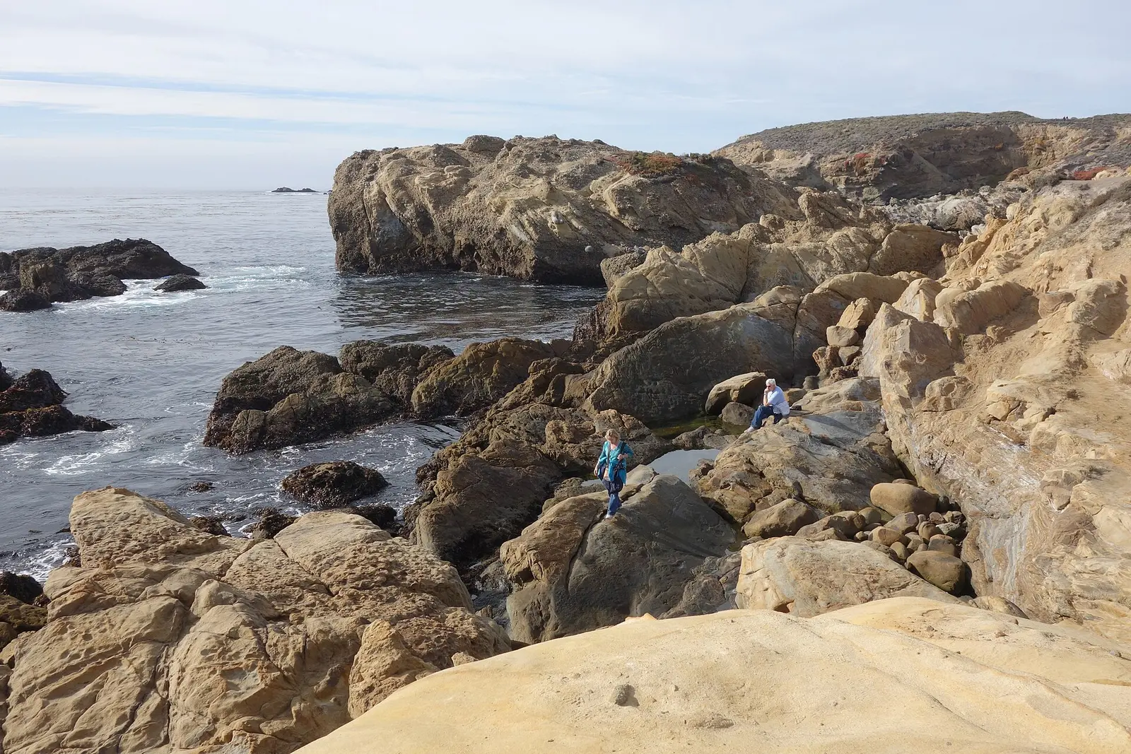

In Monterey County, about 3 miles south of Carmel-by-the-Sea, Point Lobos State Natural Reserve covers about 1,532 acres.
Popular activities here are wildlife watching and hiking.
Hours
Park, gate, office and facility hours are listed separately because they often differ. Alerts above override normal hours.
| Facility | Days | Hours | Season |
|---|---|---|---|
| Day use | Daily | 8 a.m. – 7 p.m. | — |
Official wording
Day Use Area: 8:00 a.m to 7 p.m last entry at 6:30pm.
Source: official park page, checked Oct 29, 2026. Times are local to the park (America/Los Angeles).
Fees and passes
| Item | Amount |
|---|---|
| Vehicle Day Use | $10 |
| Bus, Large | $100 |
| Bus, Small | $50 |
Official wording
Special rates may apply for peak season, high demand holiday periods, and during weekends. Prices are subject to change without notice. • Vehicle Day Use: $10.00 • Bus, Large: $100.00 • Bus, Small: $50.00
California park passes
- California Explorer Annual Pass — $195. Vehicle day-use entry to 134 state parks incl. high-demand Southern California beaches Details
- Golden Poppy Annual Pass — $125. Vehicle day-use entry to 112 state parks Details
- Historian Passport — $50. Admission for up to four people at per-person-fee State Historic Parks Details
- Off-Highway Vehicle (OHV) Annual Pass — $50. Entry to State Vehicular Recreation Areas that collect day-use fees Details
- SNO-Park Pass — $40 season / $15 day. 18 SNO-PARK winter recreation areas Details
From the California state guide. Confirm which passes this park accepts.
Reservations
- Day use
- Required
- Booking system
- ReserveCalifornia
- Phone
- (800) 444-7275
ALL school groups MUST have a reservation to enter the reserve.
We link to the official booking system rather than showing live availability, which changes minute to minute.
Pets
No dogs
Are dogs allowed? No Dogs Dogs are not allowed anywhere within the reserve and cannot be left inside parked vehicles.
Service animals are generally permitted where pets are not. Check with the park for specific areas.
Things to do
Wildlife viewing and birdingHiking
Accessibility
Overview
Deriving its name from the offshore rocks at Punta de los Lobos Marinos, Point of the Sea Wolves, Point Lobos State Reserve offers hiking, photography, painting, nature study, and picnicking, and is very popular for SCUBA diving. On nice days, prospective visitors should try to arrive early, as the park fills rapidly. The park entrance is located three miles south of Carmel on Highway One. Phone (831) 624-4909 for more information.
Easy Access Adventures! Explore the wonders of Point Lobos at your own pace along trails that are fully compliant with ADA (Americans with Disabilities Act) standards. You are welcome to tour at your own pace, whether you walk fast or slow, are pushing a stroller or walker, using a cane or a wheelchair. Docents with scopes, binoculars, otter pelts, photos, and more will be along the trails to make Point Lobos come alive! We are using state-of-the-art technology to make it easy for anyone to see what is happening in real time in the view of a spotting scope. A close-up of an otter’s face! Baby birds in a nest! Whatever is found by our docents can be seen by all. Of course, there is no charge for participating. For more information visit the Point Lobos Foundation.
Read more from the park
Picnic Area
Whaler’s Cove: The picnic area has one accessible table on a new firm, stable surface. The parking lot and route of travel are generally accessible. Restrooms: A generally accessible comfort station is nearby. The path of travel is accessible.
The Piney Woods area has an accessible table on dirt surfaces that may be usable in dry weather. An accessibly designed restroom is available in the parking area.
The picnic area at Bird Island has four accessible tables including accessible parking and restroom.
Trails
The Cypress Grove Trail is accessible for 0.25 mile and offers excellent views of the cove. The trailhead, accessible parking and a accessible comfort station are located in the Cypress Grove parking area.
The Sand Hill Trail, also called the Sea Lion Point Trail, is a paved accessible loop trail about 0.4 mile long leading to great views of the cove and perhaps the occasional otter and/or sea lion. Parking is available at the Sea Lion Point lot. The Trailhead is 200 feet beyond the parking lot along the road.
The Carmelo Meadow Trail is an ‘out-and-back accessible trail that is 0.25 miles each way that begins at the entry station and provides accessible trail linkage to the Granite Point Trail (also accessible). The trail winds through native Monterey Pine forest and terminates at Whalers Cove. The surfaced is compacted soil. The trail is generally flat at less than 5% slopes. Accessible parking is available at the park entrance.
The Granite Point Trail is an ‘out-and-back’ accessible trail that is 0.36 miles each way that is accessed by way of the Carmelo Meadow Trail. The route hugs the Whalers Cove bluff offering spectacular views of the coastline and its abundant wildlife. The surface is compacted soil. The trail is generally flat at less than 5% slopes with intermittent sections between 5% to 9%. Accessible parking is available at the park entrance.
The Bird Island Trail is an ‘out-and-back’ accessible trail that is 0.52 miles. The trail consists of an ‘out-and-back’ section for 0.36 miles and a loop section for 0.16 miles for a total round trip of 0.88 miles. The trail is at the Reserve’s southern most parking lot that provides views of Bird Island and China Cove where visitors can watch harbor seals nursing new born pups. The surface is compacted aggregate, rock, & wood. There is an overlook that the surface is rock that might be challenging to some users. The trail is generally flat at less than 5% slopes with intermittent sections between 5% to 8%. Accessible restrooms and picnic areas are located near the trailhead.
The Lace Lichen Trail is an ‘out-and-back’ accessible trail that is 0.75 miles each way that begins at the entry station and provides accessible trail linkage to the Cypress Grove parking area. The trail winds through native Monterey Pine forest. The surfaced is compacted soil. The trail is generally flat at less than 5% slopes with intermittent sections between 5% to 6%. Accessible parking is available at the park entrance.
Trail Name Running Slope Cross Slope Trail Width Trail Surface
Carmelo Meadow Trail 2% Average 4 FT Average Soil
5% Maximum 5% Maximum 4 FT Minimum
Granite Point Trail 3% Average 4 FT Average Soil
9% Maximum 5% Maximum 4 FT Minimum
Bird Island Trail 4% Average 5 FT Average Aggregate, Rock, & Wood
8% Maximum 5% Maximum 5 FT Minimum
Lace Lichen Trail 2% Average 3% Average 5 FT Average Soil
6% Maximum 5% Maximum 5 FT Minimum
Other Information
The Cypress Grove area has an information kiosk with park-related publications and other small items of interest. Accessible parking and restroom are nearby.
Official accessibility information
Conditions change. Contact the park to confirm specific accessible features before your visit.
Getting there
- Address
- 27829 Hwy 1
Carmel, CA 93923 - Nearest town
- Carmel-by-the-Sea — about 3 mi south (straight line)
- Coordinates
- 36.5160, -121.9371
- Phone
- (831) 624-4909
Entrances
- Directions point
Google Maps directionsApple MapsOfficial park map (PDF)
Directions from the park
The reserve is located on the central coast of California in Monterey County. The entrance is located three miles south of Carmel on Highway 1.
Nearby state parks
Sources and freshness
- California State Parks — park page — last checked Oct 29, 2026
- California State Parks Listing page (one link per unit, page_id = officialId), unioned with the CSP Enterprise GIS 'ParkEntryPoints' ArcGIS layer (coords, address, county, unit number, management status) and the 'CSPParkUnit_CurrentStatus' layer (open/partial/full closure)
- Wikidata
- USGS PAD-US 4.1 (boundary and acreage)
- Photo: General view - Point Lobos State Reserve - DSC07092.JPG — CC0 1.0 (public domain dedication), Daderot
“Last checked” is when our system last read the official source. No change has been detected since this page was first published. Hours, fees and rules can change without notice — confirm with the park before you go. Methodology