Moss Landing State Beach
- Status
- Open (per official listing)Daily 8 a.m. – sunset
- Entrance fee
- Statewide rule — see below
- Day-use reservations
- None mentioned
- Dogs
- Dogs allowed, with restrictions
- Camping
- Yes
- Official site
- parks.ca.gov(831) 649-2836
Official page last checked Oct 29, 2026. How we keep this current
Overview
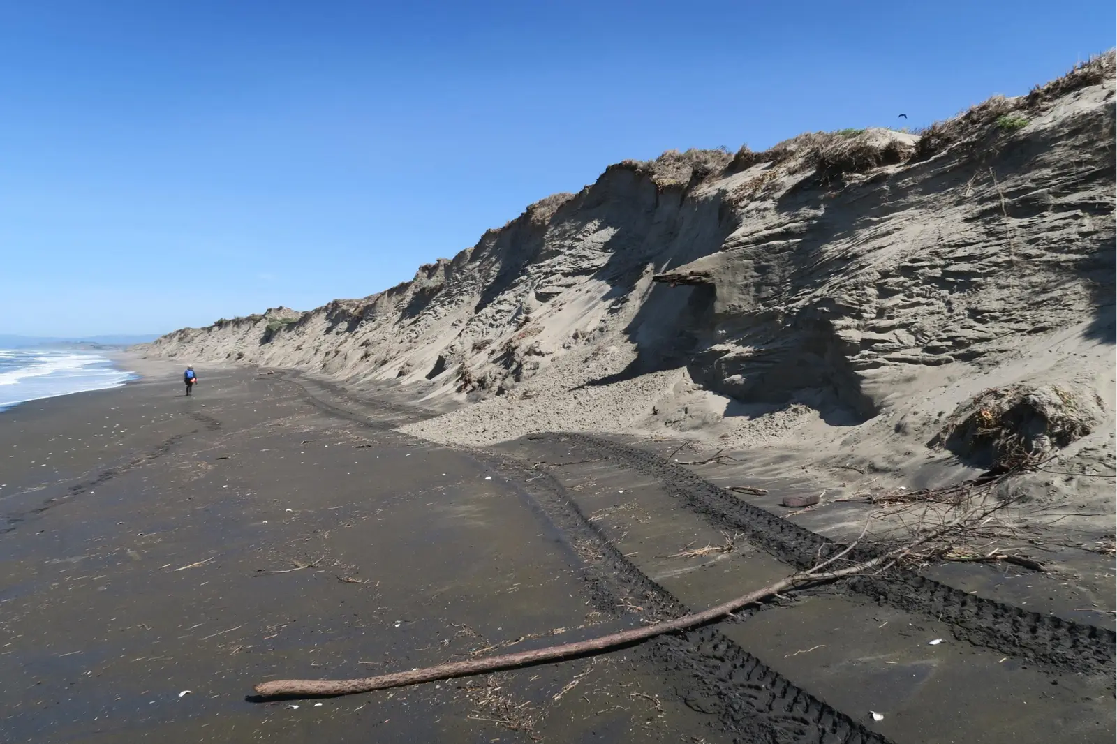

In Monterey County, about 7 miles south of Watsonville, Moss Landing State Beach covers about 54 acres.
Visitors come for surfing, horseback riding, swimming, fishing, and wildlife watching. On the water side, there is a swimming beach.
Hours
Park, gate, office and facility hours are listed separately because they often differ. Alerts above override normal hours.
| Facility | Days | Hours | Season |
|---|---|---|---|
| Park | Daily | 8 a.m. – sunset | — |
Official wording
8 AM – Sunset
Source: official park page, checked Oct 29, 2026. Times are local to the park (America/Los Angeles).
Fees and passes
Per vehicle at most parks (vehicles of 9 people or less, walk/bike-in free); per person at State Historic Parks and museums; amounts vary by park and are listed on each park page.
Statewide fee rule from California's park system; this park’s page doesn’t list its own fees.
California park passes
- California Explorer Annual Pass — $195. Vehicle day-use entry to 134 state parks incl. high-demand Southern California beaches Details
- Golden Poppy Annual Pass — $125. Vehicle day-use entry to 112 state parks Details
- Historian Passport — $50. Admission for up to four people at per-person-fee State Historic Parks Details
- Off-Highway Vehicle (OHV) Annual Pass — $50. Entry to State Vehicular Recreation Areas that collect day-use fees Details
- SNO-Park Pass — $40 season / $15 day. 18 SNO-PARK winter recreation areas Details
From the California state guide. Confirm which passes this park accepts.
Reservations
- Day use
- No day-use reservation requirement mentioned
- Booking system
- ReserveCalifornia
- Phone
- (800) 444-7275
We link to the official booking system rather than showing live availability, which changes minute to minute.
Pets
Dogs allowed, with restrictions
Not allowed in or on: the beach or dunes; this location.
Are dogs allowed? DOGS are not permitted on the beach or dunes. On-leash dogs are allowed on Jetty Road. PETS Dogs are not allowed at this location. Dogs on leash are allowed at Monterey State Beach (South of the Monterey Beach Resort hotel), Asilomar State Beach, Carmel River State Beach, and Garrapata State Park.
Service animals are generally permitted where pets are not. Check with the park for specific areas.
Camping
CAMPING
There is NO campground at this State Beach.
From the official park page, checked Oct 29, 2026. Site counts and prices can change; confirm when booking.
Things to do
PicnickingFishingSwimmingWildlife viewing and birdingSurfingGeocachingHikingHorseback riding
Amenities
Facilities
- Drinking water
- Picnic areas
- Parking
Water
- Swimming beach
Recreation
- Horse trails
✓ listed by the park · ✕ the park says it is not available. Anything not shown here isn’t mentioned by the official source — that means unknown, not unavailable.
Accessibility
Overview
Offshore fishing, surfing, windsurfing and horseback riding are referred activities. The beach is a favorite place for picnics because the dunes protect it from afternoon winds.
Water recreation is dangerous because of strong rip currents. The beach is located on Jetty Road in Moss Landing, north of Monterey via Highway One. Phone 831-649-2836.
Trails
The Beach Access Trail is a service road on packed sand leading to the (beach) jetty that is accessible for 0.06 mile. The trailhead and roadside parking are near the end of Jetty Road within 100 feet of park entrance.
Official accessibility information
Conditions change. Contact the park to confirm specific accessible features before your visit.
Getting there
- Address
- Jetty Road & Hwy 1
Watsonville, CA 95076 - Nearest town
- Watsonville — about 7 mi south (straight line)
- Coordinates
- 36.8169, -121.7860
- Phone
- (831) 649-2836
Entrances
- Directions point
Google Maps directionsApple MapsOfficial park map (PDF)
Directions from the park
The beach is located on Jetty Road in Moss Landing and 16 miles north of Monterey via Highway 1.
Nearby state parks
Sources and freshness
- California State Parks — park page — last checked Oct 29, 2026
- California State Parks Listing page (one link per unit, page_id = officialId), unioned with the CSP Enterprise GIS 'ParkEntryPoints' ArcGIS layer (coords, address, county, unit number, management status) and the 'CSPParkUnit_CurrentStatus' layer (open/partial/full closure)
- Wikidata
- USGS PAD-US 4.1 (boundary and acreage)
- Photo: Sandy beach and cliffs at Moss Landing.png — Public domain (US federal government work), Daniel Hoover, U.S. Geological Survey. Public domain.
“Last checked” is when our system last read the official source. No change has been detected since this page was first published. Hours, fees and rules can change without notice — confirm with the park before you go. Methodology