Leo Carrillo State Park
Also known as Carrillo State Park, Leo Carrillo SP
- Status
- Open (per official listing)Daily 8 a.m. – 10 p.m.
- Entrance fee
- $3 parkingAnnual pass available
- Day-use reservations
- None mentioned
- Dogs
- Dogs allowed, with restrictions
- Camping
- Yes
- Official site
- parks.ca.gov(310) 457-8144
Official page last checked Oct 29, 2026. How we keep this current
Overview
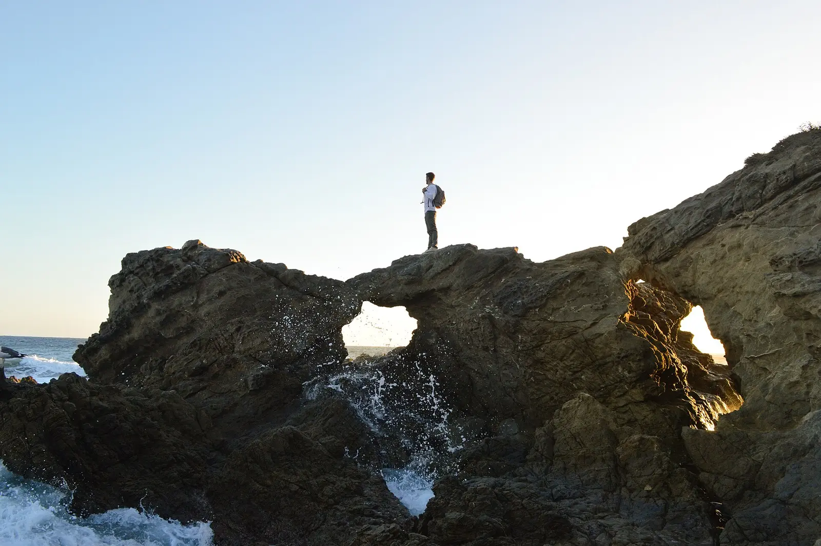

Covering about 2,542 acres, Leo Carrillo State Park lies in Los Angeles County, about 9 miles southwest of Westlake Village.
Visitors come for snorkeling and diving, surfing, boating, swimming, and fishing. On the water side, there is a swimming beach. Camping is available: campsites, including RV sites, tent sites, and showers.
Hours
Park, gate, office and facility hours are listed separately because they often differ. Alerts above override normal hours.
| Facility | Days | Hours | Season |
|---|---|---|---|
| Day use | Daily | 8 a.m. – 10 p.m. | — |
Official wording
Day-use parking: 8:00 AM – 10:00 PM
Source: official park page, checked Oct 29, 2026. Times are local to the park (America/Los Angeles).
Fees and passes
| Item | Amount |
|---|---|
| Hourly Parking | $3 |
| Vehicle Day Use | $12 |
| Bus, Large | $125 |
| Bus, Small | $50 |
Official wording
Special rates may apply for peak season, high demand holiday periods, and during weekends. Prices are subject to change without notice. • Hourly Parking: $3.00 • Vehicle Day Use: $12.00 • Bus, Large: $125.00 • Bus, Small: $50.00
California park passes
- California Explorer Annual Pass — $195. Vehicle day-use entry to 134 state parks incl. high-demand Southern California beaches Details
- Golden Poppy Annual Pass — $125. Vehicle day-use entry to 112 state parks Details
- Historian Passport — $50. Admission for up to four people at per-person-fee State Historic Parks Details
- Off-Highway Vehicle (OHV) Annual Pass — $50. Entry to State Vehicular Recreation Areas that collect day-use fees Details
- SNO-Park Pass — $40 season / $15 day. 18 SNO-PARK winter recreation areas Details
From the California state guide. Confirm which passes this park accepts.
Reservations
- Day use
- No day-use reservation requirement mentioned
- Booking system
- ReserveCalifornia
- Phone
- (800) 444-7275
We link to the official booking system rather than showing live availability, which changes minute to minute.
Pets
Dogs allowed, with restrictions
Not allowed in or on: backcountry trails or south beach.
Are dogs allowed? Yes: Dogs allowed in day-use areas, campground and North Beach (north of Lifeguard Tower 3). Dogs not allowed on backcountry trails or South Beach (south of Lifeguard Tower 3).
Service animals are generally permitted where pets are not. Check with the park for specific areas.
Camping
Campground Information Anything relating to Campground Reservations: contact Reserve California online or 1-800-444-7275. Firewood Policy: Burning firewood, Duraflame, and charcoal briquettes is allowed in the fire rings only when fire level permits. Check the sign near the entrance kiosk for the day's fire level. Showers: The park has only token-operated showers. The token machines accept ONLY one dollar bills. Change for larger bills is not available at this time. Electrical Hookup AMP details: 20 AMP, 30 AMP, 50 AMP (all 3 are present where hookups are) For camp host opportunity inquiries, email angelescamphost@parks.ca.gov. ATTENTION: Trailers may be rented and delivered to the park only through Camping Adventures Rentals, the sole authorized RV delivery business for this state park. Rentals from other businesses may be denied entry, leaving you without accommodation. Contact Camping Adventures Rentals at (805) 797-7460 or visit Camping Adventures Rentals. Overnight facilities: En route Campsites, Tent Camping, Hike-and-Bike Campsites, Remote Camping, RV Dump Station, RV Access
From the official park page, checked Oct 29, 2026. Site counts and prices can change; confirm when booking.
Things to do
BoatingPicnickingFishingSnorkeling and scubaSwimmingWildlife viewing and birdingSurfingGeocachingHikingCamping
Amenities
Facilities
- Restrooms
- Showers
- Drinking water
- Picnic areas
- Visitor center
- Nature center or museum
- Park or camp store
- Parking
Water
- Swimming beach
Camping
- RV dump station
- Tent camping
- RV camping
✓ listed by the park · ✕ the park says it is not available. Anything not shown here isn’t mentioned by the official source — that means unknown, not unavailable.
Accessibility
Overview Leo Carrillo State Park offers over a mile of beach with all the typical shore activities, shaded campgrounds, and some backcountry hiking. The park is located 28 miles northwest of Santa Monica on the Pacific Coast Highway (Highway 1). Phone (310) 457-8143 for more information. Camping Canyon Campground: Seven campsites are generally accessible (#2, #4, #33, #47, #57, #79, and #119)- including parking and routes. Three combination restroom/shower buildings, dispersed throughout the campground, are generally accessible with adjacent parking. Distances from campsites to restrooms vary but routes are generally accessible. Camp Store: Entry is accessible. Interior aisle width varies, but staff assistance is available. One designated accessible parking site is adjacent to the store. Trails The Camp 13 Trail (aka Nicholas Flat Extension) is an ‘out-and-back’ accessible trail that is 0.62 miles each way that connects the park entrance road near the park entrance kiosk to the campfire center. As the trail navigates through the valley above the campground, users will experience views of coastal mountain brush. The surface is compacted soil. The trail is generally flat at less than 5% with intermittent sections between 5% to 11%. Accessible parking is located at the campfire center. The Nicholas Pond Trail is an ‘out-and-back’ accessible trail that is 0.61 miles each way from the end of Decker School Road to an overlook deck at Nicholas Pond. Users will experience views of coastal oak and mountain brush. The surface is compacted aggregate, rock, soil, & wood. There are several armored crossings on the trail that water flows over the trail during rain events that might be challenging for some users. This trail is generally flat less than 5% with intermittent sections between 5% to 8%. Accessible parking is located at the trailhead. Portions of the trail maybe inaccessible due to wildfire damage. Trail Name Running Slope Cross Slope Trail Width Trail Surface Camp 13 Trail 4% Average 4 FT Average Soil 11% Maximum 5% Maximum 4 FT Minimum Nicholas Pond Trail 3% Average 2.7% Average 4 FT Average Aggregate 8% Maximum 5% Maximum 4 FT Minimum Beach/Shore Access Beach wheelchairs are available to check out. Contact park staff upon entry into the park, or phone (310) 457-8143 for more information. North Beach: This beach is accessed by following the park entrance road under Highway 1. Accessible parking and restrooms are available. Routes to the beach (which is a short distance from the parking lot) are usable. South Beach: This beach is accessed via the parking lot just past the park entrance station. Accessible parking and a portable restroom are available. The beach is a short distance from the parking lot, and is accessed via a route that crosses under Highway 1. The route from the parking lot to the beach is generally accessible, and terminates at a restroom building that is usable. Other Information December 2018: Leo Carrillo State Park has reopened most of the facilities; however, the visitor center, sections of trails, and the group campground remain closed until further notice due to the damages caused by the Woolsey Fire. The fire burned through the park and several structures, such as the visitor center, sector office, employee residences, three lifeguard towers, Leo Shop structures, the Junior Lifeguard Complex and several restrooms. January 2019: Accessible picnic areas at North Beach were removed due to coastal retreat.
Official accessibility information
Conditions change. Contact the park to confirm specific accessible features before your visit.
Getting there
- Address
- 35000 W Pacific Coast Highway
Malibu, CA 90265 - Nearest town
- Westlake Village — about 9 mi southwest (straight line)
- Coordinates
- 34.0449, -118.9350
- Phone
- (310) 457-8144
- angelescamphost@parks.ca.gov
Entrances
- Directions point
Google Maps directionsApple MapsOfficial park map (PDF)
Directions from the park
The park is located 28 miles northwest of Santa Monica on the Pacific Coast Highway (Highway 1.)
Nearby state parks
Sources and freshness
- California State Parks — park page — last checked Oct 29, 2026
- California State Parks Listing page (one link per unit, page_id = officialId), unioned with the CSP Enterprise GIS 'ParkEntryPoints' ArcGIS layer (coords, address, county, unit number, management status) and the 'CSPParkUnit_CurrentStatus' layer (open/partial/full closure)
- Wikidata
- USGS PAD-US 4.1 (boundary and acreage)
- Photo: Leo Carrillo State Park, Malibu, United States (Unsplash).jpg — CC0 1.0 (public domain dedication), Cam Adams camadams
“Last checked” is when our system last read the official source. No change has been detected since this page was first published. Hours, fees and rules can change without notice — confirm with the park before you go. Methodology