Humboldt Redwoods State Park
Also known as Humboldt Redwoods SP
- Status
- Open (per official listing)Daily 9 a.m. – 5 p.m. (May 1 – Sep 30)
- Entrance fee
- $8 per dayAnnual pass available
- Day-use reservations
- None mentioned
- Dogs
- Dogs allowed, with restrictions
- Camping
- Yes
- Official site
- parks.ca.gov(707) 946-2409
Official page last checked Oct 29, 2026. How we keep this current
Overview
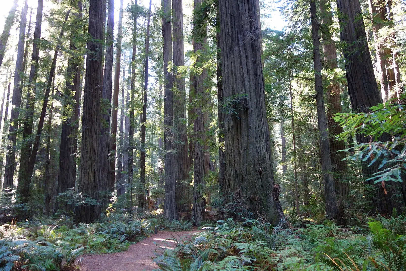

Covering about 53,918 acres, Humboldt Redwoods State Park lies in Humboldt County, about 23 miles southeast of Fortuna.
The park supports horseback riding, historic sites, swimming, fishing, and ranger programs. Overnight options include campsites, with tent sites, group camping, equestrian camping, and showers.
Hours
Park, gate, office and facility hours are listed separately because they often differ. Alerts above override normal hours.
| Facility | Days | Hours | Season |
|---|---|---|---|
| Park | Daily | 9 a.m. – 5 p.m. | May 1 – Sep 30 |
| Daily | 10 a.m. – 4 p.m. | Oct 1 – Apr 30 |
Official wording
Park open year-round. Visitor Center open every day except Thanksgiving and Christmas. 9:00am - 5:00pm, May - Sept. 10:00am - 4:00pm, Oct. - Apr.
Source: official park page, checked Oct 29, 2026. Times are local to the park (America/Los Angeles).
Fees and passes
| Item | Amount |
|---|---|
| Vehicle Day Use | $8 |
Official wording
Special rates may apply for peak season, high demand holiday periods, and during weekends. Prices are subject to change without notice. • Vehicle Day Use: $8.00
California park passes
- California Explorer Annual Pass — $195. Vehicle day-use entry to 134 state parks incl. high-demand Southern California beaches Details
- Golden Poppy Annual Pass — $125. Vehicle day-use entry to 112 state parks Details
- Historian Passport — $50. Admission for up to four people at per-person-fee State Historic Parks Details
- Off-Highway Vehicle (OHV) Annual Pass — $50. Entry to State Vehicular Recreation Areas that collect day-use fees Details
- SNO-Park Pass — $40 season / $15 day. 18 SNO-PARK winter recreation areas Details
From the California state guide. Confirm which passes this park accepts.
Reservations
- Day use
- No day-use reservation requirement mentioned
- Booking system
- ReserveCalifornia
- Phone
- (800) 444-7275
We link to the official booking system rather than showing live availability, which changes minute to minute.
Pets
Dogs allowed, with restrictions
Not allowed in or on: trails.
Are dogs allowed? Yes: Except for service animals, dogs not allowed on trails.
Service animals are generally permitted where pets are not. Check with the park for specific areas.
Camping
Overnight facilities: Equestrian Campsites, Tent Camping, Group Campsites, Hike-and-Bike Campsites, Remote Camping
From the official park page, checked Oct 29, 2026. Site counts and prices can change; confirm when booking.
Things to do
Historic sites and toursPicnickingFishingRanger and interpretive programsSwimmingHikingBikingHorseback ridingCamping
Amenities
Facilities
- Restrooms
- Showers
- Picnic areas
- Visitor center
- Nature center or museum
- Group facilities
Camping
- Tent camping
- Group camping
- Equestrian camping
Recreation
- Horse trails
✓ listed by the park · ✕ the park says it is not available. Anything not shown here isn’t mentioned by the official source — that means unknown, not unavailable.
Accessibility
Overview
Located along the scenic Avenue of the Giants, Humboldt Redwoods State Park is California's largest redwood state park and includes the Rockefeller Forest, the largest remaining contiguous old-growth coast redwood forest in the world. The trees here are thousands of years old and have never been logged. It is 45 miles south of Eureka and 20 miles north of Garberville near Weott. Many accessible features are available throughout this widespread park. Phone (707) 946-2409 for more information.
Camping
Albee Creek Campground: This campground is located 5 miles west of the Avenue of the Giants off of Mattole Road. Four campsites (4, 26, 28, and 35) are accessible including restrooms with showers and adjacent accessible parking.
Read more from the park
Burlington Campground: This campground adjacent to the Park Headquarters and Visitor Center has 4 accessible campsites: 2, 31, 36, and 54. The campground has two restroom/shower buildings, one of which is fully accessible and the other is an older accessible design. Assistance may be needed reaching shower controls from the folding bench. The path of travel from campsites to restroom is paved and generally accessible, and accessible parking is very near each restroom. The campfire center offers accessible seating and access to the stage.
Hidden Springs Campground: This campground is located 5 miles south of the Visitor Center on the Avenue of the Giants, just north of the town of Myers Flat. Seven campsites are accessible: 4, 6, 43, 117, 119, 148, and 149. Accessible combination restrooms with showers are available. Where space permits, accessible parking is adjacent to some of the restrooms.
Williams Grove Group Camp: This group campground is located 3 miles south of the Visitor Center on the Avenue of the Giants, just north of the town of Myers Flat. One accessible campsite is within the group campground. Restrooms and parking are accessible.
Cuneo Creek Horse Camp: This campground is reserved for campers bringing their horses to the park. It is located off of Mattole Road 8 miles west of the Avenue of the Giants. An accessible campsite and restrooms with showers are available. An accessible horse mounting platform is available.
Picnic Area
The Founder's Grove, Williams Grove, and California Federation of Women's Clubs Grove day use areas have accessible picnicking, parking, and restrooms.
Trails
The Drury-Chaney Loop Trail is a1.67 mile accessible loop trail located at the northern extent of the park near the town of Pepperwood. Trailhead is located off of a pullout along Avenue of the Giants, at mile marker 43.9. This trail meanders 0.8 mile through a richly lush under story within an old-growth redwood setting to a 0.9 mile loop for a trail length of 1.7 miles or 2.4 miles round trip. The trail surface is compacted soil. There are several armored crossings with steep cross slopes on the trail that water flows over the trail during rain events that might be challenging for some users. The trail is generally flat at less than 5% slopes. Accessible parking and restrooms are not available.
The Gould Grove Nature Loop Trail is a 0.62 mile accessible loop trail located near the Burlington Campground, Park Headquarters, and the Visitor Center. This short interpretive trail meanders among a small old-growth redwood grove. The trail surface is compacted soil. The trail is generally flat at less than 5% slopes with intermittent sections between 5% to 8%. Accessible parking and restrooms are located near the trailhead. For a longer hike, take the Fleishman Grove Trail which branches off from the Gould Grove Nature Loop Trail for 0.63 miles one-way.
The Fleishmann Grove Trail is an ‘out-and-back’ accessible trail that is 0.63 miles each way trail located near the Burlington Campground, Park Headquarters, and the Visitor Center. The trailhead, accessed via the Gould Grove Nature Loop Trail, follows the South Fork of the Eel River and winds through previously logged redwood stands. The trail surface is compacted soil. The trail is generally flat at less than 5% with intermittent sections between 5% to 8%. Accessible parking and restrooms are located near the Gould Grove Nature Loop trailhead.
The Founder’s Grove Loop Trail is a 0.53 mile accessible loop trail located off of Dyerville Loop Road. This self-guided nature trail meanders among majestic redwoods and features the Founder's Tree. The trail surface is compacted soil/aggregate. The trail is generally flat at less than 5% with one 22 foot section at 9%. Accessible parking and restrooms are available near the trailhead. The accessible route to the trailhead requires crossing Dyerville Loop Road; care should be taken due to vehicular traffic.
The Rockefeller Loop Trail is a 0.62 mile accessible loop trail adjacent to the South Fork Eel River near the California Federation of Women's Clubs Grove. The trail offers excellent viewing opportunities of old-growth redwoods and sweeping views of Bull Creek and the Eel River. The trail surface is compacted soil. The trail is generally flat at less than 5% slopes. Accessible parking at the trailhead is available.
Trail Name Running Slope Cross Slope Trail Width Trail Surface
Drury-Chaney Loop Trail 2% Average 3.7 5 FT Average Aggregate & Wood
5% Maximum 13% Maximum 3 FT Minimum
Gould Grove Nature Loop Trail 3% Average 5 FT Average Soil
8% Maximum 5% Maximum 5 FT Minimum
Fleischmann Grove Trail 2% Average 5 FT Average Soil
7% Maximum 5% Maximum 5 FT Minimum
Founder’s Grove Trail 2% Average 3.2% Average 5 FT Average Aggregate & Soil
9% Maximum 9% Maximum 3 FT Minimum
Rockefeller Loop Trail 1% Average 3% Average 4.5 FT Average Soil
3% Maximum 5% Maximum 3 FT Minimum
Exhibits/Programs
Visitor Center: Located adjacent to the Burlington Campground and Park Headquarters, the Visitor Center features van accessible parking, accessible paths of travel, and an accessible ramp entry into the Visitor Center. An assistive listening system is available. Some park brochures are available in Braille. Items for sale are within generally accessible reach ranges, while the sales counter is accessible. Most of the exhibits are accessibly designed. An exterior unisex restroom is accessible.
Official accessibility information
Conditions change. Contact the park to confirm specific accessible features before your visit.
Getting there
- Address
- 24700 Ave of the Giants
Myers Flat, CA 95554 - Nearest town
- Fortuna — about 23 mi southeast (straight line)
- Coordinates
- 40.3072, -123.9080
- Phone
- (707) 946-2409
Entrances
- Directions point
Google Maps directionsApple MapsOfficial park map (PDF)
Directions from the park
45 miles south of Eureka along the Avenue of the Giants and 20 miles north of Garberville.
Nearby state parks
Sources and freshness
- California State Parks — park page — last checked Oct 29, 2026
- California State Parks Listing page (one link per unit, page_id = officialId), unioned with the CSP Enterprise GIS 'ParkEntryPoints' ArcGIS layer (coords, address, county, unit number, management status) and the 'CSPParkUnit_CurrentStatus' layer (open/partial/full closure)
- Wikidata
- USGS PAD-US 4.1 (boundary and acreage)
- Photo: Founders Grove Loop Trail - Humboldt Redwoods State Park - DSC02496.JPG — CC0 1.0 (public domain dedication), Daderot
“Last checked” is when our system last read the official source. No change has been detected since this page was first published. Hours, fees and rules can change without notice — confirm with the park before you go. Methodology