Benicia State Recreation Area
Also known as Benicia SRA
- Status
- Open (per official listing)Daily 8 a.m. – sunset
- Entrance fee
- $6 per dayAnnual pass available
- Day-use reservations
- None mentioned
- Dogs
- Dogs allowed
- Camping
- Yes
- Official site
- parks.ca.gov(707) 648-1911
Official page last checked Oct 29, 2026. How we keep this current
Overview
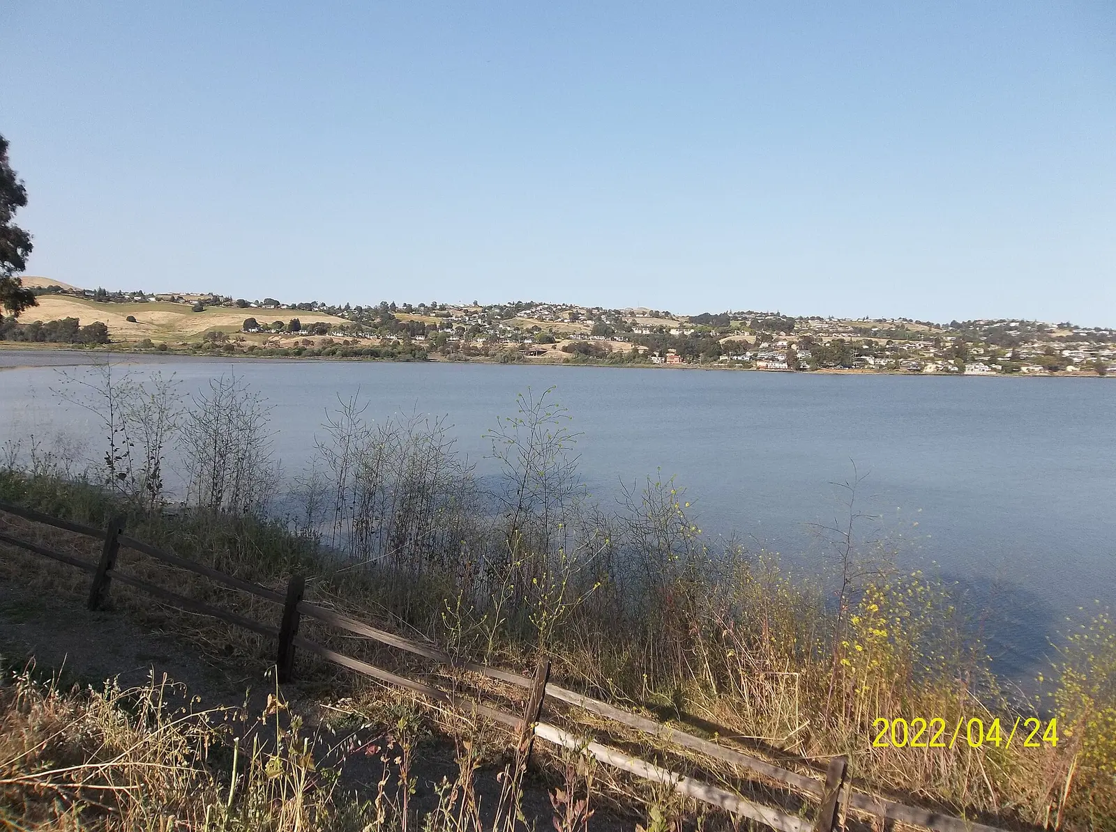

Covering about 456 acres, Benicia State Recreation Area lies in Solano County, about 2 miles west of Benicia.
The park supports fishing, wildlife watching, geocaching, biking, and picnicking. Facilities for water recreation include a swimming beach. Overnight options include campsites, with RV sites.
Hours
Park, gate, office and facility hours are listed separately because they often differ. Alerts above override normal hours.
| Facility | Days | Hours | Season |
|---|---|---|---|
| Park | Daily | 8 a.m. – sunset | — |
Official wording
Daily: 8am - Sunset
Seasons/Climate Recommended Clothing: The weather can be changeable; layered clothing is recommended.
Source: official park page, checked Oct 29, 2026. Times are local to the park (America/Los Angeles).
Fees and passes
| Item | Amount |
|---|---|
| Vehicle Day Use | $6 |
Official wording
Special rates may apply for peak season, high demand holiday periods, and during weekends. Prices are subject to change without notice. • Vehicle Day Use: $6.00
California park passes
- California Explorer Annual Pass — $195. Vehicle day-use entry to 134 state parks incl. high-demand Southern California beaches Details
- Golden Poppy Annual Pass — $125. Vehicle day-use entry to 112 state parks Details
- Historian Passport — $50. Admission for up to four people at per-person-fee State Historic Parks Details
- Off-Highway Vehicle (OHV) Annual Pass — $50. Entry to State Vehicular Recreation Areas that collect day-use fees Details
- SNO-Park Pass — $40 season / $15 day. 18 SNO-PARK winter recreation areas Details
From the California state guide. Confirm which passes this park accepts.
Reservations
- Day use
- No day-use reservation requirement mentioned
- Camping
- Not required
- Booking system
- ReserveCalifornia
- Phone
- (800) 444-7275
Three "Enroute" campsites are available for an overnight stay on a "first-come, first-served" basis with no reservations possible.
We link to the official booking system rather than showing live availability, which changes minute to minute.
Pets
Dogs allowed
Are dogs allowed? Dogs must be on a leash at all times.
Service animals are generally permitted where pets are not. Check with the park for specific areas.
Camping
Three "Enroute" campsites are available for an overnight stay on a "first-come, first-served" basis with no reservations possible. This camping is limited to motorhomes or vehicles with trailers, which must be fully self-contained. Tents are not permitted. Collecting or destroying anything in the park, including mushrooms, is prohibited. Diablo Range District - Camping Limits Overnight facilities: En route Campsites, RV Access
From the official park page, checked Oct 29, 2026. Site counts and prices can change; confirm when booking.
Things to do
PicnickingFishingWildlife viewing and birdingGeocachingHikingBikingCamping
Amenities
Facilities
- Restrooms
- Drinking water
- Picnic areas
- Parking
Water
- Swimming beach
Camping
- RV camping
✓ listed by the park · ✕ the park says it is not available. Anything not shown here isn’t mentioned by the official source — that means unknown, not unavailable.
Accessibility
Overview Benicia State Recreation Area covers 720 acres of marsh, grassy hillsides and rocky beaches. It is a day use area that offers a quiet, breezy refuge from urban bustle and great views of the bay. It is located off Interstate Highway 780 less than 2 miles west of Benicia at the Rose Drive/State Park Road/Benicia SRA exit. Alternate less freeways route: exit I80 at Columbus Parkway, follow it to Rose Drive and turn right into the park. Phone (707) 648-1911 for more information. Picnic Area Generally accessible picnicking is available in the family picnic area. Two parking lots off Sub Station Road include generally accessible parking and provide the best access to the picnic area, the Benicia Bay Trail, and the Forrest Deaner Native Plant Botanic Garden. The restroom building in the middle of the picnic area is usable; the restroom includes grab bars, but stall space is limited. An accessible portable toilet is provided in the parking lot. Trails The Mike Taugher Trail (part of the S.F. Bay Trail) is a shared-use path that is generally accessible for about 0.75 mile. The path meanders along wetlands adjoining the Carquinez Strait, and terminates at the park's main entrance on Dillon Point Road. Trailhead, accessible portable restroom, and parking lot are located in a small lot, just off the intersection of West K Street and Military West. The Benicia Bay Trail is an ‘out-and-back’ accessible trail that is 1.75 miles each way. The trail is a multi-use trail that meanders through the hills offering views of the Carquinez Strait and Southampton Bay. Trail surface is primarily compacted soil and aggregate. The trail is usable in dry conditions; some users may need assistance after periods of heavy rain. Along the first 1.2 miles of the trail, users may encounter trail width at or below 36 inches and trail cross slope at or over 5%, however, trail running slope is largely compliant. Between 1.2 miles to 1.6 miles, users may encounter trail width at or below 36 inches and trail running slope at or over 8%, however, trail cross slope is largely compliant. After roughly 1.6 miles the dirt trail junctions onto an asphalt service road, and then ends at Glen Cove Waterfront Park. Trailhead and generally accessible parking are in the family picnic area parking lot off Sub Station Road. The restroom building in the middle of the picnic area is usable; the restroom includes grab bars, but stall space is limited. An accessible portable toilet is provided in the parking lot. The Forrest Deaner Native Plant Botanic Garden contains over 250 native plant species on 3.5 acres within Benicia SRA. Accessible pathways meander through the garden, offering views of Southampton Bay and marshlands. Accessible parking is available at the entrance to the botanical garden. An accessible portable toilet is provided in the parking lot. Trail Name Running Slope Cross Slope Trail Width Trail Surface Benicia Bay Trail 4% Average 4.5 Average 5 FT Average Aggregate, Asphalt & Soil 8% Maximum 5% Maximum 5 FT Minimum
Official accessibility information
Conditions change. Contact the park to confirm specific accessible features before your visit.
Rules and permits
Park Specific Rules Superintendent Orders are laws that are specific to a State Park District and/or a California State Park. The links below will take you to a copy of each District Superintendent Order that applies to Benicia State Recreation Area (SRA). These orders are posted for viewing at each public entrance of the park. These orders are subject to change and were recently renewed in 2026. Benicia SRA is part of the Diablo Range District Benicia SRA - Operating Hours Benicia SRA - Marsh Area Diablo Range District - Trail Use Policy Diablo Range District - Unmanned Aircraft Systems Diablo Range District - Juvenile Curfew Diablo Range District - Camping Limits Diablo Range District - Rescinded Orders
Getting there
- Address
- 1197 Rose Drive
Benicia, CA 94510 - Nearest town
- Benicia — about 2 mi west (straight line)
- Coordinates
- 38.0781, -122.1933
- Phone
- (707) 648-1911
- info@solanorcd.org
Entrances
- Directions point
Google Maps directionsApple MapsOfficial park map (PDF)
Directions from the park
The recreation area is 1.5 miles west of the outskirts of Benicia on I-780, take the Columbus Parkway exit.
Nearby state parks
Sources and freshness
- California State Parks — park page — last checked Oct 29, 2026
- California State Parks Listing page (one link per unit, page_id = officialId), unioned with the CSP Enterprise GIS 'ParkEntryPoints' ArcGIS layer (coords, address, county, unit number, management status) and the 'CSPParkUnit_CurrentStatus' layer (open/partial/full closure)
- Wikidata
- USGS PAD-US 4.1 (boundary and acreage)
- Photo: View from Benicia State Recreation Area 2022-04-24 175234 100 4279.jpg — CC0 1.0 (public domain dedication), Lhimec
“Last checked” is when our system last read the official source. No change has been detected since this page was first published. Hours, fees and rules can change without notice — confirm with the park before you go. Methodology