Armstrong Redwoods State Natural Reserve
Also known as Armstrong Redwoods SNR
- Status
- Open (per official listing)
- Entrance fee
- $10 per dayAnnual pass available
- Day-use reservations
- None mentioned
- Dogs
- Dogs allowed, with restrictions
- Camping
- None listed
- Official site
- parks.ca.gov(707) 869-2015
Official page last checked Oct 29, 2026. How we keep this current
Current alerts 1
Partial closure All of the trails in Armstrong Redwoods SNR and Austin Creek SRA are open with the exception the East Ridge Connector Trail. East Ridge Connector Trail from the Volunteer Office Parking Area remains closed.
Posted by the park. Official alert
Overview
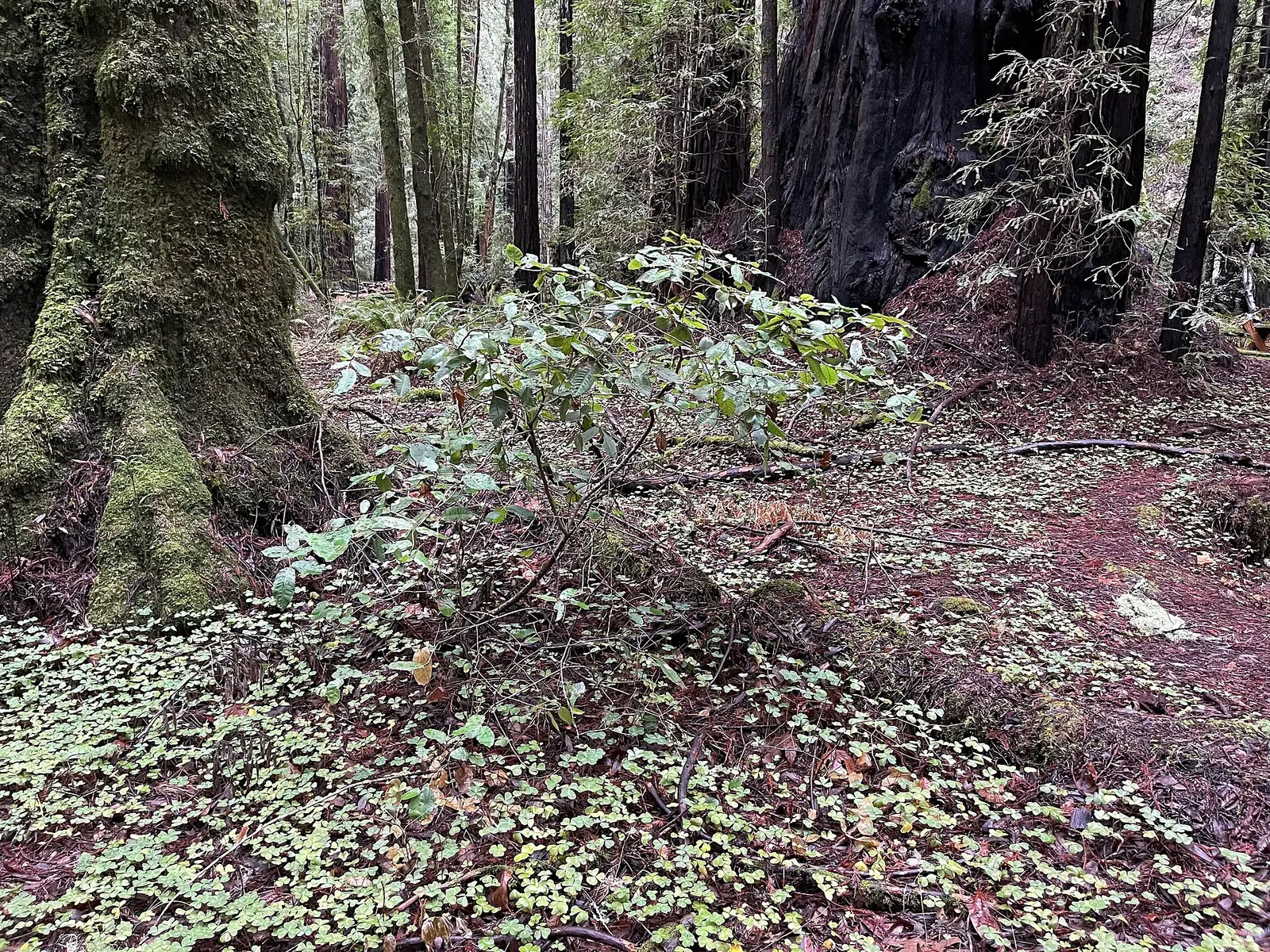

Armstrong Redwoods State Natural Reserve is a 764-acre natural area in Sonoma County, about 10 miles southwest of Healdsburg.
Visitors come for horseback riding, historic sites, picnicking, and hiking.
Hours
Park, gate, office and facility hours are listed separately because they often differ. Alerts above override normal hours.
| Facility | Days | Hours | Season |
|---|---|---|---|
| Park | 8:00 AM to one hour after official sunset. | ||
Official wording
8:00 AM to one hour after official sunset.
Seasons/Climate/Recommended Clothing: In summer, the weather can be variable. Morning fog can blanket the grove and cool the air while afternoon temperatures can warm up quite nicely. Many trails lead into the upper hills of Austin Creek where temperatures can soar above 100 degrees. Layered clothing, a fully charged cell phone and plenty of water is highly recommended. Cellphone coverage is not available in all locations. In the springtime, wildflowers are prolific, temperatures are mild and the fog is less frequent. In winter, temperatures drop but remain moderate. Rain nourishes the grove and brings life to the many plants and ferns, turning the understory into a green, lush carpet. A sweater and rain jacket will allow you to enjoy the special tranquility found in the grove as water drops work their magic.
Source: official park page, checked Oct 29, 2026. Times are local to the park (America/Los Angeles).
Fees and passes
| Item | Amount |
|---|---|
| Vehicle Day Use | $10 |
Official wording
Special rates may apply for peak season, high demand holiday periods, and during weekends. Prices are subject to change without notice. • Vehicle Day Use: $10.00
California park passes
- California Explorer Annual Pass — $195. Vehicle day-use entry to 134 state parks incl. high-demand Southern California beaches Details
- Golden Poppy Annual Pass — $125. Vehicle day-use entry to 112 state parks Details
- Historian Passport — $50. Admission for up to four people at per-person-fee State Historic Parks Details
- Off-Highway Vehicle (OHV) Annual Pass — $50. Entry to State Vehicular Recreation Areas that collect day-use fees Details
- SNO-Park Pass — $40 season / $15 day. 18 SNO-PARK winter recreation areas Details
From the California state guide. Confirm which passes this park accepts.
Reservations
- Day use
- No day-use reservation requirement mentioned
- Booking system
- ReserveCalifornia
- Phone
- (800) 444-7275
We link to the official booking system rather than showing live availability, which changes minute to minute.
Pets
Dogs allowed, with restrictions
Not allowed in or on: any dirt trail or dirt road; any trails in armstrong redwoods state natural reserve; any trail or dirt road in austin creek state recreation area.
Are dogs allowed? Yes: Dogs must be controlled on a leash at ALL times during your visit to your parks. Dogs on leash are only allowed on the main, paved road, in one of the developed picnic areas or within your registered campsite at Bullfrog Pond Campground. Dogs are NOT allowed on any dirt trail or dirt road. If camping, your pet will need to stay in your tent or in your vehicle overnight. NOTE: Dogs must be controlled on a leash at ALL times during your visit to your parks. Dogs on leash are only allowed on the main, paved road, in one of the developed picnic areas or within your registered campsite at Bullfrog Pond Campground. Dogs are NOT allowed on any dirt trail or dirt road. If camping, your pet will need to stay in your tent or in your vehicle overnight. Suggested Walks and Hikes: No dogs on trails Dogs must remain on the paved road and are not allowed on any trails in Armstrong Redwoods State Natural Reserve. Additionally, dogs are not allowed on any trail or dirt road in Austin Creek State Recreation Area.
Service animals are generally permitted where pets are not. Check with the park for specific areas.
Things to do
Historic sites and toursPicnickingHikingHorseback riding
Trails
Designated Equestrian Trails Status: CLOSED
No trails are available for equestrian use, including at Austin Creek SRA.
Suggested Walks and Hikes: No dogs on trails
Easy 1 Mile:
Take the Pioneer Nature Trail from the park entrance to the Armstrong Tree and Forest Theater, and then returning via the same route.
Easy 1.7 Miles:
Take the Pioneer Nature Trail from the park entrance to the Armstrong Tree, then to the picnic area, and return.
Park Restrictions:
Dogs must remain on the paved road and are not allowed on any trails in Armstrong Redwoods State Natural Reserve. Additionally, dogs are not allowed on any trail or dirt road in Austin Creek State Recreation Area. Bicycles are allowed on both the main paved road and the fire road off the Colonel Armstrong parking lot. Horses are not allowed on the Pioneer or Discovery Trails. All other trails remain closed. Please respect all private property and no trespassing signs when using the parks, stay on designated trails in the grove and do not cross low-level fencing.
Amenities
Facilities
- Restrooms
- Picnic areas
- Visitor center
- Nature center or museum
- Parking
Recreation
- Horse trails
✓ listed by the park · ✕ the park says it is not available. Anything not shown here isn’t mentioned by the official source — that means unknown, not unavailable.
Accessibility
Overview
Armstrong Redwoods preserves an 805-acre grove of the stately Sequoia sempervirens, commonly known as the coast redwood. The park is located two miles north of Guerneville, off Armstrong Woods Road. The park is co-managed by California State Parks and Stewards of the Coast and Redwoods (SCR). Phone the SCR Field Operations Office at (707) 869-2015 for more information.
Picnic Area
Eight accessible picnic sites are dispersed within the picnic area. From the park entrance, follow Armstrong Woods Road 0.8 mile to the picnic area. Parking and routes are accessible. Accessible restroom is located at the back of the picnic loop, adjacent to the Pool Ridge Trailhead.
Trails
The Armstrong Nature Trail aka Icicle Trail is a 0.28 mile accessible trail from the Discovery Trail near the Colonel Armstrong Tree parking area to the Pioneer Nature Trail near the Icicle Tree among a dense redwood canopy. The surface is compacted soil. The trail is generally flat at less than 5% slopes with intermittent sections between 5% to 8%. Accessible parking is available at Colonel Armstrong Tree parking area.
Read more from the park
The Discovery Trail is a 0.21 mile accessible trail from the Pioneer Nature Trail at Burbank Circle parking area to the Colonel Armstrong Tree parking area among a dense redwood canopy offering views and opportunities to touch large trees. The surface is compacted soil. The trail is generally flat at less than 5%. Accessible parking is located at Burbank Circle and Colonel Armstrong Tree parking areas. Interpretive panels are spaced randomly along the trail and discuss the forest ecosystem as well as its history. Some panels offer a tactile experience.
The Pioneer Nature Trail is a 0.77 mile accessible trail that extends from the Visitor Center to the picnic area. The trail meanders among a dense redwood canopy offering views of Fife Creek and the prominent Icicle and Parson Jones Trees. The surface is compacted soil. The trail is generally flat at less than 5% slopes with intermittent sections between 5% to 8%. Interpretive panels are spaced randomly along the trail and discuss the forest ecosystem as well as its history. Some panels offer a tactile experience.
Restrooms adjacent to the Visitor Center and within the picnic area are accessible.
Trail Name Running Slope Cross Slope Trail Width Trail Surface
Armstrong Nature Trail 4% Average 3% Average 5 FT Average Soil
8% Maximum 4% Maximum 4 FT Minimum
Discovery Trail 3% Average 3% Average 5 FT Average Soil
6% Maximum 5% Maximum 4 FT Minimum
Pioneer Nature Trail 3% Average 2% Average 6 FT Average Soil
8% Maximum 4% Maximum 5 FT Minimum
Exhibits/Programs
The Visitor Center, located at the park entrance, is accessible. The Visitor Center houses interpretive & educational displays and offers a variety of items for sale. Accessible parking and restrooms are adjacent to the building.
The park’s outdoor amphitheater, known as the Redwood Forest Theater, includes wheelchair accessible seating and an accessible route to the theater stage. Accessible parking is available in the Colonel Armstrong Tree parking area. Refer to the Picnic Area and Trails description for restroom details.
Other Information
A free beach wheelchair is available to the public for use on the park trails. Contact the SCR Field Operations Office at (707) 869-2015 to inquire about availability and to coordinate checkout of the wheelchair.
Official accessibility information
Conditions change. Contact the park to confirm specific accessible features before your visit.
Getting there
- Address
- 17150 Armstrong Woods Road
Guerneville, CA 95446 - Nearest town
- Healdsburg — about 10 mi southwest (straight line)
- Coordinates
- 38.5320, -123.0030
- Phone
- (707) 869-2015
- stewards@stewardscr.org
Entrances
- Directions point
Google Maps directionsApple MapsOfficial park map (PDF)
Directions from the park
No directions available for this park.
Nearby state parks
Sources and freshness
- California State Parks — park page — last checked Oct 29, 2026
- California State Parks Listing page (one link per unit, page_id = officialId), unioned with the CSP Enterprise GIS 'ParkEntryPoints' ArcGIS layer (coords, address, county, unit number, management status) and the 'CSPParkUnit_CurrentStatus' layer (open/partial/full closure)
- Wikidata
- USGS PAD-US 4.1 (boundary and acreage)
- Photo: Umbellularia californica - January 2023 - Sarah Stierch.jpg — CC0 1.0 (public domain dedication), Missvain
“Last checked” is when our system last read the official source. No change has been detected since this page was first published. Hours, fees and rules can change without notice — confirm with the park before you go. Methodology