Pinnacle Mountain State Park
- Status
- Status not postedDaily 6:30 a.m. – 1 hr after sunset (Jan 1 – Dec 31)
- Entrance fee
- Not posted
- Day-use reservations
- None mentioned
- Dogs
- Not stated — check with park
- Camping
- None listed
- Official site
- arkansas.com(501) 868-5806
Official page last checked Oct 29, 2026. How we keep this current
Overview
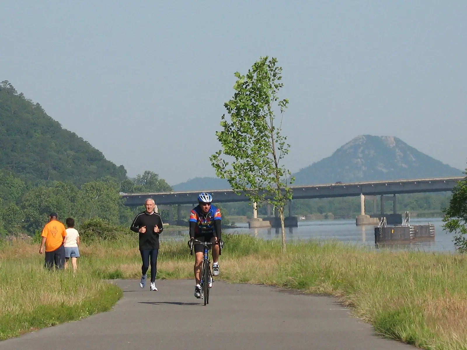

Covering about 1,772 acres, Pinnacle Mountain State Park lies in Pulaski County, about 4 miles west of Maumelle.
The official site lists about 33 miles of trails.
Hours
Park, gate, office and facility hours are listed separately because they often differ. Alerts above override normal hours.
| Facility | Days | Hours | Season |
|---|---|---|---|
| Entrance gate | Park gates are closed one hour after sunset. Closing times will be posted and vary if pavilion rentals or special events are in progress. | ||
| Visitor center | Daily | 8 a.m. – 5 p.m. | — |
| Day use — Launch Ramp/Picnic Area/Arboretum | Daily | 6:30 a.m. – 1 hr after sunset | Jan 1 – Dec 31 |
Official wording
Park gates are closed one hour after sunset. Closing times will be posted and vary if pavilion rentals or special events are in progress.
Visitor Center: Open daily 8 a.m. to 5 p.m. Closed Thanksgiving Day, Christmas Eve and Christmas Day.
Launch Ramp/Picnic Area/Arboretum: Open all year Jan-Dec open Sunday-Saturday, 6:30 a.m. to one hour after sunset NOTE: Heated restrooms are open year-round.
Source: official park page, checked Oct 29, 2026. Times are local to the park (America/Chicago).
Reservations
- Day use
- No day-use reservation requirement mentioned
- Booking system
- Arkansas State Parks reservations (reserve.arkansasstateparks.com)
We link to the official booking system rather than showing live availability, which changes minute to minute.
Things to do
Trails
| Trail | Length | Difficulty | Notes |
|---|---|---|---|
| Bobcat Way | — | — | Trail page: https://www.arkansas.com/state-parks/explore/trails/bobcat-way |
| Arboretum Connector | — | — | Trail page: https://www.arkansas.com/state-parks/explore/trails/arboretum-connector |
| River Trail Connector | — | — | Trail page: https://www.arkansas.com/state-parks/explore/trails/river-trail-connector |
| Dynamite | — | — | Trail page: https://www.arkansas.com/state-parks/explore/trails/dynamite |
| Twistflower | — | — | Trail page: https://www.arkansas.com/state-parks/explore/trails/twistflower |
| Glade Runner | — | — | Trail page: https://www.arkansas.com/state-parks/explore/trails/glade-runner |
| Turkey Tracks | — | — | Trail page: https://www.arkansas.com/state-parks/explore/trails/turkey-tracks |
| Upheaval | — | — | Trail page: https://www.arkansas.com/state-parks/explore/trails/upheaval |
| Upper Stick | — | — | Trail page: https://www.arkansas.com/state-parks/explore/trails/upper-stick |
| Lower Stick | — | — | Trail page: https://www.arkansas.com/state-parks/explore/trails/lower-stick |
| Carnasaw | — | — | Trail page: https://www.arkansas.com/state-parks/explore/trails/carnasaw |
| Middle Mountain Run | — | — | Trail page: https://www.arkansas.com/state-parks/explore/trails/middle-mountain-run |
| Armadillo Run | — | — | Trail page: https://www.arkansas.com/state-parks/explore/trails/armadillo-run |
| Centipede | — | — | Trail page: https://www.arkansas.com/state-parks/explore/trails/centipede |
| Logging Road | — | — | Trail page: https://www.arkansas.com/state-parks/explore/trails/logging-road |
| Coachwhip Connector | — | — | Trail page: https://www.arkansas.com/state-parks/explore/trails/coachwhip-connector |
| Jackfork Extension | — | — | Trail page: https://www.arkansas.com/state-parks/explore/trails/jackfork-extension |
| Whippoorwill Trail | — | — | Trail page: https://www.arkansas.com/state-parks/explore/trails/whippoorwill-trail |
| Wye Mountain Loop | — | — | Trail page: https://www.arkansas.com/state-parks/explore/trails/wye-mountain-loop |
| Greers Ferry Loop to Pinnacle Mountain | — | — | Trail page: https://www.arkansas.com/state-parks/explore/trails/greers-ferry-loop-to-pinnacle-mountain |
| West Summit Trail | — | — | Trail page: https://www.arkansas.com/state-parks/explore/trails/west-summit-trail |
| Arkansas Trail | — | — | Trail page: https://www.arkansas.com/state-parks/explore/trails/arkansas-trail |
| Base Trail | — | — | Trail page: https://www.arkansas.com/state-parks/explore/trails/base-trail |
| East Quarry Trail | — | — | Trail page: https://www.arkansas.com/state-parks/explore/trails/east-quarry-trail |
| East Summit Trail | — | — | Trail page: https://www.arkansas.com/state-parks/explore/trails/east-summit-trail |
| Kingfisher Trail (National Recreation Trail) | — | — | Trail page: https://www.arkansas.com/state-parks/explore/trails/kingfisher-trail-national-recreation-trail |
| Rocky Valley Trail | — | — | Trail page: https://www.arkansas.com/state-parks/explore/trails/rocky-valley-trail |
| Jackfork Trail | — | — | Trail page: https://www.arkansas.com/state-parks/explore/trails/jackfork-trail |
| Coachwhip | — | — | Trail page: https://www.arkansas.com/state-parks/explore/trails/coachwhip |
Boating and paddling
General Information
Visit our on-site kiosk located at the river access at the Big Maumelle Area. The kiosk allows you to rent a kayak and accessories (such as lifejackets and paddles). Just scan your phone to reserve and pay for your rental.
Wherever Watersports reserves the right to offer special rates for slow periods or special promotions. Rates will not increase unless agreed upon by the concessionaire and Arkansas State Parks.
Kayak Kiosk
Kiosk Paddleboard
1 hour: $14.99
2 hours: $24.99
4 hours (half day): $34.99
8 hours (full day): $44.99
Amenities
Facilities
- Group facilities
Water
- Marina or boat slips
✓ listed by the park · ✕ the park says it is not available. Anything not shown here isn’t mentioned by the official source — that means unknown, not unavailable.
Getting there
- Address
- 9600 Highway 300
Roland, AR 72135 - Nearest town
- Maumelle — about 4 mi west (straight line)
- Coordinates
- 34.8447, -92.4626
- Phone
- (501) 868-5806
- pinnaclemountain@arkansas.com
Google Maps directionsApple Maps
Entrance gate: Park gates are closed one hour after sunset. Closing times will be posted and vary if pavilion rentals or special events are in progress.
Nearby state parks
Sources and freshness
- Arkansas State Parks — park page — last checked Oct 29, 2026
- Arkansas State Parks park map (Leaflet features in drupalSettings)
- Wikidata
- USGS PAD-US 4.1 (boundary and acreage)
- Photo: Arkansas River Trail.jpg — Public domain (released by the author), Kmerckx at en.wikipedia
“Last checked” is when our system last read the official source. No change has been detected since this page was first published. Hours, fees and rules can change without notice — confirm with the park before you go. Methodology